 Block
Losantville, Indiana
11 topographic sheets cover this place, the earliest surveyed in 1953 and the latest in 1986. It stands in Union Township. It lies in ZIP code area 47354. The Survey maps it on the Modoc quadrangle. 221 people lived here at the 2020 count. It stands 1,132 feet above sea level.
Population over time
2 figuresLosantville fell from 237 to 221 between 2010 and 2020. These are the recorded population figures Wikidata holds for this place, reached through the Geographic Names Information System number this page is keyed on rather than by name, so they belong to this place and not to another of the same name. Most are census counts, but not all are: an early figure may be a founding or settlement estimate, and an estimate published within five years of a census is left out. The change column is computed, and is left blank where more than 20 years separate a figure from the one before it, because a gap that long is not a change between two counts.
| Year | People | Change |
|---|---|---|
| 2010 | 237 | |
| 2020 | 221 | -16 (-7%) |
Topographic sheets covering this place
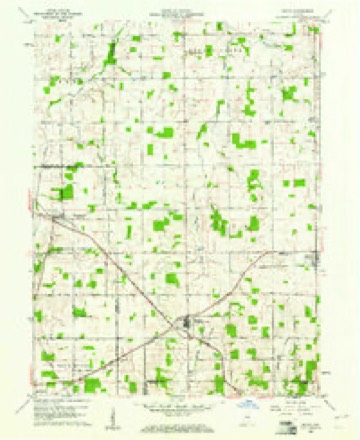
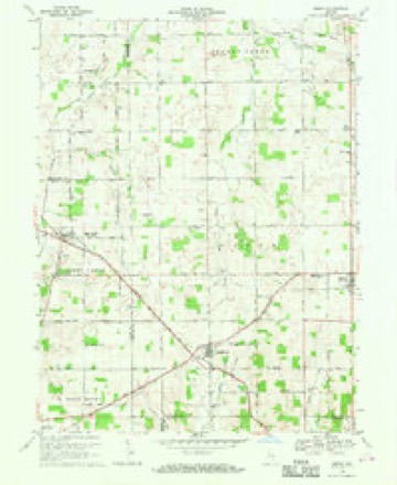
5 surveys from 11 printed sheetsMatched by testing this settlement's coordinate against the published boundary of every sheet in the United States Geological Survey's historical collection. Each opens the scanned sheet at the Survey.
- 1953 USGS Muncie quadrangle1:250000, 5 printings
- 1956 USGS Muncie quadrangle1:250000
- 1960 USGS Modoc quadrangle1:24000
- 1969 USGS Modoc quadrangle1:24000
- 1986 USGS Muncie quadrangle1:100000, 3 printings



In the county-history sources
60,303 words on this townshipHistory of Randolph County, Indiana with Illustrations and Biographical Sketches of Some of Its Prominent Men and Pioneers : to Which Are Appended Maps of Its Several Townships, published 1882 names this settlement in its chapter on Union Township. These are the passages that mention it, exactly as the scans read.
The company first bought six acres of land of Joel N. Converse, west of the present city limits, between the pike and the railroad. They nest (in 1807), bought about one acre of Joel N. Converse, extending the ground north to the pike, and two acres southward to the railroad; plat recorded October 21, 1870. The third purchase was twelve acres west of the cre^k (1874), This last tjact, as also the new grounds south, has never been platted into lots. Cost of the grounds: six acres at IIOO per acre, $600; three acres at $150 per acre, $450; twelve acres at $200 per acre, $2,400; total, $3,450. The original six acres were platted into 825 lots, with suitable streets between the lots, the re'-ord of the plat being made July 28, 1803, and the new purchase north has been platted. The plat was recorded October 21, 1870; number of lots, 120; size of lots, eight to thirty feet wide; price of lots in general, $1.50 per foot front; price of lots on streeta, 10- per cent extra; price of lots at comers, 20 per cent exti'a; ownere of lots, 328; price of digging graves at first, $1.50. under ten years; $2 above ton years; price of digging granes now, $3 aud $4. The company has been somewhat crippled by the last purchase, being considerably in debt on account of it, and not much improvement has been attempted. However, a hedge has been set around the cemetery, and it is now in the second year's growth. The ground is well situated for the purposes of burial, being moderately rolling. Several lots have been set apart irrecoverably for the interment of soldiers, as also a considerable space for the use of non-lot owners. Many fine monuments and some costly ones have been erected at the graves of friends, and some shrubbery has been set, and fences placed around lots, and the cemetery begins to present a neat and tasteful, and even elegant appearance. Among others is found the beautiful shaft eroctt^l as a soldier's moniunont. It makes a fine display, and is a creditable and appropriate tribute to the memory of the brave departed. It is to be regi-etted that provision was not made for engraving upon the monument the several names of the soldiers at their respective interments. The Sextons have been as follows : First, Samuel Sutton, until April, 1872; second, F. A. Hinsch, until April, 1874; third, J. M. Wren, until December, 1875; fourth, B. F. Buckingham, to the present time, July 27, 1881.
Passage source: History of Randolph County, Indiana with Illustrations and Biographical Sketches of Some of Its Prominent Men and Pioneers : to Which Are Appended Maps of Its Several Townships, published 1882.
Mr. Alexander was a very enterprising, hard-working citizen, entirely unleamou, but of good sense and with sound business judgment, very energetic and economical withal. Like the children of many another thriving, hard-working fnrmer, his family did not seem to acquire the habits of economy and thrift prac-' ticed by their father, and tho whole tract, except some fifty acres held by Isaac Alexander and his family, has hmg since slipped from the fingers of his descendants, leaving very little to show
Passage source: History of Randolph County, Indiana with Illustrations and Biographical Sketches of Some of Its Prominent Men and Pioneers : to Which Are Appended Maps of Its Several Townships, published 1882.
The reputation, success and esteem attained by our worthy friend is an affecting example of what, in this blessed country of ours, a poor, friendless orphan lad may achieve by the Divine blessing upon his faithful and persevering labors. Be the motto of every poor orphan, and of everybody else as well -
Passage source: History of Randolph County, Indiana with Illustrations and Biographical Sketches of Some of Its Prominent Men and Pioneers : to Which Are Appended Maps of Its Several Townships, published 1882.
Machine-read from a century-old scan, so expect the errors a machine makes: misspelled names, dropped words, stray characters.
Read the whole chapter on Union Township - it names this place 4 more 4 times.
Storms near this place
9 since 1995Regional context, not property-specific evidence. The National Weather Service names Losantville in 9 storm reports between 1995 and 2015: 4 flash flood, 3 thunderstorm wind, 2 hail. No death or injury is recorded in these reports. Each account below is quoted exactly as the forecast office filed it, from the NOAA Storm Events Database, and each date opens the federal record of that event.
| When | Event | Place named | Harm | What the report says |
|---|---|---|---|---|
| May 2008 | Thunderstorm Wind | Losantville | $15,000 | Trees were uprooted due to damaging thunderstorm winds. One tree fell onto a house and another fell onto a garage. The garage was destroyed. |
| June 2008 | Flash Flood | Losantville | $15,000 | Widespread flooding and several water rescues were reported in the southern part of Randolph county. Three cars were stranded on Main Street in Lynn. |
| January 2008 | Flash Flood | Losantville | $5,000 | Heavy rain caused flash flooding on multiple county roads across the southwestern portions of the county. |
| June 2014 | Flash Flood | Losantville | $1,000 | Water was over US Highway 35 in Losantville, near US Highway 36, due to heavy thunderstorm rainfall. One lane was closed. |
| June 2014 | Flash Flood | Losantville | $1,000 | All lanes on Highway 35 were closed by high water due to heavy thunderstorm rainfall. |
| August 2015 | Hail | Losantville | - | Hail was seen on Facebook. |
| July 2001 | Thunderstorm Wind | Losantville | - | no account filed |
| May 1999 | Thunderstorm Wind | Losantville | - | no account filed |
| May 1995 | Hail | Losantville | - | no account filed |
Nearest settlements
The eight closest, with where each one stands in the county. Distances are straight-line, computed from the Geographic Names Information System coordinates.
| Map | Place | Distance | Sheets |
|---|---|---|---|
| Modoc | 3.3 miles | 11 | |
| Scott Corner | 5.5 miles | 11 | |
| Pinch | 6.0 miles | 11 | |
| Huntsville | 6.7 miles | 12 | |
| Carlos | 7.9 miles | 12 | |
| Unionport | 8.1 miles | 12 | |
| Buena Vista | 8.8 miles | 12 | |
| Windsor | 9.1 miles | 11 |
Elsewhere
Matched on this settlement's Geographic Names Information System number rather than its name, so it cannot be a different place of the same name in another state.
| Wikipedia article on Losantville | An encyclopaedic summary. Its text is share-alike, so it is linked here rather than copied. |
| Wikidata item Q946999 | The structured record the population and elevation above come from. Public domain (CC0). |
Provenance
This settlement is recorded in the Geographic Names Information System as feature 438309. The sheet list is computed by point-in-boundary test against the United States Geological Survey's historical topographic inventory. Both are works of the United States government and carry no copyright under 17 U.S.C. 105.
Storms. NOAA National Centers for Environmental Information, Storm Events Database https://www.ncei.noaa.gov/stormevents/ A work of the United States government, no copyright under 17 U.S.C. 105. Narratives are quoted verbatim from the National Weather Service report and are not edited or summarised.