 Block
Milford, Indiana
13 topographic sheets cover this place, the earliest surveyed in 1951 and the latest in 1994. It stands in Van Buren Township. It lies in ZIP code area 46542. The Survey maps it on the Milford quadrangle. 1,614 people lived here at the 2020 count. It stands 833 feet above sea level.
Population over time
2 figuresMilford grew from 1,562 to 1,614 between 2010 and 2020. These are the recorded population figures Wikidata holds for this place, reached through the Geographic Names Information System number this page is keyed on rather than by name, so they belong to this place and not to another of the same name. Most are census counts, but not all are: an early figure may be a founding or settlement estimate, and an estimate published within five years of a census is left out. The change column is computed, and is left blank where more than 20 years separate a figure from the one before it, because a gap that long is not a change between two counts.
| Year | People | Change |
|---|---|---|
| 2010 | 1,562 | |
| 2020 | 1,614 | +52 (+3%) |
Topographic sheets covering this place
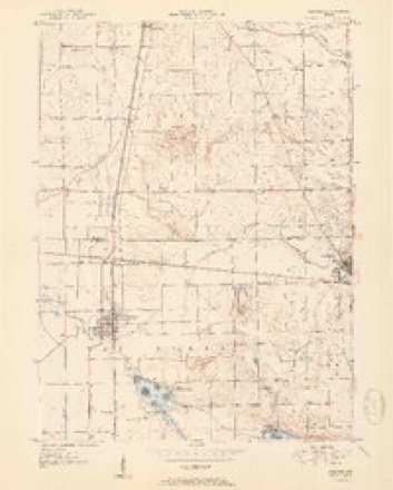
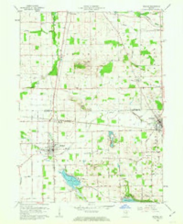
6 surveys from 13 printed sheetsMatched by testing this settlement's coordinate against the published boundary of every sheet in the United States Geological Survey's historical collection. Each opens the scanned sheet at the Survey.
- 1951 USGS Milford quadrangle1:24000, 2 printings
- 1953 USGS Fort Wayne quadrangle1:250000, 4 printings
- 1956 USGS Fort Wayne quadrangle1:250000, 2 printings
- 1962 USGS Milford quadrangle1:24000, 3 printings
- 1984 USGS Fort Wayne quadrangle1:100000
- 1994 USGS Fort Wayne quadrangle1:100000




In the county-history sources
1,256 words on this townshipBiographical and Historical Reocrd of Kosciusko County, published 1887 names this settlement in its chapter on Van Buren Township. These are the passages that mention it, exactly as the scans read.
Two railroads traverse the township, the Cincinnati, Wabash A: Michigan, and the Baltimore & Ohio. The first passes through Milford, and the second forms a junction one mile north. There are only a few houses at Milford Junction; no stores nor other business buildings. The Baltimore & Ohio Eailroad passes from southeast to northwest aci'oss sections 1, 2, 3, 4, 5 and 6. Both roads give excellent shipping facilities, but the location of the Baltimore & Ohio so far from Milford has retarded in a great measure its growth and business prospects.
Passage source: Biographical and Historical Reocrd of Kosciusko County, published 1887.
The substantial brick school building was erected in 1878, and a graded school established, with C. P. Hodge, principal; Miss Louisa Felkner, teacher of the intermediate, and Miss Jennie iLcDonald, teaelier of the primary' de])artment. There are 200 scholars enrolled at this date, with Messrs. John W. Caspar, principal; Marion Self, teacher of the intermediate, and Miss Annie AYatson, teacher of the primary department. Mr. Caspar is now serving his second term as principal of the Milford schools, and has given universal satisfaction.
Passage source: Biographical and Historical Reocrd of Kosciusko County, published 1887.
P. N. Allies and George Kleder each erected a two-story brick business house in 1881, and the ensuing year George Snow, Ed Smith and Charles A. Sparkland further improved the business center by the erection of substantial two-storv brick stores. F. P.Groves, a druggist, built his brick business block in 1885. C. C. Reytiolds, also a druggist, has been engaged in business for mcn'e tlian tliirty years in Milford, and in partnership with Martin and JVeil Felkner erected, in 1876, a hub and spoke factory and planing-mill that employed fifteen hands. This, the first and only manufactory of any kind ever attempted in Milford, was destroyed with its contents by fire in 1880, involving a direct loss to the three proprietors of !?i5,0U0 each.
Passage source: Biographical and Historical Reocrd of Kosciusko County, published 1887.
Machine-read from a century-old scan, so expect the errors a machine makes: misspelled names, dropped words, stray characters.
Read the whole chapter on Van Buren Township - it names this place 4 more 4 times.
Mines and quarries near this place
4 within 5 milesRegional context, not property-specific evidence. The federal mineral resources record lists 4 workings within 5 miles of Milford: 3 producers, 1 past producer. 3 still produce. What was taken out: Sand and Gravel, Construction. Distance is straight-line from the map coordinates, so a quarry counted here may appear on a neighbouring settlement's page as well.
| Where | Site | Commodity | Status | Recorded |
|---|---|---|---|---|
| Elkhart Gravel Pit | Sand and Gravel, Construction | Producer | ||
| Goshen Sand & Gravel Pit | Sand and Gravel, Construction | Past Producer | ||
| Kosciusko County Pit | Sand and Gravel, Construction | Producer | ||
| Zimmerman Gravel Pit | Sand and Gravel, Construction | Producer |
Storms near this place
18 since 1996Regional context, not property-specific evidence. The National Weather Service names Milford in 18 storm reports between 1996 and 2022: 15 thunderstorm wind, 1 tornado, 1 hail, 1 flood. No death or injury is recorded in these reports. Each account below is quoted exactly as the forecast office filed it, from the NOAA Storm Events Database, and each date opens the federal record of that event.
| When | Event | Place named | Harm | What the report says |
|---|---|---|---|---|
| March 2006 | Thunderstorm Wind | Milford | $265,000 | A survey of damage at the Maple Leaf Farms Distribution center, southeast of Milford, concluded that straight line winds were the cause of damage to a cold storage building. As winds striking the west side of the building interacted with the pressure within the cold storage vault, causing a vacuum that resulted in numerous panels, as well as insulation, being pulled off the building. The refrigeration equipment did not suffer any damage. However, much of its contents were exposed to the outside air, resulting in some loss of the food. Roof damage was also reported at 3 smaller buildings. As the winds continued east, trees and power lines were knocked down in an around Blueberry Island, on Dewart Lake. Damage is estimated at $250,000 at Maple Leaf Farms and roughly $15,000 on Blueberry Island. |
| May 2007 | Thunderstorm Wind | Milford | $50,000 | Sporadic tree and power line damage was reported across the county. However the highest concentration of damage was found along a path from Hastings to Milford. In and around the Hastings area, A house suffered damage to a add on room where the shingles were peeled off and thrown into the yard. Numerous trees and power lines down in the town of Milford, closing several streets, with a partially rotten tree falling onto a parked van, destroying the back half of the van and lifting the front right wheel off the ground several inches. |
| June 1999 | Thunderstorm Wind | Milford | $50,000 | 13 large trees were blown down in town. A metal roof was torn off a machine and tool shop. A pickup truck was damaged when a large tree was toppled onto it. |
| August 1998 | Thunderstorm Wind | Milford | $50,000 | SEVERAL TREES AND POWER LINES DOWN. |
| February 2008 | Flood | Milford | $15,000 | Water was reported over State Route 15, near Milford. Numerous other county roads had high water including a few road closures due to standing water. |
| July 2006 | Thunderstorm Wind | Milford | $5,000 | Approximately 50 trees were either uprooted or knocked down at Camp Mack on Waubee Lake. Most of the trees fell in open areas, but one tree did fall onto a building. No one was in the building at the time. Power lines were also reported down. Damage is estimated at $5,000. |
| August 2022 | Thunderstorm Wind | Milford | - | Mesonet station GW0734 recorded a 58 mph wind gust. |
| September 2018 | Thunderstorm Wind | Milford | - | The public reported trees were blown down as well as a power pole snapped in the area. |
| July 2016 | Thunderstorm Wind | Milford | - | The public reported multiple large tree limbs were blown down on Main and Section Street on the south side of Milford. Two trees were also uprooted with 1 falling onto a mobile home. No injuries were reported. |
| June 2016 | Thunderstorm Wind | Milford | - | Local newspapers reported significant wind damage to a barn and silo on the east side of Milford. |
| August 2014 | Thunderstorm Wind | Milford | - | Three telephone poles were snapped over railroad tracks, briefly blocking them. |
| June 2014 | Thunderstorm Wind | Milford | - | Law enforcement officials reported utility lines were blown down. |
| May 2011 | Thunderstorm Wind | Milford | - | Emergency management officials reported numerous trees and power lines down from Milford extending east into Syracuse. |
| June 2010 | Thunderstorm Wind | Milford | - | A trained spotter reported multiple trees and power lines were down. At least one power pole was snapped. |
| July 2005 | Thunderstorm Wind | Milford | - | A tree was snapped about three feet off the ground, with several large tree branches also reported down. |
| May 2004 | Thunderstorm Wind | Milford | - | Law enforcement reported trees down in Milford. |
| September 2000 | Hail | Milford | - | no account filed |
| April 1996 | Tornado (F0) | Milford | - | no account filed |
Nearest settlements
The eight closest, with where each one stands in the county. Distances are straight-line, computed from the Geographic Names Information System coordinates.
| Map | Place | Distance | Sheets |
|---|---|---|---|
| Milford Junction | 1.3 miles | 13 | |
| Shady Banks | 1.5 miles | 13 | |
| Redmon Park | 4.1 miles | 13 | |
| Musquabuck Park | 4.4 miles | 13 | |
| Gravelton | 4.5 miles | 11 | |
| Hastings | 4.8 miles | 11 | |
| Syracuse | 5.1 miles | 13 | |
| DeFries Landing | 5.1 miles | 13 |
Elsewhere
Matched on this settlement's Geographic Names Information System number rather than its name, so it cannot be a different place of the same name in another state.
| Wikipedia article on Milford | An encyclopaedic summary. Its text is share-alike, so it is linked here rather than copied. |
| Wikidata item Q2007826 | The structured record the population and elevation above come from. Public domain (CC0). |
Provenance
This settlement is recorded in the Geographic Names Information System as feature 439139. The sheet list is computed by point-in-boundary test against the United States Geological Survey's historical topographic inventory. Both are works of the United States government and carry no copyright under 17 U.S.C. 105.
Mines and quarries. USGS Mineral Resources Data System (MRDS) https://mrdata.usgs.gov/mrds/ A work of the United States government, no copyright under 17 U.S.C. 105.
Storms. NOAA National Centers for Environmental Information, Storm Events Database https://www.ncei.noaa.gov/stormevents/ A work of the United States government, no copyright under 17 U.S.C. 105. Narratives are quoted verbatim from the National Weather Service report and are not edited or summarised.