 Block
Mishawaka, Indiana
14 topographic sheets cover this place, the earliest surveyed in 1953 and the latest in 1992. It stands in Penn Township. It lies in ZIP code area 46544. It stands on Willow Creek. The Survey maps it on the South Bend East quadrangle. 51,063 people lived here at the 2020 count. It stands 719 feet above sea level.
On record in Mishawaka
Buildings and businesses the archive holds for this place. Each opens its own page, with the source record it came from.
On the National Register 12 records
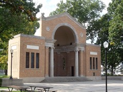 Battell Park Historic Districtlisted 1996
 Beiger Houselisted 1973
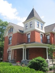 Dodge Houselisted 1978
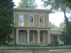 Eller-Hosford Houselisted 1983
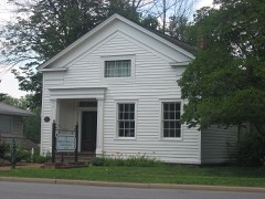 Ellis-Schindler Houselisted 1990
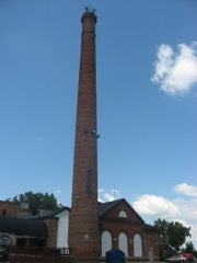 Kamm and Schellinger Brewerylisted 1979
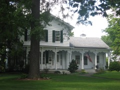 Merrifield-Cass Houselisted 1983
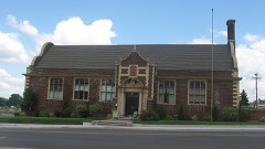 Mishawaka Carnegie Librarylisted 1998
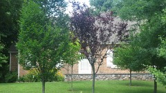 Mishawaka Reservoir Caretaker's Residencelisted 1998
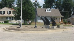 Normain Heights Historic Districtlisted 2002
- Mishawaka Fire Station No. 4listed 2017
- St. Joseph's Parish Squarelisted 2022
Population over time
2 figuresMishawaka grew from 48,252 to 51,063 between 2010 and 2020. These are the recorded population figures Wikidata holds for this place, reached through the Geographic Names Information System number this page is keyed on rather than by name, so they belong to this place and not to another of the same name. Most are census counts, but not all are: an early figure may be a founding or settlement estimate, and an estimate published within five years of a census is left out. The change column is computed, and is left blank where more than 20 years separate a figure from the one before it, because a gap that long is not a change between two counts.
| Year | People | Change |
|---|---|---|
| 2010 | 48,252 | |
| 2020 | 51,063 | +2,811 (+6%) |
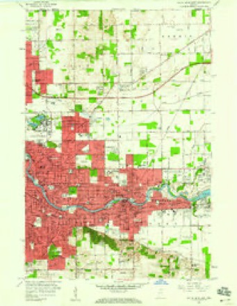
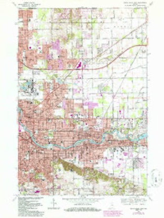
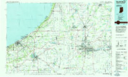
Topographic sheets covering this place
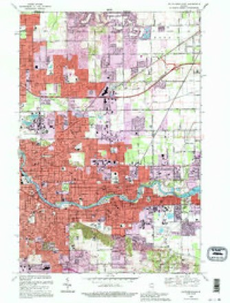
6 surveys from 14 printed sheetsMatched by testing this settlement's coordinate against the published boundary of every sheet in the United States Geological Survey's historical collection. Each opens the scanned sheet at the Survey.
- 1953 USGS Chicago quadrangle1:250000, 5 printings
- 1957 USGS Chicago quadrangle1:250000
- 1958 USGS South Bend East quadrangle1:24000
- 1969 USGS South Bend East quadrangle1:24000, 4 printings
- 1983 USGS South Bend quadrangle1:100000, 2 printings
- 1992 USGS South Bend East quadrangle1:24000


What happened here
An account from the chapter on Penn township. The inset identifies its exact source book and publication year.
History Of St. Joskph County. S25
Philip Manchester, sec. 4; was l)orn in Washington county, Penn., iSej)!. 28, ISOS, and is a son of Benjamin and Agnes (Doddridge) Manchester, the former a native of Rhode Island, and the latter of Pennsylvania. Mrs. M's brothers and sisters were captured by the Indians during the troubles early in this century.
In the county-history sources
25,242 words on this townshipHistory of St. Joseph County, Indiana :, published 1880 names this settlement in its chapter on Penn Township. These are the passages that mention it, exactly as the scans read.
The noted chief '' Raccoon " was buried near the house of Mr. James Curtis, in the eastern part of the township, and fo)- weeks his tribe would bring tlieir provisions to his grave, and sing and dance around the grave for some time, and then eat their dinners and return to camp. Raccoon's skeleton was exhumed a short time since by the Curtis boys, who took the jaw bone to Mishawaka, where it can now be found in the Enterprise office.
Passage source: History of St. Joseph County, Indiana :, published 1880.
Penn township formerly contained Harris and Madison, and a portion of Centre and Portage townships. The first settlers were William and Timothy J\Ioat, who located here about 1828, on section 17. Soon afterward came William Holt, Jesse Skinner, S. L. Cottrell, James Curtis, the Byrkits, Irelands and others. The first church edifice was built in Mishawaka. The first election was held in 1832, and Alpheus Ireland was one of the first justices of the peace. Nathan W. Young was also among the first settlers. He preempted land when the surveyors were at work here, and also carried chain for the Government surveyors. The beautiful prairie in Micliigan known as Young's Prairie was named for him. Mr. Young is a natural genius, and is the author of several useful inventions, but not being financially able to have them patented, other parties are reaping the fruits of his labors. He now resides in Mifhawaka.
Passage source: History of St. Joseph County, Indiana :, published 1880.
In 1839 St. Joseph Iron Works with its two additions, and Indiana City were incorporated as one town, and named Mishawaka. The town is situated on both banks of the St. Joseph, within about a mile of the most southern point of that river. The site is one of very great natural beauty, and art and taste have added largely to its original loveliness. On the south side there is a gentle upward slope iVnm the river bank, far oft' beyond the limits of the town. Here, embowered beneath a jn-ofusion of natural and cultivated trees, shrubbery and flowers, is built the main portion of Mishawaka. On the opposite side the batiks are more precipitous, forming a high table land, seemingly designed bj' Nature fjr its present uses. To the lover of the beautiful and the sublime, a visit to the Riverside Park is one not only to be enjoyed, but a visit to be remembered. Standing among the beautiful oaks and cedars that nature has planted upon that elevated plaiTi, his eyes are greeted bv many beautiful sights at almost the same instant. Looking directly south he sees the original Alilburn Wagon Works, that tower several stories above the basement, wliose walls are made bright by the reflection of the sun from the crystal waters of the beautiful St. Jose))h. Then a little beyond he observes many church s]iires ])ointing toward the skies, seeming to say, " Behold the Lamb of (tocI." And as he turns his eye to the southeast he is again impressed with the wonderful advancement in art, for here his eye falls ujion a neatly constructed iron bridge, with hundreds of pedeitrians, equestrians and teamsters parsing over it daily. When he has completed his stroll in Riverside Park on the north side, as the sun gradually sinks toward the western horizon, and as he wends his way back to the Milbnrn ILmse, he is struck with wonder and delight while cro.s!-ing the bridge, for, looking into the switt-runnirig water beneath, he sees hundreds of tish swimming in all directions
Passage source: History of St. Joseph County, Indiana :, published 1880.
Machine-read from a century-old scan, so expect the errors a machine makes: misspelled names, dropped words, stray characters.
Read the whole chapter on Penn Township - it names this place 109 more 109 times.
Mines and quarries near this place
4 within 5 milesRegional context, not property-specific evidence. The federal mineral resources record lists 4 workings within 5 miles of Mishawaka: 4 producers. All of them still produce. What was taken out: Sand and Gravel, Construction, Stone. Distance is straight-line from the map coordinates, so a quarry counted here may appear on a neighbouring settlement's page as well.
| Where | Site | Commodity | Status | Recorded |
|---|---|---|---|---|
| South Bend S & G Corp. | Stone | Producer | ||
| Bendix Pit | Sand and Gravel, Construction | Producer | ||
| Dry Island Pit and Mill | Sand and Gravel, Construction | Producer | ||
| St. Joseph Co. Hwy. Dept. | Sand and Gravel, Construction | Producer |
Storms near this place
60 of 82 shownRegional context, not property-specific evidence. The National Weather Service names Mishawaka in 82 storm reports between 1994 and 2025: 54 thunderstorm wind, 21 hail, 4 lightning, 2 tornado. The reports record 3 injuries. Each account below is quoted exactly as the forecast office filed it, from the NOAA Storm Events Database, and each date opens the federal record of that event.
| When | Event | Place named | Harm | What the report says |
|---|---|---|---|---|
| September 2001 | Lightning | Mishawaka | 2 hurt | Two men were struck by lightning while working on a car in Mishawaka. |
| August 2001 | Lightning | Mishawaka | 1 hurt | A Mishawaka man was indirectly hit by lightning while sitting on a vinyl chair on his apartment balcony. Lightning apparently hit a gutter on an overhang above him. |
| October 2001 | Tornado (F2) | Mishawaka | $1,300,000 | no account filed |
| October 2006 | Lightning | Mishawaka | $750,000 | A fire, started by lightning, destroyed a Methodist church in Mishawaka. Several hours passed before the fire could be brought under control. Those inside the church at the time of the strike were able to escape without injury. Damage is estimated at $750,000. |
| August 2024 | Lightning | Mishawaka | $225,000 | Lightning strike at Autumn Lakes Apartments resulting in a large fire. 22 apartment units were damaged. No known injuries. |
| March 2025 | Thunderstorm Wind | Mishawaka | $50,000 | Numerous tree damage reports from Mishawaka. There is roof damage and significant shingle loss from a building at Smith and 8th. There are trees down blocking EB Mishawaka and Liberty Rd. |
| June 2024 | Thunderstorm Wind | Mishawaka | $20,000 | Trees and powerlines down on a house. |
| March 2025 | Thunderstorm Wind | Mishawaka | $15,000 | Large pine tree uprooted and down onto a small residential structure. |
| May 2024 | Thunderstorm Wind | Mishawaka | $10,000 | Large tree branches down on a car. Estimated 60 mph winds. |
| July 2024 | Thunderstorm Wind | Mishawaka | $10,000 | Loss of siding to a home in Mishawaka. Photo on Facebook. |
| August 2022 | Thunderstorm Wind | Mishawaka | $10,000 | Trees were downed and blocking the road. |
| July 2007 | Flash Flood | Mishawaka | $10,000 | Several roads in the city of Mishawaka were flooded and temporarily closed by flowing water, including Hickory road. |
| August 2003 | Tornado (F1) | Mishawaka | $10,000 | Some evidence was found of a brief touchdown near the intersection of Logan Street and Dragoon Trail in Mishawaka. Damage in the area was consistent with F1 intensity. |
| June 2024 | Thunderstorm Wind | Mishawaka | $5,000 | Numerous trees down in Mishawaka. |
| July 2023 | Hail | Mishawaka | $5,000 | Photo on Facebook shows several 2 inch hailstones. |
| July 2023 | Hail | Mishawaka | $5,000 | A two inch hail stone was measured near Marion High School. |
| July 1994 | Hail | Mishawaka | $5,000 | Sixty mph winds downed trees and power lines. |
| July 1994 | Thunderstorm Wind | Mishawaka | $5,000 | Sixty mph winds downed trees and power lines. |
| August 2021 | Thunderstorm Wind | Mishawaka | $3,000 | Trees down on active power line. |
| July 2024 | Thunderstorm Wind | Mishawaka | $1,000 | Tree uprooted on east 11th street. |
| July 2023 | Hail | Mishawaka | $1,000 | Hail reported ranging from quarters to golf balls. |
| July 2023 | Thunderstorm Wind | Mishawaka | $1,000 | Tree down bloacking roadway. Time estimated by radar. |
| July 2023 | Hail | Mishawaka | $1,000 | no account filed |
| June 2021 | Thunderstorm Wind | Mishawaka | - | Multiple reports of power lines down in Mishawaka as well as Liberty, Greene, Penn and Clay Townships. |
| June 2021 | Thunderstorm Wind | Mishawaka | - | Local fire departments reported multiple power lines down in Mishawaka as well as Liberty, Greene, Penn and Clay townships. Exact causes unknown, but likely due to down tree limbs. |
| June 2021 | Thunderstorm Wind | Mishawaka | - | A few large, healthy tree limbs down on Whitehall Dr. |
| August 2021 | Thunderstorm Wind | Mishawaka | - | The media reports one large tree limb down and estimated the wind to be 60 mph. |
| August 2021 | Thunderstorm Wind | Mishawaka | - | Small hail was observed, along with the wind gust of 52 knots. |
| May 2020 | Thunderstorm Wind | Mishawaka | - | The public reported through Twitter that a tree was blown down across the road at Grove Street and West Benton Street. |
| May 2020 | Thunderstorm Wind | Mishawaka | - | A trained spotter recorded a 60 mph wind gust. |
| May 2019 | Thunderstorm Wind | Mishawaka | - | Trees and power lines were blown down across the east side of Mishawaka along US 331 and Bremen Highway. |
| September 2018 | Thunderstorm Wind | Mishawaka | - | Local media reported trees were blown down or uprooted in River Park. |
| September 2018 | Thunderstorm Wind | Mishawaka | - | Local media reported part of a tree was blown down onto a residence in the 800 block of 27th Street. |
| September 2018 | Thunderstorm Wind | Mishawaka | - | Local media reported part of a tree was blown down into a fence and vehicle. |
| August 2018 | Thunderstorm Wind | Mishawaka | - | Local law enforcement reported a large tree was blown down, blocking Filbert Rd between Day Rd and McKinley Highway. |
| May 2018 | Thunderstorm Wind | Mishawaka | - | Law enforcement officials reported power lines down in the city from the wind and falling trees. |
| March 2017 | Thunderstorm Wind | Mishawaka | - | The public reported wind gusts estimated to 60 mph. |
| June 2016 | Thunderstorm Wind | Mishawaka | - | A trained spotter reported a large tree was blown down. |
| June 2016 | Thunderstorm Wind | Mishawaka | - | The public reported via Facebook of several trees and tree limbs down in Mishawaka. |
| June 2014 | Thunderstorm Wind | Mishawaka | - | A trained spotter reported several trees down. |
| June 2014 | Thunderstorm Wind | Mishawaka | - | Law enforcement officials reported numerous trees and utility lines down across much of the eastern half of the county. |
| May 2013 | Thunderstorm Wind | Mishawaka | - | A trained spotter reported a portion of a large tree was snapped near the base of the tree along North Main Street. |
| June 2013 | Thunderstorm Wind | Mishawaka | - | The broadcast media measured a 58 mph wind gust at Old Reverewood in Mishawaka. |
| November 2013 | Thunderstorm Wind | Mishawaka | - | A measured wind gust of 67 mph was reported by the public. |
| November 2013 | Thunderstorm Wind | Mishawaka | - | Emergency management officials reported eight inch pine trees down on the east side of Marion High School. |
| August 2012 | Thunderstorm Wind | Mishawaka | - | An off duty NWS employee estimated a wind gust to 60 mph. |
| June 2012 | Thunderstorm Wind | Mishawaka | - | A trained spotter reported a large tree was blown over onto the top of a car, blocking the street. No reports of injuries were noted. |
| July 2012 | Thunderstorm Wind | Mishawaka | - | The public reported a vehicle hit a tree limb that had fallen onto the road at US 331 and Kern Rd. Power lines were also reported down in the area. |
| May 2011 | Thunderstorm Wind | Mishawaka | - | Local media reported large trees down onto Lincolnway East, blocking portions of the road. |
| July 2011 | Thunderstorm Wind | Mishawaka | - | Trained spotters reported a few trees as well as several tree limbs down throughout the city. |
| June 2010 | Thunderstorm Wind | Mishawaka | - | Trained spotter measured 84 mph gusts. Large tree branches were downed and lawn furniture was blown around. |
| June 2008 | Hail | Mishawaka | - | Numerous phone calls into local television stations reported hail up to the size of silver dollars. |
| June 2008 | Hail | Mishawaka | - | Numerous public reports of hail ranging from the size of quarters to golf-balls. |
| July 2004 | Thunderstorm Wind | Mishawaka | - | Two trees reported knocked down, blocking Capital Street, |
| August 2004 | Thunderstorm Wind | Mishawaka | - | Law enforcement reported trees down in Mishawaka. |
| August 2004 | Thunderstorm Wind | Mishawaka | - | Local television reported several very large trees down in Mishawaka with winds estimated between 70 and 80 MPH. |
| August 2002 | Thunderstorm Wind | Mishawaka | - | Law enforcement reported tress and power lines down in Mishawaka. |
| June 2000 | Thunderstorm Wind | Mishawaka | - | North side of town. |
| June 2000 | Thunderstorm Wind | Mishawaka | - | Trees down. |
| May 2000 | Thunderstorm Wind | Mishawaka | - | Power lines down. |
Nearest settlements
The eight closest, with where each one stands in the county. Distances are straight-line, computed from the Geographic Names Information System coordinates.
| Map | Place | Distance | Sheets |
|---|---|---|---|
| Hi-View Addition | 3.8 miles | 11 | |
| Maple Lane | 4.1 miles | 14 | |
| Osceola | 4.4 miles | 13 | |
| Tamarack Grange | 4.7 miles | 11 | |
| Pleasant Valley | 5.0 miles | 13 | |
| Crest Manor Addition | 5.1 miles | 11 | |
| South Bend | 5.1 miles | 13 | |
| Indian Village | 5.4 miles | 14 |
Elsewhere
Matched on this settlement's Geographic Names Information System number rather than its name, so it cannot be a different place of the same name in another state.
| Wikipedia article on Mishawaka | An encyclopaedic summary. Its text is share-alike, so it is linked here rather than copied. |
| Wikidata item Q990691 | The structured record the population and elevation above come from. Public domain (CC0). |
Provenance
This settlement is recorded in the Geographic Names Information System as feature 452691. The sheet list is computed by point-in-boundary test against the United States Geological Survey's historical topographic inventory. Both are works of the United States government and carry no copyright under 17 U.S.C. 105.
Mines and quarries. USGS Mineral Resources Data System (MRDS) https://mrdata.usgs.gov/mrds/ A work of the United States government, no copyright under 17 U.S.C. 105.
Storms. NOAA National Centers for Environmental Information, Storm Events Database https://www.ncei.noaa.gov/stormevents/ A work of the United States government, no copyright under 17 U.S.C. 105. Narratives are quoted verbatim from the National Weather Service report and are not edited or summarised.