 Block
Mohawk, Indiana
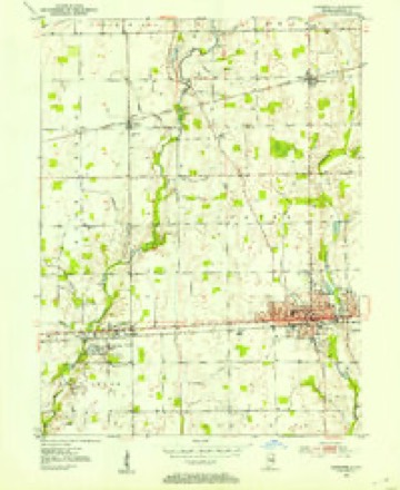
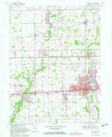
12 topographic sheets cover this place, the earliest surveyed in 1952 and the latest in 1986. It stands in Buck Creek Township. It lies in ZIP code area 46140. The Survey maps it on the Greenfield quadrangle. It stands 869 feet above sea level.
Topographic sheets covering this place
5 surveys from 12 printed sheetsMatched by testing this settlement's coordinate against the published boundary of every sheet in the United States Geological Survey's historical collection. Each opens the scanned sheet at the Survey.
- 1952 USGS Greenfield quadrangle1:24000
- 1953 USGS Cincinnati quadrangle1:250000, 3 printings
- 1957 USGS Cincinnati quadrangle1:250000
- 1962 USGS Greenfield quadrangle1:24000, 5 printings
- 1986 USGS New Castle quadrangle1:100000, 2 printings



In the county-history sources
8,036 words on this townshipHistory of Hancock County, Indiana; Its People, Industries and Institutions, published 1916 names this settlement in its chapter on Buck Creek Township. These are the passages that mention it, exactly as the scans read.
A blacksmith shop, established during the forties, and probably earlier, by Ebenezer Scotten, on the east line of the southeast quarter of the southeast quarter of section 21, township 16, range 6, and operated for a number of years. A blacksmith and wagon shop, conducted for a number of years, beginning in the early forties, by John and Robert Wallace, along the north line of the east half of the northwest quarter of section 20, township 16, range 6. A saw- and grist-mill, erected about i860 on the southeast quarter of seclion 17, township 16, range 6, by one Corbm. This mill was bought later by McClain & Buroaker. A saw-mill, established about 1863 by one Whitlock, and operated for three or four years in the vicinity of Mt. Comfort. A saw-mill, established by Maulden & Hopkins about 1874, on the northeast corner of section 19, township 16, range 6. A tile factory, established by Ebenezer Steele along the middle of the south line of section 8, township 16, range 6. A saw-mill, established by Ebenezer Steele about 1882, at the southeast corner of the northeast quarter of section 18, township 16, range 6. A saw-mill, erected by Adam F. Wilson, in the latter seventies, in section 10, township 16, range 6, near the present west line of Mohawk. A grain elevator, erected by William H. Dunn at Mt. Comfort, about 1890, and later owned by his son, George Dunn. A grain elevator, erected by Barnard & Newman and now owned by Thomas H. New and the Grist heirs. A tile yard, established on the west side of the road at Mt. Comfort in 1884, by Fred Wicker, and operated until 1891.
Passage source: History of Hancock County, Indiana; Its People, Industries and Institutions, published 1916.
The original plat of Mohawk was made on January 25, 1883, by Catherine Wilson and Adam F. Wilson. It was located along the east line of the southeast quarter of section 10, township 16, range 6, and consisted of twelve lots. Since that time two additions have been made. The first was made by William New on March 21, 1887, consisting of nine lots and located just across the road east from the original plat. The next addition was made by Margaret New, on October 1, 1895. It consists of fifteen lots and adjoins William New's addition. The latter two additions are located in Center township, McConnell street being the section line and also the township line dividing Center and Buck Creek townships. A postoffice has always been maintained at Mohawk. No rural routes have been established.
Passage source: History of Hancock County, Indiana; Its People, Industries and Institutions, published 1916.
Quite a number of men have been engaged in business at this point. Among them have been Joseph Hanna, Adam Wilson and Wilford Dobbins, grocers and hardware dealers ; James and William Albea, Arthur Kingery and J. O. Dunn, grocers. Martin Breece, A. W. Steele, O. C. Steele, Charles Barnard, Henry Fuller, William Eakins, L. A. Cox and A. M. Maroska have all been engaged in the grocery and drug business at different times. Soon after the railroad was constructed McConnell & Wilson erected an elevator which burned. Later, Newman & Barnard constructed the elevator which is now owned by Thomas H. New and the Grist heirs under the name of the Mohawk Elevator Company. A heading factory was also established for a time by Hill Brothers. This was followed by a saw-mill operated by one Small. Later, Oliver A. Newman took charge of the mill, which is now operated under the name of the Mohawk Lumber Company. George Kerr, Bert Doughty, William Bell, Frank Wood and John McCarty have conducted blacksmith shops, while the health of the people has been cared for by Drs. True, Nicholson and O. A. Collins, the latter being located in the town now. U. G. Wilson and Sam Roney have been known as the horsemen of the locality for a number of years.
Passage source: History of Hancock County, Indiana; Its People, Industries and Institutions, published 1916.
Machine-read from a century-old scan, so expect the errors a machine makes: misspelled names, dropped words, stray characters.
Read the whole chapter on Buck Creek Township - it names this place 4 more 4 times.
Mines and quarries near this place
2 within 5 milesRegional context, not property-specific evidence. The federal mineral resources record lists 2 workings within 5 miles of Mohawk: 2 past producers. None of them still produces. What was taken out: Sand and Gravel, Construction. Distance is straight-line from the map coordinates, so a quarry counted here may appear on a neighbouring settlement's page as well.
| Where | Site | Commodity | Status | Recorded |
|---|---|---|---|---|
| Leary's Pit & Mill | Sand and Gravel, Construction | Past Producer | ||
| Strubbe Gravel Pit | Sand and Gravel, Construction | Past Producer |
Storms near this place
6 since 2009Regional context, not property-specific evidence. The National Weather Service names Mohawk in 6 storm reports between 2009 and 2023: 3 thunderstorm wind, 2 flood, 1 hail. No death or injury is recorded in these reports. Each account below is quoted exactly as the forecast office filed it, from the NOAA Storm Events Database, and each date opens the federal record of that event.
| When | Event | Place named | Harm | What the report says |
|---|---|---|---|---|
| April 2009 | Flood | Mohawk | $3,000,000 | Two cars were reported to be stuck in high water at county road 600 north and county road 400 west. Flood damage to vehicles estimated. |
| September 2015 | Thunderstorm Wind | Mohawk | $10,000 | Trees and/or utility lines were downed due to damaging thunderstorm wind gusts. This was one of multiple locations. |
| August 2019 | Thunderstorm Wind | Mohawk | $5,000 | Several large tree limbs and power poles were snapped due to damaging thunderstorm wind gusts. |
| April 2011 | Flood | Mohawk | $500 | A report of creek flooding and water coming onto roadways was received due to thunderstorm heavy rainfall. Flooding was also occurring near County Roads West 700 North and North 300 West. Rainfall of 2.10 inches had been received since 5:45 AM. |
| July 2023 | Hail | Mohawk | - | Hail fell for about 7 minutes. |
| April 2018 | Thunderstorm Wind | Mohawk | - | A thunderstorm wind gust of 60 mph was estimated in this location. |
Nearest settlements
The eight closest, with where each one stands in the county. Distances are straight-line, computed from the Geographic Names Information System coordinates.
| Map | Place | Distance | Sheets |
|---|---|---|---|
| Sugar Hills | 1.5 miles | 12 | |
| Denny Corner | 3.1 miles | 10 | |
| Maxwell | 3.9 miles | 12 | |
| Mount Comfort | 4.0 miles | 12 | |
| Pleasant Acres | 4.1 miles | 12 | |
| Cooper Corner | 4.2 miles | 12 | |
| Philadelphia | 4.3 miles | 12 | |
| Spring Lake | 4.7 miles | 12 |
Elsewhere
Matched on this settlement's Geographic Names Information System number rather than its name, so it cannot be a different place of the same name in another state.
| Wikipedia article on Mohawk | An encyclopaedic summary. Its text is share-alike, so it is linked here rather than copied. |
| Wikidata item Q6893738 | The structured record the population and elevation above come from. Public domain (CC0). |
Provenance
This settlement is recorded in the Geographic Names Information System as feature 439311. The sheet list is computed by point-in-boundary test against the United States Geological Survey's historical topographic inventory. Both are works of the United States government and carry no copyright under 17 U.S.C. 105.
Mines and quarries. USGS Mineral Resources Data System (MRDS) https://mrdata.usgs.gov/mrds/ A work of the United States government, no copyright under 17 U.S.C. 105.
Storms. NOAA National Centers for Environmental Information, Storm Events Database https://www.ncei.noaa.gov/stormevents/ A work of the United States government, no copyright under 17 U.S.C. 105. Narratives are quoted verbatim from the National Weather Service report and are not edited or summarised.