 Block
Philadelphia, Indiana
12 topographic sheets cover this place, the earliest surveyed in 1952 and the latest in 1986. It stands in Sugar Creek Township. It lies in ZIP code area 46140. The Survey maps it on the Greenfield quadrangle. It stands 850 feet above sea level.
On record in Philadelphia
Buildings and businesses the archive holds for this place. Each opens its own page, with the source record it came from.
On the National Register 1 record
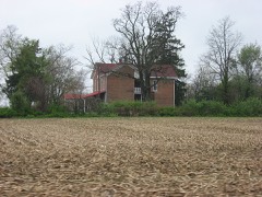 Rufus and Amanda Black Houselisted 2014
Topographic sheets covering this place
5 surveys from 12 printed sheetsMatched by testing this settlement's coordinate against the published boundary of every sheet in the United States Geological Survey's historical collection. Each opens the scanned sheet at the Survey.
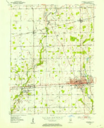
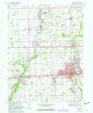
- 1952 USGS Greenfield quadrangle1:24000
- 1953 USGS Cincinnati quadrangle1:250000, 3 printings
- 1957 USGS Cincinnati quadrangle1:250000
- 1962 USGS Greenfield quadrangle1:24000, 5 printings
- 1986 USGS New Castle quadrangle1:100000, 2 printings



In the county-history sources
46,576 words on this townshipHistory of Hancock County, Indiana, from Its Earliest Settlement by the "pale Face," in 1818, Down to 1882, published 1882 names this settlement in its chapter on Sugar Creek Township. These are the passages that mention it, exactly as the scans read.
Philadelphia, named in commemoration of the city of brotherly love, is located four miles west of Greenfield, on the National road. The P., C. and St. L. R. R. runs by it. It contains a two-story public school building, one sawmill, a flouring mill, post-office, express office, daily mail, druggist, grocer, merchants, mechanics, physicians, and other necessaries to a village of her dimensions. Philadelphia was laid out by the records fail to show whom, on the nth day of April, 1838, being about six months prior to the laying out of New Palestine. The original plat consists of one hundred and two lots and six out-lots. The first and only addition was made by Clark, on the second day of April, 1864, and consisted of nineteen lots, located south of the old plat. Among the first business men of this place were: Charles Atherton, Sen., general merchant and post-master; Allen McCane, Joseph Marshall, G. W. Willett, Samuel McConaha, J. B. Sting, J. B. Conover and O. S. Meek. First physicians. Dr. Hodson McCallister & Son, J. H. Hazen, W. H. Dye, G. T. Rennick and H. B. Tilson. We will not consume space in ijivinij a full list of the business throuirh her entire history, but will now come up to the present, and furnish for this date a
Passage source: History of Hancock County, Indiana, from Its Earliest Settlement by the "pale Face," in 1818, Down to 1882, published 1882.
About the 3'ear 1835, the Methodists organized a class at Philadelphia. Among the first members were Owen Griffith, wife and two daughters ; William Brown, wife and daughter; Mrs. Willett ; Charles Atherton, Sr., and wife ; Jonathan Hornida}' and wife, Thomas J. Smith and wife, and Joseph Grey and lady. The first ministers were J. B. Burch, Rev. Edwards and Landy Havens.
Passage source: History of Hancock County, Indiana, from Its Earliest Settlement by the "pale Face," in 1818, Down to 1882, published 1882.
Bonge. For a number of years they cleared up, fenced, and made a home in the swamps. Mr. Lange sold his 160 acres eight years after, and settled in Terre Haute, where he was mayor of the city for a time, and auditor of Vigo county for a number of 3-ears. He was three times the nominee of the republican party for auditor of state, to which position he was elected in i860, and filled the place of trust with credit to himself and honor to the people. Indeed, Mr. L. was a prominent citizen of the state until his death. Mr. B. sold his quarter .section also about twelve years after entering. He tl.en settled over the line in Cumberland, Marion county, where he resided and engaged in the mercantile business. Here he lived, a useful citizen, to a good old age, and died only a few years since ; and his pioneer wife, the first German woman that ever located in this prosperous German settlement, is still living. She was born in 1813, at Heil Bron, in the kinirdom of Wurtemburfj, Germanv, and was married to said Carl Julius Leopold Albert \on Bonge in the year 183 1, at Dayton, Ohio.
Passage source: History of Hancock County, Indiana, from Its Earliest Settlement by the "pale Face," in 1818, Down to 1882, published 1882.
Machine-read from a century-old scan, so expect the errors a machine makes: misspelled names, dropped words, stray characters.
Read the whole chapter on Sugar Creek Township - it names this place 24 more 24 times.
Mines and quarries near this place
1 within 5 milesRegional context, not property-specific evidence. The federal mineral resources record lists 1 working within 5 miles of Philadelphia: 1 producer. All of them still produce. What was taken out: Sand and Gravel, Construction. Distance is straight-line from the map coordinates, so a quarry counted here may appear on a neighbouring settlement's page as well.
| Where | Site | Commodity | Status | Recorded |
|---|---|---|---|---|
| Leary's Gravel Co. | Sand and Gravel, Construction | Producer |
Storms near this place
6 since 2012Regional context, not property-specific evidence. The National Weather Service names Philadelphia in 6 storm reports between 2012 and 2020: 3 thunderstorm wind, 2 hail, 1 flood. No death or injury is recorded in these reports. Each account below is quoted exactly as the forecast office filed it, from the NOAA Storm Events Database, and each date opens the federal record of that event.
| When | Event | Place named | Harm | What the report says |
|---|---|---|---|---|
| June 2019 | Thunderstorm Wind | Philadelphia | $15,000 | Several trees were downed in Spring Lake with some power poles down as well due to damaging thunderstorm wind gusts. |
| February 2019 | Flood | Philadelphia | $1,000 | Water was reported to be over the road on County Road 100 North due to heavy rainfall. |
| September 2015 | Thunderstorm Wind | Philadelphia | - | An estimated 60 mph thunderstorm wind gust was observed in this location. |
| July 2012 | Thunderstorm Wind | Philadelphia | - | An estimated 60 mph damaging wind gust was observed near the intersection of County Roads 150 West and 150 South. |
| April 2020 | Hail | Philadelphia | - | no account filed |
| September 2015 | Hail | Philadelphia | - | no account filed |
Nearest settlements
The eight closest, with where each one stands in the county. Distances are straight-line, computed from the Geographic Names Information System coordinates.
| Map | Place | Distance | Sheets |
|---|---|---|---|
| Spring Lake | 0.5 miles | 12 | |
| Gem | 2.7 miles | 12 | |
| Carriage Estates | 4.0 miles | 11 | |
| Greenfield | 4.0 miles | 12 | |
| Mohawk | 4.3 miles | 12 | |
| Bowman Acres | 4.3 miles | 12 | |
| New Palestine | 4.7 miles | 11 | |
| Mount Comfort | 5.0 miles | 12 |
Elsewhere
Matched on this settlement's Geographic Names Information System number rather than its name, so it cannot be a different place of the same name in another state.
| Wikipedia article on Philadelphia | An encyclopaedic summary. Its text is share-alike, so it is linked here rather than copied. |
| Wikidata item Q7182599 | The structured record the population and elevation above come from. Public domain (CC0). |
Provenance
This settlement is recorded in the Geographic Names Information System as feature 441077. The sheet list is computed by point-in-boundary test against the United States Geological Survey's historical topographic inventory. Both are works of the United States government and carry no copyright under 17 U.S.C. 105.
Mines and quarries. USGS Mineral Resources Data System (MRDS) https://mrdata.usgs.gov/mrds/ A work of the United States government, no copyright under 17 U.S.C. 105.
Storms. NOAA National Centers for Environmental Information, Storm Events Database https://www.ncei.noaa.gov/stormevents/ A work of the United States government, no copyright under 17 U.S.C. 105. Narratives are quoted verbatim from the National Weather Service report and are not edited or summarised.