 Block
Spring Lake, Indiana
12 topographic sheets cover this place, the earliest surveyed in 1952 and the latest in 1986. It stands in Sugar Creek Township. It lies in ZIP code area 46140. The Survey maps it on the Greenfield quadrangle. 210 people lived here at the 2020 count. It stands 850 feet above sea level.
On record in Spring Lake
Buildings and businesses the archive holds for this place. Each opens its own page, with the source record it came from.
On the National Register within a mile 1 record
The National Register names another town for these. They stand within one mile of this settlement's coordinate.
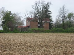 Rufus and Amanda Black Houselisted 2014 · 0.7 miles away
Population over time
2 figuresSpring Lake fell from 218 to 210 between 2010 and 2020. These are the recorded population figures Wikidata holds for this place, reached through the Geographic Names Information System number this page is keyed on rather than by name, so they belong to this place and not to another of the same name. Most are census counts, but not all are: an early figure may be a founding or settlement estimate, and an estimate published within five years of a census is left out. The change column is computed, and is left blank where more than 20 years separate a figure from the one before it, because a gap that long is not a change between two counts.
| Year | People | Change |
|---|---|---|
| 2010 | 218 | |
| 2020 | 210 | -8 (-4%) |
Topographic sheets covering this place
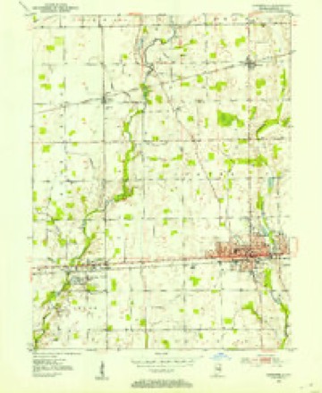
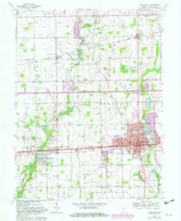
5 surveys from 12 printed sheetsMatched by testing this settlement's coordinate against the published boundary of every sheet in the United States Geological Survey's historical collection. Each opens the scanned sheet at the Survey.
- 1952 USGS Greenfield quadrangle1:24000
- 1953 USGS Cincinnati quadrangle1:250000, 3 printings
- 1957 USGS Cincinnati quadrangle1:250000
- 1962 USGS Greenfield quadrangle1:24000, 5 printings
- 1986 USGS New Castle quadrangle1:100000, 2 printings



In the county-history sources
46,576 words on this townshipHistory of Hancock County, Indiana; Its People, Industries and Institutions, published 1916 names this settlement in its chapter on Sugar Creek Township. These are the passages that mention it, exactly as the scans read.
An agitation was started about that time - for a new building at New Palestine. Different citizens advocated its location in sections 29, 30, 31 and 32. Some of these points were three-fourths of a mile from New Palestine. The new law, however, required that the school house should be built where it would accommodate the majority of the children of the school district. The new township trustee, with the advice and direction of the state superintendent, built the old frame house that is now known as the "old school house." For a number of years past it has been used by Mr. Huber for storing machinery. It was built in i860. In the east end of the building was a township room, where the township trustee transacted his business and where elections were held. A number of citizens also made arrangements with the township trustee to build a second story, which was to be used for different purposes. Dances and exhibitions were held there, and during the Civil War it became known as "Union Hall." It was here that Thomas C. Tuttle's company of "Anderson Guards" was organized.
Passage source: History of Hancock County, Indiana; Its People, Industries and Institutions, published 1916.
In 1866 the number of school children of the district became so large that more room was necessary and the township trustee bought the interest of each stockholder and converted the hall into two school rooms. The house was then used for school purposes until the spring of 1884, when the brick building, which is still in use, was constructed.
Passage source: History of Hancock County, Indiana; Its People, Industries and Institutions, published 1916.
Machine-read from a century-old scan, so expect the errors a machine makes: misspelled names, dropped words, stray characters.
Mines and quarries near this place
1 within 5 milesRegional context, not property-specific evidence. The federal mineral resources record lists 1 working within 5 miles of Spring Lake: 1 producer. All of them still produce. What was taken out: Sand and Gravel, Construction. Distance is straight-line from the map coordinates, so a quarry counted here may appear on a neighbouring settlement's page as well.
| Where | Site | Commodity | Status | Recorded |
|---|---|---|---|---|
| Leary's Gravel Co. | Sand and Gravel, Construction | Producer |
Storms near this place
4 since 2016Regional context, not property-specific evidence. The National Weather Service names Spring Lake in 4 storm reports between 2016 and 2025: 3 thunderstorm wind, 1 flash flood. No death or injury is recorded in these reports. Each account below is quoted exactly as the forecast office filed it, from the NOAA Storm Events Database, and each date opens the federal record of that event.
| When | Event | Place named | Harm | What the report says |
|---|---|---|---|---|
| April 2025 | Flash Flood | Spring Lake | $50,000 | Aerial flooding photographs from Hancock County 911 center show flooding at and near Arrowhead golf course including a flooded roadway. Total rainfall ranged from 2.3 to 3.1 inches. |
| May 2018 | Thunderstorm Wind | Spring Lake | $5,000 | Utility lines, trees, and tree limbs were downed in this location due to damaging thunderstorm wind gusts. |
| August 2025 | Thunderstorm Wind | Spring Lake | $2,000 | A tree was snapped by thunderstorm winds. |
| July 2016 | Thunderstorm Wind | Spring Lake | - | An estimated 60 mph thunderstorm wind gust was observed in this location. The wind was pushing trees over with small ones almost touching the ground. |
Nearest settlements
The eight closest, with where each one stands in the county. Distances are straight-line, computed from the Geographic Names Information System coordinates.
| Map | Place | Distance | Sheets |
|---|---|---|---|
| Philadelphia | 0.5 miles | 12 | |
| Gem | 2.3 miles | 12 | |
| Carriage Estates | 3.5 miles | 11 | |
| New Palestine | 4.2 miles | 11 | |
| Greenfield | 4.5 miles | 12 | |
| Brookville Heights | 4.6 miles | 11 | |
| Bowman Acres | 4.6 miles | 12 | |
| Mohawk | 4.7 miles | 12 |
Elsewhere
Matched on this settlement's Geographic Names Information System number rather than its name, so it cannot be a different place of the same name in another state.
| Wikipedia article on Spring Lake | An encyclopaedic summary. Its text is share-alike, so it is linked here rather than copied. |
| Wikidata item Q2395033 | The structured record the population and elevation above come from. Public domain (CC0). |
Provenance
This settlement is recorded in the Geographic Names Information System as feature 443991. The sheet list is computed by point-in-boundary test against the United States Geological Survey's historical topographic inventory. Both are works of the United States government and carry no copyright under 17 U.S.C. 105.
Mines and quarries. USGS Mineral Resources Data System (MRDS) https://mrdata.usgs.gov/mrds/ A work of the United States government, no copyright under 17 U.S.C. 105.
Storms. NOAA National Centers for Environmental Information, Storm Events Database https://www.ncei.noaa.gov/stormevents/ A work of the United States government, no copyright under 17 U.S.C. 105. Narratives are quoted verbatim from the National Weather Service report and are not edited or summarised.