 Block
Selma, Indiana
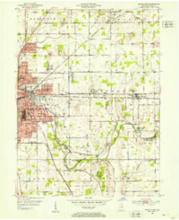
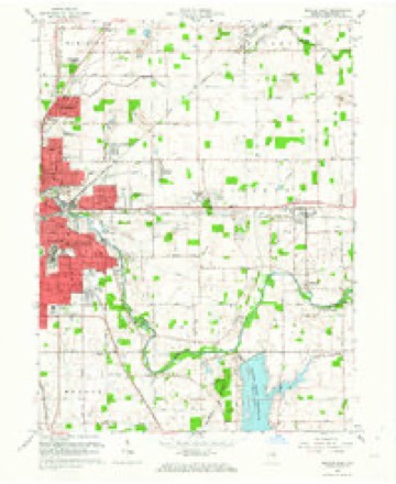
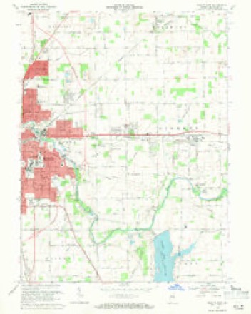
15 topographic sheets cover this place, the earliest surveyed in 1952 and the latest in 1986. It stands in Liberty Township. It lies in ZIP code area 47383. The Survey maps it on the Muncie East quadrangle. 747 people lived here at the 2020 count. It stands 1,010 feet above sea level.
Population over time
2 figuresSelma fell from 866 to 747 between 2010 and 2020. These are the recorded population figures Wikidata holds for this place, reached through the Geographic Names Information System number this page is keyed on rather than by name, so they belong to this place and not to another of the same name. Most are census counts, but not all are: an early figure may be a founding or settlement estimate, and an estimate published within five years of a census is left out. The change column is computed, and is left blank where more than 20 years separate a figure from the one before it, because a gap that long is not a change between two counts.
| Year | People | Change |
|---|---|---|
| 2010 | 866 | |
| 2020 | 747 | -119 (-14%) |
Topographic sheets covering this place
6 surveys from 15 printed sheetsMatched by testing this settlement's coordinate against the published boundary of every sheet in the United States Geological Survey's historical collection. Each opens the scanned sheet at the Survey.
- 1952 USGS Muncie East quadrangle1:24000, 2 printings
- 1953 USGS Muncie quadrangle1:250000, 5 printings
- 1956 USGS Muncie quadrangle1:250000
- 1962 USGS Muncie East quadrangle1:24000
- 1969 USGS Muncie East quadrangle1:24000, 3 printings
- 1986 USGS Muncie quadrangle1:100000, 3 printings



In the county-history sources
16,146 words on this townshipHistory of Delaware County, Indiana : with Illustrations and Biographical Sketches of Some of Its Prominent Men and Pioneers, published 1881 names this settlement in its chapter on Liberty Township. These are the passages that mention it, exactly as the scans read.
This is one of the central townships in the tier which forms the eastern limit of the county. It is six miles long and six miles wide, its area, therefore, being in round numbers 23,040 acres. It is bounded on the north by the township of Delaware, on the east by a portion of Randolph County, on the south by Perry Township, and on the west by Center.
Passage source: History of Delaware County, Indiana : with Illustrations and Biographical Sketches of Some of Its Prominent Men and Pioneers, published 1881.
The surface is generally level, broken only by the valleys of the streams which traverse it. These streams are, with one or two excep tions, unimportant brooks or branches, tributaries of White River, which flows in a westerly course across the southern portion of the township. None of them are of sufficient magnitude to afford propelling power for machinery, and during very dry seasons their course across the township is only recognizable by their deserted beds. When the opposite extreme prevails, and there is an abundant rainfall, their narrow beds are quickly filled, and for the tiue being, these little streams, usually so insignificant, become roaring torrents, rushing impetuously toward their respective outlets, the Mississinewa and White Rivers. > malarial diseases which, half a century ago, were so common. In these later days, however, scientific farming has opened up a medium of egress for the water left in the depressed places by the receding streams, and the modern system of underdraining has been both the means of conveying away the waste water and redeeming lands otherwise useless. The soil in the vicinity of the river is of a sandy nature, but in other places it is almost wholly clay. It is quite rich and well adapted to the successful cultivation of all the varieties of fruit and grain common
Passage source: History of Delaware County, Indiana : with Illustrations and Biographical Sketches of Some of Its Prominent Men and Pioneers, published 1881.
The first tract of land was entered at the Government land office at Fort}Wayne, by William Blunt, Sr., on the 9th day of December, 1822. The land then entered was a portion of Section 28. Mr. Blunt was probably the first permanent settler in the township. He cleared and improved a large farm, and was long a valued and useful member of the community. On the 16th day of December, 1822, Wilder Potter entered a tract of land in the same section (28), and cleared a portion of it. The remainder he sold to settlers who came to the township at a later date. The east half of the southeast quarter of Section 22 was entered by David Branson, December 11, 1823. Alanson Ashley and Henry Bolton entered land in Section 30, May 31, 1823. Both were industrious and respected members of the community. Mr. Ashley afterward became identified with other localities. James Jackson, formerly a citizen of Portsmouth, Ohio, entered a tract of land in Section 21, October 1, 1827. His farm was the east half of the northeast quarter of this section, and upon this farm he made his home until death. . His from Clark County, Ohio, accompanied by his wife and seven children, viz., Jacob, John, Elizabeth, Samuel, Jane, James and Rebecca, four of whom survive him and reside in this county. About the year 1830, his daughter Rachel was born, and was one of the first white children born in the settlement. He improved the farm which he had entered, making it his home until death. In November, 1830, John Moore came from Portsmouth, Ohio, and entered a body of land lying partially in Center and partially in Liberty. To this he added another tract, by purchase, making his possessions several hundred acres. His journey from Ohio was accomplished by the usual method of travel in those days, i. e., in wagons, containing the family and household goods. The children who accompanied him were Cynthia, William J., Philip, Levi, J emima, J. Spencer, Charles Wesley, Joseph and Milton. His son Enos was born February 15, 1834. His uncle, John Moore, had preceded him, having located here in 1829.:
Passage source: History of Delaware County, Indiana : with Illustrations and Biographical Sketches of Some of Its Prominent Men and Pioneers, published 1881.
Machine-read from a century-old scan, so expect the errors a machine makes: misspelled names, dropped words, stray characters.
Read the whole chapter on Liberty Township - it names this place 20 more 20 times.
Storms near this place
8 since 2001Regional context, not property-specific evidence. The National Weather Service names Selma in 8 storm reports between 2001 and 2024: 3 thunderstorm wind, 2 hail, 2 flash flood, 1 tornado. No death or injury is recorded in these reports. Each account below is quoted exactly as the forecast office filed it, from the NOAA Storm Events Database, and each date opens the federal record of that event.
| When | Event | Place named | Harm | What the report says |
|---|---|---|---|---|
| March 2024 | Tornado (EF2) | Selma | $4,000,000 | The tornado started northwest of Selma northwest of Truitt Rd damaging roofs|on homes. It then moved east southeast through Selma damaging a|number of homes, uprooting and snapping trees, and knocking over|some utility poles. Highest wind intensity in Selma, indicated by|extensive damage to a couple homes, was estimated at 120 mph, or|EF2 on the Enhanced Fujita Scale. Maximum path width through Selma|was about 125-175 yards. |
| February 2019 | Flash Flood | Selma | $30,000 | Water was reported to be flowing over numerous roads in eastern Delaware County, with at least one report of a car stalling, due to flash flooding from heavy rainfall. |
| June 2010 | Thunderstorm Wind | Selma | $2,000 | A utility pole was reportedly snapped off at ground level on East Centennial Avenue, approximately 2 miles east of the Muncie Bypass. This event occurred due to damaging thunderstorm wind gusts. |
| July 2019 | Flash Flood | Selma | $1,000 | High water was blocking portions of the road near South Street and East Jackson Street due to heavy thunderstorm rainfall. |
| August 2010 | Thunderstorm Wind | Selma | $250 | Numerous limbs were reported down, due to damaging thunderstorm wind gusts, in Selma. |
| July 2003 | Thunderstorm Wind | Selma | - | Trees down |
| May 2006 | Hail | Selma | - | no account filed |
| August 2001 | Hail | Selma | - | no account filed |
Nearest settlements
The eight closest, with where each one stands in the county. Distances are straight-line, computed from the Geographic Names Information System coordinates.
| Map | Place | Distance | Sheets |
|---|---|---|---|
| Smithfield | 1.5 miles | 15 | |
| Hyde Park | 2.1 miles | 15 | |
| Woodland Park | 2.1 miles | 15 | |
| Liberty Corners | 3.2 miles | 15 | |
| Desoto | 4.0 miles | 15 | |
| Irvington | 4.3 miles | 15 | |
| Mayfield | 4.3 miles | 15 | |
| Aultshire | 4.3 miles | 15 |
Elsewhere
Matched on this settlement's Geographic Names Information System number rather than its name, so it cannot be a different place of the same name in another state.
| Wikipedia article on Selma | An encyclopaedic summary. Its text is share-alike, so it is linked here rather than copied. |
| Wikidata item Q1862840 | The structured record the population and elevation above come from. Public domain (CC0). |
Provenance
This settlement is recorded in the Geographic Names Information System as feature 443212. The sheet list is computed by point-in-boundary test against the United States Geological Survey's historical topographic inventory. Both are works of the United States government and carry no copyright under 17 U.S.C. 105.
Storms. NOAA National Centers for Environmental Information, Storm Events Database https://www.ncei.noaa.gov/stormevents/ A work of the United States government, no copyright under 17 U.S.C. 105. Narratives are quoted verbatim from the National Weather Service report and are not edited or summarised.