 Block
New Haven, Indiana
13 topographic sheets cover this place, the earliest surveyed in 1953 and the latest in 1998. It stands in Adams Township. It lies in ZIP code area 46774. The Survey maps it on the Fort Wayne East quadrangle. 15,583 people lived here at the 2020 count. It stands 758 feet above sea level.
On record in New Haven
Buildings and businesses the archive holds for this place. Each opens its own page, with the source record it came from.
On the National Register 4 records
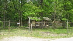 Craigville Depotlisted 1984
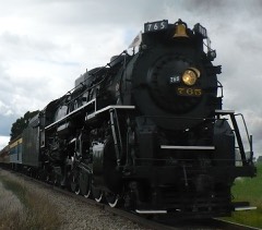 New York Chicago and St. Louis Railroad Steam Locomotive No. 765listed 1996
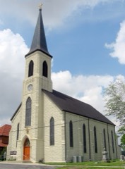 Besancon St. Louis Historic Districtlisted 1995
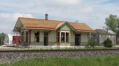 Wabash Railroad Depotlisted 2003
Population over time
2 figuresNew Haven grew from 14,794 to 15,583 between 2010 and 2020. These are the recorded population figures Wikidata holds for this place, reached through the Geographic Names Information System number this page is keyed on rather than by name, so they belong to this place and not to another of the same name. Most are census counts, but not all are: an early figure may be a founding or settlement estimate, and an estimate published within five years of a census is left out. The change column is computed, and is left blank where more than 20 years separate a figure from the one before it, because a gap that long is not a change between two counts.
| Year | People | Change |
|---|---|---|
| 2010 | 14,794 | |
| 2020 | 15,583 | +789 (+5%) |
Topographic sheets covering this place
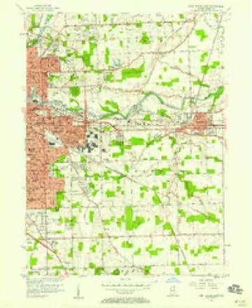
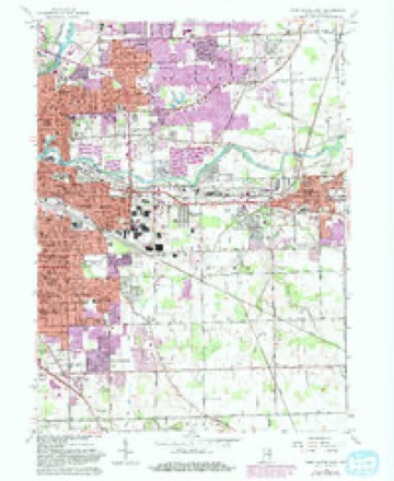
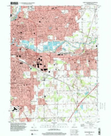
7 surveys from 13 printed sheetsMatched by testing this settlement's coordinate against the published boundary of every sheet in the United States Geological Survey's historical collection. Each opens the scanned sheet at the Survey.
- 1953 USGS Fort Wayne quadrangle1:250000, 4 printings
- 1956 USGS Fort Wayne quadrangle1:250000, 2 printings
- 1956 USGS Fort Wayne East quadrangle1:24000
- 1963 USGS Fort Wayne East quadrangle1:24000, 3 printings
- 1984 USGS Fort Wayne quadrangle1:100000
- 1994 USGS Fort Wayne quadrangle1:100000
- 1998 USGS Fort Wayne East quadrangle1:24000




In the county-history sources
8,526 words on this townshipHistory of Allen County, Indiana., published 1880 names this settlement in its chapter on Adams Township. These are the passages that mention it, exactly as the scans read.
Jesse Adams, William Caswell, Eliphalet Edmunds, Charles Weeks, Sr., | Charles Weeks, Jr., Martin Weeks, Israel Taylor, Philip Fall, and Capt. Hurst, all settled here in 1823. Mr. Adams came from Rochester, N. Y., and for many years was prominently identified with the history of this township. It was he who gave it its name, not, however, to perpetuate his own, but, according to his own statement, in honor of John Quincy Adams, of whom he was a great admirer. Later in life, Mr. Adams removed to Jefferson Township, where he died in 1S55. William Caswell and Charles Weeks, Sr., removed to the northern part of the county, in 1830, and settled in Perry Township. Henry Cooper came in 1824, and was equally prominent with his associates P the organization and early history of the township. Judge Wolcott also settled, late in 1824. John Rogers came from Preble County, Ohio, in December, 1825. He was then forty years of age, j and brought with him a large family, for whose sake he had sought a home in the Western wilds. They were all dependent upon him for their maintenance, and this fact stimulated him to the most tireless efforts in the preparation of his forest land for cultivation ; and the same is true of all who were associated with him in l -those days. The necessities of their loved ones was the talisman which brought about such glorious results in the redemption of the wilderness, and its transform¬ ation into a rich farming district. Mr. Rogers cleared a farm, upon which he I resided for a period of twenty-five years; then, in 1850, removed to New Haven, i where a home had been made for him by his children. Here, and at Fort Wayne, he passed the remainder of his days. He died September 15,1877. Only five of his children now survive, viz.: Dorcas, the wife of John Brown, of Kendallville, Ind.; Leonard M., now a resident of New Haven; Alanson A., residing at Fort Wayne; Orrin D., editor of the New Haven Palladium , and Helen M., widow of Amasa Bowers. Mr. Rogers filled various local offices during- his life, ^ notably those of Justice of the Peace, Towuship Treasurer, Assessor, and County : Commissioner. Jabez Rogers came with the family of his brother John, in 1825. i He was then an unmarried man, but married Miss Margaret Brown in 1835, and purchased and cleared a farm, upon which he resided until his decease, in 1845. Early in 1S26 came Samuel Brown and John McIntosh, from Montgomery County, Ohio. Both cleared and improved large farms, upon which they resided until death. In 1827, John Blakely, from Shelby County, Ohio, rented the land of Absalom Holcomb, a portion of which he cleared and improved. Several years later, he purchased and moved to a tract of land in the adjoining township of Jef¬ ferson, and finally removed to Noble County, Ind., where he died. He, with Jabez Rogers and Benjamin H. Rogers, was associated with the surveying party who ran the experimental line for the Wabash & Erie Canal, from Fort Wayne. John K. Senseny, Joseph Townsend, David W. and Abraham Miller, Thomas Daniels, John Troutner and Judge Nathan Coleman came to the township in 1827. Thomas Daniels was a bachelor, and a prominent man in the township. He filled the office of Justice of the Peace, as weil as other local offices. Judge Coleman .was also a prominent man, and served as Associate Judge and County | Commissioner. He also filled local offices in the township. In 1837, he removed to Marion Township, where he continued to reside until his decease. Henry Tilbury and Jeremiah Bateman came in 1828. Tilbury came from near Sidney, l
Passage source: History of Allen County, Indiana., published 1880.
After 1829, immigration increased so rapidly that it would be almost impos¬ sible to give a full list of names. Samuel and Evan Lovall, Jacob Miller, James Embry, William Watson and Henry Cushman were prominent among those who came between 1829 and 1832.
Passage source: History of Allen County, Indiana., published 1880.
In 1827, Chauncy Charter, of Logansport, Ind., surveye'd the first road through the township. It was surveyed from Fort Wayne to a point just east of New Haven, and was known as the river road. It became a popular thor¬ oughfare, and was subsequently continued as far as Defiance, Ohio.
Passage source: History of Allen County, Indiana., published 1880.
Machine-read from a century-old scan, so expect the errors a machine makes: misspelled names, dropped words, stray characters.
Read the whole chapter on Adams Township - it names this place 30 more 30 times.
Fires near this place
1 since 2006Regional context, not property-specific evidence. The federal wildfire occurrence database lists 1 fire within 5 miles of New Haven in 2006, burning about 50 acres in total. None started naturally. None was recorded as arson. Distance is straight-line from the map coordinates, so a fire counted here may appear on a neighbouring settlement's page as well.
| Reported cause | Fires |
|---|---|
| Missing data/not specified/undetermined | 1 |
The most recent of them, most recent first, with the day each was reported and the service that recorded it.
| Date | Cause | Size | Reported by | Name on the report |
|---|---|---|---|---|
| 10 April 2006 | Missing data/not specified/undetermined | 50 acres | Indiana State Fire Marshal's Office | not named |
Settlements close enough to share some of these fires:
Mines and quarries near this place
1 within 5 milesRegional context, not property-specific evidence. The federal mineral resources record lists 1 working within 5 miles of New Haven: 1 past producer. None of them still produces. What was taken out: Sand and Gravel, Construction. Distance is straight-line from the map coordinates, so a quarry counted here may appear on a neighbouring settlement's page as well.
| Where | Site | Commodity | Status | Recorded |
|---|---|---|---|---|
| Nail Road Pit | Sand and Gravel, Construction | Past Producer |
Storms near this place
24 since 1993Regional context, not property-specific evidence. The National Weather Service names New Haven in 24 storm reports between 1993 and 2022: 14 thunderstorm wind, 7 hail, 1 tornado, 1 flash flood. No death or injury is recorded in these reports. Each account below is quoted exactly as the forecast office filed it, from the NOAA Storm Events Database, and each date opens the federal record of that event.
| When | Event | Place named | Harm | What the report says |
|---|---|---|---|---|
| June 2009 | Lightning | New Haven | $100,000 | Lightning appears to have started a detached garage fire in the 1300 block of Baywood drive. This fire spread rapidly to two adjacent houses. The garage was a total loss, with one home suffering severe damage and the other moderate damage. No specific damage estimates were given, but will be assessed at $100,000. |
| April 1993 | Thunderstorm Wind | New Haven | $5,000 | A drive in movie screen that was scheduled for demolition was blown down. |
| March 2022 | Thunderstorm Wind | New Haven | - | The public reported a door with framing flew into a car. The door was not rom the same property as the car. |
| July 2022 | Thunderstorm Wind | New Haven | - | Damage to trees was reported via mPING. |
| July 2022 | Thunderstorm Wind | New Haven | - | A large tree limb was broken. The limb did show some signs of rot. |
| June 2020 | Thunderstorm Wind | New Haven | - | Trained spotter estimated 60 mph gusts based on numerous branches down. |
| May 2014 | Thunderstorm Wind | New Haven | - | A trained spotter estimated wind gust to 60 mph. |
| November 2013 | Thunderstorm Wind | New Haven | - | The public reported several trees down. |
| July 2010 | Thunderstorm Wind | New Haven | - | A trained spotter reported a tree down onto a trailer. No information was available on damage. |
| June 2008 | Thunderstorm Wind | New Haven | - | A local television station reported a large tree down in the town of New Haven. |
| June 2005 | Thunderstorm Wind | New Haven | - | Numerous trees were blown down from northeast of New Haven to the Woodburn area. Reports of corn fields being flattened just north of Woodburn were also received. |
| July 2005 | Thunderstorm Wind | New Haven | - | Trees were blown down in the area. |
| June 2004 | Flash Flood | New Haven | - | Amateur radio reported stalled vehicles and flash flooding in New Haven. |
| July 1999 | Thunderstorm Wind | New Haven | - | Power lines downed. |
| May 1998 | Tornado (F0) | New Haven | - | BRIEF TOUCHDOWN ALONG ROUTE 30 AND LINCOLN HIGHWAY |
| February 2017 | Hail | New Haven | - | no account filed |
| June 2010 | Thunderstorm Wind | New Haven | - | no account filed |
| June 2010 | Thunderstorm Wind | New Haven | - | no account filed |
| August 2003 | Hail | New Haven | - | no account filed |
| July 2003 | Hail | New Haven | - | no account filed |
| May 2002 | Hail | New Haven | - | no account filed |
| June 2002 | Hail | New Haven | - | no account filed |
| May 2000 | Hail | New Haven | - | no account filed |
| May 1998 | Hail | New Haven | - | no account filed |
Nearest settlements
The eight closest, with where each one stands in the county. Distances are straight-line, computed from the Geographic Names Information System coordinates.
| Map | Place | Distance | Sheets |
|---|---|---|---|
| Tanglewood | 0.6 miles | 13 | |
| Meadowbrook | 1.5 miles | 13 | |
| River Haven | 2.2 miles | 13 | |
| Sunnymede Woods | 2.8 miles | 13 | |
| Hacienda Village | 3.3 miles | 13 | |
| Thurman | 3.5 miles | 13 | |
| Maplewood Park | 3.8 miles | 13 | |
| Fairfax | 4.4 miles | 13 |
Elsewhere
Matched on this settlement's Geographic Names Information System number rather than its name, so it cannot be a different place of the same name in another state.
| Wikipedia article on New Haven | An encyclopaedic summary. Its text is share-alike, so it is linked here rather than copied. |
| Wikidata item Q748020 | The structured record the population and elevation above come from. Public domain (CC0). |
Provenance
This settlement is recorded in the Geographic Names Information System as feature 449699. The sheet list is computed by point-in-boundary test against the United States Geological Survey's historical topographic inventory. Both are works of the United States government and carry no copyright under 17 U.S.C. 105.
Wildfire. Short, Karen C. 2022. Spatial wildfire occurrence data for the United States, 1992-2020 [FPA_FOD_20221014]. 6th Edition. Fort Collins, CO: Forest Service Research Data Archive. https://doi.org/10.2737/RDS-2013-0009.6 Collected with United States Government funding and usable without additional permissions or fees.
Mines and quarries. USGS Mineral Resources Data System (MRDS) https://mrdata.usgs.gov/mrds/ A work of the United States government, no copyright under 17 U.S.C. 105.
Storms. NOAA National Centers for Environmental Information, Storm Events Database https://www.ncei.noaa.gov/stormevents/ A work of the United States government, no copyright under 17 U.S.C. 105. Narratives are quoted verbatim from the National Weather Service report and are not edited or summarised.