 Block
North Liberty, Indiana
12 topographic sheets cover this place, the earliest surveyed in 1953 and the latest in 1983. It stands in Liberty Township. It lies in ZIP code area 46554. It stands on Kartoffel Creek. The Survey maps it on the North Liberty quadrangle. 1,623 people lived here at the 2020 count. It stands 732 feet above sea level.
On record in North Liberty
Buildings and businesses the archive holds for this place. Each opens its own page, with the source record it came from.
On the National Register 2 records
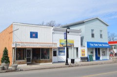 North Liberty Commercial Historic Districtlisted 2014
 North Liberty Parklisted 2007
Population over time
2 figuresNorth Liberty fell from 1,896 to 1,623 between 2010 and 2020. These are the recorded population figures Wikidata holds for this place, reached through the Geographic Names Information System number this page is keyed on rather than by name, so they belong to this place and not to another of the same name. Most are census counts, but not all are: an early figure may be a founding or settlement estimate, and an estimate published within five years of a census is left out. The change column is computed, and is left blank where more than 20 years separate a figure from the one before it, because a gap that long is not a change between two counts.
| Year | People | Change |
|---|---|---|
| 2010 | 1,896 | |
| 2020 | 1,623 | -273 (-14%) |
Topographic sheets covering this place
5 surveys from 12 printed sheetsMatched by testing this settlement's coordinate against the published boundary of every sheet in the United States Geological Survey's historical collection. Each opens the scanned sheet at the Survey.
- 1953 USGS Chicago quadrangle1:250000, 5 printings
- 1957 USGS Chicago quadrangle1:250000
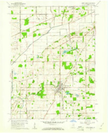
- 1958 USGS North Liberty quadrangle1:24000, 2 printings
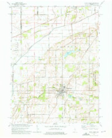
- 1974 USGS North Liberty quadrangle1:24000, 2 printings
- 1983 USGS South Bend quadrangle1:100000, 2 printings


In the county-history sources
6,497 words on this townshipHistory of St. Joseph County, Indiana :, published 1880 names this settlement in its chapter on Liberty Township. These are the passages that mention it, exactly as the scans read.
Liberty township formerly embraced the territory included iu Lincoln township, but being inconvenient for the settlers that resided in (now) Lincoln township to attend elections, in June, 1866, according to petitions of Lincoln settlers, it was detached and made an independent township. Liberty is generally known as being among the first settled townships in St. Joseph county. The first settlements were made iu 1833 near North Liberty, by John Kane, John and Jacob Earhart and Isaac Townsend. But few other settlers came into the township till 1836. John Rupel came in January, tliis year, soon followed by David Rupel, Jas. Cole, Jacob Rupel and Joseph Liggett.
Passage source: History of St. Joseph County, Indiana :, published 1880.
In May, 1837, the township was organized by the following persons: Daniel and James Antrim, John and David Rupel, Samuel Loring, James Cole, Jacob Rupel and Joseph Liggett. The first election was held the same spring, in North Liberty, at the house of Jas. P. Antrim, who was elected Justice of the Peace. In 1838 Mr. AValdsmith, father of Geo. Waldsmith, a present resident of Liberty township, settled on section 30.
Passage source: History of St. Joseph County, Indiana :, published 1880.
In 1837 a grist mill was built in North Liberty, much to the convenience and accommodation of the settlers. In 1S39 Hiram Bean and Alonzo Hill built a saw-mill not far Irom where the present grist-mill stands.
Passage source: History of St. Joseph County, Indiana :, published 1880.
Machine-read from a century-old scan, so expect the errors a machine makes: misspelled names, dropped words, stray characters.
Read the whole chapter on Liberty Township - it names this place 15 more 15 times.
Mines and quarries near this place
2 within 5 milesRegional context, not property-specific evidence. The federal mineral resources record lists 2 workings within 5 miles of North Liberty: 1 producer, 1 past producer. 1 still produces. What was taken out: Stone, Sand and Gravel, Construction. Distance is straight-line from the map coordinates, so a quarry counted here may appear on a neighbouring settlement's page as well.
| Where | Site | Commodity | Status | Recorded |
|---|---|---|---|---|
| Bills Gravel Pit | Sand and Gravel, Construction | Past Producer | ||
| Futa Marl Quarry | Stone | Producer |
Storms near this place
25 since 1996Regional context, not property-specific evidence. The National Weather Service names North Liberty in 25 storm reports between 1996 and 2024: 15 thunderstorm wind, 8 hail, 1 flash flood, 1 flood. No death or injury is recorded in these reports. Each account below is quoted exactly as the forecast office filed it, from the NOAA Storm Events Database, and each date opens the federal record of that event.
| When | Event | Place named | Harm | What the report says |
|---|---|---|---|---|
| August 2016 | Flash Flood | North Liberty | $5,100,000 | Emergency management officials reported widespread flooding and flash flooding across portions of the county from North Liberty into the South Bend/Mishawaka area to the state line. The most extensive, and in some cases life threatening, flash flooding occurred in the city of South Bend where over a dozen roads were closed due to a foot or more of water flowing over the roads. Several homes were impacted by flood waters with basement/foundation damage to at least 2 homes that required evacuation/rescue of the homeowners. Many others were displaced across the city and outlying county areas. The flood waters lifted a local media outlets car off the road and onto a rail along the road, allowing the occupants to escape before it flipped over. Rainfall reports of 4 to 8 inches were recorded in a short period of time as precipitable waters of over 2.2 inches advected into the area. Many roads remained closed for several days as flood waters were slow to recede. Damage totals were $5,100,000. Under FEMA guidelines, a total of 845 homes were affected. Of those 300 suffered significant damage and 180 were deemed catastrophic. |
| February 2018 | Flood | North Liberty | $1,100,000 | Extensive flooding occurred across the county as all area waterways exceeded their limited, reaching record levels in some spots. Residents had to be evacuated along many of the rivers with numerous homes and businesses suffering varying degrees of damage. In addition, numerous roads were closed due to high water for several days including portions of US 331, 20 and 6 as well as several state routes. Washouts were reported in some areas. Damage estimates totaled at least 1.1 million dollars. |
| March 2023 | Thunderstorm Wind | North Liberty | $25,000 | A building collapsed in North Liberty. This building was damaged by a fire in February. |
| March 2023 | Thunderstorm Wind | North Liberty | $5,000 | The roadway was blocked due to a downed tree. |
| June 2021 | Thunderstorm Wind | North Liberty | $5,000 | A picture was submitted of a large 12 to 18 inch diameter tree blown down onto a home and metal fence, but the base of the tree was rotten. |
| July 2023 | Thunderstorm Wind | North Liberty | $3,000 | Broadcast media reports several trees down in North Liberty. |
| July 2023 | Thunderstorm Wind | North Liberty | $1,500 | Tree snapped in half on IN-23 in North Liberty at the intersection with Market Street. Time estimated by radar. |
| June 2024 | Thunderstorm Wind | North Liberty | $1,000 | Large tree down across State Route 4. |
| July 2023 | Thunderstorm Wind | North Liberty | $1,000 | Report of power lines down in North Liberty. |
| July 2021 | Thunderstorm Wind | North Liberty | - | Limb down of unknown size. |
| May 2019 | Thunderstorm Wind | North Liberty | - | Local media reported trees wre blown down onto power lines. |
| August 2016 | Thunderstorm Wind | North Liberty | - | A tree was blown down onto a house with power lines also down in the area. |
| June 2014 | Thunderstorm Wind | North Liberty | - | The public reported a tree was blown down onto County Road 4. |
| June 2014 | Hail | North Liberty | - | The public reported hail to the size of nickels just north of North Liberty on State Route 23. |
| June 2014 | Hail | North Liberty | - | Amateur radio operators relayed reports of hail ranging from the size of quarters to golf balls in an area from North Liberty to three miles north of North Liberty. |
| June 2014 | Hail | North Liberty | - | A trained spotter reported half dollar size hail north of North Liberty. |
| June 2013 | Hail | North Liberty | - | Several reports were relayed by local media of hail ranging from the size of quarters to half dollars. |
| June 2012 | Thunderstorm Wind | North Liberty | - | Local media outlets reported scattered trees and tree limbs down across the city of North Liberty, including near the intersection of Wolf and State Route 23. Several tents at local festival were also picked up. No injuries were reported. |
| July 2005 | Thunderstorm Wind | North Liberty | - | Numerous trees reported down in and near the city of North Liberty. |
| May 2014 | Hail | North Liberty | - | no account filed |
| May 2014 | Hail | North Liberty | - | no account filed |
| July 2003 | Hail | North Liberty | - | no account filed |
| July 2003 | Hail | North Liberty | - | no account filed |
| May 2000 | Thunderstorm Wind | North Liberty | - | no account filed |
| January 1996 | Thunderstorm Wind | North Liberty | - | no account filed |
Nearest settlements
The eight closest, with where each one stands in the county. Distances are straight-line, computed from the Geographic Names Information System coordinates.
| Map | Place | Distance | Sheets |
|---|---|---|---|
| Pine Station | 5.4 miles | 11 | |
| Walkerton | 5.5 miles | 10 | |
| Crumstown | 6.3 miles | 12 | |
| Lakeville | 8.2 miles | 11 | |
| Colburn | 8.5 miles | 11 | |
| Nutwood | 8.7 miles | 11 | |
| Westfield | 10.1 miles | 11 | |
| Orchard Heights Addition | 11.0 miles | 11 |
Elsewhere
Matched on this settlement's Geographic Names Information System number rather than its name, so it cannot be a different place of the same name in another state.
| Wikipedia article on North Liberty | An encyclopaedic summary. Its text is share-alike, so it is linked here rather than copied. |
| Wikidata item Q2251089 | The structured record the population and elevation above come from. Public domain (CC0). |
Provenance
This settlement is recorded in the Geographic Names Information System as feature 452707. The sheet list is computed by point-in-boundary test against the United States Geological Survey's historical topographic inventory. Both are works of the United States government and carry no copyright under 17 U.S.C. 105.
Mines and quarries. USGS Mineral Resources Data System (MRDS) https://mrdata.usgs.gov/mrds/ A work of the United States government, no copyright under 17 U.S.C. 105.
Storms. NOAA National Centers for Environmental Information, Storm Events Database https://www.ncei.noaa.gov/stormevents/ A work of the United States government, no copyright under 17 U.S.C. 105. Narratives are quoted verbatim from the National Weather Service report and are not edited or summarised.