 Block
Perkinsville, Indiana
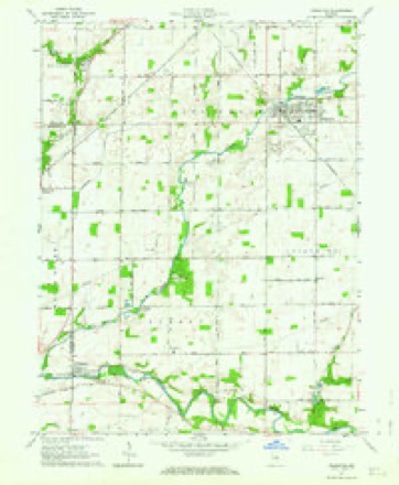
11 topographic sheets cover this place, the earliest surveyed in 1953 and the latest in 1986. It stands in Jackson Township. It lies in ZIP code area 46011. It stands on Pipe Creek. The Survey maps it on the Frankton quadrangle.
Topographic sheets covering this place
4 surveys from 11 printed sheetsMatched by testing this settlement's coordinate against the published boundary of every sheet in the United States Geological Survey's historical collection. Each opens the scanned sheet at the Survey.
- 1953 USGS Muncie quadrangle1:250000, 5 printings
- 1956 USGS Muncie quadrangle1:250000
- 1962 USGS Frankton quadrangle1:24000, 2 printings
- 1986 USGS Muncie quadrangle1:100000, 3 printings



In the county-history sources
447 words on this townshipHistory of Madison County, Indiana, from 1820 to 1874 : Giving a General Review of Principal Events, Statistical and Historical Items, Derived from Official Sources, published 1874 names this settlement in its chapter on Jackson Township. These are the passages that mention it, exactly as the scans read.
This township was named in honor of Ex-President Andrew Jackson. It is six miles from north to south, and is in the shape of an L, and contains twenty-eight square miles. White river runs through this township from east to west, and Pipe Creek through the northwest corner. Stony Creek has its source in the southeast corner. Perkinsville and Hamilton are in this township, both of which are voting places.
Passage source: History of Madison County, Indiana, from 1820 to 1874 : Giving a General Review of Principal Events, Statistical and Historical Items, Derived from Official Sources, published 1874.
Among the first Justices were Henry Shetterly and J. N. Berreman. The present one is J. M. Garrettson. Among the first ministers we find the names of Nathaniel Hichmond, James Perkins, H. Smith, James Havens and John H. Hull. Among the first merchants were Beck with <& Cole, and Hedrick & Bristol. Among the first pliysicians were Dr. Douglass, T. L. Carr and Dr. Clark. The trade of this township is divided between Anderson, Xoblesville and Perkinsville. The northern and southern parts of this township are level ; the central portion is inclined to be a little broken and is excellent land.
Passage source: History of Madison County, Indiana, from 1820 to 1874 : Giving a General Review of Principal Events, Statistical and Historical Items, Derived from Official Sources, published 1874.
Machine-read from a century-old scan, so expect the errors a machine makes: misspelled names, dropped words, stray characters.
Mines and quarries near this place
4 within 5 milesRegional context, not property-specific evidence. The federal mineral resources record lists 4 workings within 5 miles of Perkinsville: 2 producers, 1 occurrence, 1 past producer. 2 still produce. What was taken out: Stone, Crushed/Broken, Zinc, Sulfur, Sand and Gravel, Construction. Distance is straight-line from the map coordinates, so a quarry counted here may appear on a neighbouring settlement's page as well.
| Where | Site | Commodity | Status | Recorded |
|---|---|---|---|---|
| Southard Pit | Sand and Gravel, Construction | Producer | ||
| Sphalerite Occurrence Z80 | Zinc, Sulfur | Occurrence | Sphalerite | |
| Lapel Mine & Mill | Stone, Crushed/Broken | Producer | ||
| Lapel Quarry | Stone, Crushed/Broken | Past Producer |
Storms near this place
6 since 2009Regional context, not property-specific evidence. The National Weather Service names Perkinsville in 6 storm reports between 2009 and 2025: 3 hail, 2 thunderstorm wind, 1 tornado. No death or injury is recorded in these reports. Each account below is quoted exactly as the forecast office filed it, from the NOAA Storm Events Database, and each date opens the federal record of that event.
| When | Event | Place named | Harm | What the report says |
|---|---|---|---|---|
| July 2024 | Tornado (EF2) | Perkinsville | $750,000 | The tornado began in far eastern Hamilton County as an EF0 before skipping across Indiana Route 13 into Madison County and quickly landing in a field at a cemetery south of Perkinsville in Madison county, causing sporadic tree damage. The tornado crossed the White River, snapping and uprooting several trees at a residence south of County Road 300 North where it was rated an EF1. The tornado then moved into a corn field before lifting briefly prior to hitting the Frankton Lapel Administration Building where significant brick wall and roof damage occurred. The roof of a small gymnasium at this building was lifted and thrown approximately 150 yards to the north northeast while the western brick wall collapsed inward. Numerous concrete masonry blocks were thrown from the wall into the top of several school buses that also sustained damage. One bus had a small but long metal support driven through the frame. The tornado was rated EF2 here before it continued into a corn field to the northeast and dissipated. |
| June 2025 | Thunderstorm Wind | Perkinsville | $10,000 | Considerable tree limbs and tree debris from thunderstorm wind gusts in Camp Kikthawenund. |
| August 2009 | Thunderstorm Wind | Perkinsville | $1,000 | A 12 inch diameter tree was blown down at State Route 13 and County Road 400 North due to thunderstorm wind gusts. |
| May 2011 | Hail | Perkinsville | - | Hail, half dollar to golf ball sized, was reported with this storm. |
| May 2011 | Hail | Perkinsville | - | no account filed |
| May 2011 | Hail | Perkinsville | - | no account filed |
Nearest settlements
The eight closest, with where each one stands in the county. Distances are straight-line, computed from the Geographic Names Information System coordinates.
| Map | Place | Distance | Sheets |
|---|---|---|---|
| Hamilton | 4.3 miles | 13 | |
| Fishersburg | 5.0 miles | 13 | |
| Lapel | 5.3 miles | 13 | |
| Edgewood Village | 6.5 miles | 13 | |
| Bloomer | 6.5 miles | 13 | |
| Frankton | 7.0 miles | 11 | |
| Edgewood | 7.3 miles | 14 | |
| River Forest | 7.5 miles | 14 |
Provenance
This settlement is recorded in the Geographic Names Information System as feature 441022. The sheet list is computed by point-in-boundary test against the United States Geological Survey's historical topographic inventory. Both are works of the United States government and carry no copyright under 17 U.S.C. 105.
Mines and quarries. USGS Mineral Resources Data System (MRDS) https://mrdata.usgs.gov/mrds/ A work of the United States government, no copyright under 17 U.S.C. 105.
Storms. NOAA National Centers for Environmental Information, Storm Events Database https://www.ncei.noaa.gov/stormevents/ A work of the United States government, no copyright under 17 U.S.C. 105. Narratives are quoted verbatim from the National Weather Service report and are not edited or summarised.