 Block
Pleasant Mills, Indiana
12 topographic sheets cover this place, the earliest surveyed in 1953 and the latest in 1986. It stands in St. Marys Township. It lies in ZIP code area 46733. It stands on Martz Creek. The Survey maps it on the Wren quadrangle. It stands 794 feet above sea level.
On record in Pleasant Mills
Buildings and businesses the archive holds for this place. Each opens its own page, with the source record it came from.
On the National Register 1 record
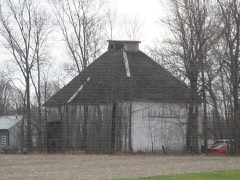 Ben Colter Polygonal Barnlisted 1993
Topographic sheets covering this place
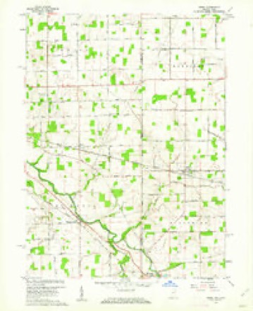
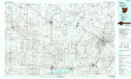
4 surveys from 12 printed sheetsMatched by testing this settlement's coordinate against the published boundary of every sheet in the United States Geological Survey's historical collection. Each opens the scanned sheet at the Survey.
- 1953 USGS Muncie quadrangle1:250000, 5 printings
- 1956 USGS Muncie quadrangle1:250000
- 1960 USGS Wren quadrangle1:24000, 3 printings
- 1986 USGS Lima quadrangle1:100000, 3 printings


In the county-history sources
1,069 words on this townshipSnow's History of Adams County, Indiana, published 1907 names this settlement in its chapter on St. Marys Township. These are the passages that mention it, exactly as the scans read.
Its history would be interesting reading if all were given. The Hope Well church building to the cast of Pleasant Mills, in section 28, is a log structure, but has long since been used as a residence. This township has two railroads, the Clover Leaf, which passes through Pleasant Mills, and the Chicago & Lrie, through Rivare.
Passage source: Snow's History of Adams County, Indiana, published 1907.
183S. This was the fust white child born in this township. Some of the other early residents of this tosvnship were a Mr. A.yres, who came in 1S21, and settled in section 16, on the Wayne trace; that John Ross came in 1S29 and settled in section 28. and Esias Daily in 1833 and settled in section 26 ; that Zachariah Smith and William Heath, Sr., came in 1S36. Andrew Teeple, Robert D. Tisdale, Elisha Gulic and Ardillas Carter were all early settlers. The Wayne trace passes along the Saint Mary's river and through the Rivare Reservation, which was platted for allotment on the 26th day of May, 1S55. This township has two towns, Rivare and Pleasant Mills, also two railroads. The plat of Pleasant Mills was recorded on the 8th day of September, 1846. The town was laid out by F. A. Goddard and George W. Heath in thirty iots, sixty-six by one hundred and thirty-two feet in size. On the 27th day of December, 1850. an addition of thirty-two lots was made by the original proprietors of tins town site. Pleasant Alills is on the plank road route connecting Saint Mary's with Fort Wayne, and in the fifties was a flourishing town. Eefore that time the river was used as a means of travel and for carrying produce to market. The boats and large canoes conveyed grain, lumber, furs and other produce from Goddard's stores and mills down the river to market. The first mill was on the east side of the river and was built in 1834. The next was on the west side and was built four years later, with buhrs for grinding grain. This mill changed to a woolen factory and a new grist mill built in 1846. This was operated for about fifty years, and rebuilt in 1896 by J. C. Cowan and W. W. Smith.. In this village many of the old buildings have outlived their usefulness and have been torn down. However, one of the old Goddard store buildings is yet standing at the corner of Main and Jefferson streets and is used as a residence and baiber shop. Pleasant Mills has three churches, the Baptist, a brick building, put up in 1878; a United Brethren structure that shows its age, and a new frame house, built by the Methodist congregation. This town, unlike Monmouth, when its railroad was completed in 18S0, regained some of its lost vitality and took on new life. It opened up a grain market and now has several good general stores. This town has a large brick graded school building. The original was a two-story, two-room brick building that was put up in 1881 by Trustee A. M. Fuller. This was remodeled and enlarged in 1897 and an additional primary room built in 1906 by Trustee William II. Teeple. Pleasant Mills has one brick residence, one restaurant, one blacksmith shop, one barber shop, one grain elevator, one livery stable, one butcher shop, one hardware store, threegeneral stores and one doctor, Dr. J. W. Vizard, state representative for Adams county at this time.
Passage source: Snow's History of Adams County, Indiana, published 1907.
Machine-read from a century-old scan, so expect the errors a machine makes: misspelled names, dropped words, stray characters.
Mines and quarries near this place
1 within 5 milesRegional context, not property-specific evidence. The federal mineral resources record lists 1 working within 5 miles of Pleasant Mills: 1 producer. All of them still produce. What was taken out: Stone, Crushed/Broken. Distance is straight-line from the map coordinates, so a quarry counted here may appear on a neighbouring settlement's page as well.
| Where | Site | Commodity | Status | Recorded |
|---|---|---|---|---|
| Pleasant Mills Quarry | Stone, Crushed/Broken | Producer |
Storms near this place
5 since 1998Regional context, not property-specific evidence. The National Weather Service names Pleasant Mills in 5 storm reports between 1998 and 2015: 5 hail. No death or injury is recorded in these reports. Each account below is quoted exactly as the forecast office filed it, from the NOAA Storm Events Database, and each date opens the federal record of that event.
| When | Event | Place named | Harm | What the report says |
|---|---|---|---|---|
| May 2015 | Hail | Pleasant Mills | - | Amateur radio operators reported dime size hail in the Pleasant Mills area. |
| August 2009 | Hail | Pleasant Mills | - | A trained spotter reported penny size hail for approximately thirty seconds. |
| June 2012 | Hail | Pleasant Mills | - | no account filed |
| June 2012 | Hail | Pleasant Mills | - | no account filed |
| May 1998 | Hail | Pleasant Mills | - | no account filed |
Nearest settlements
The eight closest, with where each one stands in the county. Distances are straight-line, computed from the Geographic Names Information System coordinates.
| Map | Place | Distance | Sheets |
|---|---|---|---|
| Rivare | 2.4 miles | 12 | |
| Salem | 4.2 miles | 13 | |
| Monroe | 5.5 miles | 13 | |
| Decatur | 5.9 miles | 13 | |
| Elm Tree Crossroads | 6.1 miles | 13 | |
| Coppess Corner | 6.5 miles | 13 | |
| Monmouth | 8.2 miles | 13 | |
| Peterson | 9.5 miles | 10 |
Elsewhere
Matched on this settlement's Geographic Names Information System number rather than its name, so it cannot be a different place of the same name in another state.
| Wikipedia article on Pleasant Mills | An encyclopaedic summary. Its text is share-alike, so it is linked here rather than copied. |
| Wikidata item Q7203904 | The structured record the population and elevation above come from. Public domain (CC0). |
Provenance
This settlement is recorded in the Geographic Names Information System as feature 441289. The sheet list is computed by point-in-boundary test against the United States Geological Survey's historical topographic inventory. Both are works of the United States government and carry no copyright under 17 U.S.C. 105.
Mines and quarries. USGS Mineral Resources Data System (MRDS) https://mrdata.usgs.gov/mrds/ A work of the United States government, no copyright under 17 U.S.C. 105.
Storms. NOAA National Centers for Environmental Information, Storm Events Database https://www.ncei.noaa.gov/stormevents/ A work of the United States government, no copyright under 17 U.S.C. 105. Narratives are quoted verbatim from the National Weather Service report and are not edited or summarised.