 Block
Decatur, Indiana
13 topographic sheets cover this place, the earliest surveyed in 1953 and the latest in 1992. It stands in Washington Township. It lies in ZIP code area 46733. It stands on Borum Run. The Survey maps it on the Decatur quadrangle. 9,913 people lived here at the 2020 count. It stands 801 feet above sea level.
Research this city
On record in Decatur
Buildings and businesses the archive holds for this place. Each opens its own page, with the source record it came from.
On the National Register 6 records
 Adams County Courthouselisted 2008
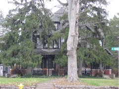 Bowers, John S. Houselisted 1982
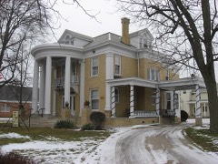 Charles Dugan Houselisted 2009
 Grand Rapids and Indiana Railroad Depotlisted 2017
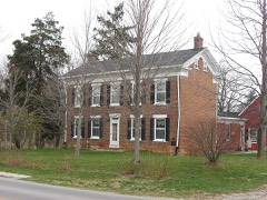 Lenhart Farmhouselisted 2002
- Decatur Homesteadslisted 2022
Population over time
2 figuresDecatur grew from 9,405 to 9,913 between 2010 and 2020. These are the recorded population figures Wikidata holds for this place, reached through the Geographic Names Information System number this page is keyed on rather than by name, so they belong to this place and not to another of the same name. Most are census counts, but not all are: an early figure may be a founding or settlement estimate, and an estimate published within five years of a census is left out. The change column is computed, and is left blank where more than 20 years separate a figure from the one before it, because a gap that long is not a change between two counts.
| Year | People | Change |
|---|---|---|
| 2010 | 9,405 | |
| 2020 | 9,913 | +508 (+5%) |
Topographic sheets covering this place
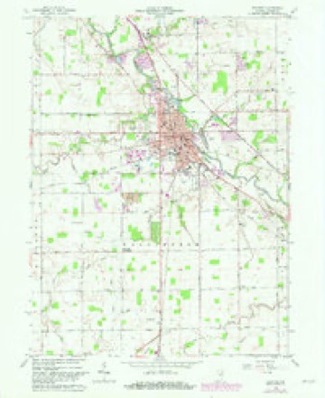
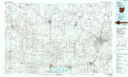
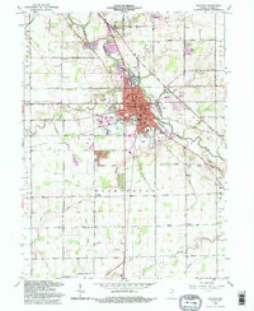
5 surveys from 13 printed sheetsMatched by testing this settlement's coordinate against the published boundary of every sheet in the United States Geological Survey's historical collection. Each opens the scanned sheet at the Survey.
- 1953 USGS Muncie quadrangle1:250000, 5 printings
- 1956 USGS Muncie quadrangle1:250000
- 1962 USGS Decatur quadrangle1:24000, 3 printings
- 1986 USGS Lima quadrangle1:100000, 3 printings
- 1992 USGS Decatur quadrangle1:24000


In the county-history sources
975 words on this townshipSnow's History of Adams County, Indiana, published 1907 has no passage naming this settlement, which was common for smaller places. Its township is covered in full.
The chapter on Washington Township covers the township.
Read the chapter on Washington Township - 975 words.
Mines and quarries near this place
4 within 5 milesRegional context, not property-specific evidence. The federal mineral resources record lists 4 workings within 5 miles of Decatur: 3 producers, 1 past producer. 3 still produce. What was taken out: Sand and Gravel, Construction, Stone, Clay. Distance is straight-line from the map coordinates, so a quarry counted here may appear on a neighbouring settlement's page as well.
| Where | Site | Commodity | Status | Recorded |
|---|---|---|---|---|
| Decatur City Engr. | Stone | Producer | ||
| Krick-Tyndall Pit | Clay | Past Producer | ||
| Adams County Sand & Gravel Pit | Sand and Gravel, Construction | Producer | ||
| Cly Gravel Company | Sand and Gravel, Construction | Producer |
Storms near this place
60 of 70 shownRegional context, not property-specific evidence. The National Weather Service names Decatur in 70 storm reports between 1997 and 2025: 36 thunderstorm wind, 28 hail, 2 lightning, 2 tornado. The reports record 1 injury. Each account below is quoted exactly as the forecast office filed it, from the NOAA Storm Events Database, and each date opens the federal record of that event.
| When | Event | Place named | Harm | What the report says |
|---|---|---|---|---|
| July 2005 | Lightning | Decatur | 1 hurt | A firefighter was outside his home watching the storms approach when he was struck by lightning. He was taken to the hospital for evaluation but was released a few hours later with no major injuries. The same lightning strike also affected an adjacent house. The energy form the lightning entered a house and traveled through a set of video game controllers being held by two boys. Each received a shock from the strike, but did not require medical treatment. |
| August 2006 | Tornado (F1) | Decatur | $125,000 | The tornado briefly touched down 2 miles east of Decatur, in the Briarwood subdivision, at the intersection of US 224 and CR 200 E. Part of a roof was ripped off, with a garage door being pulled out. A leaf was found sucked up under a piece of siding. The tornado crossed 200 E, damaging some trees, blowing a barn door in and flattening a small area of soy beans before lifting. The funnel moved across US 224 and touched down about a quarter mile from where it lifted. A parked car was flipped, totallin |
| August 1998 | Flash Flood | Decatur | $100,000 | NUMEROUS COUNTY ROADS ESPECIALLY ACROSS THE SOUTHERN HALF OF THE COUNTY WERE INUNDATED ALONG WITH LOW LYING AGRICULTURAL FARMLANDS. |
| July 1998 | Lightning | Decatur | $50,000 | A DOUBLE WIDE TRAILER AT THE CALVARY WORSHIP CENTER BURNED TO THE GROUND DUE TO A LIGHTNING STRIKE. |
| April 2006 | Tornado (F1) | Decatur | $45,000 | A tornado touched down roughly 3 miles northwest of Decatur and moved southeast across mainly open fields. Eyewitness reports of debris at the ground but no immediate condensation funnel. The tornado moved over a farm just east of the intersection of county roads West 750 North and North 200 W. While no significant damage occurred, several buildings suffered minor damage including damage to doors and a roof of a barn, trees being uprooted, and structure damage to a refinished garage. A corncob was also found inside a mini van on the property, apparently being thrown by the tornado through the back window. The circulation ended as it move into a grove of trees, roughly 2 miles northwest of Decatur. The damage was consistent with a low end F1 tornado with winds of around 80 mph. No injuries or fatalities were reported. Damage to all property is estimated at around $45,000. |
| December 1998 | Thunderstorm Wind | Decatur | $30,000 | GARAGE DESTROYED. EIGHT AMERICAN ELECTRIC POWER POLES WERE KNOCKED DOWN. |
| August 2001 | Thunderstorm Wind | Decatur | $25,000 | The Quality Glass store at 12th Street and Nuttman Avenue had the top section of its roof torn off by a thunderstorm wind gust. Damage to the roof was estimated to be between $10,000 and $15,000. Debris from the roof was blown across 12th Street and onto a parked car and into two yards. A power pole behind the building was also damaged and had to be replaced. |
| November 2005 | Thunderstorm Wind | Decatur | $20,000 | Numerous trees, as well as a barn were blown over. |
| June 2008 | Thunderstorm Wind | Decatur | $15,000 | Amateur radio operators reported numerous trees and power lines down in the city of Decatur. |
| May 2000 | Thunderstorm Wind | Decatur | $15,000 | A travel trailer overturned and two barns destroyed. |
| June 2008 | Thunderstorm Wind | Decatur | $10,000 | County officials reported a tree branch down onto a power line with other power outages in the area. |
| August 2005 | Thunderstorm Wind | Decatur | $10,000 | A large tree was blown down northwest of Decatur and a roof was blown off a building near the town of Monmouth. |
| November 1998 | Thunderstorm Wind | Decatur | $10,000 | MANY TREES AND POWER LINES WERE DOWN ACROSS THE TOWN. |
| April 2025 | Hail | Decatur | $1,000 | Quarter size hail in Decatur. |
| March 2024 | Hail | Decatur | $1,000 | no account filed |
| July 1999 | Thunderstorm Wind | Decatur | $500 | Trees downed. |
| June 2022 | Thunderstorm Wind | Decatur | - | Amateur radio operators reported multiple trees blown down. |
| July 2021 | Flood | Decatur | - | The Indiana State Police reports high water over the road at W 600 N around N 100 W. |
| May 2019 | Thunderstorm Wind | Decatur | - | The public reported a one foot diameter trees was uprooted. |
| July 2017 | Thunderstorm Wind | Decatur | - | Trees were blown down in the area. |
| July 2017 | Thunderstorm Wind | Decatur | - | A trained spotter estimated wind gusts to 60 mph. |
| July 2016 | Thunderstorm Wind | Decatur | - | A trained spotter reported several healthy four to six inch tree limbs being blown down. |
| July 2016 | Thunderstorm Wind | Decatur | - | A trained spotter reported a 45 foot tall, two foot diameter tree was blown down. Other smaller branches were also downed in the area. |
| July 2016 | Thunderstorm Wind | Decatur | - | Emergency management officials reported several tree limbs down, some up to eight inches in diameter. An evergreen tree was also uprooted with tree limbs suffering damage at Belmont High School. |
| June 2014 | Thunderstorm Wind | Decatur | - | A tree was reported blown down one mile northwest of Decatur by emergency management officials. |
| July 2014 | Thunderstorm Wind | Decatur | - | Trained spotters reported several small to medium size branches down across the town. |
| November 2013 | Hail | Decatur | - | A trained spotter reported quarter size hail. |
| November 2013 | Thunderstorm Wind | Decatur | - | A trained spotter reported wind gusts of at least 60 mph. |
| September 2012 | Thunderstorm Wind | Decatur | - | Law enforcement officials reported a tree was blown down onto Winchester Road. |
| June 2012 | Thunderstorm Wind | Decatur | - | Emergency management officials reported massive damage throughout the northern part of the county with intermittent damage across the remainder of the county. In Decatur, roofs were blown off, trucks blown over and several small fires reported, likely from downed power lines. |
| August 2011 | Hail | Decatur | - | A trained spotter reported hail to the size of dimes lasted for about 5 minutes in downtown Decatur. |
| May 2011 | Hail | Decatur | - | A trained spotter reported tennis ball size hail at U.S. 224 and County Road 300 West. |
| June 2007 | Thunderstorm Wind | Decatur | - | Two trees, one of which was 12 inches in diameter, were blown down along with several small branches. |
| July 2005 | Thunderstorm Wind | Decatur | - | A few trees were blown down just north of Decatur. |
| May 2004 | Thunderstorm Wind | Decatur | - | Trained spotter estimated wind gusts to 60 MPH. |
| July 2003 | Thunderstorm Wind | Decatur | - | Law enforcement reported trees and power lines down west of Decatur. |
| September 2002 | Thunderstorm Wind | Decatur | - | Emergency management reported a shed was blown over. |
| November 2002 | Thunderstorm Wind | Decatur | - | A trained spotter reported numerous trees down just north of Decatur. |
| August 2001 | Thunderstorm Wind | Decatur | - | Numerous power lines down. |
| August 2001 | Thunderstorm Wind | Decatur | - | Trees and power lines blown down. |
| May 2000 | Thunderstorm Wind | Decatur | - | Trees down. |
| May 2000 | Thunderstorm Wind | Decatur | - | Trees down on power lines. |
| July 1998 | Thunderstorm Wind | Decatur | - | ROOF DAMAGE JUST WEST OF DECATUR. |
| July 2016 | Hail | Decatur | - | no account filed |
| May 2011 | Hail | Decatur | - | no account filed |
| May 2011 | Hail | Decatur | - | no account filed |
| May 2005 | Hail | Decatur | - | no account filed |
| May 2004 | Hail | Decatur | - | no account filed |
| May 2004 | Hail | Decatur | - | no account filed |
| April 2003 | Hail | Decatur | - | no account filed |
| April 2003 | Hail | Decatur | - | no account filed |
| July 2003 | Hail | Decatur | - | no account filed |
| July 2003 | Hail | Decatur | - | no account filed |
| May 2002 | Hail | Decatur | - | no account filed |
| June 2002 | Hail | Decatur | - | no account filed |
| June 2002 | Hail | Decatur | - | no account filed |
| May 2001 | Hail | Decatur | - | no account filed |
| May 2001 | Hail | Decatur | - | no account filed |
| May 2001 | Hail | Decatur | - | no account filed |
| May 2001 | Hail | Decatur | - | no account filed |
Nearest settlements
The eight closest, with where each one stands in the county. Distances are straight-line, computed from the Geographic Names Information System coordinates.
| Map | Place | Distance | Sheets |
|---|---|---|---|
| Monmouth | 2.7 miles | 13 | |
| Elm Tree Crossroads | 3.2 miles | 13 | |
| Preble | 4.5 miles | 10 | |
| Peterson | 4.7 miles | 10 | |
| Rivare | 4.8 miles | 12 | |
| Pleasant Mills | 5.9 miles | 12 | |
| Monroe | 5.9 miles | 13 | |
| Coppess Corner | 6.1 miles | 13 |
Elsewhere
Matched on this settlement's Geographic Names Information System number rather than its name, so it cannot be a different place of the same name in another state.
| Wikipedia article on Decatur | An encyclopaedic summary. Its text is share-alike, so it is linked here rather than copied. |
| Wikidata item Q2348734 | The structured record the population and elevation above come from. Public domain (CC0). |
Provenance
This settlement is recorded in the Geographic Names Information System as feature 446543. The sheet list is computed by point-in-boundary test against the United States Geological Survey's historical topographic inventory. Both are works of the United States government and carry no copyright under 17 U.S.C. 105.
Mines and quarries. USGS Mineral Resources Data System (MRDS) https://mrdata.usgs.gov/mrds/ A work of the United States government, no copyright under 17 U.S.C. 105.
Storms. NOAA National Centers for Environmental Information, Storm Events Database https://www.ncei.noaa.gov/stormevents/ A work of the United States government, no copyright under 17 U.S.C. 105. Narratives are quoted verbatim from the National Weather Service report and are not edited or summarised.