 Block
Raber, Indiana
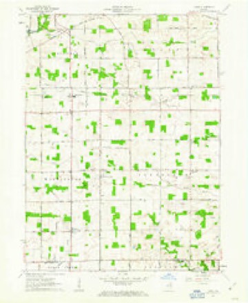
11 topographic sheets cover this place, the earliest surveyed in 1953 and the latest in 1994. It stands in Jefferson Township. It lies in ZIP code area 46725. The Survey maps it on the Laud quadrangle. It stands 846 feet above sea level.
Topographic sheets covering this place
5 surveys from 11 printed sheetsMatched by testing this settlement's coordinate against the published boundary of every sheet in the United States Geological Survey's historical collection. Each opens the scanned sheet at the Survey.
- 1953 USGS Fort Wayne quadrangle1:250000, 4 printings
- 1956 USGS Fort Wayne quadrangle1:250000, 2 printings
- 1961 USGS Laud quadrangle1:24000, 3 printings
- 1984 USGS Fort Wayne quadrangle1:100000
- 1994 USGS Fort Wayne quadrangle1:100000




What happened here
An account from the chapter on Jefferson township. The inset identifies its exact source book and publication year.
The Barkdall Murder
One of the events that attracted the attention of the people of Whitley county a generation ago was the Barkdall murder, that occurred in Jefferson township in 1871. Henry Barkdall, Sr., was born in Wurtemberg, Germany, October 15, 1805; was married there and in the year 1839. he emigrated to America. He first settled in Stark county, Ohio, three miles east of Canal Fulton, where he remained about ten years as a renter on a small farm.
In the county-history sources
21,244 words on this townshipHistory of Whitley County, Indiana, published 1907 names this settlement in its chapter on Jefferson Township. These are the passages that mention it, exactly as the scans read.
About 1886 a saw-mill was established by Taylor Brothers on the "Nickel Plate" Railroad two miles east of the town of Raber, where it was in 'operation a year or two, then moved to the Taylor farm in section 10, but soon after was sold and moved out of the township.
Passage source: History of Whitley County, Indiana, published 1907.
The mail was carried to Laud first from Fort Wayne and afterward from Aboite Station until 1879, when a tri-weekly route was established from Columbia City and Joseph Yontz was the carrier. This continued until the "Nickel Plate" Railroad was built. The Columbia City route was discontinued in 1883 and a daily mail was established from Peabody Station. In 1890, this was changed and the mail was carried from Raber Station until the establishment 1 if rural route No. 6, from Columbia City, March 1, 1902.
Passage source: History of Whitley County, Indiana, published 1907.
In the spring of 1883, a petition was circulated asking for the establishment of a postoffice at Raber Station on the "Nickel Plate" Railroad. The petition was granted the office was established and Samuel Clark was appointed the first postmaster. He was succeeded by Thomas J- Berry, who served until his death, July 30, 1901, when William Bogner was appointed as his successor and conducted the office until it was discontinued, March 31, 1902.
Passage source: History of Whitley County, Indiana, published 1907.
Machine-read from a century-old scan, so expect the errors a machine makes: misspelled names, dropped words, stray characters.
Read the whole chapter on Jefferson Township - it names this place 12 more 12 times.
Storms near this place
4 since 2013Regional context, not property-specific evidence. The National Weather Service names Raber in 4 storm reports between 2013 and 2026: 3 thunderstorm wind, 1 hail. No death or injury is recorded in these reports. Each account below is quoted exactly as the forecast office filed it, from the NOAA Storm Events Database, and each date opens the federal record of that event.
| When | Event | Place named | Harm | What the report says |
|---|---|---|---|---|
| February 2026 | Hail | Raber | - | CoCoRaHS observer measured at least one hailstone just over 1.5 inches in diameter. |
| November 2016 | Thunderstorm Wind | Raber | - | The public estimated wind gusts to 60 mph. |
| July 2014 | Thunderstorm Wind | Raber | - | Local officials reported trees, tree limbs and power lines down across the county. A power line was reported down across train tracks near State Route 9 and 14. |
| November 2013 | Thunderstorm Wind | Raber | - | Emergency management officials reported half of a barn roof was torn off. |
Nearest settlements
The eight closest, with where each one stands in the county. Distances are straight-line, computed from the Geographic Names Information System coordinates.
| Map | Place | Distance | Sheets |
|---|---|---|---|
| Briggs | 2.0 miles | 11 | |
| Laud | 2.7 miles | 11 | |
| Peabody | 3.0 miles | 11 | |
| Coesse | 3.5 miles | 11 | |
| Coesse Corners | 4.2 miles | 11 | |
| Walnut Corners | 4.7 miles | 11 | |
| Washington Center | 4.8 miles | 10 | |
| Dunfee | 5.1 miles | 10 |
Elsewhere
Matched on this settlement's Geographic Names Information System number rather than its name, so it cannot be a different place of the same name in another state.
| Wikipedia article on Raber | An encyclopaedic summary. Its text is share-alike, so it is linked here rather than copied. |
| Wikidata item Q7278679 | The structured record the population and elevation above come from. Public domain (CC0). |
Provenance
This settlement is recorded in the Geographic Names Information System as feature 441712. The sheet list is computed by point-in-boundary test against the United States Geological Survey's historical topographic inventory. Both are works of the United States government and carry no copyright under 17 U.S.C. 105.
Storms. NOAA National Centers for Environmental Information, Storm Events Database https://www.ncei.noaa.gov/stormevents/ A work of the United States government, no copyright under 17 U.S.C. 105. Narratives are quoted verbatim from the National Weather Service report and are not edited or summarised.