 Block
Peabody, Indiana
11 topographic sheets cover this place, the earliest surveyed in 1953 and the latest in 1994. It stands in Washington Township. It lies in ZIP code area 46725. The Survey maps it on the Laud quadrangle. It stands 830 feet above sea level.
Topographic sheets covering this place
5 surveys from 11 printed sheetsMatched by testing this settlement's coordinate against the published boundary of every sheet in the United States Geological Survey's historical collection. Each opens the scanned sheet at the Survey.
- 1953 USGS Fort Wayne quadrangle1:250000, 4 printings
- 1956 USGS Fort Wayne quadrangle1:250000, 2 printings
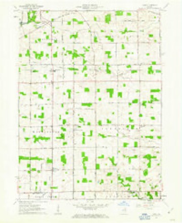
- 1961 USGS Laud quadrangle1:24000, 3 printings
- 1984 USGS Fort Wayne quadrangle1:100000
- 1994 USGS Fort Wayne quadrangle1:100000




In the county-history sources
7,634 words on this townshipHistory of Whitley County, Indiana, published 1907 names this settlement in its chapter on Washington Township. These are the passages that mention it, exactly as the scans read.
Washington is strictly an agricultural township. With the exception of lumber, brick and tile, very little manufacturing has been done in the township. Grain, hay. fruit and vegetables have been produced in large quatities and considerable attention has been given to raising live stock. Some 1 if the finest horses, cattle, hogs and sheep in the country can be found in this township. Xo large towns are located in the township. When the Nickel Plate Railroad was built in 1 881, a station was located in the north- ern part of the township and named "Peabody" in honor of S. J. Peabody. Whitley county's lumber king and soon after a postoffice was established at the place and Amos E. Redman was the first postmaster. Mr. Redman also conducted a general store in connection with the postoffice. Henry J. Ummel is conducting the business at the present time and is the present postmaster. A saw mill did an extensive business here for many years under the management of Lewis Gross, James B. Peabody. Cox & Sons, etc. George W. Irwin. Henry Lucke and Noah E. Hoops have also conducted stores here. Peabody is a good shipping point; large amounts of hay, grain, live stuck and lumber have been shipped from this point.
Passage source: History of Whitley County, Indiana, published 1907.
About 1867 David Ummel was killed by falling from a wagon while going to Columbia City and on February 8. 1877, Luther Jones was killed by a falling tree near what is now Maple Grove church. January 29, 1889, Lewis Cupp was killed by a log rolling upon him while hauling logs near the village of Peabody and John P. Rittenhouse was drowned at the gravel pit near the northwestern part of the township on June 17. 1888. and on May 5, 1885. John Wolford was killed by lightning- at Peabodv station.
Passage source: History of Whitley County, Indiana, published 1907.
Machine-read from a century-old scan, so expect the errors a machine makes: misspelled names, dropped words, stray characters.
Mines and quarries near this place
1 within 5 milesRegional context, not property-specific evidence. The federal mineral resources record lists 1 working within 5 miles of Peabody: 1 producer. All of them still produce. What was taken out: Stone. Distance is straight-line from the map coordinates, so a quarry counted here may appear on a neighbouring settlement's page as well.
| Where | Site | Commodity | Status | Recorded |
|---|---|---|---|---|
| Whitley County Hwy. Dept. | Stone | Producer |
Storms near this place
5 since 2011Regional context, not property-specific evidence. The National Weather Service names Peabody in 5 storm reports between 2011 and 2026: 3 thunderstorm wind, 2 hail. No death or injury is recorded in these reports. Each account below is quoted exactly as the forecast office filed it, from the NOAA Storm Events Database, and each date opens the federal record of that event.
| When | Event | Place named | Harm | What the report says |
|---|---|---|---|---|
| March 2017 | Thunderstorm Wind | Peabody | - | A trained spotter estimated wind gusts to 60 mph in the area. |
| July 2011 | Thunderstorm Wind | Peabody | - | Trained spotters estimated 60 mph wind gusts with the outflow of the thunderstorms. |
| February 2026 | Hail | Peabody | - | no account filed |
| June 2020 | Thunderstorm Wind | Peabody | - | no account filed |
| March 2016 | Hail | Peabody | - | no account filed |
Nearest settlements
The eight closest, with where each one stands in the county. Distances are straight-line, computed from the Geographic Names Information System coordinates.
| Map | Place | Distance | Sheets |
|---|---|---|---|
| Briggs | 1.0 miles | 11 | |
| Washington Center | 2.8 miles | 10 | |
| Raber | 3.0 miles | 11 | |
| Laud | 3.2 miles | 11 | |
| Walnut Corners | 3.3 miles | 11 | |
| Tunker | 4.4 miles | 10 | |
| Columbia City | 4.9 miles | 11 | |
| Coesse | 5.8 miles | 11 |
Elsewhere
Matched on this settlement's Geographic Names Information System number rather than its name, so it cannot be a different place of the same name in another state.
| Wikipedia article on Peabody | An encyclopaedic summary. Its text is share-alike, so it is linked here rather than copied. |
| Wikidata item Q7157212 | The structured record the population and elevation above come from. Public domain (CC0). |
Provenance
This settlement is recorded in the Geographic Names Information System as feature 440953. The sheet list is computed by point-in-boundary test against the United States Geological Survey's historical topographic inventory. Both are works of the United States government and carry no copyright under 17 U.S.C. 105.
Mines and quarries. USGS Mineral Resources Data System (MRDS) https://mrdata.usgs.gov/mrds/ A work of the United States government, no copyright under 17 U.S.C. 105.
Storms. NOAA National Centers for Environmental Information, Storm Events Database https://www.ncei.noaa.gov/stormevents/ A work of the United States government, no copyright under 17 U.S.C. 105. Narratives are quoted verbatim from the National Weather Service report and are not edited or summarised.