 Block
Washington Center, Indiana
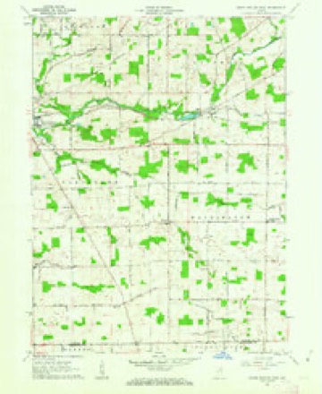
10 topographic sheets cover this place, the earliest surveyed in 1953 and the latest in 1994. It stands in Washington Township. It lies in ZIP code area 46725. The Survey maps it on the South Whitley East quadrangle.
Topographic sheets covering this place
5 surveys from 10 printed sheetsMatched by testing this settlement's coordinate against the published boundary of every sheet in the United States Geological Survey's historical collection. Each opens the scanned sheet at the Survey.
- 1953 USGS Fort Wayne quadrangle1:250000, 4 printings
- 1956 USGS Fort Wayne quadrangle1:250000, 2 printings
- 1962 USGS South Whitley East quadrangle1:24000, 2 printings
- 1984 USGS Fort Wayne quadrangle1:100000
- 1994 USGS Fort Wayne quadrangle1:100000




In the county-history sources
7,634 words on this townshipHistory of Whitley County, Indiana, published 1907 names this settlement in its chapter on Washington Township. These are the passages that mention it, exactly as the scans read.
The early settlers were at great inconveniences for many years in regard to postal matters. Those living in the north part of the township were obliged to go to Columbia City or South Whitley for their mail, while those living in the southern part went to Huntington or Liberty Mills. What a contrast now when most of the residents have their mail delivered daily at their gates. June 2/, 1855, the first postoffice was established in the township and was named "Washington Center," and Martin Bechtel was the postmaster and kept the office at his residence one mile south of the center of the township. He was succeeded by William Chamberlain but the office was discontinued many years ago.
Passage source: History of Whitley County, Indiana, published 1907.
The Washington Center United Brethren church was organized at the house of Martin Penn in 1866 by Rev. Fletcher Thomas. The charter members were : Martin Penn and wife, Peter R. Goble and wife, John Smith and wife. Peter Wagner and wife and Milton B. Emerson. In 1873 the society erected a large frame church at a cost of about two thousand dollars, which was dedicated by Rev. Cassel. The building committee was composed of Peter Creager, Milton B. Emerson. Levi Sickafoose, John Smith and S. P. Wagner. The contractors were Samuel Wolf and Samuel Sickafoose. In 1905 this church was replaced by a modern brick church building at a cost of three thousand one hundred and fifty dollars, and was dedicated on Sunday. December 31, 1905, by Rev. H. H. Font, D. D., of Dayton. Ohio. Waterfall & Son, of Columbia City, were the contractors and William H. Waterfall was the architect.
Passage source: History of Whitley County, Indiana, published 1907.
Machine-read from a century-old scan, so expect the errors a machine makes: misspelled names, dropped words, stray characters.
Fires near this place
5 since 2003Regional context, not property-specific evidence. The federal wildfire occurrence database lists 5 fires within 5 miles of Washington Center between 2003 and 2007, burning about 7 acres in total. None started naturally. None was recorded as arson. Distance is straight-line from the map coordinates, so a fire counted here may appear on a neighbouring settlement's page as well.
| Reported cause | Fires |
|---|---|
| Debris and open burning | 2 |
| Missing data/not specified/undetermined | 2 |
| Recreation and ceremony | 1 |
The most recent of them, most recent first, with the day each was reported and the service that recorded it.
| Date | Cause | Size | Reported by | Name on the report |
|---|---|---|---|---|
| 30 May 2007 | Debris and open burning | 3.0 acres | Indiana State Fire Marshal's Office | not named |
| 18 April 2003 | Missing data/not specified/undetermined | 1.0 acres | Indiana State Fire Marshal's Office | not named |
| 16 April 2003 | Missing data/not specified/undetermined | 1.0 acres | Indiana State Fire Marshal's Office | not named |
| 1 April 2005 | Debris and open burning | 1.0 acres | Indiana State Fire Marshal's Office | not named |
| 27 March 2003 | Recreation and ceremony | 1.0 acres | Indiana State Fire Marshal's Office | not named |
Settlements close enough to share some of these fires:
Storms near this place
8 since 2004Regional context, not property-specific evidence. The National Weather Service names Washington Center in 8 storm reports between 2004 and 2020: 7 thunderstorm wind, 1 hail. No death or injury is recorded in these reports. Each account below is quoted exactly as the forecast office filed it, from the NOAA Storm Events Database, and each date opens the federal record of that event.
| When | Event | Place named | Harm | What the report says |
|---|---|---|---|---|
| June 2004 | Thunderstorm Wind | Washington Center | $2,000 | Emergency management reported a roof torn off a barn near Washington Center. |
| June 2020 | Thunderstorm Wind | Washington Center | - | Several tree limbs down. |
| May 2019 | Thunderstorm Wind | Washington Center | - | The public reported an anchored play set was flipped upside down with several small tree limbs being blown down. |
| June 2016 | Thunderstorm Wind | Washington Center | - | Emergency management officials reported two power poles were down. |
| June 2012 | Thunderstorm Wind | Washington Center | - | Emergency management officials reported a roof was blown off a local fire station, as well as a radio tower being blown down. |
| August 2011 | Thunderstorm Wind | Washington Center | - | Emergency management officials reported a large tree down across the road at the intersection of County Road 800 South and South Washington Road. |
| June 2004 | Thunderstorm Wind | Washington Center | - | Emergency management reported numerous trees down near Washington Center. |
| June 2004 | Hail | Washington Center | - | no account filed |
Nearest settlements
The eight closest, with where each one stands in the county. Distances are straight-line, computed from the Geographic Names Information System coordinates.
| Map | Place | Distance | Sheets |
|---|---|---|---|
| Tunker | 2.5 miles | 10 | |
| Peabody | 2.8 miles | 11 | |
| Laud | 3.0 miles | 11 | |
| Briggs | 3.3 miles | 11 | |
| Luther | 4.6 miles | 10 | |
| Raber | 4.8 miles | 11 | |
| Walnut Corners | 5.9 miles | 11 | |
| South Whitley | 6.8 miles | 10 |
Provenance
This settlement is recorded in the Geographic Names Information System as feature 445498. The sheet list is computed by point-in-boundary test against the United States Geological Survey's historical topographic inventory. Both are works of the United States government and carry no copyright under 17 U.S.C. 105.
Wildfire. Short, Karen C. 2022. Spatial wildfire occurrence data for the United States, 1992-2020 [FPA_FOD_20221014]. 6th Edition. Fort Collins, CO: Forest Service Research Data Archive. https://doi.org/10.2737/RDS-2013-0009.6 Collected with United States Government funding and usable without additional permissions or fees.
Storms. NOAA National Centers for Environmental Information, Storm Events Database https://www.ncei.noaa.gov/stormevents/ A work of the United States government, no copyright under 17 U.S.C. 105. Narratives are quoted verbatim from the National Weather Service report and are not edited or summarised.