 Block
Russellville, Indiana
13 topographic sheets cover this place, the earliest surveyed in 1953 and the latest in 1986. It stands in Russell Township. It lies in ZIP code area 46175. The Survey maps it on the Russellville quadrangle. 306 people lived here at the 2020 count. It stands 820 feet above sea level.
On record in Russellville
Buildings and businesses the archive holds for this place. Each opens its own page, with the source record it came from.
On the National Register 1 record
- Russellville Historic Districtlisted 2019
Population over time
2 figuresRussellville fell from 358 to 306 between 2010 and 2020. These are the recorded population figures Wikidata holds for this place, reached through the Geographic Names Information System number this page is keyed on rather than by name, so they belong to this place and not to another of the same name. Most are census counts, but not all are: an early figure may be a founding or settlement estimate, and an estimate published within five years of a census is left out. The change column is computed, and is left blank where more than 20 years separate a figure from the one before it, because a gap that long is not a change between two counts.
| Year | People | Change |
|---|---|---|
| 2010 | 358 | |
| 2020 | 306 | -52 (-15%) |
Topographic sheets covering this place
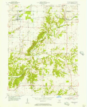
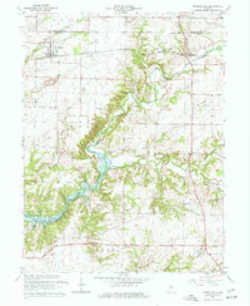
7 surveys from 13 printed sheetsMatched by testing this settlement's coordinate against the published boundary of every sheet in the United States Geological Survey's historical collection. Each opens the scanned sheet at the Survey.
- 1953 USGS Indianapolis quadrangle1:250000, 4 printings
- 1955 USGS Russellville quadrangle1:24000
- 1956 USGS Indianapolis quadrangle1:250000
- 1957 USGS Indianapolis quadrangle1:250000, 2 printings
- 1962 USGS Indianapolis quadrangle1:250000
- 1963 USGS Russellville quadrangle1:24000, 2 printings
- 1986 USGS Indianapolis quadrangle1:100000, 2 printings





In the county-history sources
1,491 words on this townshipBiographical and Historical Record of Putnam County, Indiana .., published 1887 names this settlement in its chapter on Russell Township. These are the passages that mention it, exactly as the scans read.
This township was originally a part of j Clinton, but in 1828 Clinton was divided, j and Russell was formed as it now stands. It occupies the northwest corner of the county, | and is bounded on the north by Montgomery County, on the east by Franklin Township, on the south by Clinton Township, on the j west by Parke County. This township is 1 composed of the Congressional township 16, | range 5. The streams that drain Russell are Raccoon Creek and Ramp Creek, with their ; several tributaries, all taking a southwestward course. The timber is of an excellent quality, and of a variety similar to that of the neighboring townships. The soil is excellent, especially in the northern and northwestern portions, the country around Russellvillc being charming in its natural character, and finely improved. The southwestern portion is considerably broken, though the soil is good and there are many fine farms. The township, upon the whole, is considered one of the finest in the county.
Passage source: Biographical and Historical Record of Putnam County, Indiana .., published 1887.
Daniel Anderson, who ministered unto tlie people of ,the township during the years 1821 | and 1825, Mas their first preacher. He was i followed by William II. Smith, Lorenzo Dow j and others of the noble band which they j represent. The iirst school-house .was built on the farm of John Foaher in 1823, in j which the first school was taught the same j year. The Iirst mill in the township was I built by Jacob Beck, and was long known as j "Beck's Mill." This was erected in 1820 j and 1821. The burr's of this mill were made j bv John Guy, from a bowlder which lay near j the mill site. The next was -Swank's Mill," j bnilt in 1823. James Secrest opened at Blakesburg the Iirst store from which .goods were sold in Russell Township. In 1823 John Fasher established a tan-yard on Bam p Creek, which was the first- in this portion of the comity. ' (Jolonel James Blake erected a | » 'Sang factory " at the "same place, and operated it from 1820 to 1830. This factory gave employment to all who were not otherwise employed, in digging "'sang," which found a ready market. Jesse Blake, also, who is. still. living in the vicinity, had an interest in this factory. The iirst church was built at Russellville in 1880. When the town was laid out in 1828 arrangements were made for the erection of a church, which was completed two years later. The first Fourth of July celebration/ was held on the' farm of John Dougherty, near Portland Mills, in 1828, General George K. Steele acting as marshal of the day. Drs. James B. Clark, Copeland, Winslow, Rogers and John Slavens were the1 first practicing physicians in this Community.
Passage source: Biographical and Historical Record of Putnam County, Indiana .., published 1887.
In the year 1828 the town of Russellville was laid out by Jacob Durham, who was the first merchant and carried on the first blacksmith-sno'p. Dr. Striker was the first physician who resided there. The educational and charitable interests are provided for by a graded school, and a very large, prosperous Masonic lodge. The Methodist church was the first organized in Russellville. It now has aboil t' 300 members, and a remarkably large and ' Well-conducted Sabbath-sehool. The population is about 175.
Passage source: Biographical and Historical Record of Putnam County, Indiana .., published 1887.
Machine-read from a century-old scan, so expect the errors a machine makes: misspelled names, dropped words, stray characters.
Read the whole chapter on Russell Township - it names this place 3 more 3 times.
Fires near this place
6 since 2002Regional context, not property-specific evidence. The federal wildfire occurrence database lists 6 fires within 5 miles of Russellville between 2002 and 2004, burning about 6 acres in total. None started naturally. 2 were recorded as arson. Distance is straight-line from the map coordinates, so a fire counted here may appear on a neighbouring settlement's page as well.
| Reported cause | Fires |
|---|---|
| Debris and open burning | 2 |
| Arson/incendiarism | 2 |
| Missing data/not specified/undetermined | 2 |
The most recent of them, most recent first, with the day each was reported and the service that recorded it.
| Date | Cause | Size | Reported by | Name on the report |
|---|---|---|---|---|
| 7 April 2004 | Arson/incendiarism | under an acre | Indiana State Fire Marshal's Office | not named |
| 2 December 2002 | Missing data/not specified/undetermined | 5.0 acres | Indiana State Fire Marshal's Office | not named |
| 1 December 2002 | Debris and open burning | under an acre | Indiana State Fire Marshal's Office | not named |
| 7 November 2004 | Debris and open burning | 1.0 acres | Indiana State Fire Marshal's Office | not named |
| 17 October 2003 | Arson/incendiarism | under an acre | Indiana State Fire Marshal's Office | not named |
| 22 January 2002 | Missing data/not specified/undetermined | under an acre | Indiana State Fire Marshal's Office | not named |
Settlements close enough to share some of these fires:
Mines and quarries near this place
2 within 5 milesRegional context, not property-specific evidence. The federal mineral resources record lists 2 workings within 5 miles of Russellville: 2 producers. All of them still produce. What was taken out: Stone, Crushed/Broken. Distance is straight-line from the map coordinates, so a quarry counted here may appear on a neighbouring settlement's page as well.
| Where | Site | Commodity | Status | Recorded |
|---|---|---|---|---|
| Russellville Plant | Stone, Crushed/Broken | Producer | ||
| Russellville Stone Co. With Mill | Stone, Crushed/Broken | Producer |
Storms near this place
7 since 2001Regional context, not property-specific evidence. The National Weather Service names Russellville in 7 storm reports between 2001 and 2022: 2 hail, 2 thunderstorm wind, 2 flash flood, 1 flood. No death or injury is recorded in these reports. Each account below is quoted exactly as the forecast office filed it, from the NOAA Storm Events Database, and each date opens the federal record of that event.
| When | Event | Place named | Harm | What the report says |
|---|---|---|---|---|
| June 2018 | Thunderstorm Wind | Russellville | $12,000 | Scattered trees were downed across the northwest quarter of the county due to damaging thunderstorm wind gusts. |
| March 2008 | Flood | Russellville | $12,000 | Flooding occurred across numerous locations in Putnam County due to heavy rain. High water closed over 18 county roads. |
| June 2022 | Flash Flood | Russellville | $10,000 | Thunderstorm heavy rains washed out an approximate 15-foot segment of County Road 900 West at about 1100 North, along and above drain pipes crossing under the road. Relayed by broadcast media via Twitter. Damage at Putnam-Parke County Line. |
| June 2008 | Flash Flood | Russellville | $2,000 | Widespread flooding was observed across Putnam county. US 236 was under a foot of flowing water and subsequently closed. Plum Creek near Bainbridge flooded. |
| May 2005 | Hail | Russellville | - | no account filed |
| April 2001 | Hail | Russellville | - | no account filed |
| July 2001 | Thunderstorm Wind | Russellville | - | no account filed |
Nearest settlements
The eight closest, with where each one stands in the county. Distances are straight-line, computed from the Geographic Names Information System coordinates.
| Map | Place | Distance | Sheets |
|---|---|---|---|
| Raccoon | 4.6 miles | 13 | |
| Blakesburg | 5.3 miles | 13 | |
| Portland Mills | 5.7 miles | 13 | |
| Fincastle | 5.9 miles | 13 | |
| Morton | 7.0 miles | 13 | |
| Van Bibber Lake | 9.4 miles | 14 | |
| Roachdale | 9.7 miles | 11 | |
| Clinton Falls | 9.7 miles | 14 |
Elsewhere
Matched on this settlement's Geographic Names Information System number rather than its name, so it cannot be a different place of the same name in another state.
| Wikipedia article on Russellville | An encyclopaedic summary. Its text is share-alike, so it is linked here rather than copied. |
| Wikidata item Q3212589 | The structured record the population and elevation above come from. Public domain (CC0). |
Provenance
This settlement is recorded in the Geographic Names Information System as feature 442418. The sheet list is computed by point-in-boundary test against the United States Geological Survey's historical topographic inventory. Both are works of the United States government and carry no copyright under 17 U.S.C. 105.
Wildfire. Short, Karen C. 2022. Spatial wildfire occurrence data for the United States, 1992-2020 [FPA_FOD_20221014]. 6th Edition. Fort Collins, CO: Forest Service Research Data Archive. https://doi.org/10.2737/RDS-2013-0009.6 Collected with United States Government funding and usable without additional permissions or fees.
Mines and quarries. USGS Mineral Resources Data System (MRDS) https://mrdata.usgs.gov/mrds/ A work of the United States government, no copyright under 17 U.S.C. 105.
Storms. NOAA National Centers for Environmental Information, Storm Events Database https://www.ncei.noaa.gov/stormevents/ A work of the United States government, no copyright under 17 U.S.C. 105. Narratives are quoted verbatim from the National Weather Service report and are not edited or summarised.