 Block
Scircleville, Indiana
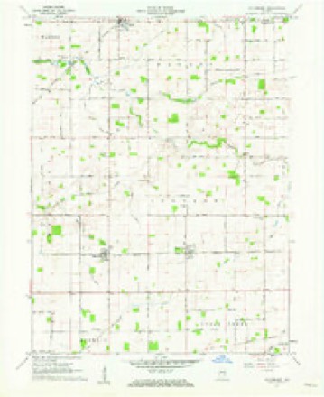
9 topographic sheets cover this place, the earliest surveyed in 1953 and the latest in 1984. It stands in Johnson Township. It lies in ZIP code area 46041. The Survey maps it on the Hillisburg quadrangle. It stands 928 feet above sea level.
Topographic sheets covering this place
5 surveys from 9 printed sheetsMatched by testing this settlement's coordinate against the published boundary of every sheet in the United States Geological Survey's historical collection. Each opens the scanned sheet at the Survey.
- 1953 USGS Danville quadrangle1:250000, 3 printings
- 1955 USGS Danville quadrangle1:250000
- 1956 USGS Danville quadrangle1:250000
- 1961 USGS Hillisburg quadrangle1:24000, 2 printings
- 1984 USGS Lafayette quadrangle1:100000, 2 printings




In the county-history sources
3,552 words on this townshipCombination Atlas Map of Clinton County, Indiana, published 1878; History of Clinton County, Indiana. Together with Sketches of Its Cities, Villages and Towns, Educational, Religious, Civil, Military, and Political History, Portraits of Prominent Persons, and Biographies of Representative Citizens. Also a Condensed History of Indiana, Embodying Accounts of Prehistoric Races, Indian Wars, and a Brief Review of Its Civil and Political History, published 1886 names this settlement in its chapter on Johnson Township. These are the passages that mention it, exactly as the scans read.
Those of 1843 were Uriah Edwards, on the Weaver farm; Adam Merritt on the farm owned by the Widow Orr (his son Samuel, who came at the same time, is now a resident of Scircleville) ; William Hobbs, on the land at present. belonging to William Gossip; Joseph Munnell, on the Wilson farm; Rockwell, on what is now the John Hillis farm; and James Hodgins and mother, whose exact location is unknown.
Passage source: Combination Atlas Map of Clinton County, Indiana, published 1878.
In 1844, William Burget, Mathew Orr and Isaac McClelland, being interested in the cause of education, were instrumental in building the first school house of the township, which stood on the farm of Mr. Orr. From their own private funds they hired a man by the name of Peter Stowers, for the sum of $10 per month and board, who taught the first school, in the Winter of 1844-5. Isaac McClelland acted as School Examiner. Some other early teachers were Elijah Boxley, Nelson Purdom, William Louden, George H. Merritt, and Alfred Carver.
Passage source: Combination Atlas Map of Clinton County, Indiana, published 1878.
Among the settlers who came in 1843 were Uriah Edwards, who settled on the Weaver farm; Adam Merritt, on the farm owned by the widow Orr; William Hobbs, on the W. Gossard farm; Joseph Munnell, on the land now owned by G. H. Wilson; and Mr. Rockwell, on the farm of the late John E. Hillis. During the next three years the settlement increased very rapidly.
Machine-read from a century-old scan, so expect the errors a machine makes: misspelled names, dropped words, stray characters.
Read the whole chapter on Johnson Township - it names this place 2 more 2 times.
Nearest settlements
The eight closest, with where each one stands in the county. Distances are straight-line, computed from the Geographic Names Information System coordinates.
| Map | Place | Distance | Sheets |
|---|---|---|---|
| Hillisburg | 2.1 miles | 9 | |
| Pickard | 4.9 miles | 9 | |
| Boyleston | 5.0 miles | 9 | |
| Michigantown | 5.6 miles | 9 | |
| Forest | 6.2 miles | 9 | |
| Kirklin | 7.2 miles | 9 | |
| Avery | 7.6 miles | 9 | |
| Cyclone | 8.1 miles | 9 |
Elsewhere
Matched on this settlement's Geographic Names Information System number rather than its name, so it cannot be a different place of the same name in another state.
| Wikipedia article on Scircleville | An encyclopaedic summary. Its text is share-alike, so it is linked here rather than copied. |
| Wikidata item Q7434035 | The structured record the population and elevation above come from. Public domain (CC0). |
Provenance
This settlement is recorded in the Geographic Names Information System as feature 443130. The sheet list is computed by point-in-boundary test against the United States Geological Survey's historical topographic inventory. Both are works of the United States government and carry no copyright under 17 U.S.C. 105.