 Block
Forest, Indiana
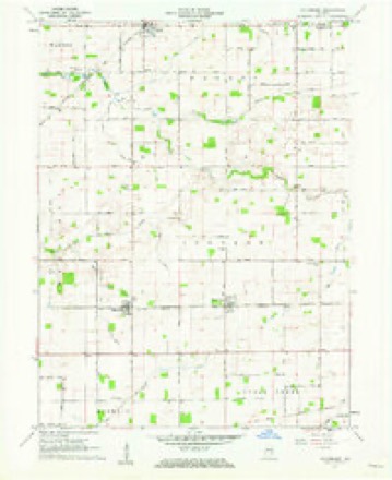
9 topographic sheets cover this place, the earliest surveyed in 1953 and the latest in 1984. It stands in Forest Township. It lies in ZIP code area 46039. The Survey maps it on the Hillisburg quadrangle. It stands 879 feet above sea level.
Topographic sheets covering this place
5 surveys from 9 printed sheetsMatched by testing this settlement's coordinate against the published boundary of every sheet in the United States Geological Survey's historical collection. Each opens the scanned sheet at the Survey.
- 1953 USGS Danville quadrangle1:250000, 3 printings
- 1955 USGS Danville quadrangle1:250000
- 1956 USGS Danville quadrangle1:250000
- 1961 USGS Hillisburg quadrangle1:24000, 2 printings
- 1984 USGS Lafayette quadrangle1:100000, 2 printings




In the county-history sources
6,142 words on this townshipHistory of Clinton County, Indiana. Together with Sketches of Its Cities, Villages and Towns, Educational, Religious, Civil, Military, and Political History, Portraits of Prominent Persons, and Biographies of Representative Citizens. Also a Condensed History of Indiana, Embodying Accounts of Prehistoric Races, Indian Wars, and a Brief Review of Its Civil and Political History, published 1886 names this settlement in its chapter on Forest Township. These are the passages that mention it, exactly as the scans read.
Forest is the youngest township in the conntj. Many of the citizens of Warren and Johnson townships being located at an inconvenient distance from the respective polling places, presented a petition to the county commissioners for the formation of a new township and the board issued the following order, January 2, 1882: "The board having duly considered the matter and being sufficiently advised in the premises, do find that for the convenience of many citizens it is necessary that a new township be formed and established from a portion of Johnson and Warren townships, in Clinton County, Indiana, and the board do order that a new township be formed and established in said Clinton County to be known as Forest Township, the boundary lines of which are as follows, to wit: Beginning at the southwest corner of the northwest quarter of section nineteen (19), in township twenty-two (22) north, of range two (2) east, in Clinton County, Indiana, and running thence east on the half (i) section line, six (6) miles to the southeast corner of the northeast quarter of section twenty-four (24) in said township and range; thence north on the section line two and onehalf (2^) miles to the northeast corner of section twelve (12) in said township and range; thence on the section line west two (2) miles to the southeast corner of section thi-ee (3) in said township and range; thence on the section line one (1) mile to the northeast corner of said section three (3) in said township and range; thence on the section line west one and one-half (H) miles to the southeast corner of the southwest quarter of section thirty-three (33), in township twenty-three (23) north, of range two
Forest Township lies in the extreme northeastern part of the county and is bounded on the north by Howard County, on the east by Howard and Tipton counties, on the south by Johnson Township and on the west by "Warren Township. It is six and one-half miles from north to south and will average about four and one-half miles from east to west. It contains 16,900 acres, about one-quarter of which is timber land. The soil is a dark loam and very productive of corn, wheat and the other small grains. Much attention has been given to the draining of the wet lands in this township, consequently there is but very little cleared land that is not under a high state of cultivation.
The early settlement of Forest will necessarily be included in the histories of Johnson and Warren townships. Probably the first settlement made in/what is now Forest was on the southeast quarter of section 18, by a man by the name of Nutter and his son. Page. Sims built the first log cabin on the Miami Reserve in the locality where he now resides (1886).
Machine-read from a century-old scan, so expect the errors a machine makes: misspelled names, dropped words, stray characters.
Read the whole chapter on Forest Township - it names this place 19 more 19 times.
Storms near this place
8 since 1998Regional context, not property-specific evidence. The National Weather Service names Forest in 8 storm reports between 1998 and 2023: 6 thunderstorm wind, 1 hail, 1 tornado. No death or injury is recorded in these reports. Each account below is quoted exactly as the forecast office filed it, from the NOAA Storm Events Database, and each date opens the federal record of that event.
| When | Event | Place named | Harm | What the report says |
|---|---|---|---|---|
| June 2016 | Thunderstorm Wind | Forest | $50,000 | Two hog barns collapsed and a house was damaged near this location due to damaging thunderstorm wind gusts. |
| March 2023 | Thunderstorm Wind | Forest | $40,000 | Thunderstorm winds collapsed barn doors on County Road 700 North at 1050 East, and also lifted a barn roof which collapsed beams on County Road 700 North at 1070 East. |
| May 2017 | Tornado (EF1) | Forest | $40,000 | An EF-1 tornado briefly touched down in Forest, Indiana. The approximate 95 mph tornado winds caused significant damage to a fire station and a nearby pole barn. Some roof damage also occurred to a home. |
| May 2019 | Thunderstorm Wind | Forest | $5,000 | Power poles were downed near County Road 600 North, west of Forest, due to damaging thunderstorm wind gusts. |
| November 2005 | Thunderstorm Wind | Forest | $1,000 | Trees and power lines were downed. |
| June 2016 | Thunderstorm Wind | Forest | - | A 68 mph thunderstorm wind gust was measured in this location. This report was relayed by the media. |
| November 2005 | Thunderstorm Wind | Forest | - | Several trees downed. |
| July 1998 | Hail | Forest | - | Hail reportedly covered the ground. |
Nearest settlements
The eight closest, with where each one stands in the county. Distances are straight-line, computed from the Geographic Names Information System coordinates.
| Map | Place | Distance | Sheets |
|---|---|---|---|
| Middlefork | 4.3 miles | 10 | |
| Michigantown | 4.6 miles | 9 | |
| Hillisburg | 6.0 miles | 9 | |
| Scircleville | 6.2 miles | 9 | |
| Beard | 6.2 miles | 9 | |
| Boyleston | 6.9 miles | 9 | |
| Avery | 7.3 miles | 9 | |
| Geetingsville | 7.8 miles | 10 |
Elsewhere
Matched on this settlement's Geographic Names Information System number rather than its name, so it cannot be a different place of the same name in another state.
| Wikipedia article on Forest | An encyclopaedic summary. Its text is share-alike, so it is linked here rather than copied. |
| Wikidata item Q5468768 | The structured record the population and elevation above come from. Public domain (CC0). |
Provenance
This settlement is recorded in the Geographic Names Information System as feature 434646. The sheet list is computed by point-in-boundary test against the United States Geological Survey's historical topographic inventory. Both are works of the United States government and carry no copyright under 17 U.S.C. 105.
Storms. NOAA National Centers for Environmental Information, Storm Events Database https://www.ncei.noaa.gov/stormevents/ A work of the United States government, no copyright under 17 U.S.C. 105. Narratives are quoted verbatim from the National Weather Service report and are not edited or summarised.