 Block
Michigantown, Indiana
9 topographic sheets cover this place, the earliest surveyed in 1953 and the latest in 1984. It stands in Michigan Township. It lies in ZIP code area 46057. The Survey maps it on the Michigantown quadrangle. 441 people lived here at the 2020 count. It stands 876 feet above sea level.
Population over time
2 figuresMichigantown fell from 467 to 441 between 2010 and 2020. These are the recorded population figures Wikidata holds for this place, reached through the Geographic Names Information System number this page is keyed on rather than by name, so they belong to this place and not to another of the same name. Most are census counts, but not all are: an early figure may be a founding or settlement estimate, and an estimate published within five years of a census is left out. The change column is computed, and is left blank where more than 20 years separate a figure from the one before it, because a gap that long is not a change between two counts.
| Year | People | Change |
|---|---|---|
| 2010 | 467 | |
| 2020 | 441 | -26 (-6%) |
Topographic sheets covering this place
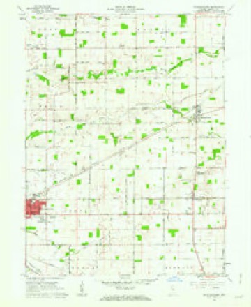
5 surveys from 9 printed sheetsMatched by testing this settlement's coordinate against the published boundary of every sheet in the United States Geological Survey's historical collection. Each opens the scanned sheet at the Survey.
- 1953 USGS Danville quadrangle1:250000, 3 printings
- 1955 USGS Danville quadrangle1:250000
- 1956 USGS Danville quadrangle1:250000
- 1961 USGS Michigantown quadrangle1:24000, 2 printings
- 1984 USGS Lafayette quadrangle1:100000, 2 printings




In the county-history sources
13,772 words on this townshipCombination Atlas Map of Clinton County, Indiana, published 1878 names this settlement in its chapter on Michigan Township. These are the passages that mention it, exactly as the scans read.
Emigration having turned toward Michigan, before the elose of 1830, six energetie, determined men had entered the township for the purpose of assisting in bringing her forests into a state of cultivation. 'They were Robert Johnson and his family, of which James H. and William were members, fixing his home on the land now the present site of Michigantown; George H. Downs, on the Riser farm ; Enoch T. Williams, in Michigantown; William Phelps, on the land belonging to Isaac Painter, and John Whitmore and sons, on the Brandon farm.
Passage source: Combination Atlas Map of Clinton County, Indiana, published 1878.
Of those who came up to this date, but three are now living. They are David Kelley, James H. Johnson and Samuel Paris. At that time, they were young men, vigorous and strong, and while they bear their ages well for the hardships endured, yet Time has left his mark upon them, tinging gently their locks with gray.
Passage source: Combination Atlas Map of Clinton County, Indiana, published 1878.
Later, in the year 1831, came the following men: Carlton Kent and his son George, who located on the Baird Farm; David Kelly, on the farm belonging to his son James; James Scott, on the Jacob Heicy farm ;° Benjamin Saylor, in. Michigantown, and a man by the name of Langlin, who also made his home in Michigantown.
Passage source: Combination Atlas Map of Clinton County, Indiana, published 1878.
Machine-read from a century-old scan, so expect the errors a machine makes: misspelled names, dropped words, stray characters.
Read the whole chapter on Michigan Township - it names this place 5 more 5 times.
Storms near this place
11 since 2004Regional context, not property-specific evidence. The National Weather Service names Michigantown in 11 storm reports between 2004 and 2026: 6 thunderstorm wind, 2 tornado, 1 flash flood, 1 flood. No death or injury is recorded in these reports. Each account below is quoted exactly as the forecast office filed it, from the NOAA Storm Events Database, and each date opens the federal record of that event.
| When | Event | Place named | Harm | What the report says |
|---|---|---|---|---|
| July 2005 | Tornado (F0) | Michigantown | $175,000 | An F0 tornado touched down briefly in Michigantown. One mobile home was destroyed and four others were moved. |
| November 2013 | Tornado (EF2) | Michigantown | $60,000 | At 1513EST, the EF-2 tornado touched down in Michigantown. This EF-2 tornado caused damage to a hog farm and several properties northeast of Michigantown, with additional damage found to the east of Rossville. At 1519EST, the tornado crossed into southwest Howard County. The tornado was at its strongest as it crossed through the southeast side of Kokomo, causing extensive property damage. A BMO Bank was destroyed with significant damage to several fast food restaurants along South Washington Street. The tornado lifted 2 miles north of Greentown at 1536EST. |
| May 2022 | Thunderstorm Wind | Michigantown | $30,000 | Thunderstorm winds downed trees and power lines across multiple areas between Frankfort and Michigantown. |
| July 2020 | Thunderstorm Wind | Michigantown | $10,000 | Tree limbs, trees, and power lines downed due to thunderstorm wind gusts in the nearby area. |
| March 2025 | Thunderstorm Wind | Michigantown | $5,000 | Trees and power poles downed by thunderstorm wind gusts. |
| April 2026 | Thunderstorm Wind | Michigantown | $1,000 | Thunderstorm wind gusts downed an 18 inch tree. |
| July 2011 | Flood | Michigantown | $500 | Water was reported over State Road 29 between County Roads 200 and 300 North due to thunderstorm heavy rainfall. |
| June 2009 | Flash Flood | Michigantown | $500 | Flash Flooding was observed across many county roads. |
| June 2022 | Hail | Michigantown | - | Thunderstorm produced 1.00 inch hail along Indiana Route 29 north of Michigantown. |
| May 2009 | Thunderstorm Wind | Michigantown | - | Trees were blown down by thunderstorm winds along State Route 29 just north of Michigantown. |
| July 2004 | Thunderstorm Wind | Michigantown | - | no account filed |
Nearest settlements
The eight closest, with where each one stands in the county. Distances are straight-line, computed from the Geographic Names Information System coordinates.
| Map | Place | Distance | Sheets |
|---|---|---|---|
| Boyleston | 2.8 miles | 9 | |
| Avery | 2.8 miles | 9 | |
| Hillisburg | 4.0 miles | 9 | |
| Beard | 4.5 miles | 9 | |
| Forest | 4.6 miles | 9 | |
| Scircleville | 5.6 miles | 9 | |
| East Park | 6.0 miles | 9 | |
| Risse | 6.1 miles | 9 |
Elsewhere
Matched on this settlement's Geographic Names Information System number rather than its name, so it cannot be a different place of the same name in another state.
| Wikipedia article on Michigantown | An encyclopaedic summary. Its text is share-alike, so it is linked here rather than copied. |
| Wikidata item Q2207465 | The structured record the population and elevation above come from. Public domain (CC0). |
Provenance
This settlement is recorded in the Geographic Names Information System as feature 439080. The sheet list is computed by point-in-boundary test against the United States Geological Survey's historical topographic inventory. Both are works of the United States government and carry no copyright under 17 U.S.C. 105.
Storms. NOAA National Centers for Environmental Information, Storm Events Database https://www.ncei.noaa.gov/stormevents/ A work of the United States government, no copyright under 17 U.S.C. 105. Narratives are quoted verbatim from the National Weather Service report and are not edited or summarised.