 Block
Sharpsville, Indiana
10 topographic sheets cover this place, the earliest surveyed in 1953 and the latest in 1984. It stands in Liberty Township. It lies in ZIP code area 46068. It stands on Mud Creek. The Survey maps it on the Kokomo East quadrangle. 553 people lived here at the 2020 count. It stands 879 feet above sea level.
Population over time
2 figuresSharpsville fell from 607 to 553 between 2010 and 2020. These are the recorded population figures Wikidata holds for this place, reached through the Geographic Names Information System number this page is keyed on rather than by name, so they belong to this place and not to another of the same name. Most are census counts, but not all are: an early figure may be a founding or settlement estimate, and an estimate published within five years of a census is left out. The change column is computed, and is left blank where more than 20 years separate a figure from the one before it, because a gap that long is not a change between two counts.
| Year | People | Change |
|---|---|---|
| 2010 | 607 | |
| 2020 | 553 | -54 (-9%) |
Topographic sheets covering this place
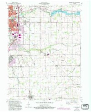
5 surveys from 10 printed sheetsMatched by testing this settlement's coordinate against the published boundary of every sheet in the United States Geological Survey's historical collection. Each opens the scanned sheet at the Survey.
- 1953 USGS Danville quadrangle1:250000, 3 printings
- 1955 USGS Danville quadrangle1:250000
- 1956 USGS Danville quadrangle1:250000
- 1960 USGS Kokomo East quadrangle1:24000, 3 printings
- 1984 USGS Lafayette quadrangle1:100000, 2 printings




In the county-history sources
3,277 words on this townshipHistory of Tipton County Indiana, published 1914 names this settlement in its chapter on Liberty Township. These are the passages that mention it, exactly as the scans read.
In the north central part of Tipton county is located the township of Liberty. East and west it measures seven miles, and north and south five miles, the territory containing thirty-five square miles. The great portion of Liberty township is in congressional township 22 north, range 4 east. There are six sections on the north in township 23 north, range 4 east, and one section in township 23 north, range 5 east. On the east end of the township there are four sections in township 22 north, range 5 east. The township is bounded on the north by Howard county, on the east by Wild¬ cat township, on the sputh by Cicero township, and on the west by Prairie township. The general surface of Liberty township is level : the soil is deep and rich and at one time in the past was covered with a rich growth of timber, including such woods as the walnut, poplar, oak, sycamore, elm, beech, maple, hickory and ash. Mud creek enters the township a little south of center on the west, flows m ' a northeasterly direction, and leaves the township just south of the corner section. North creek rises in the extreme southwest corner of the township, flows northeast, and empties into Mud creek, one mile and a half east of Sharpsville. Turkey creek crosses the ex¬ treme southeast corner of the township, being confined within the southeast quarter of the comer section.
Passage source: History of Tipton County Indiana, published 1914.
The hardihood of the pioneer women has been written and sung, and it is fitting that an incident of feminine courage should be noted. The widow Van Horn moved to Liberty township from Wayne county in the fall of 1851 or 1852, and settled south of Sharpsville. She brought with her a favorite roan mare. One day during the winter when the snow was deep and the mercury below zero, the mare escaped from the rail inclosure near the house and started toward the old home. As night approached the widow discovered her loss, and she immediately set out on foot in search of the mare. She trailed the animal southwest, the trail leading through Tetersburg and Boxleytown and thence southeast, crossing the Peru road be¬ tween Cicero and Noblesville. She caught the mare in the vicinity of Perkins¬ ville. Mounting her, she made her way back, reaching home before daylight the next morning.
Passage source: History of Tipton County Indiana, published 1914.
Before the year 1849 Prairie township extended to Sharpsville and then Wildcat township commenced. The first elections were held at Circle's, about where the Baldwin place afterward was. Afterward they were moved back to the Evans neighborhood, where they remained until the organization of Liberty tQwnship. Richard Humphries was elected justice of the peace on August 27, 1845, and qualified December 12, 1845, with the following sure¬ ties: Jesse Harding, David Humphrey, Willias Ball and Caleb Richardson.
Passage source: History of Tipton County Indiana, published 1914.
Machine-read from a century-old scan, so expect the errors a machine makes: misspelled names, dropped words, stray characters.
Read the whole chapter on Liberty Township - it names this place 9 more 9 times.
Storms near this place
15 since 1994Regional context, not property-specific evidence. The National Weather Service names Sharpsville in 15 storm reports between 1994 and 2024: 8 thunderstorm wind, 6 hail, 1 flash flood. The reports record 1 injury. Each account below is quoted exactly as the forecast office filed it, from the NOAA Storm Events Database, and each date opens the federal record of that event.
| When | Event | Place named | Harm | What the report says |
|---|---|---|---|---|
| June 2012 | Thunderstorm Wind | Sharpsville | 1 hurt, $10,000 | A tree fell on a truck near the intersection of County Roads 300 West and 700 North due to damaging thunderstorm wind gusts. Report came in via e-spotter. There is an unknown number of injuries, but the report implies at least one. |
| July 2024 | Thunderstorm Wind | Sharpsville | $50,000 | Thunderstorm winds blew over a semi truck on US Highway 31, 3 miles southwest of Sharpsville, while a tree was downed onto a house in Tipton. |
| June 2016 | Thunderstorm Wind | Sharpsville | $25,000 | A barn wall was blown out with several trees snapped and down on the property due to damaging thunderstorm wind gusts. |
| May 2015 | Thunderstorm Wind | Sharpsville | $3,000 | Three trees were reported down due to damaging thunderstorm wind gusts. Power outages were also reported. |
| May 2010 | Flash Flood | Sharpsville | $1,000 | A few streets were reported closed due to high water in Kokomo. |
| July 2012 | Thunderstorm Wind | Sharpsville | $750 | Power lines were downed in this location due to damaging thunderstorm wind gusts. |
| June 2020 | Thunderstorm Wind | Sharpsville | - | Thunderstorm wind gust measured with a Davis Instrument. |
| April 2017 | Thunderstorm Wind | Sharpsville | - | A measured 73 mph thunderstorm wind gust was observed in this location. |
| June 1995 | Thunderstorm Wind | Sharpsville | - | Tree blown down. |
| March 2024 | Hail | Sharpsville | - | no account filed |
| April 2017 | Hail | Sharpsville | - | no account filed |
| May 2016 | Hail | Sharpsville | - | no account filed |
| March 2003 | Hail | Sharpsville | - | no account filed |
| May 2000 | Hail | Sharpsville | - | no account filed |
| May 1994 | Hail | Sharpsville | - | no account filed |
Nearest settlements
The eight closest, with where each one stands in the county. Distances are straight-line, computed from the Geographic Names Information System coordinates.
| Map | Place | Distance | Sheets |
|---|---|---|---|
| Jacksons | 3.8 miles | 9 | |
| Nevada | 4.6 miles | 10 | |
| Groomsville | 6.5 miles | 9 | |
| Normanda | 6.7 miles | 9 | |
| Goldsmith | 7.0 miles | 9 | |
| Windfall | 7.1 miles | 11 | |
| Tipton | 7.2 miles | 9 | |
| Tetersburg | 7.9 miles | 9 |
Elsewhere
Matched on this settlement's Geographic Names Information System number rather than its name, so it cannot be a different place of the same name in another state.
| Wikipedia article on Sharpsville | An encyclopaedic summary. Its text is share-alike, so it is linked here rather than copied. |
| Wikidata item Q2278579 | The structured record the population and elevation above come from. Public domain (CC0). |
Provenance
This settlement is recorded in the Geographic Names Information System as feature 443313. The sheet list is computed by point-in-boundary test against the United States Geological Survey's historical topographic inventory. Both are works of the United States government and carry no copyright under 17 U.S.C. 105.
Storms. NOAA National Centers for Environmental Information, Storm Events Database https://www.ncei.noaa.gov/stormevents/ A work of the United States government, no copyright under 17 U.S.C. 105. Narratives are quoted verbatim from the National Weather Service report and are not edited or summarised.