 Block
Nevada, Indiana
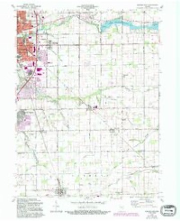
10 topographic sheets cover this place, the earliest surveyed in 1953 and the latest in 1984. It stands in Liberty Township. It lies in ZIP code area 46068. The Survey maps it on the Kokomo East quadrangle. It stands 863 feet above sea level.
Topographic sheets covering this place
5 surveys from 10 printed sheetsMatched by testing this settlement's coordinate against the published boundary of every sheet in the United States Geological Survey's historical collection. Each opens the scanned sheet at the Survey.
- 1953 USGS Danville quadrangle1:250000, 3 printings
- 1955 USGS Danville quadrangle1:250000
- 1956 USGS Danville quadrangle1:250000
- 1960 USGS Kokomo East quadrangle1:24000, 3 printings
- 1984 USGS Lafayette quadrangle1:100000, 2 printings




In the county-history sources
3,277 words on this townshipHistory of Tipton County Indiana, published 1914 names this settlement in its chapter on Liberty Township. These are the passages that mention it, exactly as the scans read.
Thomas Cole, a Kentuckian, came to Shelby county in 1835. From there he came to Liberty township, Tipton county, in 1847, and pre-empted a quarter section of land. James Cole, a brother, came from Henry county, Indiana, in the spring of 1848 and bought a claim, upon which he resided until his death in 1870. Granville Wilson emigrated from Shelby county in the fall of 1848 and bought land. James Maze came from Butler county, Ohio, to Shelby county, Indiana, in 1827; thence he moved to Liberty town¬ ship in 1848, where he entered the tract of land he lived upon the rest of his life. William Jarrett came from Greenbrier county, Virginia, to De¬ catur county, Indiana, in 1847; thence he moved to Madison county, and thence to Liberty township in 1851. Benjamin Denny, William Sims and William Marshall were the first settlers in the northeast part of the town¬ ship. They came from Madison county in 1850. Denny died here in 1855, and Sims in 1863. Marshall enlisted in the army and passed away in 1864, while in active service. Lindsay Ballew came from Howard county and settled in Nevada in 1854. He lived for many years in this township. Other early settlers in that part of the township were John Smith, William Smith and James Barrow. Among the early pioneers in the southeast portion of Liberty township might be mentioned Alexander Mills, Jesse Smiley, Messick Turner, Jonathan Hayworth and Lilburn Cox. A great number of men entered land in 1848, and this list, which is a very long one, is led by such names as Lewis Small, George Stewart, James Bennett, Larkin Ward, John W. Pyke, George B. W. Parks, W. M. Hutto, W. Caldwell, Wesley Umfreys, E. M. Shrap, P. H. Smiley, Jesse Wells, William Bess, Francis McGuire and Henry Goar.
Passage source: History of Tipton County Indiana, published 1914.
The first county road laid out began at the county line on the north on range line 3, thence one and a half miles south, then in a southeast di¬ rection to Tipton. Harvey Wells and Thomas Cole got up the petition for this road in the spring of 1848, and Cole took it up with the county board. The next road was between sections 22 and 23, beginning at the range line and running to Nevada. This was in the fall of 1848.
Passage source: History of Tipton County Indiana, published 1914.
Benjamin Denny was the first settler in what is now the village of Nevada. He came from Madison county about 1850. William Sims and William Marshall came at the same time, but the life of this trio of settlers is discussed in the early settlement of the township.
Passage source: History of Tipton County Indiana, published 1914.
Machine-read from a century-old scan, so expect the errors a machine makes: misspelled names, dropped words, stray characters.
Read the whole chapter on Liberty Township - it names this place 1 more 1 time.
Mines and quarries near this place
1 within 5 milesRegional context, not property-specific evidence. The federal mineral resources record lists 1 working within 5 miles of Nevada: 1 producer. All of them still produce. What was taken out: Sand and Gravel, Construction. Distance is straight-line from the map coordinates, so a quarry counted here may appear on a neighbouring settlement's page as well.
| Where | Site | Commodity | Status | Recorded |
|---|---|---|---|---|
| Windfall Sand and Gravel Pit | Sand and Gravel, Construction | Producer |
Storms near this place
1 since 2020Regional context, not property-specific evidence. The National Weather Service names Nevada in 1 storm report in 2020: 1 thunderstorm wind. No death or injury is recorded in these reports. Each account below is quoted exactly as the forecast office filed it, from the NOAA Storm Events Database, and each date opens the federal record of that event.
| When | Event | Place named | Harm | What the report says |
|---|---|---|---|---|
| June 2020 | Thunderstorm Wind | Nevada | $25,000 | Ten power poles snapped due to thunderstorm wind gusts. A travel trailer was also overturned and slammed into the side of a house. Location is approximate. |
Nearest settlements
The eight closest, with where each one stands in the county. Distances are straight-line, computed from the Geographic Names Information System coordinates.
| Map | Place | Distance | Sheets |
|---|---|---|---|
| Windfall | 3.4 miles | 11 | |
| Sharpsville | 4.6 miles | 10 | |
| Jacksons | 5.5 miles | 9 | |
| Curtisville | 7.7 miles | 11 | |
| Tipton | 8.0 miles | 9 | |
| Hobbs | 8.3 miles | 11 | |
| Goldsmith | 10.6 miles | 9 | |
| Normanda | 10.6 miles | 9 |
Elsewhere
Matched on this settlement's Geographic Names Information System number rather than its name, so it cannot be a different place of the same name in another state.
| Wikipedia article on Nevada | An encyclopaedic summary. Its text is share-alike, so it is linked here rather than copied. |
| Wikidata item Q7003318 | The structured record the population and elevation above come from. Public domain (CC0). |
Provenance
This settlement is recorded in the Geographic Names Information System as feature 440011. The sheet list is computed by point-in-boundary test against the United States Geological Survey's historical topographic inventory. Both are works of the United States government and carry no copyright under 17 U.S.C. 105.
Mines and quarries. USGS Mineral Resources Data System (MRDS) https://mrdata.usgs.gov/mrds/ A work of the United States government, no copyright under 17 U.S.C. 105.
Storms. NOAA National Centers for Environmental Information, Storm Events Database https://www.ncei.noaa.gov/stormevents/ A work of the United States government, no copyright under 17 U.S.C. 105. Narratives are quoted verbatim from the National Weather Service report and are not edited or summarised.