 Block
Windfall, Indiana
11 topographic sheets cover this place, the earliest surveyed in 1953 and the latest in 1986. It stands in Wildcat Township. It lies in ZIP code area 46076. The Survey maps it on the Windfall quadrangle. 696 people lived here at the 2020 count. It stands 866 feet above sea level.
Population over time
2 figuresWindfall fell from 708 to 696 between 2010 and 2020. These are the recorded population figures Wikidata holds for this place, reached through the Geographic Names Information System number this page is keyed on rather than by name, so they belong to this place and not to another of the same name. Most are census counts, but not all are: an early figure may be a founding or settlement estimate, and an estimate published within five years of a census is left out. The change column is computed, and is left blank where more than 20 years separate a figure from the one before it, because a gap that long is not a change between two counts.
| Year | People | Change |
|---|---|---|
| 2010 | 708 | |
| 2020 | 696 | -12 (-2%) |
Topographic sheets covering this place
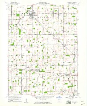
4 surveys from 11 printed sheetsMatched by testing this settlement's coordinate against the published boundary of every sheet in the United States Geological Survey's historical collection. Each opens the scanned sheet at the Survey.
- 1953 USGS Muncie quadrangle1:250000, 5 printings
- 1956 USGS Muncie quadrangle1:250000
- 1960 USGS Windfall quadrangle1:24000, 2 printings
- 1986 USGS Muncie quadrangle1:100000, 3 printings



What happened here
An account from the chapter on Wildcat township. The inset identifies its exact source book and publication year.
Town Notes
Windfall has been the scene of many crimes in the past, before law and order had been sufficiently well established. In the year 1865 one Noble Goff was murdered in his bed, by an assassin who used a large, old-fashioned hatchet. Goff had at one time been a respectable citizen, but in later years had fallen into heavy dissipation and had made many enemies.
In the county-history sources
4,082 words on this townshipHistory of Tipton County Indiana, published 1914 names this settlement in its chapter on Wildcat Township. These are the passages that mention it, exactly as the scans read.
Records prove that the first actual white settlers came in near the year 1845, and located near the north fork of Wildcat, in the northern part of the township. These were David Decker, Philemon Plummer, Robert Stephens, Ira Plummer and their respective families. Decker came from Madison county, adjoining, and erected a primitive pole cabin, around which a few rods of ground were cleared for a truck patch. However, the wet state of the country precluded a very bountiful living from the soil, so Decker was forced to depend upon his rifle for his main subsistence. Game was plentiful, and the meat used for the table and the skins used as a medium of exchange or for clothing. Decker lived on his original claim some five years, when he disposed of it and moved farther south, near the present site of Windfall. Here he became the possessor of a valuable tract of real estate, which he owned until 1871, when he sold all of his property and moved from the township. 1 le was a man of prominence in his community and was chosen a justice of the peace at the first election after the township organization.
Passage source: History of Tipton County Indiana, published 1914.
Other early settlers who came a short time afterward were John Morris, James Hitt and a Mr. Forbes. Morris took out a claim on what was later known as the John Pumphrey land. He was simply a squatter, and did nothing in the way of improving except erecting a rude cabin and clearing a very few acres of land. His death, in the year 1846, was the first in the township. Hitt arrived in the spring of 1847. He settled two miles east of Windfall. He lived here for two years and then disposed of his land, only to enter another claim. Forbes located in the northern part of the township near Mud Creek, and proved a valuable acquisition to the community. His tastes, however, did not run in the direction of farm¬ ing, and thinking there were more easy ways of gaining a livelihood be¬ sides digging and grubbing, he procured a small stock of groceries and notions, which he kept at his house for the accommodation of the sparse settlement. In after years, he traveled about the country as a clock peddler, and when that occupation no longer returned a fair profit, he turned his attention to tinkering.
Passage source: History of Tipton County Indiana, published 1914.
From 1845 until 1848 the development of the county progressed rather slowly, and in the latter year there were but forty acres of cultivat¬ ed land in the township. The settlements were confined principally to the northern and eastern parts, and it was not until the beginning of 1849 that any attempts were made to bring under cultivation the interior and southern portions of the township. In 1848 the settlers were: Avery Chase, who opened a claim in section 4, which he sold to James B. Fouch six years later; John Smith, who located on North Fork, where he lived five or six years, when he sold to Cyrus Holloway and emigrated to Missouri : Theophilus Calmut, who secured land a short distance west of Windfall: Elisha Pickering, who settled near the northeast corner of the township; Henry Yeakley, who secured land in the same locality; William Myers, who entered land in section 5, a short distance north of Windfall, and Thomas Legg, who made his first entry near Windfall. The last named was one of the promi¬ nent citizens of Wildcat, and a man of more than ordinary energy and in¬ telligence. He remained in the vicinity of Windfall a few years, when, be¬ coming dissatisfied with this part of the country, he moved further north and entered land, where a son had previously settled and died. Arthur, Benjamin and William, sons of Thomas Legg, came a few years later. They were men of rharacter and influence, and prominently connected with the progress of the township.
Passage source: History of Tipton County Indiana, published 1914.
Machine-read from a century-old scan, so expect the errors a machine makes: misspelled names, dropped words, stray characters.
Read the whole chapter on Wildcat Township - it names this place 12 more 12 times.
Mines and quarries near this place
1 within 5 milesRegional context, not property-specific evidence. The federal mineral resources record lists 1 working within 5 miles of Windfall: 1 producer. All of them still produce. What was taken out: Sand and Gravel, Construction. Distance is straight-line from the map coordinates, so a quarry counted here may appear on a neighbouring settlement's page as well.
| Where | Site | Commodity | Status | Recorded |
|---|---|---|---|---|
| Windfall Sand and Gravel Pit | Sand and Gravel, Construction | Producer |
Storms near this place
16 since 1996Regional context, not property-specific evidence. The National Weather Service names Windfall in 16 storm reports between 1996 and 2025: 7 thunderstorm wind, 4 hail, 4 flood, 1 flash flood. No death or injury is recorded in these reports. Each account below is quoted exactly as the forecast office filed it, from the NOAA Storm Events Database, and each date opens the federal record of that event.
| When | Event | Place named | Harm | What the report says |
|---|---|---|---|---|
| July 2003 | Flash Flood | Windfall | $5,100,000 | no account filed |
| September 2020 | Flood | Windfall | $10,000 | Standing water across several roads in the town of Windfall. A car stalled in standing water along State Road 213. |
| June 2020 | Thunderstorm Wind | Windfall | $5,000 | Multiple tree limbs and various backyard items blown away by thunderstorm wind gusts. Live power line was wrapped around a trampoline. Tree was also reported on fire. |
| June 2025 | Thunderstorm Wind | Windfall | $2,000 | Thunderstorm wind gusts downed a large tree limb. It caused minor damage to a house. |
| October 1996 | Thunderstorm Wind | Windfall | $1,000 | no account filed |
| June 2012 | Thunderstorm Wind | Windfall | $600 | An empty 500 gallon capacity water tank was blown approximately 1000 feet due to damaging thunderstorm wind gusts. |
| April 2013 | Flood | Windfall | $500 | Some streets, including State Route 213, in town were flooded after 2.81 inches of rain for the day. |
| April 2012 | Flood | Windfall | $500 | Street flooding was reported along State Route 213 due to heavy thunderstorm rainfall. Some side roads were affected as well. |
| August 2012 | Flood | Windfall | $500 | State Road 213 and County Road 400 North have flooding of unknown depth due to thunderstorm heavy rainfall. |
| March 2023 | Thunderstorm Wind | Windfall | - | A storm spotter measured a 73 mph thunderstorm wind gust in Windfall. |
| May 2019 | Thunderstorm Wind | Windfall | - | An estimated 60 mph thunderstorm wind gust was observed in this location. |
| April 2017 | Hail | Windfall | - | no account filed |
| June 2012 | Hail | Windfall | - | no account filed |
| May 1999 | Thunderstorm Wind | Windfall | - | no account filed |
| May 1999 | Hail | Windfall | - | no account filed |
| July 1998 | Hail | Windfall | - | no account filed |
Nearest settlements
The eight closest, with where each one stands in the county. Distances are straight-line, computed from the Geographic Names Information System coordinates.
| Map | Place | Distance | Sheets |
|---|---|---|---|
| Nevada | 3.4 miles | 10 | |
| Curtisville | 4.3 miles | 11 | |
| Hobbs | 5.5 miles | 11 | |
| Jacksons | 6.0 miles | 9 | |
| Sharpsville | 7.1 miles | 10 | |
| Tipton | 7.2 miles | 9 | |
| West Elwood | 7.7 miles | 11 | |
| New Lancaster | 8.5 miles | 11 |
Elsewhere
Matched on this settlement's Geographic Names Information System number rather than its name, so it cannot be a different place of the same name in another state.
| Wikipedia article on Windfall | An encyclopaedic summary. Its text is share-alike, so it is linked here rather than copied. |
| Wikidata item Q3238499 | The structured record the population and elevation above come from. Public domain (CC0). |
Provenance
This settlement is recorded in the Geographic Names Information System as feature 446173. The sheet list is computed by point-in-boundary test against the United States Geological Survey's historical topographic inventory. Both are works of the United States government and carry no copyright under 17 U.S.C. 105.
Mines and quarries. USGS Mineral Resources Data System (MRDS) https://mrdata.usgs.gov/mrds/ A work of the United States government, no copyright under 17 U.S.C. 105.
Storms. NOAA National Centers for Environmental Information, Storm Events Database https://www.ncei.noaa.gov/stormevents/ A work of the United States government, no copyright under 17 U.S.C. 105. Narratives are quoted verbatim from the National Weather Service report and are not edited or summarised.