 Block
Tipton, Indiana
9 topographic sheets cover this place, the earliest surveyed in 1953 and the latest in 1984. It stands in Cicero Township. It lies in ZIP code area 46072. It stands on Buck Creek. The Survey maps it on the Tipton quadrangle. 5,275 people lived here at the 2020 count. It stands 869 feet above sea level.
Research this city
On record in Tipton
Buildings and businesses the archive holds for this place. Each opens its own page, with the source record it came from.
On the National Register 3 records
 Tipton County Courthouselisted 1984
 Tipton County Jail and Sheriff's Homelisted 1984
- Tipton Courthouse Square Historic Districtlisted 2026
Population over time
2 figuresTipton grew from 5,106 to 5,275 between 2010 and 2020. These are the recorded population figures Wikidata holds for this place, reached through the Geographic Names Information System number this page is keyed on rather than by name, so they belong to this place and not to another of the same name. Most are census counts, but not all are: an early figure may be a founding or settlement estimate, and an estimate published within five years of a census is left out. The change column is computed, and is left blank where more than 20 years separate a figure from the one before it, because a gap that long is not a change between two counts.
| Year | People | Change |
|---|---|---|
| 2010 | 5,106 | |
| 2020 | 5,275 | +169 (+3%) |
Topographic sheets covering this place
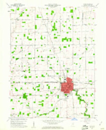
5 surveys from 9 printed sheetsMatched by testing this settlement's coordinate against the published boundary of every sheet in the United States Geological Survey's historical collection. Each opens the scanned sheet at the Survey.
- 1953 USGS Danville quadrangle1:250000, 3 printings
- 1955 USGS Danville quadrangle1:250000
- 1956 USGS Danville quadrangle1:250000
- 1960 USGS Tipton quadrangle1:24000, 2 printings
- 1984 USGS Lafayette quadrangle1:100000, 2 printings




What happened here
An account from the chapter on Cicero township. The inset identifies its exact source book and publication year.
Hunting And Amusements
The early game of the township was exceedingly plentiful; a farmer or settler never gave thought to the putting up of meat for the winter in the late fall, as the modern agriculturist does. There was always food within gunshot, necessitating but a few yards' walk from the cabin door. Deer, squirrels, wild turkeys, raccoons, mink, opossums and musk rats were to be seen on every side; in the territory near Cicero creek, black bears were fre¬ quently seen, and as often shot, their meat used for food and the thick skins for covering and protection against the severe weather.
In the county-history sources
9,569 words on this townshipHistory of Tipton County Indiana, published 1914 names this settlement in its chapter on Cicero Township. These are the passages that mention it, exactly as the scans read.
The first settlers in the township of Cicero were the Miami Indians, who resented the first few scattering white men who entered the territory to make settlement. The portion north of the Indian reserve line was occu¬ pied by these Indians, and was then called Hamilton county, but later was severed from the name by act of the Legislature, approved January 15, 1844, and the county named Tipton created. The Miamis were forced to relin¬ quish . their hold upon these lands in 1845 and were transported to the reservation set aside for them in the state of Kansas. The first permanent white settlements were made in the territory south of the reserve line, while that portion was still a part of Hamilton county. There were no entries at the government land offices prior to the year of 1834; in fact, there were but twro during that year, Absalom Sumner and Philip W. Barger. During ing the following four years all of the remainder of this portion of the township was entered, several land speculators, among them Stoughton A. Fletcher and Nichols McCarty of Indianapolis, taking a large portion of the ground. The name of the first settler in this locality known as the "Old Purchase" cannot be ascertained with any certainty. Suffice to say he came very early and pitched his rude hut in Hamilton county. One Charles Freel, a trapper, came early and settled in the eastern part of the township, but disappeared when the other settlers begun to build up homes.
Passage source: History of Tipton County Indiana, published 1914.
From Wayne county, Indiana, in 1837, came Isaac J. Parker, and he settled one mile east of the present site of Tipton, where he lived until his death in the year 1866. Parker was a native of New Jersey. He encoun¬ tered the usual strenuous hardships of the pioneer and was forced to carry on his ordinary trade at Strawtown, in Hamilton county, twelve miles distant. Joab E. Parker, a brother, came into the county about the same time and entered land farther south. He passed to his reward in 1859. In 1836 Thomas Corbin located in the eastern portion of the township, with no neighbor within a distance of five miles. Allen and James Goodpasture came in 1836, also, and remained until their death. Land was entered in this same year by Joseph Shank, and he moved his family thereon, died in 1882, and. left a good estate to his widow. James Egler settled later in the western part of the township. He died in 1882. Land was purchased by William Bishop in 1835, but he did not make a settlement on it until a few years later; Daniel Smith also lived in the southern part as early as 1835 or 1836.
Passage source: History of Tipton County Indiana, published 1914.
The Whisler brothers, John and Jacob, settled about two and a half miles east of Tipton prior to the year of 1830. Jacob Whisler was the first treasurer of the county, but later moved into Hamilton county. John Whis¬ ler moved, with his family, to Kansas in T833. Near the opening of the year 1838, if not in that year, William Deal made a settlement in this township, and a trifle later John Emehiser emigrated here. Emehiser was a native of Pennsylvania .and of German descent. His first inroad into Indiana was to Wayne county. In 1838, or a year later, William Dickson came, also Anson King. Samuel King was one of the largest owners of land here, at one time possessing over one thousand acres. He first entered land in 1835. John Forkner entered land south of Tipton in 1839. Dr. Silas Blount moved from Ohio and located just north of the Hamilton county line in 1841. The village of West Kinderhook was afterward established there by him. He was one of the first physicians to practice in Tipton county. He was also one of the first associate judges. For a period of forty years he followed diligently his practice and was esteemed by all who knew him. In the eastern part of the township Jackson Reed settled at an early date. Records show that probably the first Methodist religious services in the county were held in his home. Harvey Goodykoontz locat¬ ed in the southern part of the township near the. subsequent site of the Peru & Indianapolis Railroad. He, during his life, held the positions of justice of the peace and assessor, being the second of the latter officer in the county. His death occurred in 1882. Newton J. Jackson, John S. Ressler, Martin Prilliman, William Buffington, Jesse Brown, William H. Nelson, William F. Brady and others settled in or near the town of Tipton.
Passage source: History of Tipton County Indiana, published 1914.
Machine-read from a century-old scan, so expect the errors a machine makes: misspelled names, dropped words, stray characters.
Read the whole chapter on Cicero Township - it names this place 36 more 36 times.
Mines and quarries near this place
2 within 5 milesRegional context, not property-specific evidence. The federal mineral resources record lists 2 workings within 5 miles of Tipton: 2 producers. All of them still produce. What was taken out: Stone, Stone, Crushed/Broken. Distance is straight-line from the map coordinates, so a quarry counted here may appear on a neighbouring settlement's page as well.
| Where | Site | Commodity | Status | Recorded |
|---|---|---|---|---|
| Muncie Plant | Stone, Crushed/Broken | Producer | ||
| Tipton Co. Hwy. Dept. | Stone | Producer |
Storms near this place
50 since 1995Regional context, not property-specific evidence. The National Weather Service names Tipton in 50 storm reports between 1995 and 2026: 33 thunderstorm wind, 9 hail, 4 flood, 3 flash flood. No death or injury is recorded in these reports. Each account below is quoted exactly as the forecast office filed it, from the NOAA Storm Events Database, and each date opens the federal record of that event.
| When | Event | Place named | Harm | What the report says |
|---|---|---|---|---|
| June 2002 | Thunderstorm Wind | Tipton | $100,000 | no account filed |
| June 2008 | Thunderstorm Wind | Tipton | $85,000 | Thunderstorm winds collapsed a farm building, landing on farm equipment inside, near the intersection of Division and Meridian Roads. Nearby, a large evergreen tree and large shed were damaged. A large tree blew down onto a house on North West Street. A trailer at Country Living Trailer Park was heavily damaged by a large tree. The Tipton County Jail's radio tower folded over the top of the jail. SR 19 south of Tipton was closed due to downed utility lines. Billboards were damaged and shingles were blown off a storage unit in town. Large limbs, trees, sheds, barns, and other damages were found throughout the general area. |
| July 2003 | Thunderstorm Wind | Tipton | $50,000 | no account filed |
| September 2014 | Thunderstorm Wind | Tipton | $10,000 | WISH-TV reported tents for the Tipton County Pork Festival had major damage due to damaging thunderstorm wind gusts. Some of the vendors' personal tents were also damaged. |
| February 2014 | Thunderstorm Wind | Tipton | $7,000 | Roof damage was observed on the west side of town due to damaging thunderstorm wind gusts. Extensive power outages were noted as well. |
| August 2012 | Thunderstorm Wind | Tipton | $6,000 | A tree was downed on a home in Tipton due to damaging thunderstorm wind gusts. |
| June 2016 | Thunderstorm Wind | Tipton | $5,000 | Utility lines were blown down at the intersection of 1100 West and Division Road due to damaging thunderstorm wind gusts. |
| February 2008 | Flood | Tipton | $5,000 | Some creeks were out of their banks and flood waters were covering roads due to heavy rain. |
| February 2014 | Thunderstorm Wind | Tipton | $3,000 | An aluminum outbuilding was destroyed on the west side of the Tipton due damaging thunderstorm wind gusts. |
| March 2026 | Thunderstorm Wind | Tipton | $2,000 | A 4.5-inch diameter pine tree was downed by thunderstorm wind gusts. |
| June 2014 | Thunderstorm Wind | Tipton | $1,500 | Carts rolled into and scraped cars at the local Marsh store. Also, a stop sign based in concrete blew over and was possibly dragged due to damaging thunderstorm wind gusts. |
| June 2020 | Thunderstorm Wind | Tipton | $1,000 | Small tree limbs downed due to thunderstorm wind gusts along State Road 26. Pea sized hail also reported at this time. |
| May 2013 | Flood | Tipton | $1,000 | Road flooding was reported from the southern part of the county due to thunderstorm heavy rainfall. Some roads were impassable. |
| June 2013 | Flash Flood | Tipton | $1,000 | Street flooding, multiple inches deep in some locations, was observed in Tipton due to thunderstorm heavy rainfall. |
| April 2013 | Flood | Tipton | $1,000 | Multiple reports of flooding came in from across the county due to thunderstorm heavy rainfall. |
| September 2012 | Flood | Tipton | $1,000 | Street flooding was occurring in downtown Tipton due to heavy thunderstorm rainfall. |
| November 2005 | Thunderstorm Wind | Tipton | $1,000 | Power lines were downed. |
| May 2002 | Thunderstorm Wind | Tipton | $1,000 | Trees down |
| May 1995 | Tornado (F0) | Tipton | $1,000 | Sharpsville Fire Department reported a tornado briefly touched down in a field at U.S. 31 and County Road 300N. Numerous trees and power lines were knocked down in the vicinity of Sharpsville. |
| September 2011 | Thunderstorm Wind | Tipton | $750 | Utility lines were downed due to strong thunderstorm wind gusts on West Jefferson Street. This report was received from the public and relayed by the fire department. Emergency services estimate the winds in the are were about 50 mph at the time. |
| November 2017 | Thunderstorm Wind | Tipton | $500 | Thunderstorm wind gusts were measured at 64 mph on the south side of Tipton. A shed was destroyed as well. |
| April 2025 | Thunderstorm Wind | Tipton | - | A 68 mph thunderstorm wind gust was measured at this location. |
| June 2025 | Thunderstorm Wind | Tipton | - | A 69 mph thunderstorm wind gust was measured. |
| June 2016 | Thunderstorm Wind | Tipton | - | A 59 mph thunderstorm wind gust was measured in this location. |
| June 2014 | Thunderstorm Wind | Tipton | - | An estimated thunderstorm wind gust of 60 mph was observed in this location, along with penny size hail. |
| August 2014 | Thunderstorm Wind | Tipton | - | An estimated 60 mph thunderstorm wind gust was observed in this location. |
| February 2014 | Thunderstorm Wind | Tipton | - | An estimated 65 mph thunderstorm wind gust was observed in Tipton. |
| January 2013 | Thunderstorm Wind | Tipton | - | A 58 mph thunderstorm wind gust was measured at Twin Lakes High School. |
| January 2013 | Thunderstorm Wind | Tipton | - | A 63 mph thunderstorm wind gust was measured in this location. |
| November 2013 | Thunderstorm Wind | Tipton | - | An estimated 60 mph thunderstorm wind gust was observed in this location. |
| July 2012 | Thunderstorm Wind | Tipton | - | Damaging winds estimated at 50 to 60 mph were observed at County Road 300 West and State Route 28. |
| June 2011 | Hail | Tipton | - | Large hail was accompanied by 45 mph thunderstorm wind gusts. |
| June 2011 | Hail | Tipton | - | Hail the size of quarters fell on Mound Street for 5 to 7 minutes. |
| June 2008 | Thunderstorm Wind | Tipton | - | Thunderstorm winds split and fell half of a large healthy tree. |
| June 2006 | Hail | Tipton | - | No property damage reported. |
| June 2005 | Thunderstorm Wind | Tipton | - | A large billboard was blown down. |
| June 2005 | Thunderstorm Wind | Tipton | - | Large limbs were blown down at U.S. 31 and County Road 450 South. |
| August 2005 | Thunderstorm Wind | Tipton | - | Trees and power lines were blown down. |
| July 2005 | Thunderstorm Wind | Tipton | - | Trees were blown down. |
| May 2004 | Hail | Tipton | - | Hail two inches deep on the ground |
| April 2007 | Hail | Tipton | - | no account filed |
| September 2006 | Hail | Tipton | - | no account filed |
| January 2005 | Flash Flood | Tipton | - | no account filed |
| March 2003 | Hail | Tipton | - | no account filed |
| July 2003 | Thunderstorm Wind | Tipton | - | no account filed |
| July 2003 | Flash Flood | Tipton | - | no account filed |
| July 2002 | Thunderstorm Wind | Tipton | - | no account filed |
| June 2002 | Hail | Tipton | - | no account filed |
| July 2001 | Thunderstorm Wind | Tipton | - | no account filed |
| May 2000 | Hail | Tipton | - | no account filed |
Nearest settlements
The eight closest, with where each one stands in the county. Distances are straight-line, computed from the Geographic Names Information System coordinates.
| Map | Place | Distance | Sheets |
|---|---|---|---|
| Jacksons | 3.4 miles | 9 | |
| Hobbs | 5.0 miles | 11 | |
| Goldsmith | 5.7 miles | 9 | |
| Tetersburg | 5.8 miles | 9 | |
| East Union | 6.4 miles | 10 | |
| Normanda | 6.7 miles | 9 | |
| Windfall | 7.2 miles | 11 | |
| Sharpsville | 7.2 miles | 10 |
Elsewhere
Matched on this settlement's Geographic Names Information System number rather than its name, so it cannot be a different place of the same name in another state.
| Wikipedia article on Tipton | An encyclopaedic summary. Its text is share-alike, so it is linked here rather than copied. |
| Wikidata item Q994988 | The structured record the population and elevation above come from. Public domain (CC0). |
Provenance
This settlement is recorded in the Geographic Names Information System as feature 444784. The sheet list is computed by point-in-boundary test against the United States Geological Survey's historical topographic inventory. Both are works of the United States government and carry no copyright under 17 U.S.C. 105.
Mines and quarries. USGS Mineral Resources Data System (MRDS) https://mrdata.usgs.gov/mrds/ A work of the United States government, no copyright under 17 U.S.C. 105.
Storms. NOAA National Centers for Environmental Information, Storm Events Database https://www.ncei.noaa.gov/stormevents/ A work of the United States government, no copyright under 17 U.S.C. 105. Narratives are quoted verbatim from the National Weather Service report and are not edited or summarised.