 Block
Smythe, Indiana
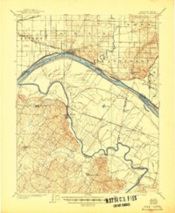
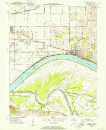
16 topographic sheets cover this place, the earliest surveyed in 1905 and the latest in 1991. It stands in Knight Township. It lies in ZIP code area 47715. The Survey maps it on the Newburgh quadrangle.
Topographic sheets covering this place
8 surveys from 16 printed sheetsMatched by testing this settlement's coordinate against the published boundary of every sheet in the United States Geological Survey's historical collection. Each opens the scanned sheet at the Survey.
- 1905 USGS Newburg quadrangle1:62500, 3 printings
- 1952 USGS Newburgh quadrangle1:24000, 2 printings
- 1954 USGS Evansville quadrangle1:250000
- 1957 USGS Evansville quadrangle1:250000, 3 printings
- 1961 USGS Evansville quadrangle1:250000, 2 printings
- 1964 USGS Newburgh quadrangle1:24000, 3 printings
- 1986 USGS Evansville quadrangle1:100000
- 1991 USGS Evansville quadrangle1:100000
In the county-history sources
12,937 words on this townshipHistory of Vanderburgh County, Indiana, from Earliest Times to the Present; with Biographical Sketches, Reminiscences, Etc, published 1889 names this settlement in its chapter on Knight Township. These are the passages that mention it, exactly as the scans read.
Christian Order. - Through that part of the township called in early times the upper bayou settlement, or along the river near the Three Mile Island, there has grown up a strong society of those who worship according to the faith of the Christian Order. This sect is an offshoot from the Christian church as established by Alexander Campbell, and was founded by John McCrary, Joseph Wasson and John Boren. The Rev. George Grimm first came preaching in this neighborhood. He was succeeded b}' Rev. Tibbetts, and he in turn by Rev. John T. Phillips, who for several years has been the faithful pastor in charge. Preaching was first held in the district school-house, but in 1868 a neat frame church was erected. Mrs. Elizabeth Aikin is recognized b\' all as probably the most devoted and earnest supporter of this church. The congregation is very large, and the Sunday school is in a prosperous condition.
Passage source: History of Vanderburgh County, Indiana, from Earliest Times to the Present; with Biographical Sketches, Reminiscences, Etc, published 1889.
Machine-read from a century-old scan, so expect the errors a machine makes: misspelled names, dropped words, stray characters.
Read the whole chapter on Knight Township - it names this place 1 more 1 time.
Mines and quarries near this place
2 within 5 milesRegional context, not property-specific evidence. The federal mineral resources record lists 2 workings within 5 miles of Smythe: 2 producers. All of them still produce. What was taken out: Stone, Sand and Gravel, Construction. Distance is straight-line from the map coordinates, so a quarry counted here may appear on a neighbouring settlement's page as well.
| Where | Site | Commodity | Status | Recorded |
|---|---|---|---|---|
| Evansville Mill | Sand and Gravel, Construction | Producer | ||
| Vanderburg Co. Hwy. Dept. | Stone | Producer |
Storms near this place
28 since 2009Regional context, not property-specific evidence. The National Weather Service names Smythe in 28 storm reports between 2009 and 2025: 14 flood, 5 thunderstorm wind, 5 flash flood, 3 heavy rain. The reports record 1 death and 1 injury. Each account below is quoted exactly as the forecast office filed it, from the NOAA Storm Events Database, and each date opens the federal record of that event.
| When | Event | Place named | Harm | What the report says |
|---|---|---|---|---|
| March 2015 | Flood | Smythe | 1 killed, 1 hurt, $50,000 | Minor flooding occurred on the Ohio River. At the Evansville river gage, the river crested at 45.21 feet on the 18th. Flood stage is 42 feet. About 20 secondary roads were flooded in bottomland areas near the river. They were mostly farm roads flooded near the river, outside the Evansville city limits. Most of the flooded roads were south of Interstate 164 in the southeast part of the county and in lowland areas in the southwest part of the county. One motorist drowned after disregarding barricades and driving down a flooded road. A passenger in the vehicle was able to roll down a window and escape from the pickup truck. A police officer arrived, threw a rope to the passenger, and pulled her to safety. The driver of the truck was located underwater by the dive team of the Evansville Fire Department. CPR was administered to the driver, who was rushed to a local hospital. The passenger was treated and released from the hospital. The driver died at the hospital. The estimated water level at the scene of the drowning was estimated to be at least 6 or 7 feet. Floodwaters backed up into Pigeon Creek, forcing that creek well out of its banks. The crest of 45.21 feet was about a foot-and-a-half below the crest of the April, 2011 flood. |
| May 2011 | Flood | Smythe | $1,000,000 | Minor flooding continued on the Ohio River from April. At the Evansville river gage, the river crested at 46.78 feet on May 5. This was the 8th highest crest on record, and less than a foot below the 1997 flood. Ohio River floodwaters backed up into Pigeon Creek in the Evansville area. Widespread flooding of fields and some farm buildings occurred along Pigeon Creek, especially near Interstate 164. About 40 to 50 homes near Pigeon Creek were sandbagged or evacuated. At least 35 to 40 roads were underwater and closed. A truss bridge spanning Pigeon Creek at the mouth of the Ohio River was partially underwater. Another bridge over Pigeon Creek on the northeast side of Evansville was under about eight inches of water. |
| July 2025 | Flash Flood | Smythe | $75,000 | Significant flooding occurred in Southeastern Evansville. Several spots on Lincoln Avenue east of Burkhardt Rd and on Fuquay Ave had water spilling into yards and the road, including near Plaza Park Middle School. Portions of Covert Avenue had approximately nine inches of water covering the road and over a foot of water near Greenfield Rd. Over a foot of water covered Heritage Dr, Kingswood Dr, and Lake Terrace Dr. Several inches of water were observed at the intersection of Covert Ave and I-69. |
| June 2021 | Flash Flood | Smythe | $30,000 | Several water rescues were reported on the east side of Evansville. |
| March 2021 | Flood | Smythe | $15,000 | Minor flooding occurred on the Ohio River. About a dozen county roads in the floodplain were flooded, and some were impassable. They were mostly county roads flooded near the river, outside the Evansville city limits. Most of the flooded roads were south of Interstate 69 in the southeast part of the county and in lowland areas in the southwest part of the county. Basements along the riverfront began to fill. Backwater flooding of Pigeon Creek inundated low-lying fields and woodlands. The levee authority operated several pumping stations and closed the flood gates downtown. |
| June 2020 | Flash Flood | Smythe | $10,000 | Flooding occurred on the Lloyd Expressway on the east side of Evansville. A water rescue was reported at an intersection on the northeast side of Evansville. |
| April 2018 | Flood | Smythe | $10,000 | no account filed |
| June 2011 | Thunderstorm Wind | Smythe | $3,000 | On the east side of Evansville, a trained spotter measured a wind gust to 67 mph. Power lines were blown down near the community of Angel Mounds, which is in the southeast corner of the county. A trained spotter there estimated the wind gusted to 65 mph. There were a couple of measured wind gusts to 55 mph on the north and northeast sides of Evansville. |
| May 2024 | Thunderstorm Wind | Smythe | $1,000 | Wind gusts estimated to near 65 mph. |
| February 2025 | Flash Flood | Smythe | - | Heavy rainfall (up to 3) resulted in flash flooding of streets, creeks, and especially low-lying areas in and around the Angel Mounds area on the southeast side of Evansville. |
| July 2025 | Flood | Smythe | - | Flooding issues lingered in Southeastern Vanderburgh County as floodwaters were slow to recede, leaving standing water covering portions of roads and yards into the evening. |
| July 2025 | Flood | Smythe | - | Heavy rain resulted in about a foot of standing water on the 4400 block of Bellemeade Ave in Evansville. Rainfall rates with the passing storm peaked at almost an inch of rain within thirty minutes, but the lack of additional thunderstorms/heavy rain moving over the same area prevented any flash flood development. |
| November 2025 | Flood | Smythe | - | A couple inches of water covered part of the eastbound Green River Road exit of the Lloyd Expressway. Portions of the right lanes on the expressway also had puddles form. Rainfall rates peaked at around half an inch in twenty minutes, but the heavy rainfall duration was brief. |
| May 2024 | Flood | Smythe | - | Water over the road near North Green Rover Rd/Vogel Rd in Evansville. |
| August 2024 | Flood | Smythe | - | Minor street flooding occurred in Evansville as a strong line of storms moved through with hourly rainfall rates peaking at around .75 inch an hour. |
| July 2024 | Hail | Smythe | - | Hail estimated at dime to nickel size fell on the southeast side of Evansville. |
| March 2023 | Thunderstorm Wind | Smythe | - | A trained spotter estimated a wind gust to 60 mph on the east side of Evansville. |
| June 2023 | Thunderstorm Wind | Smythe | - | There were two estimates of winds around 70 mph on the southeast side of Evansville. Winds were estimated up to 70 mph just inside the Warrick County line, west of Newburgh. Another estimate a few miles southeast of downtown Evansville was from a trained spotter. |
| February 2021 | Flood | Smythe | - | Street flooding occurred near Angel Mounds on the southeast side of Evansville. |
| July 2021 | Flood | Smythe | - | Street flooding was reported in the Angel Mounds area. The storm total rainfall amount for the day was 2.6 inches. |
| April 2020 | Flood | Smythe | - | About six inches of water was over a street in a residential neighborhood on the east side of Evansville. |
| February 2020 | Flash Flood | Smythe | - | A trained spotter reported 1.4 inches of rain over the past 12 hours, with flash flooding in the Angel Mounds community. |
| October 2017 | Flood | Smythe | - | Minor flooding was reported in low-lying areas in the Angel Mounds area southeast of the city of Evansville. |
| December 2015 | Flood | Smythe | - | The Ohio River rose above flood stage on New Year's Eve. The river crested in early January. There was minor flooding of low-lying fields and woodlands. Some river access roads were underwater. |
| June 2013 | Heavy Rain | Smythe | - | A storm-total rainfall of 5.30 inches was measured at Angel Mounds, just southeast of Evansville. |
| June 2011 | Thunderstorm Wind | Smythe | - | A microburst containing peak winds estimated near 75 mph nearly levelled a large building. The building was constructed of wooden beams and sheet metal, similar to many external home garages only larger. At least one other smaller building was destroyed. Several tree limbs were blown down. There was minor damage to a couple of homes, including the loss of a few shingles. The microburst occurred just northwest of exit 10 on Interstate 164. The average path width was one-quarter mile. The length of the damage path was about one-half mile. |
| July 2011 | Heavy Rain | Smythe | - | A total of 2.90 inches of rainfall was measured in the Angel Mounds area in the southeast corner of Vanderburgh County. |
| September 2009 | Heavy Rain | Smythe | - | Two inches of rain were measured in 45 minutes on the southeast side of Evansville near Angel Mounds. Yards were covered in several inches of water. A CoCoRaHS (Community Collaborative Rain, Hail, and Snow) Network observer measured 5.19 inches for the 48-hour period ending early on the 7th. |
Nearest settlements
The eight closest, with where each one stands in the county. Distances are straight-line, computed from the Geographic Names Information System coordinates.
| Map | Place | Distance | Sheets |
|---|---|---|---|
| Lakewood Hills | 1.3 miles | 18 | |
| Melody Hill | 2.7 miles | 18 | |
| Knob Hill | 3.1 miles | 18 | |
| Evansville | 3.5 miles | 18 | |
| Stringtown | 4.2 miles | 18 | |
| Erskine Station | 4.3 miles | 18 | |
| Harwood | 4.4 miles | 18 | |
| Mechanicsville | 4.7 miles | 18 |
Provenance
This settlement is recorded in the Geographic Names Information System as feature 443719. The sheet list is computed by point-in-boundary test against the United States Geological Survey's historical topographic inventory. Both are works of the United States government and carry no copyright under 17 U.S.C. 105.
Mines and quarries. USGS Mineral Resources Data System (MRDS) https://mrdata.usgs.gov/mrds/ A work of the United States government, no copyright under 17 U.S.C. 105.
Storms. NOAA National Centers for Environmental Information, Storm Events Database https://www.ncei.noaa.gov/stormevents/ A work of the United States government, no copyright under 17 U.S.C. 105. Narratives are quoted verbatim from the National Weather Service report and are not edited or summarised.