| November 2005 | Tornado (F3) | Evansville | 20 killed, 200 hurt, $15,000,000 | The tornado crossed into Vanderburgh County from Henderson County, KY a second time near Ellis Park, a horse-racing facility off U.S. Highway 41. The tornado moved rapidly east-northeast at close to 60 MPH, staying a mile or less south of Interstate 164 and the southern city limit of Evansville. Twenty people perished at a large mobile home park on the south side of the interstate. Of about 350 mobile homes in the park, 100 were destroyed and another 125 were damaged. Many of the destroyed homes were obliterated. The coroner reported that most of the victims were probably killed instantly, many by spine and skull fractures. Several bodies were carried almost two hundred yards. Several of the fatally injured persons were found in a nearby retention pond that was drained to find victims. An 8-year-old child was found alive in a ditch after being trapped under debris for about 12 hours. One person, who was thrown 150 feet, died of complications from tornado injuries on December 17. The tornado exited into Warrick County at the Angel Mounds State Historic Site, just south of Interstate 164. |
| March 2015 | Flood | Smythe | 1 killed, 1 hurt, $50,000 | Minor flooding occurred on the Ohio River. At the Evansville river gage, the river crested at 45.21 feet on the 18th. Flood stage is 42 feet. About 20 secondary roads were flooded in bottomland areas near the river. They were mostly farm roads flooded near the river, outside the Evansville city limits. Most of the flooded roads were south of Interstate 164 in the southeast part of the county and in lowland areas in the southwest part of the county. One motorist drowned after disregarding barricades and driving down a flooded road. A passenger in the vehicle was able to roll down a window and escape from the pickup truck. A police officer arrived, threw a rope to the passenger, and pulled her to safety. The driver of the truck was located underwater by the dive team of the Evansville Fire Department. CPR was administered to the driver, who was rushed to a local hospital. The passenger was treated and released from the hospital. The driver died at the hospital. The estimated water level at the scene of the drowning was estimated to be at least 6 or 7 feet. Floodwaters backed up into Pigeon Creek, forcing that creek well out of its banks. The crest of 45.21 feet was about a foot-and-a-half below the crest of the April, 2011 flood. |
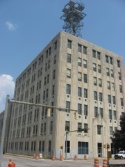
| July 2020 | Lightning | Evansville | 1 killed | A construction worker on the roof of a building was struck by lightning. The individual was a 34-year-old male who was on top of a tall building in downtown Evansville. The lightning hit the roof, causing damage about the size of a softball. The individual was near the damage site when he was struck. He received a burn mark on his chest but no other obvious injuries. The man was admitted to a hospital and then passed away two days later. |
| November 1955 | Tornado (F3) | not stated | 9 hurt, $250,000 | no account filed |
| June 2010 | Thunderstorm Wind | Mc Cutchanville | 2 hurt, $50,000 | In Evansville, two people were injured when a tree fell on the bedroom, hallway, and living room of a house. Both were transported to a hospital with non life-threatening injuries. One suffered a head injury, and the other had a neck injury. Both injured people were attempting to leave the house through the front door when the tree landed on the home. They exited through the back door after being injured. The structural damage to the house was moderate to major. Elsewhere, there were numerous reports of utility lines blown down in McCutchanville. A trampoline blew in front of cars on the Lloyd Expressway in Evansville. Trained spotters estimated wind gusts near 60 mph in Evansville. |
| July 2004 | Thunderstorm Wind | Evansville | 1 hurt, $300,000 | Wind speeds were estimated from 60 to 70 MPH at downtown Evansville, along the Ohio riverfront. Many trees were blown down across the city. At least a few houses received major damage due to falling trees. A large oak tree crashed through the living room and kitchen of a house, injuring one person inside. The person was treated for a hip injury at a local hospital. The Red Cross opened a temporary emergency shelter for those without power. Police barricaded numerous streets blocked by downed trees, utility poles, and power lines. One tree service estimated they received 90 calls to have downed trees removed from yards and houses. Falling trees also damaged vehicles. |
| June 1977 | Tornado (F1) | not stated | 1 hurt, $250,000 | no account filed |
| May 2023 | Lightning | Evansville | 1 hurt | A 20-year-old maintenance worker was struck by lightning while working on a piece of equipment at a fabricating company. The man was taken to a local hospital. |
| May 2014 | Thunderstorm Wind | Howell | $35,000,000 | A very intense macroburst caused extensive damage across the Evansville metro area, primarily the north half of the city. The macroburst was about three miles wide on average. The macroburst started on the west side of Evansville and moved east-northeast across the Melody Hill area into Warrick County. Peak winds were estimated near 120 mph. Wind speeds averaged from 60 to 90 mph, with frequent peaks over 100 mph. A damage assessment indicated roughly 100 structures were damaged, with dozens destroyed. Dozens of vehicles were damaged due to falling trees. The assessed number of damaged homes and vehicles includes Warrick County as well. Thousands of trees were uprooted, snapped, or otherwise damaged. Hundreds of power poles were snapped or blown over. Damage to one farmstead was estimated at over two million dollars. The specific types of damage included a mobile home that was blown off its support piers, roofing that was blown off some structures, and window and siding damage to many others. Most of the structural damage was caused by falling trees. Power was out to a large part of the city. The power company servicing the region reported 50,000 customers without power a couple hours after the storm. Numerous roads were blocked by downed trees and power lines. Numerous wires were blown down or hanging low, and telephone service was not reliable. At the Evansville airport, several trailers and a semi were overturned. The automated weather observing equipment at the airport was damaged. A wind gust to 89 mph was measured at the Evansville airport control tower. The Red Cross set up a shelter for those without power. An outdoor warning siren was blown into the woods. The total length of the damage area across Vanderburgh, Warrick, and Spencer Counties was 35 miles. |
| September 2006 | Flash Flood | Evansville | $1,800,000 | Major flash flooding inundated sections of Evansville. A total of 248 occupied structures were affected. Of those 248, fifteen were single family homes that sustained major damage, 141 were structures that received minor damage, and 92 others were affected in some way. The totals include three businesses and 40 to 50 apartments. A school cafeteria was flooded with an inch or two of water. The basement wall of a residence collapsed. Thirteen families were displaced, and at least four of those families were placed in hotels by the Red Cross. Over 30 water rescues were conducted from cars stalled in flooded streets. Six persons were rescued from a stranded school bus. The occupants of four flooded residences were rescued by firefighters. Long-time residents reported this was the worst flood in memory. Many roads were barricaded and closed. Persistent and repeated drainage problems on the southeast side of Evansville prompted complaints from area residents. A target completion date for the Southeast Evansville Drainage Project is early 2007. The flash flooding occurred when lines of thunderstorms moved through the city during the mid and late afternoon hours. These lines of storms occurred as a cold front stalled just west of the area. Based on radar estimates, about one inch of rain fell within 20 minutes of the onset of heavy rain. Flooding occurred within 30 minutes of the onset of heavy rain. The extreme rainfall was very localized. A total rainfall measurement of 4.87 inches was received from the Community Collaborative Rain, Hail, and Snow (CoCoRaHS) Network just east-southeast of Evansville. In northern and central parts of Vanderburgh County, measurements from the same network were only about one inch. |
| May 2004 | Tornado (F1) | Darmstadt | $1,200,000 | The tornado first touched down on Bromm Road, then tracked east directly across Darmstadt, finally lifting at Browning Road. Hundreds of trees were blown down, including many that landed on houses and power lines. A total of 42 single family homes, 6 commercial structures, and 1 agricultural structure were affected. One single family home and one business was destroyed. Five single family homes and four commercial buildings received major damage. The remainder of the 42 structures received only minor damage. Peak winds were estimated near 100 MPH. Strong gusty winds occurred throughout Vanderburgh County. A gust to 57 MPH was measured in Evansville. |
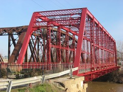
| May 2011 | Flood | Smythe | $1,000,000 | Minor flooding continued on the Ohio River from April. At the Evansville river gage, the river crested at 46.78 feet on May 5. This was the 8th highest crest on record, and less than a foot below the 1997 flood. Ohio River floodwaters backed up into Pigeon Creek in the Evansville area. Widespread flooding of fields and some farm buildings occurred along Pigeon Creek, especially near Interstate 164. About 40 to 50 homes near Pigeon Creek were sandbagged or evacuated. At least 35 to 40 roads were underwater and closed. A truss bridge spanning Pigeon Creek at the mouth of the Ohio River was partially underwater. Another bridge over Pigeon Creek on the northeast side of Evansville was under about eight inches of water. |
| April 2024 | Thunderstorm Wind | St Joseph | $850,000 | A macroburst with peak winds of 95 mph caused thousands of trees in its path to be uprooted or snapped. There was also damage to some home and outbuildings, mainly shingle loss, minor roof damage, or damage to gutters and fascia. There were also several homes damaged by trees falling onto them. The macroburst began in extreme eastern Posey County, near Parkers Settlement, continuing east-southeast into Vanderburgh County, where damage occurred north and south along Highway 66 for a while before impacting residential areas east of Highway 66 near Mill Road and north of Kasson Drive. A large tree was uprooted and fell on a car near North Park. Additional damage continued to occur as the storm moved eastward, with damage on Kratzville Road, at Thunderbolt Pass Golf Course, and Evansville Regional Airport. At the airport, an airplane was damaged and roof damage occurred at a warehouse. Significant tree damage occurred in Melody Hill. The macroburst path was approximately 11 miles long and 1.2 miles wide at its widest. The survey was completed in partnership with Vanderburgh County Emergency Management Agency. |
| April 2024 | Tornado (EF2) | Martin | $500,000 | An EF-2 tornado formed in far western Vanderburgh County during the early morning hours of April 2nd. After producing tree damage initially, the tornado tracked east-southeastward. One home on Nisbet Rd lost many shingles, while another lost a section of the roof. Roof damage occurred on Wallemmeyer Rd as well, with missiles embedded into the barn. On Owensville Rd, a barn lost its roof while a grain silo was heavily damaged. A 32 ft trailer flipped on its side on Schillinger Rd and electrical transmission line poles were broken. More barn, roof, and tree damage occurred further southeast. The tornado shifted to a more easterly path at Baseline Rd, crossing I-69 and overturning a semi truck, before proceeding into Warrick County near Elliott. Overall, hundreds of trees were snapped or uprooted, dozens of outbuildings were damaged or destroyed, minor to moderate damage occurred to several homes, and electrical power poles were snapped. Estimated peak winds for the tornado as a whole and in Vanderburgh County were 115 mph. |
| July 2012 | Thunderstorm Wind | Darmstadt | $500,000 | A microburst struck a high school sports complex. Several bleachers and stadium lights were damaged or destroyed. A set of bleachers was picked up and thrown to the other side of some tennis courts. Other bleachers that were bolted into the ground were blown over a baseball field. Light poles were snapped and fences were destroyed. A parked semi-trailer used for storage was blown over. The tops of trees were snapped. Several trees fell onto nearby homes. The porch was ripped off the front of a house and blown 80 yards. Power lines were blown down. Damage was reported throughout the surrounding area of the high school. Damage to the high school itself was minor. Road crews worked through most of the next day to clear roads of debris. |
| August 2005 | Flash Flood | Evansville | $500,000 | Rainfall amounts reported by emergency management officials ranged from 2.2 inches in downtown Evansville to 5 inches on the east side. Numerous city roads and one county road were closed by high water. Residential areas that were affected were mostly limited to three neighborhoods on Evansville's southeast side. Approximately 50 homes and 3 apartment buildings were affected by high water, many with water in the basements. Numerous vehicles were flooded, including those parked on the street, in garages, and driven into high water. At least 17 cars were reportedly flooded in the Dexter neighborhood. |
| June 1997 | Tornado (F1) | Evansville | $500,000 | The tornado occurred in a densely populated suburban area called North Park, about 2 miles northwest of downtown Evansville. There were many witnesses, so the event was well documented by photographers and eyewitnesses. Although the tornado was unusual in the respect that it developed from a non-severe thunderstorm in a weakly sheared environment, it caused considerable damage in such a populated setting. A survey conducted by National Weather Service personnel determined the damage path was narrow, well defined, and highly convergent. Most of the damage was a result of trees falling on houses (at least a dozen) and causing roof damage and some structural damage. The neighborhood was 40 years old so most trees were full grown. A liquor store, bowling alley, and grocery store suffered primarily roof damage due to winds estimated near 100 MPH. About 2,800 people were without power for several hours. The tornado was well photographed by personnel at the Evansville Airport. |
| April 1994 | Thunderstorm Wind | Evansville | $500,000 | Trees and power lines were blown down and the roofs were blown from two homes on the west side of Evansville. Two construction site trailers were blown over on Green River Road on Evansville's east side. |
| June 1994 | Thunderstorm Wind | Evansville | $500,000 | Numerous trees and utility poles were blown down on Evansville's north side. Several homes and automobiles were damaged. Electrical power was not restored for up to 12 hours in some locations. |
| April 2015 | Tornado (EF1) | Darmstadt | $400,000 | The tornado touched down just west of U.S. Highway 41 and then moved south of due east. Power poles were broken along U.S. Highway 41. At least three farm machinery sheds and garages were destroyed. Three grain bins were destroyed. Numerous other small structures were overturned or destroyed. One home had major structural damage, including an exterior wall pushed outward. The exterior wall was on the end of the house with an attached garage. Dozens of homes lost shingles or gutters. Many dozens of trees were uprooted or snapped. A semi was overturned at the Interstate 164 junction with State Route 57. Peak winds were estimated near 110 mph. The average path width was 325 yards. The majority of damage occurred in Vanderburgh County. This tornado continued into Warrick County. |
| April 1996 | Flash Flood | Evansville | $400,000 | no account filed |
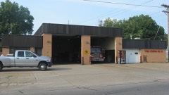
| April 2014 | Flash Flood | Stringtown | $350,000 | Widespread flash flooding of streets and highways occurred in Evansville. A couple of major highways were impassable. The Lloyd Expressway was impassable at Highway 41. Vehicles were abandoned. At the Perry Township fire station, floodwaters in the station were up to the bumpers of the trucks, about 3 to 4 feet deep. The parking area was washed away, exposing a natural gas line approximately three feet deep. A number of Evansville houses had major damage, such as basement walls collapsed. Small streams were well out of their banks. Water was shooting out of sewers. Water was flowing over numerous roads in Evansville. A storm total rainfall of 5.01 inches was reported along the Lloyd Expressway. An unofficial report of 6.00 inches was received on the southeast side of town. |
| March 2008 | Flood | Evansville | $350,000 | Major flooding of Pigeon Creek occurred. Sandbag walls and pumps were placed around a number of residences near the creek, which flows into the Ohio River near Evansville. National Guard troops and firefighters were among those helping with sandbagging. About 100,000 sandbags were filled in this massive flood-fighting effort. Voluntary evacuations were in effect for residents of 194 mobile homes at a mobile home park which was threatened by a weakening levee. Water was about one feet from the top of the levee, and sinkholes formed in the levee. Floodwaters seeping through the levee flooded parts of the mobile home park, but water was not believed to have entered any homes. At least a dozen other homes were threatened by the creek. The Red Cross opened a shelter for evacuees. Access to one home was by boat only. Four teenagers were rescued from an SUV that stalled in floodwaters. In the city of Evansville, the manager of the water and sewer department received 29 reports of storm water in homes. Thirty homes were affected by floodwaters, and a few were heavily damaged. Motorists were stuck in high water on roads near the Evansville Regional Airport. Schools were closed across the county, and a State of Emergency was declared. |
| April 2024 | Tornado (EF2) | St Wendells | $275,000 | An EF-2 tornado entered Vanderburgh County, IN, from Posey County in the St. Wendel area during the early morning hours. The tornado tracked east-southeastward across the entire width of Vanderburgh County. Initially tracking near Boonville New Harmony Rd, the strongest damage in Vanderburgh was a roof entirely removed from a home. Minor structural damage to multiple homes occurred in Hillsdale near US-41. A couple homes on Eagle Crossing Drive suffered shingle loss or minor facia damage. Power poles snapped along I-69. The tornado crossed I-69, continuing into Warrick County north of Kansas Rd. For the county, numerous outbuildings or sheds were damaged or destroyed along the path. There were hundreds of trees snapped or uprooted as well. Peak estimated wind gusts for this tornado as a whole, and for Vanderburgh County, were 120 mph. |
| March 2018 | Flood | Evansville | $250,000 | Minor flooding continued on the Ohio River from late February. Water from the Ohio River backed up into Pigeon Creek, which flows through Evansville. Some homes were evacuated along Pigeon Creek. Numerous roads were closed for days at a time, mostly county roads in bottomland fields. |
| April 2016 | Tornado (EF1) | Kasson | $250,000 | This tornado tracked across the northern parts of the city of Evansville, following a track along or just north of Indiana Route 66. Dozens of trees were uprooted or broken. At least eight buildings were damaged on Indiana Route 66 due to fallen electric transmission poles and lines. At least one building had part of its metal roofing peeled up at Skylane Airport, and minor damage occurred to some homes and fences. Seven power poles were snapped. Straight-line wind damage also occurred, mainly south of the tornado track, where several trees were uprooted and tree limbs broken. Several eyewitnesses observed or photographed the tornado, mainly along the northwest section of its track. Peak winds were estimated near 100 mph. |
| January 2008 | Thunderstorm Wind | St Wendells | $250,000 | Numerous buildings around the county sustained mostly minor damage, such as shingles blown off. Several reports of wind gusts from 60 to 75 mph were received. At the Evansville airport, a gust to 71 mph was measured by the automated surface observing system. Sustained winds were clocked at 52 mph. The highest estimated gust was 75 mph in the northwest part of the county, reported by a trained spotter. In Evansville, a gust to 60 mph was measured on the west side of the city, and a gust to 63 mph was measured on the southeast side. Numerous trees and power lines were down. A semi was blown over, and roofs were blown completely off two homes. An elementary school sustained considerable roof damage. North of St. Wendel, a pole barn, hay barn, implement shed, and a grain bin were destroyed. Minor damage occurred to tractors and farm equipment. A pole barn in the exact same place was destroyed just a few years earlier, in 2004. |
| May 1989 | Tornado (F1) | not stated | $250,000 | no account filed |
| May 1986 | Tornado (F2) | not stated | $250,000 | no account filed |
| April 2024 | Tornado (EF1) | Stacer | $225,000 | An EF-1 tornado formed at the Gibson/Vanderburgh county line at I-64 near Old Princeton Rd during the early morning hours of April 2nd. The tornado tracked southeastward doing significant damage to roofing material at a farm on US-41 along with broken power poles. Trees were uprooted near the Cambridge Golf Club. On Volkman Rd a pole barn had partial roof loss next to a house with broken windows. The tornado crossed I-69, overturning a semi truck, continuing into Warrick County. Overall, dozens of trees were snapped or uprooted, several outbuildings were damaged or destroyed, and minor to moderate damage occurred at a few homes. Estimated peak winds for the tornado and the Vanderburgh segment were 110 mph. |
| February 1999 | Thunderstorm Wind | Evansville | $200,000 | Numerous trees and power lines were down in and around Evansville.Wind speeds were measured to 75 MPH at a television station in Evansville. A few microbursts with estimated wind speeds between 80 and 90 MPH occurred in and near Evansville. Two of the most intense microbursts were on the northwest side of Evansville and the east side of Evansville. On the northwest side, shingles were off roofs, some 2 by 4's were blown through a car windshield, and large storage buildings were damaged. This damage path was 1 to 2 miles long and 300 yards wide. Elsewhere in the county, in the McCutchanville area, large doors of a building were shoved in. About 3 miles north of Daylight on Interstate 164, a tractor trailer was overturned.Just east of Evansville, near the junction of Interstate 164 and Route 62, two power poles were downed, and three houses sustained significant roof damage. A light commercial structure that was under construction was blown down. |
| March 2023 | Tornado (EF1) | Kasson | $150,000 | An EF-1 tornado began northwest of Kasson, IN, in western Vanderburgh County. Moving north, the tornado did tree and minor roof damage along Happe Road and Henze Road. The tornado widened as it crossed Plainview Drive, Goebel Lane, and St. Pauls Drive, just south of the community of St. Joseph, where it continued to produce tree damage and minor structural damage to roofs and fascia of homes. In St. Joseph, the tornado did its most significant damage when it removed the roof of St. Joseph Catholic Church. A gathering of people inside the church for a funeral received warning of the tornado and safely sheltered in the churchs basement as the tornado passed. In addition to the damage to the church, several homes received minor roof and fascia damage, and dozens of trees suffered major limb damage or were uprooted or snapped at the base. Peak winds were estimated near 100 mph. |
| August 2022 | Thunderstorm Wind | Evansville | $150,000 | Widespread damaging winds continued their path through the metropolitan area. Areas east and southeast of downtown Evansville received considerable tree damage. The most intense wind damage was in and around Wesselman Park, which is located just east of downtown Evansville. Winds estimated near 75 mph downed numerous trees in that area. The roof of an athletic building at the park was damaged. A trained spotter estimated winds gusted to 65 mph just southeast of downtown. |
| July 2016 | Thunderstorm Wind | Darmstadt | $150,000 | Widespread damaging winds from 60 to 65 mph were reported throughout the city of Evansville. Multiple trees and power lines were blown down throughout the city, causing numerous power outages. A regional utility company reported 23,000 customers were without power at the height of the storm. The day after the storm, there were still 7,000 outages, mostly in Evansville. Trees fell onto several houses and other buildings, including a church. The roof of the church collapsed. A trained spotter measured a wind gust to 60 mph along the west side of Evansville. A trained spotter measured a wind gust to 60 mph in the downtown area, where large tree limbs were blown down. A trained spotter estimated winds gusted around 65 mph at the civic center downtown. A wind gust to 60 mph was measured near Deaconess Hospital, and some shingles were blown off nearby roofs. Southeast of Evansville near the Warrick County line, tree limbs at least three inches in diameter were blown down. At Darmstadt, a large tree was blown down, pulling up a sidewalk and roadway. |
| November 2005 | Tornado (F3) | Cypress | $150,000 | This tornado first crossed into Vanderburgh County, Indiana from Henderson County, KY at a peninsula formed by the Ohio River just west of Henderson. This peninsula is Ohio River bottomland primarily used for farming. From the air, scour marks were clearly visible on farmland. There were very few structures impacted in this small part of the county. A two-story house built in 1875 sustained major roof damage. Tree branches were embedded into the house. One farm equipment shed was demolished, and another sustained major damage. A 10,000-pound truck was flipped over. Heavy farm equipment was moved several feet. The tornado crossed the Ohio River back into Henderson County in a sparsely populated flood plain, used mostly for farming. |
| June 2009 | Thunderstorm Wind | Stacer | $125,000 | A downburst with peak winds estimated near 95 mph affected an area one mile wide and six miles long. The damage started near the Gibson County line not far from Interstate 64. Many dozens of trees and tree limbs were blown down. Several homes sustained damage, mainly to roofs. Two barns were destroyed. Other farm buildings were damaged. Metal farm bins were partially blown over. Damage near the north end of the track was noticeably divergent. |
| August 2022 | Thunderstorm Wind | Darmstadt | $100,000 | Widespread damaging winds from 60 to 70 mph swept across the Evansville metropolitan area from north to south. A few businesses suffered roof damage. Hundreds of trees were snapped, uprooted, or had large branches broken. Some of the trees landed across power lines. Some downed trees blocked roads. Numerous power outages occurred. Up to 28,000 electric customers in and near Evansville were without power in the aftermath of the storm. The first report of a downed tree and power lines was about ten miles north of downtown Evansville, or three miles northeast of Darmstadt. Tree damage became more widespread as the storms moved across the north side of the Evansville metro area and then across downtown Evansville. A peak wind gust of 68 mph was measured by the Evansville airport automated observing system. The duration of wind gusts above 60 mph lasted for at least four minutes at the airport. There was an unofficial measured gust of 62 mph a couple miles south of Darmstadt. |
| May 2018 | Hail | Evansville | $100,000 | A swath of very large hail crossed most of the city of Evansville. Hail the size of hen eggs fell near the downtown area. Ping pong ball size hail was reported on the north side of the city. Quarter-size hail fell on the northeast and west sides of the city. Several windshields were shattered or damaged. Strong winds were associated with the storm. |
| May 2011 | Tornado (EF2) | Nisbet | $100,000 | The tornado entered Vanderburgh County from Posey County and remained in Vanderburgh County for just a short time. Structures were destroyed at a small airfield. The tornado crossed Interstate 64 north of Nisbet into Gibson County. Peak winds were estimated near 125 mph. The average path width was 100 yards. |
| April 2011 | Thunderstorm Wind | Evansville | $100,000 | Widespread damage to trees and power lines occurred. A tree fell across a car, trapping a man inside. |
| February 2006 | Thunderstorm Wind | Evansville | $100,000 | Damage started at Burdette Park, where roofs were blown off and trees were uprooted. About one half to three quarters of a mile to the east of the park, the tops of two pole barns were blown off. Several homes sustained roof damage. Near the end of the damage path, the roof was blown off a garage and into a back yard. |
| January 2000 | Thunderstorm Wind | Evansville | $100,000 | Thunderstorm winds caused extensive damage in a small area, covering approximately a four square block area on the east side of Evansville. About 25 homes were damaged. Most of the damage was due to trees being blown onto roofs. Five homes had to be abandoned due to severe roof damage. Damage to the remainder of the homes was mainly light. A vehicle was damaged by wind-blown fencing. About 30 trees were down. |
| May 2000 | Thunderstorm Wind | Evansville | $100,000 | Damaging thunderstorm winds affected the west side of Evansville. The hardest hit neighborhood was just off Route 62 about 2 miles west of the Evansville city limits. The main damage was done to an elementary school, which lost a large section of roof. A large tree toppled through a classroom. There was water damage inside the school, and a cinder-block baseball dugout was destroyed. Other damage included many large limbs blown down and privacy fences down. The back deck of a house near the school was heavily damaged. Another nearby house lost part of its roof. About 5,000 electric customers were without power because of fallen tree limbs and utility poles. In the city of Evansville, on the west side of downtown, a few businesses along West Franklin Street received siding and window damage. Trees were blown down in Wesselman Woods Nature Preserve and at the West Side Branch Library. |
| May 1998 | Thunderstorm Wind | Evansville | $100,000 | A roof was blown off an industrial building on Diamond Avenue. Debris was scattered across First Avenue, which disrupted traffic. Trees and wires were blown down. About 3,000 Vanderburgh County electric customers were still without power a few hours later. |
| May 2011 | Flash Flood | Evansville | $80,000 | Two trailer parks were flooded. One of the trailer parks had about four feet of water, and the other had between two and three feet. The flooding was due to a swollen creek. Two main roads were closed in Evansville, including State Route 66. |
| March 2006 | Thunderstorm Wind | Evansville Dress Arp | $80,000 | Major roof damage occurred to a few homes in Green River Estates, just northeast of the airport. One house was completely unroofed. Windows were broken and siding was stripped off. At the Evansville Regional Airport, a wind gust to 59 MPH was measured. Trees and power lines were blown down around the airport. |
| July 2025 | Flash Flood | Smythe | $75,000 | Significant flooding occurred in Southeastern Evansville. Several spots on Lincoln Avenue east of Burkhardt Rd and on Fuquay Ave had water spilling into yards and the road, including near Plaza Park Middle School. Portions of Covert Avenue had approximately nine inches of water covering the road and over a foot of water near Greenfield Rd. Over a foot of water covered Heritage Dr, Kingswood Dr, and Lake Terrace Dr. Several inches of water were observed at the intersection of Covert Ave and I-69. |
| September 2022 | Flash Flood | Stringtown | $75,000 | Widespread street flooding occurred in the Evansville metro area. The water was waist deep in spots. Some water rescues were conducted from stranded vehicles. In the large retail area on the east side of Evansville, Green River Road was flooded both north and south of the Lloyd Expressway. Flash flooding was reported all along Highway 41 in Evansville. The storm total rainfall was about three inches at rain gages in the county. |
| April 2024 | Tornado (EF1) | Elliott | $60,000 | An EF-1 tornado struck far northeast Vanderburgh County, IN, during the early morning hours of April 2nd. The tornado began southwest of the I-69 and I-64 interchange with tree damage occurring on Barton Rd. Near the Coal Mine Rd underpass, a semi-truck overturned on I-69. At the county line, a home suffered minor roof damage while many pine trees were snapped. The tornado continued into Warrick County. Estimated peak winds for the Vanderburgh County segment of this tornado were 90 mph. |
| March 1997 | Lightning | Evansville | $60,000 | no account filed |
| July 2024 | Flash Flood | Harwood | $50,000 | Cars stalled out due to flash flooding in Southeast Evansville. Flooded roads included S Green River Rd and S Burkhardt Rd. Numerous measurements of more than 1 inch of rain in 20-25 minutes were reported in the area. Radar estimated 2-hour rainfall totals were 1-2 inches between 1800-2000CST. |
| May 2018 | Thunderstorm Wind | Evansville | $50,000 | A semi tractor-trailer was blown over near the intersection of Interstate 64 and U.S. Highway 41. A trained spotter in Evansville estimated the wind gusted to 65 mph. There were numerous reports of trees and power lines down across the county. |
| April 2015 | Thunderstorm Wind | Evansville Dress Arp | $50,000 | Thunderstorm winds estimated near 70 mph caused damage at the Evansville Regional Airport. The three-mile long damage area began about two miles west of the airport and ended on the east side of the airport. The damage area was up to two-thirds of a mile wide. West of the airport, several sections of yard fencing and numerous tree limbs and small trees were blown down. The end roof section of a vinyl roof building was blown off. The covering of a nearby sign board was blown partially off. At the Evansville airport, a tarmac loading ramp was blown into the side of a commercial aircraft. The aircraft was dented, and the flight was cancelled. A utility light pole was blown over at the airport. A wind gust to 67 mph was measured by the automated observing system at the Evansville Regional Airport. |
| September 2012 | Thunderstorm Wind | Belknap | $50,000 | Substantial tree damage occurred in southwest parts of the county. Trees were down on power lines, causing numerous power outages. |
| September 2012 | Thunderstorm Wind | Nisbet | $50,000 | Substantial tree damage occurred in northwest parts of the county. Trees were down on power lines, causing numerous power outages. |
| September 2012 | Thunderstorm Wind | Darmstadt | $50,000 | Many trees were blown down in Darmstadt. A barn was blown into the road at Darmstadt. Power lines were blown down in and around the city of McCutchanville. |
| May 2011 | Thunderstorm Wind | St Joseph | $50,000 | Widespread damage to trees and power lines occurred in Evansville and surrounding suburbs. Power poles were down. Much of the west side of the metro area was without power. A wind gust to 75 mph was measured by the automated observing system at the Evansville airport. |
| June 2011 | Thunderstorm Wind | Evansville | $50,000 | A tree fell on a house, causing minor to moderate damage. Downed tree limbs knocked out power to about 5,000 customers. Most of the outages were on the east side of Evansville. Power lines were blown down. |
| September 2009 | Flash Flood | Evansville | $50,000 | A CoCoRaHS (Community Collaborative Rain, Hail, and Snow) Network observer measured 1.67 inches of rain in less than an hour on the southeast side of Evansville. Widespread street flooding caused numerous vehicles to stall out. Police and fire crews were kept busy with vehicle rescues. Water was up to waist-deep on one side street south of downtown. The most affected areas of Evansville were from the downtown area to the southeast side. Garages and basements were flooded in the southeast section of the city. Flooding occurred on the Lloyd Expressway, causing westbound traffic to narrow to one lane that was under water but passable. The CoCoRaHS observer recorded 3.64 inches for the 24-hour period ending early on the 6th. |
| August 2008 | Thunderstorm Wind | Evansville | $50,000 | Numerous trees and power lines were down throughout Evansville. A spotter measured a wind gust to 60 mph. The highest wind gust at the Evansville airport was 51 mph. The strongest winds occurred just ahead of the leading edge of rain. |
 Block