 Block
Sulphur Springs, Indiana
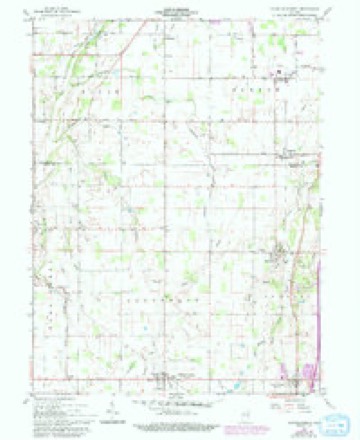
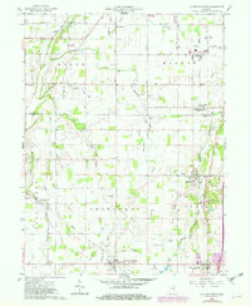
13 topographic sheets cover this place, the earliest surveyed in 1953 and the latest in 1986. It stands in Jefferson Township. It lies in ZIP code area 47356. It stands on Lake Branch. The Survey maps it on the Sulphur Springs quadrangle. 331 people lived here at the 2020 count. It stands 1,063 feet above sea level.
Population over time
2 figuresSulphur Springs fell from 399 to 331 between 2010 and 2020. These are the recorded population figures Wikidata holds for this place, reached through the Geographic Names Information System number this page is keyed on rather than by name, so they belong to this place and not to another of the same name. Most are census counts, but not all are: an early figure may be a founding or settlement estimate, and an estimate published within five years of a census is left out. The change column is computed, and is left blank where more than 20 years separate a figure from the one before it, because a gap that long is not a change between two counts.
| Year | People | Change |
|---|---|---|
| 2010 | 399 | |
| 2020 | 331 | -68 (-17%) |
Topographic sheets covering this place
5 surveys from 13 printed sheetsMatched by testing this settlement's coordinate against the published boundary of every sheet in the United States Geological Survey's historical collection. Each opens the scanned sheet at the Survey.
- 1953 USGS Muncie quadrangle1:250000, 5 printings
- 1956 USGS Muncie quadrangle1:250000
- 1960 USGS Sulpher Springs quadrangle1:24000
- 1960 USGS Sulphur Springs quadrangle1:24000, 3 printings
- 1986 USGS Muncie quadrangle1:100000, 3 printings



In the county-history sources
25,944 words on this townshipHistory of Henry County, Indiana : Together with Sketches of Its Cities, Villages, and Towns ... Also a Condensed History of Indiana, Embracing Accounts of Pre-historic Races, Aborigines, Winnebago and Black Hawk Wars, and a Brief Review of Its Civil and Political History., published 1884 names this settlement in its chapter on Jefferson Township. These are the passages that mention it, exactly as the scans read.
Sulphur Springs, so named from the many mineral springs found in its vicinity, is a thriving and prosperous village, situated on the Chicago, St. Louis & Pittsburg Railroad, seven miles northwest of Hew Castle. The town was platted by Win. S. Yost, who was also the first merchant in the place, and the plat was recorded Jan. 1, 1853. The town is incorporated, has a variety of business interests, a good graded school, one church, etc. The population in 1880 was 256.
Passage source: History of Henry County, Indiana : Together with Sketches of Its Cities, Villages, and Towns ... Also a Condensed History of Indiana, Embracing Accounts of Pre-historic Races, Aborigines, Winnebago and Black Hawk Wars, and a Brief Review of Its Civil and Political History., published 1884.
George W. Baker was born in Preble County, Ohio, May 22, 1843, a son of John and Rebecca (Yost) Baker, natives of Rockingham County, Ya., the father born in 1811 and the mother in 1813. His parents were married in 1833, and in 1836 moved to Preble County, Ohio, remaining there until Feb. 27, 1862, when, with their two youngest children they moved to Henry County, Ind., where Mr. Baker died the same year. Seven of a family of eleven children are living - Mary, Jane, John W., Charles F., Jacob F., George W. and James C. George W. was reared and educated in Ohio, and when seventeen years of age began the carpenter's trade, which he has since worked at. He was married in 1864 to Mary E. Rardin, who was born in Scioto County, Ohio, Dec. 9, 1842, a daughter of Philip and Mary Rardin. Of five children born to them but two are living - John A. and Mary A.; Wecy J. G. D., died Oct. 31, 1882; Elma L. B., Nov. 3, 1882; Jesse L., Oct. 27, 1882. Mr. Baker has served as Constable six years, as Assessor of his township, and eleven years in the City Council. He is a member of the Masonic fra ternity, and has been Master of Sulphur Springs Lodge four years. In 1864-'65 served in Company A, Twenty-fourth Indiana Infantry, seven months. Mrs. Baker is a member .of the Methodist Episcopal church.
Passage source: History of Henry County, Indiana : Together with Sketches of Its Cities, Villages, and Towns ... Also a Condensed History of Indiana, Embracing Accounts of Pre-historic Races, Aborigines, Winnebago and Black Hawk Wars, and a Brief Review of Its Civil and Political History., published 1884.
He was reared and educated in his native township. Upon reaching manhood he chose farming as his lifework, and has carried on the occupation successfully and profltably. He moved to Jefferson Township in 1863, and bought 160 acres of land which was mostly uncultivated. He has improved it in both a useful and ornamental manner and now has one of the most beautiful homes in the township. He was married Feb. 2, 1862, to Mary J., daughter of Jonathan and Su^rJCanadav. She is a native of Ban- -dolpli County, Ind., born Feb. l3, 1844. Mr. and Mrs. Cory have had a family of nine children - Bosetta and Yiretta, born Oct. 18, was educated in the common schools and reared a farmer, following that vocation till 1878. In 1875 he bought a farm in Wells County, Ind., and moved there the same fall. He remained in Wells County till 1878, when, his health failing, he moved to Sulphur Springs and opened a general store, where he has since carried on a lucrative business, carrying a complete stock of notions, hardware, provisions, etc. Feb. 27, 1868, he was married to Sarah Beeson, a native of Parke County, Ind., born March 7, 1847, a daughter of Isaac K. and Rebecca Beeson. They have one chil - Rebecca Jane, born Feb. 25, 1869. Mr. Cory has always been a strictly temperate man, and is a firm advocate of all that tends to the upbuilding of morality.
Passage source: History of Henry County, Indiana : Together with Sketches of Its Cities, Villages, and Towns ... Also a Condensed History of Indiana, Embracing Accounts of Pre-historic Races, Aborigines, Winnebago and Black Hawk Wars, and a Brief Review of Its Civil and Political History., published 1884.
Machine-read from a century-old scan, so expect the errors a machine makes: misspelled names, dropped words, stray characters.
Read the whole chapter on Jefferson Township - it names this place 12 more 12 times.
Mines and quarries near this place
3 within 5 milesRegional context, not property-specific evidence. The federal mineral resources record lists 3 workings within 5 miles of Sulphur Springs: 2 past producers, 1 unknown. None of them still produces. What was taken out: Sand and Gravel, Construction. Distance is straight-line from the map coordinates, so a quarry counted here may appear on a neighbouring settlement's page as well.
| Where | Site | Commodity | Status | Recorded |
|---|---|---|---|---|
| Mt. Summit Pit | Sand and Gravel, Construction | Past Producer | ||
| Oakville Pit | Sand and Gravel, Construction | Unknown | ||
| Springport Plant | Sand and Gravel, Construction | Past Producer |
Nearest settlements
The eight closest, with where each one stands in the county. Distances are straight-line, computed from the Geographic Names Information System coordinates.
| Map | Place | Distance | Sheets |
|---|---|---|---|
| Honey Creek | 3.0 miles | 13 | |
| Mount Summit | 3.1 miles | 13 | |
| Fayne Siding | 3.5 miles | 11 | |
| Springport | 3.9 miles | 13 | |
| Cadiz | 4.4 miles | 11 | |
| Foley | 4.4 miles | 11 | |
| Van Nuys | 5.6 miles | 11 | |
| Westwood | 6.1 miles | 11 |
Elsewhere
Matched on this settlement's Geographic Names Information System number rather than its name, so it cannot be a different place of the same name in another state.
| Wikipedia article on Sulphur Springs | An encyclopaedic summary. Its text is share-alike, so it is linked here rather than copied. |
| Wikidata item Q2101339 | The structured record the population and elevation above come from. Public domain (CC0). |
Provenance
This settlement is recorded in the Geographic Names Information System as feature 444380. The sheet list is computed by point-in-boundary test against the United States Geological Survey's historical topographic inventory. Both are works of the United States government and carry no copyright under 17 U.S.C. 105.
Mines and quarries. USGS Mineral Resources Data System (MRDS) https://mrdata.usgs.gov/mrds/ A work of the United States government, no copyright under 17 U.S.C. 105.