 Block
Springport, Indiana
13 topographic sheets cover this place, the earliest surveyed in 1953 and the latest in 1986. It stands in Prairie Township. It lies in ZIP code area 47386. It stands on Port Run. The Survey maps it on the Sulphur Springs quadrangle. 131 people lived here at the 2020 count. It stands 1,063 feet above sea level.
Population over time
2 figuresSpringport fell from 149 to 131 between 2010 and 2020. These are the recorded population figures Wikidata holds for this place, reached through the Geographic Names Information System number this page is keyed on rather than by name, so they belong to this place and not to another of the same name. Most are census counts, but not all are: an early figure may be a founding or settlement estimate, and an estimate published within five years of a census is left out. The change column is computed, and is left blank where more than 20 years separate a figure from the one before it, because a gap that long is not a change between two counts.
| Year | People | Change |
|---|---|---|
| 2010 | 149 | |
| 2020 | 131 | -18 (-12%) |
Topographic sheets covering this place
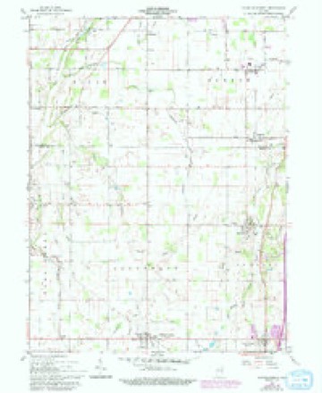
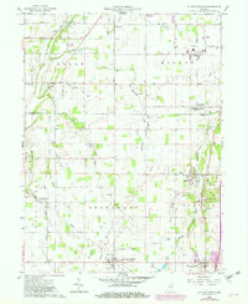
5 surveys from 13 printed sheetsMatched by testing this settlement's coordinate against the published boundary of every sheet in the United States Geological Survey's historical collection. Each opens the scanned sheet at the Survey.
- 1953 USGS Muncie quadrangle1:250000, 5 printings
- 1956 USGS Muncie quadrangle1:250000
- 1960 USGS Sulpher Springs quadrangle1:24000
- 1960 USGS Sulphur Springs quadrangle1:24000, 3 printings
- 1986 USGS Muncie quadrangle1:100000, 3 printings



In the county-history sources
18,112 words on this townshipHistory of Henry County, Indiana : Together with Sketches of Its Cities, Villages, and Towns ... Also a Condensed History of Indiana, Embracing Accounts of Pre-historic Races, Aborigines, Winnebago and Black Hawk Wars, and a Brief Review of Its Civil and Political History., published 1884 names this settlement in its chapter on Prairie Township. These are the passages that mention it, exactly as the scans read.
Luray^ in the northern part of the township, is another village, old but small. It was laid out in 1836 by Lot Hazel ton. It is situated ten miles north of Hew Castle and a mile and a half east ' of the railroad. The building of the railroad took the life out of the place. A postoffice was established here in 1850, George Louthain, Postmaster.
Passage source: History of Henry County, Indiana : Together with Sketches of Its Cities, Villages, and Towns ... Also a Condensed History of Indiana, Embracing Accounts of Pre-historic Races, Aborigines, Winnebago and Black Hawk Wars, and a Brief Review of Its Civil and Political History., published 1884.
James S. Clawson was born in Preble County, Ohio, May 20, 1821, a son of Josiah and Phoebe (Woodward) Clawson, his father a native of Pennsylvania and his mother of Kentucky. Both moved to Ohio when quite young, with their parents, and were there married. They came to Henry County, Ind., in 1821 and settled on Flatrock. Josiah Clawson entered 160 acres from the Government and after living on it fifteen years exchanged it for a farm two miles north of New Castle, containing 320 acres now known as the Jno. Huddleson and Jas. Richey farms. He lived on this farm about twelve years after which he sold it and went into the drug business with his eldest sou. Dr. A. J. Clawson, at New Castle, and in 1858 he retired from business and he and his wife^ lived with their son, James S., until their death. Phoebe, his^ wife, died in 1861, and Josiah, in 1869. They had a family of ten children; but four are living. James S. remained with his parents till manhood. After his marriage he lived on a farm north of New Castle three years and then purchased the farm upon which he now resides, which contains 460 acres of tine land. Although his means were limited when he began life he has been successful and now has a good property. He pays special attention to the raising of grain and stock. Mr. Clawson was married in his twenty-second year to Miss Mary A., daughter of Jesse and Sara Ice. They have six living children - Caroline C. (wife of G. E. Messerley), JohnM., Orlistus P., Jessie J., (wife of F. B. Hurst), Josiah L., Mary F. In 1866 Mary A., his wife, died, and in 1869 he was again married to Sophronia J., widow of Dr. J. J. Drummond and daughter of Jacob V. and Rachel Hickman, of La Porte County, Ind. By this second marriage he has two living children - Charlie E. and Estella F. Mr. Clawson was twice engaged in the dry-goods business, and has served four years as Justice of the Peace, and in 1882 was a candidate for Representative on the Democratic ticket. He and his wife and all of his children except his youngest daughter are members of the Christian church.
Passage source: History of Henry County, Indiana : Together with Sketches of Its Cities, Villages, and Towns ... Also a Condensed History of Indiana, Embracing Accounts of Pre-historic Races, Aborigines, Winnebago and Black Hawk Wars, and a Brief Review of Its Civil and Political History., published 1884.
John Mortimer Clawson^ a son of James S. and Mary Ann Clawson, was born in Henry County, Ind., Sept. 26, 1847. He attended the district school and when eighteen years of age taught one term of six months. He afterward attended Franklin Academy, Johnson County, Ind., and Eureka College, of Illinois. He then began clerking for Hiram Allen, and in 1871 formed a partnership with Henry Rieman, in the general mercantile business, in Springport. In 1872 he sold out at auction and again clerked for Hiram Allen a year. He then engaged in farming a year and then went to New Comer, Delaware Co., Ind., and engaged in the general mercantile business a year. In 1875 he returned to Springport and bought the store of Hiram Allen. He was appointed express and railroad agent and remained in Springport something over three years. He then sold his store to Manning Smith and bought a farm a mile southwest of Springport, where he lived four years., when he rented his farm and moved to Mnncie and engaged in the boot and shoe business about a year. He then returned to Springport where he still resides, engaged in general farming and stock-raising. Mr. Clawson is a prominent member of the Masonic fraternity; a member of Muncie Lodge, No. 433, Delaware County. He was married in 1874 to Margaret, daugh-
Passage source: History of Henry County, Indiana : Together with Sketches of Its Cities, Villages, and Towns ... Also a Condensed History of Indiana, Embracing Accounts of Pre-historic Races, Aborigines, Winnebago and Black Hawk Wars, and a Brief Review of Its Civil and Political History., published 1884.
Machine-read from a century-old scan, so expect the errors a machine makes: misspelled names, dropped words, stray characters.
Read the whole chapter on Prairie Township - it names this place 10 more 10 times.
Mines and quarries near this place
4 within 5 milesRegional context, not property-specific evidence. The federal mineral resources record lists 4 workings within 5 miles of Springport: 2 past producers, 1 unknown, 1 producer. 1 still produces. What was taken out: Sand and Gravel, Construction. Distance is straight-line from the map coordinates, so a quarry counted here may appear on a neighbouring settlement's page as well.
| Where | Site | Commodity | Status | Recorded |
|---|---|---|---|---|
| Luray Pit | Sand and Gravel, Construction | Producer | ||
| Mt. Summit Pit | Sand and Gravel, Construction | Past Producer | ||
| Oakville Pit | Sand and Gravel, Construction | Unknown | ||
| Springport Plant | Sand and Gravel, Construction | Past Producer |
Nearest settlements
The eight closest, with where each one stands in the county. Distances are straight-line, computed from the Geographic Names Information System coordinates.
| Map | Place | Distance | Sheets |
|---|---|---|---|
| Luray | 2.2 miles | 13 | |
| Mount Summit | 3.0 miles | 13 | |
| Rogersville | 3.5 miles | 13 | |
| Sulphur Springs | 3.9 miles | 13 | |
| Honey Creek | 4.9 miles | 13 | |
| Fayne Siding | 5.0 miles | 11 | |
| Foley | 5.7 miles | 11 | |
| Van Nuys | 6.4 miles | 11 |
Elsewhere
Matched on this settlement's Geographic Names Information System number rather than its name, so it cannot be a different place of the same name in another state.
| Wikipedia article on Springport | An encyclopaedic summary. Its text is share-alike, so it is linked here rather than copied. |
| Wikidata item Q2764772 | The structured record the population and elevation above come from. Public domain (CC0). |
Provenance
This settlement is recorded in the Geographic Names Information System as feature 444015. The sheet list is computed by point-in-boundary test against the United States Geological Survey's historical topographic inventory. Both are works of the United States government and carry no copyright under 17 U.S.C. 105.
Mines and quarries. USGS Mineral Resources Data System (MRDS) https://mrdata.usgs.gov/mrds/ A work of the United States government, no copyright under 17 U.S.C. 105.