 Block
Tunker, Indiana
10 topographic sheets cover this place, the earliest surveyed in 1953 and the latest in 1994. It stands in Washington Township. It lies in ZIP code area 46787. It stands on Huffman Branch. The Survey maps it on the South Whitley East quadrangle. It stands 843 feet above sea level.
Topographic sheets covering this place
5 surveys from 10 printed sheetsMatched by testing this settlement's coordinate against the published boundary of every sheet in the United States Geological Survey's historical collection. Each opens the scanned sheet at the Survey.
- 1953 USGS Fort Wayne quadrangle1:250000, 4 printings
- 1956 USGS Fort Wayne quadrangle1:250000, 2 printings
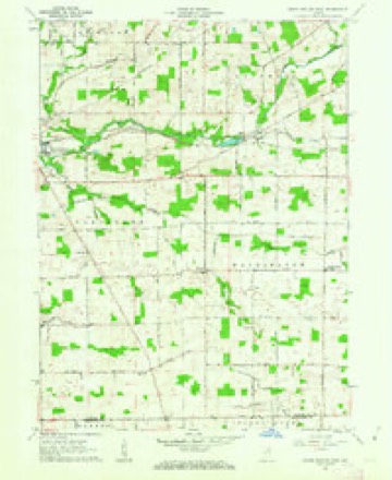
- 1962 USGS South Whitley East quadrangle1:24000, 2 printings
- 1984 USGS Fort Wayne quadrangle1:100000
- 1994 USGS Fort Wayne quadrangle1:100000




In the county-history sources
7,634 words on this townshipHistory of Whitley County, Indiana, published 1907 names this settlement in its chapter on Washington Township. These are the passages that mention it, exactly as the scans read.
A little town had sprung up in the wester 1 part of the township in the Dunkard settlement and during Cleveland's first term as president a postoffice was established there and was named "Tunker." Tunker is an old town in years, but time has never blessed it with a great population, yet it is proud t" say that it is not on the decline. Frederick Weybright, who located here in 1839, was the first settler near the present site of the village. He was soon followed by John Wise and Phillip Holler, Sr.
Passage source: History of Whitley County, Indiana, published 1907.
Like Pilgrims of old. the early adherents of the Dunkard faith in Washington township met in the homes of the brethren and worshiped God in accordance with the dictates of their own consciences and in the year 1866 they erected a large brick church, f«irty by eight}', in what is now the village of Tunker, and is known as the "Sugar Creek Church." The house was erected at a cost of two thousand four hundred dollars and the present value of the property is about three thousand five hundred dollars. Rev. David Bear preached the sermon of dedication and David Shoemaker did the carpenter work on the building. About thirty-five years ago Rev. Kripe manufactured the seats with which the church is now furnished. He worked at the seats during the day and preached to the people at night.
Passage source: History of Whitley County, Indiana, published 1907.
Machine-read from a century-old scan, so expect the errors a machine makes: misspelled names, dropped words, stray characters.
Fires near this place
10 since 2002Regional context, not property-specific evidence. The federal wildfire occurrence database lists 10 fires within 5 miles of Tunker between 2002 and 2007, burning about 10 acres in total. 1 started naturally. None was recorded as arson. Distance is straight-line from the map coordinates, so a fire counted here may appear on a neighbouring settlement's page as well.
| Reported cause | Fires |
|---|---|
| Recreation and ceremony | 4 |
| Missing data/not specified/undetermined | 3 |
| Debris and open burning | 2 |
| Natural | 1 |
The most recent of them, most recent first, with the day each was reported and the service that recorded it.
| Date | Cause | Size | Reported by | Name on the report |
|---|---|---|---|---|
| 31 July 2002 | Recreation and ceremony | 1.0 acres | Indiana State Fire Marshal's Office | not named |
| 30 May 2007 | Debris and open burning | 3.0 acres | Indiana State Fire Marshal's Office | not named |
| 7 April 2002 | Natural | under an acre | Indiana State Fire Marshal's Office | not named |
| 28 April 2003 | Missing data/not specified/undetermined | 1.0 acres | Indiana State Fire Marshal's Office | not named |
| 18 April 2003 | Missing data/not specified/undetermined | 1.0 acres | Indiana State Fire Marshal's Office | not named |
| 16 April 2004 | Recreation and ceremony | under an acre | Indiana State Fire Marshal's Office | not named |
| 16 April 2003 | Missing data/not specified/undetermined | 1.0 acres | Indiana State Fire Marshal's Office | not named |
| 1 April 2005 | Debris and open burning | 1.0 acres | Indiana State Fire Marshal's Office | not named |
Settlements close enough to share some of these fires:
Mines and quarries near this place
1 within 5 milesRegional context, not property-specific evidence. The federal mineral resources record lists 1 working within 5 miles of Tunker: 1 producer. All of them still produce. What was taken out: Sand and Gravel, Construction. Distance is straight-line from the map coordinates, so a quarry counted here may appear on a neighbouring settlement's page as well.
| Where | Site | Commodity | Status | Recorded |
|---|---|---|---|---|
| South Whitley Pit and Mill | Sand and Gravel, Construction | Producer |
Storms near this place
2 since 2010Regional context, not property-specific evidence. The National Weather Service names Tunker in 2 storm reports between 2010 and 2013: 2 thunderstorm wind. No death or injury is recorded in these reports. Each account below is quoted exactly as the forecast office filed it, from the NOAA Storm Events Database, and each date opens the federal record of that event.
| When | Event | Place named | Harm | What the report says |
|---|---|---|---|---|
| July 2013 | Thunderstorm Wind | Tunker | - | Local fire officials estimated 60 mph winds at County Road 200 West and State Route 114. Pea size hail also occurred. |
| October 2010 | Thunderstorm Wind | Tunker | - | Emergency management officials reported portion of a roof from a church was ripped off and a nearby grain bin destroyed on County Road 1000 South near State Road 5. |
Nearest settlements
The eight closest, with where each one stands in the county. Distances are straight-line, computed from the Geographic Names Information System coordinates.
| Map | Place | Distance | Sheets |
|---|---|---|---|
| Washington Center | 2.5 miles | 10 | |
| Luther | 3.3 miles | 10 | |
| Peabody | 4.4 miles | 11 | |
| South Whitley | 4.5 miles | 10 | |
| Briggs | 5.3 miles | 11 | |
| Laud | 5.6 miles | 11 | |
| Collamer | 6.0 miles | 10 | |
| Walnut Corners | 6.6 miles | 11 |
Elsewhere
Matched on this settlement's Geographic Names Information System number rather than its name, so it cannot be a different place of the same name in another state.
| Wikipedia article on Tunker | An encyclopaedic summary. Its text is share-alike, so it is linked here rather than copied. |
| Wikidata item Q7853232 | The structured record the population and elevation above come from. Public domain (CC0). |
Provenance
This settlement is recorded in the Geographic Names Information System as feature 444950. The sheet list is computed by point-in-boundary test against the United States Geological Survey's historical topographic inventory. Both are works of the United States government and carry no copyright under 17 U.S.C. 105.
Wildfire. Short, Karen C. 2022. Spatial wildfire occurrence data for the United States, 1992-2020 [FPA_FOD_20221014]. 6th Edition. Fort Collins, CO: Forest Service Research Data Archive. https://doi.org/10.2737/RDS-2013-0009.6 Collected with United States Government funding and usable without additional permissions or fees.
Mines and quarries. USGS Mineral Resources Data System (MRDS) https://mrdata.usgs.gov/mrds/ A work of the United States government, no copyright under 17 U.S.C. 105.
Storms. NOAA National Centers for Environmental Information, Storm Events Database https://www.ncei.noaa.gov/stormevents/ A work of the United States government, no copyright under 17 U.S.C. 105. Narratives are quoted verbatim from the National Weather Service report and are not edited or summarised.