 Block
Veedersburg, Indiana
9 topographic sheets cover this place, the earliest surveyed in 1953 and the latest in 1987. It stands in Van Buren Township. It lies in ZIP code area 47987. It stands on East Fork Coal Creek. The Survey maps it on the Veedersburg quadrangle. 2,098 people lived here at the 2020 count. It stands 633 feet above sea level.
On record in Veedersburg
Buildings and businesses the archive holds for this place. Each opens its own page, with the source record it came from.
On the National Register 4 records
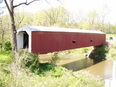 Cades Mill Covered Bridgelisted 2021
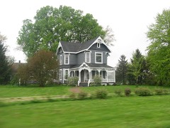 Clinton F. Hesler Farmlisted 1989
- Veedersburg Clover Leaf Route Depotlisted 2020
- Veedersburg First Christian Churchlisted 2025
Population over time
2 figuresVeedersburg fell from 2,180 to 2,098 between 2010 and 2020. These are the recorded population figures Wikidata holds for this place, reached through the Geographic Names Information System number this page is keyed on rather than by name, so they belong to this place and not to another of the same name. Most are census counts, but not all are: an early figure may be a founding or settlement estimate, and an estimate published within five years of a census is left out. The change column is computed, and is left blank where more than 20 years separate a figure from the one before it, because a gap that long is not a change between two counts.
| Year | People | Change |
|---|---|---|
| 2010 | 2,180 | |
| 2020 | 2,098 | -82 (-4%) |
Topographic sheets covering this place
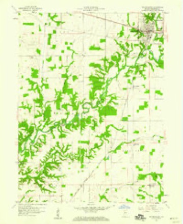
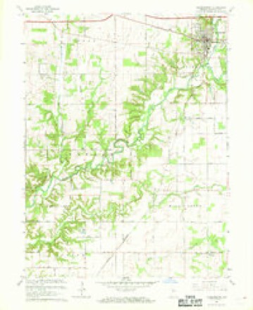
7 surveys from 9 printed sheetsMatched by testing this settlement's coordinate against the published boundary of every sheet in the United States Geological Survey's historical collection. Each opens the scanned sheet at the Survey.
- 1953 USGS Danville quadrangle1:250000, 3 printings
- 1955 USGS Danville quadrangle1:250000
- 1956 USGS Danville quadrangle1:250000
- 1958 USGS Veedersburg quadrangle1:24000
- 1967 USGS Veedersburg quadrangle1:24000
- 1984 USGS Danville quadrangle1:100000
- 1987 USGS Danville quadrangle1:100000



In the county-history sources
20,751 words on this townshipHistory of Fountain County : Together with Historic Notes on the Wabash Valley, Gleaned from Early Authors, Old Maps and Manuscripts, published 1881 names this settlement in its chapter on Van Buren Township. These are the passages that mention it, exactly as the scans read.
The second society of the United Brethren church holds its meetings in the Methodist Episcopal church at Sterling. This class proper is the one that formerly held its services in Chambersburg. It is prospecting for a new church building to be built in Veedersburg. The society is in an active working condition. The third society is at Stone Bluff. This society was organized at this place in 1860. The prominent members were Samuel Morgan and Francis Markham. The prosperity of the society has usually been good. It now has under progress of erection a new frame church 32x48, which, w lien completed, will be second to none in the township. The present trustees of this society are George Dice, Samuel Morgan, and John Simpson. It numbers fifty active members. The Sunday-school connected with the society is in a live condition.
Passage source: History of Fountain County : Together with Historic Notes on the Wabash Valley, Gleaned from Early Authors, Old Maps and Manuscripts, published 1881.
The Christian Disciples. This order, under this name, first made its appearance in Van Buren township in 1835, at Cool Springs Church, where it remained a successful society till 1874, when it removed to Veedersburg, erecting at that place a handsome frame churchhouse at a cost of §2,000. Among its first prominent members are the names of Daniel Osborn, Isac Spinning, Aaron Death, John Jack, John Deth, Harvy Applegate, and William Osborn. A great part of these united, under the name of Disciples, at Cool Springs Church, in 1835. This society, now located at Veedersburg, is one of the most active in the township. Eev. Martin is the present ofiiciating clergyman. Prominent among its members are John McClure, Watson Clark, D. C. Smith, Oliver Osborn, E. M. Osborn, D. K. Smith, and Harvy Young. The society now has fifty members ; the Sunday-school has an attendance of 112.
Passage source: History of Fountain County : Together with Historic Notes on the Wabash Valley, Gleaned from Early Authors, Old Maps and Manuscripts, published 1881.
D. K. Smith, farmer and stock raiser, Veedersburg, is a son of Silas and Clarrissa (Chapman) Smith. The former came to Fountain count> with his parents, Cetns and Nancy (More) Smith, in 182i. Cetus Smith was a native of Connecticut, and when a young man went to New York, where he married and then moved to Ohio, where he rented land of General Harrison, which he formed five years, and then came and settled in Fountain county, where be died in 1840. His ^ife Kancy More, moved to Kansas, where she died. Silas, son of Cetus, was born in 1816. Sliortly after coming to Fountain county he married and settled on Sec. 31, where he lived till his death, in 1852 ; except five years of this time he lived in Iowa. Clarrlssa (Chapman) Smith, is a native of Iventucky, and daughter of Joshua and Rachel Chapman, settlers of Fountain county in 1824, then residents of Iowa five years, then returned to Fountain county, where they both died in 1856, the father aged seventy-six, and the mother aged eighty. Silis Smith raised a family of five children, three of whom are living: I) K., America E., Laura E. D. K. lives near the old town, Chambersburg. He was married in 1864 to Alcinda Walker, daughter of Wesley ''and Margret Osborn, early settlers of Fountain county. By this^ marriage D. K. has three children : James C, Charles W., and Silas M. He and his wife are members of the order of christians known as Disciples, at Cool Creek church. He has a fine farm of 266 acres, all under fence and well improved. D. K.'s mother, an old soldier of the cross, and member of the church at Cool Creek, lives with him. D. K. is, and ever has been, a staunch republican, a wellto-do farmer, and good citizen. His early education was such as he could procure in the district school. While he is a successful man in business, he is a lover of literature and moral development in society. Thomas Patton (deceased) was a native of Pennsylvania. He first emigrated to Franklin county, Ohio, where he remained till 1819, when he c°ame to Parke county, Indiana, where he remained five years, and then moved to Fountain county in 1824, being among the first settlers of Van Buren township. He was married in Ohio to Nancy Hendry, a native of Virginia, by whom he raised a family of seven children, only two of whom are now living. Thomas Patton died in 1858, m his' seventy-first year. He was one of those hardy, energetic pioneers whose influence is long felt, and whose works live long after them. He and his wife were strict communicants of the Presbyterian faith. Thomas Patton's father was a native of Scotland ; his mother, Martha Pritchy, a native of England. His wife's people originally came from Ireland. William Patton, the only surviving son. lives on the old homeplace of his father. He was born in 1821 in Parke county, Indiana, and his early educational training was limited. He was married in 1850 to Deborah Kepner, who died, leaving eight children to mourn her loss: Volney, Sarah, Nancy, Edward, Morton, and Cora; Thomas and Francis, deceased. William Patton was married a second time, in 1875, to Mary J. Bell, with whom he is now living. Mr. Patton is one of those characters who never sought the honors of office, and has ever been content with the blessings of home life. His former wife was a member of the Presbyterian church, so, also, is his present wife. He is at present an elder in the church. He has all his life been a farmer. Success has crowned his efforts. He owns one of the finest farms, of 500 acres, in the southern part of Van Bnren township. In politics he is a staunch republican.
Passage source: History of Fountain County : Together with Historic Notes on the Wabash Valley, Gleaned from Early Authors, Old Maps and Manuscripts, published 1881.
Machine-read from a century-old scan, so expect the errors a machine makes: misspelled names, dropped words, stray characters.
Read the whole chapter on Van Buren Township - it names this place 37 more 37 times.
Mines and quarries near this place
2 within 5 milesRegional context, not property-specific evidence. The federal mineral resources record lists 2 workings within 5 miles of Veedersburg: 2 unknowns. None of them still produces. What was taken out: Sand and Gravel, Construction. Distance is straight-line from the map coordinates, so a quarry counted here may appear on a neighbouring settlement's page as well.
| Where | Site | Commodity | Status | Recorded |
|---|---|---|---|---|
| C. A. Miller Gravel Pit | Sand and Gravel, Construction | Unknown | ||
| F. I. Mitchell Gravel Pit | Sand and Gravel, Construction | Unknown |
Storms near this place
26 since 1996Regional context, not property-specific evidence. The National Weather Service names Veedersburg in 26 storm reports between 1996 and 2026: 14 thunderstorm wind, 8 hail, 2 tornado, 1 lightning. The reports record 1 death. Each account below is quoted exactly as the forecast office filed it, from the NOAA Storm Events Database, and each date opens the federal record of that event.
| When | Event | Place named | Harm | What the report says |
|---|---|---|---|---|
| May 2004 | Lightning | Veedersburg | 1 killed | A 24 year old male was hit by lightning on a baseball field and died shortly thereafter. |
| June 2023 | Thunderstorm Wind | Veedersburg | $350,000 | Large tree downed by thunderstorm wind gusts on a house. Numerous other reports of downed trees across the county with over 2500 power outages. |
| August 2025 | Thunderstorm Wind | Veedersburg | $30,000 | Thunderstorm winds downed power poles on West Public Service Road and blew metal roofing into fields on both sides of US Highway 136, one-eighth to one-quarter mile west of Interstate 74 overpass. |
| May 2019 | Thunderstorm Wind | Veedersburg | $20,000 | Trees and utility lines were blown down due to damaging thunderstorm wind gusts. Scattered reports came in from around the county of this type of damage. |
| September 2011 | Thunderstorm Wind | Veedersburg | $5,000 | Several trees, up to three feet in diameter, were downed due to damaging thunderstorm wind gusts. |
| August 2019 | Thunderstorm Wind | Veedersburg | $1,000 | Multiple large tree limbs downed due to thunderstorm wind gusts. |
| April 2018 | Tornado (EF0) | Veedersburg | $1,000 | This EF-0 tornado, with a max wind speed of 75 mph, primarily went across cornfields while glancing two homesteads, where a few large tree branches were downed and one large trash dumpster blown over in a direction opposite from the environmental wind at the time. |
| June 2006 | Thunderstorm Wind | Veedersburg | $1,000 | Trees and power lines downed. |
| October 1996 | Thunderstorm Wind | Veedersburg | $500 | no account filed |
| August 2020 | Thunderstorm Wind | Veedersburg | - | A 67 mph thunderstorm wind gust was measured at this location. |
| August 2019 | Thunderstorm Wind | Veedersburg | - | This was a public report of an estimated 60 mph thunderstorm wind gust in this location. |
| June 2010 | Funnel Cloud | Veedersburg | - | Movement of the funnel cloud was to the southeast. |
| May 2006 | Thunderstorm Wind | Veedersburg | - | Trees were downed. |
| September 2005 | Thunderstorm Wind | Veedersburg | - | Trees were downed. |
| May 2004 | Tornado (F0) | Veedersburg | - | State police reported a brief weak tornado touchdown in a field near Veedersburg. |
| March 2026 | Hail | Veedersburg | - | no account filed |
| May 2012 | Hail | Veedersburg | - | no account filed |
| March 2011 | Hail | Veedersburg | - | no account filed |
| June 2009 | Hail | Veedersburg | - | no account filed |
| September 2006 | Hail | Veedersburg | - | no account filed |
| July 2003 | Thunderstorm Wind | Veedersburg | - | no account filed |
| June 2002 | Thunderstorm Wind | Veedersburg | - | no account filed |
| May 2000 | Thunderstorm Wind | Veedersburg | - | no account filed |
| May 2000 | Hail | Veedersburg | - | no account filed |
| May 1998 | Hail | Veedersburg | - | no account filed |
| July 1996 | Hail | Veedersburg | - | no account filed |
Nearest settlements
The eight closest, with where each one stands in the county. Distances are straight-line, computed from the Geographic Names Information System coordinates.
| Map | Place | Distance | Sheets |
|---|---|---|---|
| Simpson Corner | 2.3 miles | 9 | |
| Mackie | 3.8 miles | 9 | |
| Layton | 3.9 miles | 9 | |
| Harrison Lake | 3.9 miles | 9 | |
| Stone Bluff | 4.0 miles | 9 | |
| Hillsboro | 4.1 miles | 9 | |
| Hunter Corner | 4.2 miles | 9 | |
| Graham | 4.7 miles | 9 |
Elsewhere
Matched on this settlement's Geographic Names Information System number rather than its name, so it cannot be a different place of the same name in another state.
| Wikipedia article on Veedersburg | An encyclopaedic summary. Its text is share-alike, so it is linked here rather than copied. |
| Wikidata item Q2548419 | The structured record the population and elevation above come from. Public domain (CC0). |
Provenance
This settlement is recorded in the Geographic Names Information System as feature 449742. The sheet list is computed by point-in-boundary test against the United States Geological Survey's historical topographic inventory. Both are works of the United States government and carry no copyright under 17 U.S.C. 105.
Mines and quarries. USGS Mineral Resources Data System (MRDS) https://mrdata.usgs.gov/mrds/ A work of the United States government, no copyright under 17 U.S.C. 105.
Storms. NOAA National Centers for Environmental Information, Storm Events Database https://www.ncei.noaa.gov/stormevents/ A work of the United States government, no copyright under 17 U.S.C. 105. Narratives are quoted verbatim from the National Weather Service report and are not edited or summarised.