 Block
Vermont, Indiana
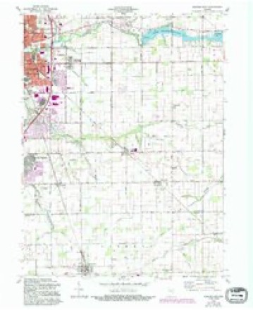
10 topographic sheets cover this place, the earliest surveyed in 1953 and the latest in 1984. It stands in Howard Township. It lies in ZIP code area 46901. The Survey maps it on the Kokomo East quadrangle. It stands 830 feet above sea level.
Topographic sheets covering this place
5 surveys from 10 printed sheetsMatched by testing this settlement's coordinate against the published boundary of every sheet in the United States Geological Survey's historical collection. Each opens the scanned sheet at the Survey.
- 1953 USGS Danville quadrangle1:250000, 3 printings
- 1955 USGS Danville quadrangle1:250000
- 1956 USGS Danville quadrangle1:250000
- 1960 USGS Kokomo East quadrangle1:24000, 3 printings
- 1984 USGS Lafayette quadrangle1:100000, 2 printings




In the county-history sources
11,525 words on this townshipCounties of Howard and Tipton, Indiana. Historical and Biographical.., published 1883 names this settlement in its chapter on Howard Township. These are the passages that mention it, exactly as the scans read.
The Vermont Methodist Episcopal Church is an oiFshoot of the Hopewell Methodist Church, and dates its history from the year 1875. The principal cause which led to its formation was the difficulty experienced by the members living north of the creek in reaching their place of worship during inclement seasons. The class was organized with a membership of twenty-five, and attached to Jerome Circuit. A beautiful temple of worship was erected shortly after the organization, on land donated for the purpose by James Miller and Jacob Brunk. The building is brick, cost the sum of $2,500, and is the best church edifice in the circuit. The present membership is about thirty. Rev. Mr. Wilcox is pastor.
Passage source: Counties of Howard and Tipton, Indiana. Historical and Biographical.., published 1883.
In the year 1845, Milton Hadley, a native of Ohio, came to the township, and settled near the southeast corner, where he took a claim. He made a treaty with the Indians, and secured from them a valuable tract of land in Section 7, in which he laid out the village of Vermont four years later. Hadley appears to have been a man of some energy and forethought. He platted his town for the ostensible purpose of securing the county seat, but the selection of Kokomo for that purpose proved a death-blow to the village, and put an effectual check upon its development. One of the first houses in the town was erected by Charley Ellison, and used by him for a grocery store and dram shop. His saloon was the general resort for the hard characters of the surrounding country, a fact which caused the place to be looked upon as a rough locality. An early merchant was Benjamin Jackson, who sold goods for about three years, when he disposed of his stock to John Colescott. The last store was kept by Charles Lindley. Joshua Galway started a tan-yard in the village about the year 1850, and kept it up five or six years. It proved a paying venture, and was conducted very successfully. Galway had a blacksmith shop also, which he operated in connection with his other business.
Passage source: Counties of Howard and Tipton, Indiana. Historical and Biographical.., published 1883.
The city of Kokomo on the west and Greentown on the east absorbed the business interests of Vermont to such an extent that the town plat was finally abandoned, and of the city of large pretensions nothing now remains but a plowed field. On the completion of the Toledo, Delphos & St. Louis Narrow-Guage Railroad through the township in 1880, a station was established near the original village, and a good business house erected. There is a good store at the present time kept by James Miller, a grain house belonging to Russell, Dolman & Co., of Kokomo, and a post ofiice.
Passage source: Counties of Howard and Tipton, Indiana. Historical and Biographical.., published 1883.
Machine-read from a century-old scan, so expect the errors a machine makes: misspelled names, dropped words, stray characters.
Mines and quarries near this place
1 within 5 milesRegional context, not property-specific evidence. The federal mineral resources record lists 1 working within 5 miles of Vermont: 1 occurrence. None of them still produces. What was taken out: Zinc, Sulfur. Distance is straight-line from the map coordinates, so a quarry counted here may appear on a neighbouring settlement's page as well.
| Where | Site | Commodity | Status | Recorded |
|---|---|---|---|---|
| Sphalerite Occurrence Z77 | Zinc, Sulfur | Occurrence | Sphalerite |
Storms near this place
4 since 2008Regional context, not property-specific evidence. The National Weather Service names Vermont in 4 storm reports between 2008 and 2024: 3 thunderstorm wind, 1 tornado. No death or injury is recorded in these reports. Each account below is quoted exactly as the forecast office filed it, from the NOAA Storm Events Database, and each date opens the federal record of that event.
| When | Event | Place named | Harm | What the report says |
|---|---|---|---|---|
| October 2010 | Tornado (EF0) | Vermont | $80,000 | A brief tornado touchdown was confirmed about two and a half miles east of downtown Kokomo near County Roads 300 East and 50 North. One home had significant damage and six other structures had minor roof or fence damage. Numerous trees were also reported down. This tornado has been rated an EF0 (wind speeds between 65 and 85 mph). |
| February 2024 | Thunderstorm Wind | Vermont | $10,000 | A billboard was uprooted and then blown over 1500 feet by thunderstorm wind gusts. |
| November 2013 | Thunderstorm Wind | Vermont | - | An estimated 60 mph thunderstorm wind gust was observed in this location. |
| June 2008 | Thunderstorm Wind | Vermont | - | A twelve inch diameter tree was snapped off due to damaging thunderstorm winds. |
Nearest settlements
The eight closest, with where each one stands in the county. Distances are straight-line, computed from the Geographic Names Information System coordinates.
Elsewhere
Matched on this settlement's Geographic Names Information System number rather than its name, so it cannot be a different place of the same name in another state.
| Wikipedia article on Vermont | An encyclopaedic summary. Its text is share-alike, so it is linked here rather than copied. |
| Wikidata item Q7921665 | The structured record the population and elevation above come from. Public domain (CC0). |
Provenance
This settlement is recorded in the Geographic Names Information System as feature 445252. The sheet list is computed by point-in-boundary test against the United States Geological Survey's historical topographic inventory. Both are works of the United States government and carry no copyright under 17 U.S.C. 105.
Mines and quarries. USGS Mineral Resources Data System (MRDS) https://mrdata.usgs.gov/mrds/ A work of the United States government, no copyright under 17 U.S.C. 105.
Storms. NOAA National Centers for Environmental Information, Storm Events Database https://www.ncei.noaa.gov/stormevents/ A work of the United States government, no copyright under 17 U.S.C. 105. Narratives are quoted verbatim from the National Weather Service report and are not edited or summarised.