 Block
Greentown, Indiana
13 topographic sheets cover this place, the earliest surveyed in 1953 and the latest in 1986. It stands in Liberty Township. It lies in ZIP code area 46936. It stands on Loop Drain. The Survey maps it on the Greentown quadrangle. 2,370 people lived here at the 2020 count. It stands 840 feet above sea level.
On record in Greentown
Buildings and businesses the archive holds for this place. Each opens its own page, with the source record it came from.
On the National Register 2 records
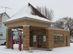 Hy-Red Gasoline Stationlisted 1983
- Greentown Commercial Historic Districtlisted 2018
Population over time
2 figuresGreentown fell from 2,415 to 2,370 between 2010 and 2020. These are the recorded population figures Wikidata holds for this place, reached through the Geographic Names Information System number this page is keyed on rather than by name, so they belong to this place and not to another of the same name. Most are census counts, but not all are: an early figure may be a founding or settlement estimate, and an estimate published within five years of a census is left out. The change column is computed, and is left blank where more than 20 years separate a figure from the one before it, because a gap that long is not a change between two counts.
| Year | People | Change |
|---|---|---|
| 2010 | 2,415 | |
| 2020 | 2,370 | -45 (-2%) |
Topographic sheets covering this place
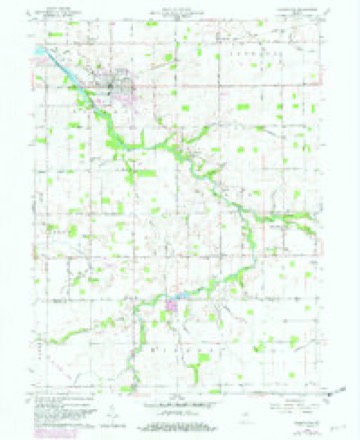
4 surveys from 13 printed sheetsMatched by testing this settlement's coordinate against the published boundary of every sheet in the United States Geological Survey's historical collection. Each opens the scanned sheet at the Survey.
- 1953 USGS Muncie quadrangle1:250000, 5 printings
- 1956 USGS Muncie quadrangle1:250000
- 1960 USGS Greentown quadrangle1:24000, 4 printings
- 1986 USGS Muncie quadrangle1:100000, 3 printings



In the county-history sources
72,258 words on this townshipCounties of Howard and Tipton, Indiana. Historical and Biographical.., published 1883 names this settlement in its chapter on Liberty Township. These are the passages that mention it, exactly as the scans read.
In the year 1844, Joshua Freeman settled about one mile south of Greentown, in Section 5, where he took a claim and cleared a small patch of ground. He was a noted hunter and trapper, and passed over almost every acre of ground in the eastern part of the county in his quest of game, which, in that early day, Avas abundant and easily procured. He afterward disposed of his improvements to a Mr. I >imb and left the township.
Passage source: Counties of Howard and Tipton, Indiana. Historical and Biographical.., published 1883.
Henry Bailly, and moved where the latter lived in this township, on Section 4 - land which he entered in 1847. Fry was a man of considerable note in the community where he resided, and took a lively interest in all movements calculated to develop the country's resources. He was the chief mover in the laying-out of Greentown, and it is to him as much as to any other man that the village is indebted for its success and prosperity. In addition to farming. Fry gave some attention to stockraising, and was one of the first citizens of the township to make that industry a success. He was identified with the township for a period of sixteen years, when he sold his real estate to Stephen Kirkpatrick and moved to Marion County, near Indianapolis, where he died in 1876.
Passage source: Counties of Howard and Tipton, Indiana. Historical and Biographical.., published 1883.
The same year that saw Fry locate in Liberty witnessed the arrival of James Morton, William Cox, John Sharpe and Matthew Golden. The first named settled about one-half mile east of Greentown, on land where a few improvements had formerly been made by Stephen Comer, of whom the claim was purchased. Morton was a native of Virginia, a man of considerable energy, and soon had a goodly number of acres under successful cultivation. He became a prominent farmer and stock-dealer, and earned the reputation of being a public-spirited citizen during the period of his residence in the township. He died in the year 1849. The place on which he first settled is owned and occupied at the present time by Henry Brunk. Cox located about one and a half miles southeast of Greentown, in Section 10, where he entered land a few years later. He came here from Wayne County, and resided in Liberty until 1858, at which time he sold to Stephen Kirkpatrick and moved to another part of the county. Sharpe located in Section 3, near the eastern boundary of the township, where he lived until 1850, when he sold his farm to Benjamin Wood and moved to Clay County. He was a man of more than ordinary education and culture, and served several terms as a teacher in the early schools of the township. Golden took a claim a short distance east of Sharpe's place on land at present owned by Jesse Ware. He came to this locality from Shelby County and became a man of some note in the community, being elected one of the first Justices of the Peace in the township. He resided on his fiirm until the year 1856, when he sold to W^illiam Hatfield and moved to one of the Western States.
Passage source: Counties of Howard and Tipton, Indiana. Historical and Biographical.., published 1883.
Machine-read from a century-old scan, so expect the errors a machine makes: misspelled names, dropped words, stray characters.
Read the whole chapter on Liberty Township - it names this place 49 more 49 times.
Mines and quarries near this place
1 within 5 milesRegional context, not property-specific evidence. The federal mineral resources record lists 1 working within 5 miles of Greentown: 1 occurrence. None of them still produces. What was taken out: Zinc, Sulfur. Distance is straight-line from the map coordinates, so a quarry counted here may appear on a neighbouring settlement's page as well.
| Where | Site | Commodity | Status | Recorded |
|---|---|---|---|---|
| Sphalerite Occurrence Z77 | Zinc, Sulfur | Occurrence | Sphalerite |
Storms near this place
30 since 1996Regional context, not property-specific evidence. The National Weather Service names Greentown in 30 storm reports between 1996 and 2023: 15 thunderstorm wind, 14 hail, 1 tornado. The reports record 9 injuries. Each account below is quoted exactly as the forecast office filed it, from the NOAA Storm Events Database, and each date opens the federal record of that event.
| When | Event | Place named | Harm | What the report says |
|---|---|---|---|---|
| June 1998 | Tornado (F3) | Greentown | 8 hurt, $5,000,000 | no account filed |
| July 2013 | Thunderstorm Wind | Greentown | 1 hurt, $15,000 | Numerous tents were blown over at the Howard County Fairgrounds, including on well staked tent, due to an estimated 50 mph thunderstorm wind gust. Injuries are bruises and cuts on a worker who was inside a tent as it fell. |
| April 2017 | Thunderstorm Wind | Greentown | $10,000 | Numerous trees were downed across Greentown due to damaging thunderstorm wind gusts. |
| August 2010 | Thunderstorm Wind | Greentown | $9,500 | Two trees, one blocking the road, were reported down due to damaging thunderstorm wind gusts. Roofing was also blown off a barn. |
| February 2023 | Thunderstorm Wind | Greentown | $5,000 | Thunderstorm winds blew shingles off and tree branches down. |
| September 2012 | Thunderstorm Wind | Greentown | $5,000 | Trees and power lines were downed in this location due to damaging thunderstorm wind gusts. |
| June 2020 | Thunderstorm Wind | Greentown | $1,000 | Two inch diameter tree limbs downed due to thunderstorm wind gusts. 1/2 inch hail was also reported at this time. |
| June 2020 | Hail | Greentown | $500 | Hail cracked wind shield. |
| August 1998 | Thunderstorm Wind | Greentown | $500 | Two trees blown down. |
| July 2022 | Thunderstorm Wind | Greentown | - | Numerous tree limbs up to 3 inches snapped by thunderstorm wind gusts near Greentown. Power poles broken. |
| June 2020 | Thunderstorm Wind | Greentown | - | A 70 mph thunderstorm wind gust was measured at this location. |
| June 2008 | Thunderstorm Wind | Greentown | - | A tree was knocked down due to damaging thunderstorm winds. |
| May 2007 | Hail | Greentown | - | Hail was covering the ground in Greentown. |
| May 2011 | Hail | Greentown | - | no account filed |
| May 2011 | Hail | Greentown | - | no account filed |
| March 2006 | Hail | Greentown | - | no account filed |
| March 2006 | Hail | Greentown | - | no account filed |
| March 2006 | Hail | Greentown | - | no account filed |
| April 2006 | Hail | Greentown | - | no account filed |
| April 2006 | Hail | Greentown | - | no account filed |
| June 2006 | Hail | Greentown | - | no account filed |
| May 2005 | Hail | Greentown | - | no account filed |
| June 2005 | Hail | Greentown | - | no account filed |
| June 2005 | Thunderstorm Wind | Greentown | - | no account filed |
| July 2005 | Thunderstorm Wind | Greentown | - | no account filed |
| July 2001 | Thunderstorm Wind | Greentown | - | no account filed |
| May 2000 | Hail | Greentown | - | no account filed |
| May 1998 | Hail | Greentown | - | no account filed |
| July 1996 | Thunderstorm Wind | Greentown | - | no account filed |
| July 1996 | Thunderstorm Wind | Greentown | - | no account filed |
Nearest settlements
The eight closest, with where each one stands in the county. Distances are straight-line, computed from the Geographic Names Information System coordinates.
Elsewhere
Matched on this settlement's Geographic Names Information System number rather than its name, so it cannot be a different place of the same name in another state.
| Wikipedia article on Greentown | An encyclopaedic summary. Its text is share-alike, so it is linked here rather than copied. |
| Wikidata item Q2183329 | The structured record the population and elevation above come from. Public domain (CC0). |
Provenance
This settlement is recorded in the Geographic Names Information System as feature 435455. The sheet list is computed by point-in-boundary test against the United States Geological Survey's historical topographic inventory. Both are works of the United States government and carry no copyright under 17 U.S.C. 105.
Mines and quarries. USGS Mineral Resources Data System (MRDS) https://mrdata.usgs.gov/mrds/ A work of the United States government, no copyright under 17 U.S.C. 105.
Storms. NOAA National Centers for Environmental Information, Storm Events Database https://www.ncei.noaa.gov/stormevents/ A work of the United States government, no copyright under 17 U.S.C. 105. Narratives are quoted verbatim from the National Weather Service report and are not edited or summarised.