 Block
West Grove, Indiana
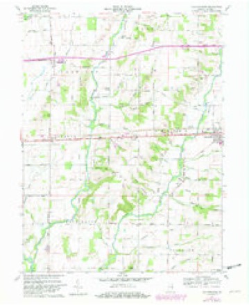
9 topographic sheets cover this place, the earliest surveyed in 1953 and the latest in 1986. It stands in Center Township. It lies in ZIP code area 47330. It stands on Far Run. The Survey maps it on the Jacksonburg quadrangle.
Topographic sheets covering this place
4 surveys from 9 printed sheetsMatched by testing this settlement's coordinate against the published boundary of every sheet in the United States Geological Survey's historical collection. Each opens the scanned sheet at the Survey.
- 1953 USGS Cincinnati quadrangle1:250000, 3 printings
- 1957 USGS Cincinnati quadrangle1:250000
- 1960 USGS Jacksonburg quadrangle1:24000, 3 printings
- 1986 USGS New Castle quadrangle1:100000, 2 printings



In the county-history sources
12,705 words on this townshipHistory of Wayne County, Indiana, from Its First Settlement to the Present Time : with Numerous Biographical and Family Sketches, published 1872 names this settlement in its chapter on Center Township. These are the passages that mention it, exactly as the scans read.
Among the earliest settlers in the township were those who first settled on this stream. They were the following: Isaac Julian, on the land now owned by Oliver II. Brumfield, IJ miles south-west of Centerville. Mr. Julian's cabin was, in the time of the Indian alarms, altered to a block-house. In this house, which stood a little below Ephraim Alerritt's present residence, his first three children were born, jNathan Overman settled near and west of town, the land now owned by Wm. S. T. Morton. Henry Bryan, Wm. Hosier, Robert Culbertson, Greenburg Cornelius, some of the Kings, and others, also settled in this valley.
Passage source: History of Wayne County, Indiana, from Its First Settlement to the Present Time : with Numerous Biographical and Family Sketches, published 1872.
The first Religious Society in the township was that of the Friends, who, in 1815, organized the West Grove meeting, about 3 miles north-west from Centerville, and built a log meeting-house. The society, at its organization, was composed of the families of Robert Commons, Wm. Hastings, James Townsend, Benj. Maudlin, Jacob Griffin, Wm. Harvey, Axuni Elliott, Obed Barnard, and perhaps Edward Benbo. It was named by Robert Commons, West Grove, that being the name of the place where he had resided in Pennsylvania. They met in the woods at the place selected for the meetinghouse. The following named persons were also early members, some of them, perhaps, at the time of the organization : Abraham and Joseph Cook, Jehu Wickersham, John Maxwell, John Brumfield, John Copeland, John Harvey, Robert Harvey, Charles Canaday, George Russell, Nathan Overman. Among their early preachers were Jesse Bond, Hannah Baldwin, and Daniel WiUiams, who is still living in Clay. This meeting has been continued until the present time.
Passage source: History of Wayne County, Indiana, from Its First Settlement to the Present Time : with Numerous Biographical and Family Sketches, published 1872.
John King, son of Jesse King, settled a mile and a half north of Centerville, where Joseph King's widow resides, and in 1830, where Jackson King resides, near Centerville. His children were, 1. Lucinda, who married Joshua Eliason. 2. James, who married Malinda, a daughter of Caleb B. Jackson, and died at West Grove, where he resided. 3. Joseph, who married Sarah Way, daughter of Seth Way, of Green, and died where his widow resides. 4. William, who married Jemima, daughter of Caleb B. Jackson, and resides four miles north-east of Centerville. 5. Mary, wife of Oliver T. Jones. 6. Presley, who married a daughter of Ebenezer Cheeseraan, and has lately removed to Kansas. 7. Nancy married John M. Maxwell, who resides near Richmond. She died in Center. 9. Jackson, who married Elizabeth Davis, and lives on the late home of his father, near the town. 10. Jesse [not the last born, it is believed,] died at the age of 14.
Passage source: History of Wayne County, Indiana, from Its First Settlement to the Present Time : with Numerous Biographical and Family Sketches, published 1872.
Machine-read from a century-old scan, so expect the errors a machine makes: misspelled names, dropped words, stray characters.
Nearest settlements
The eight closest, with where each one stands in the county. Distances are straight-line, computed from the Geographic Names Information System coordinates.
| Map | Place | Distance | Sheets |
|---|---|---|---|
| Centerville | 2.2 miles | 10 | |
| Hoover Mill | 2.9 miles | 9 | |
| College Corner | 3.1 miles | 9 | |
| Pinhook | 3.1 miles | 9 | |
| Greens Fork | 3.5 miles | 8 | |
| Hiser | 4.0 miles | 9 | |
| East Haven | 4.4 miles | 10 | |
| Jacksonburg | 4.9 miles | 9 |
Provenance
This settlement is recorded in the Geographic Names Information System as feature 452207. The sheet list is computed by point-in-boundary test against the United States Geological Survey's historical topographic inventory. Both are works of the United States government and carry no copyright under 17 U.S.C. 105.