 Block
Centerville, Indiana
10 topographic sheets cover this place, the earliest surveyed in 1915 and the latest in 1986. It stands in Center Township. It lies in ZIP code area 47330. It stands on Crown Creek. The Survey maps it on the Richmond quadrangle. 2,748 people lived here at the 2020 count. It stands 1,010 feet above sea level.
On record in Centerville
Buildings and businesses the archive holds for this place. Each opens its own page, with the source record it came from.
On the National Register 7 records
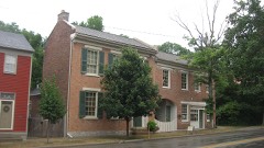 Centerville Historic Districtlisted 1971
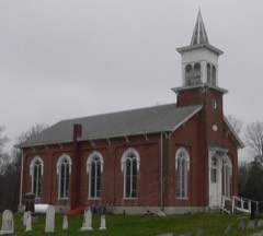 Doddridge Chapel and Cemeterylisted 2003
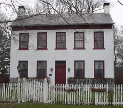 Lewis Jones Houselisted 1984
 King-Dennis Farmlisted 2000
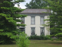 Oliver P. Morton Houselisted 1975
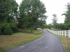 Westcott Stock Farmlisted 1998
- Eliason Farmlisted 2019
Population over time
2 figuresCenterville grew from 2,552 to 2,748 between 2010 and 2020. These are the recorded population figures Wikidata holds for this place, reached through the Geographic Names Information System number this page is keyed on rather than by name, so they belong to this place and not to another of the same name. Most are census counts, but not all are: an early figure may be a founding or settlement estimate, and an estimate published within five years of a census is left out. The change column is computed, and is left blank where more than 20 years separate a figure from the one before it, because a gap that long is not a change between two counts.
| Year | People | Change |
|---|---|---|
| 2010 | 2,552 | |
| 2020 | 2,748 | +196 (+8%) |
Topographic sheets covering this place
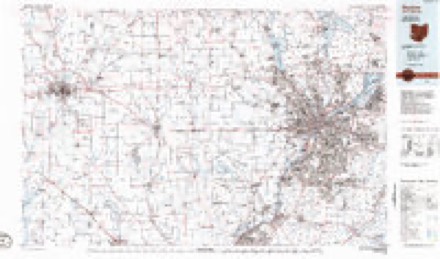
6 surveys from 10 printed sheetsMatched by testing this settlement's coordinate against the published boundary of every sheet in the United States Geological Survey's historical collection. Each opens the scanned sheet at the Survey.
- 1915 USGS New Paris quadrangle1:48000
- 1918 USGS New Paris quadrangle1:62500
- 1953 USGS Cincinnati quadrangle1:250000, 3 printings
- 1957 USGS Cincinnati quadrangle1:250000
- 1960 USGS Richmond quadrangle1:24000, 2 printings
- 1986 USGS Dayton quadrangle1:100000, 2 printings


In the county-history sources
12,705 words on this townshipHistory of Wayne County, Indiana, from Its First Settlement to the Present Time : with Numerous Biographical and Family Sketches, published 1872 names this settlement in its chapter on Center Township. These are the passages that mention it, exactly as the scans read.
Tills township was formed in An2:ust, 1817, and comprises an area of about 49 miles. It is 9 miles in length, north and south. Its average breadth is less than 5J miles, being on tlie north line oh miles, and on the south about 6f miles. It is watered, principally, by ]^oland's Fork and its branches. The main branch of the stream enters the township near the northeast corner, and passes through it to the south-west corner. It derives its name from Daniel Noland, the first settler in its valle}", about four miles south-west from Centerville, now in the township of Washington.
Passage source: History of Wayne County, Indiana, from Its First Settlement to the Present Time : with Numerous Biographical and Family Sketches, published 1872.
Among the earliest settlers in the township were those who first settled on this stream. They were the following: Isaac Julian, on the land now owned by Oliver II. Brumfield, IJ miles south-west of Centerville. Mr. Julian's cabin was, in the time of the Indian alarms, altered to a block-house. In this house, which stood a little below Ephraim Alerritt's present residence, his first three children were born, jNathan Overman settled near and west of town, the land now owned by Wm. S. T. Morton. Henry Bryan, Wm. Hosier, Robert Culbertson, Greenburg Cornelius, some of the Kings, and others, also settled in this valley.
Passage source: History of Wayne County, Indiana, from Its First Settlement to the Present Time : with Numerous Biographical and Family Sketches, published 1872.
Charmaii lives. Crawford also manufactured wliisky on a small scale, and was, probably, the first distiller in the county. Caleb Jackson, where his son Caleb B. Jackson now resides. Greenbury Cornelias, in 1811, on the land belonging to the present county asylum. Wm. Harvey, on the quarter east of the above. John Harvey, from JSTorth Carolina, on land now owned by the heirs of John P. Harvey. Robert Commons, from Virginia, settled, in 1813, where he died December 19, 1837, aged 90 years; the place now owned by John Myers. James Townsend, from South Carolina, on land now owned by Melinda King. Joseph Holman, on the land now owned by Wm. Q. Elliott. Axium Elliott, from ISTorth Carolina, three miles north from Centerville; land now owned by Mark Elliott's heirs. Robert Galbraith, where Joseph A. Commons resides, four miles north from town. John Copeland, first, afterward Daniel King, from Kentucky, about 1816, near where he now lives. His son Levi now lives on the homestead. Robert Culbertson, from Kentucky, in 1815, on land lately owned by Leonard Wolfert, now by Lorenzo D, King. He lives with his son William, four miles north of Centerville. Edward Benbo, on the land now owned by the heirs of Jackson Culbertson. Walter Roberts, from South Carolina, son of Thomas Roberts, an early settler near Richmond, settled, in 1816, where he now lives. John Stigleman, where his son Henry now resides. Joseph t)verman, from JSTorth Carolina, about 1813, where he still resides, in the north-east part of the township. Michael Harvey, from North Carolina, in the
Passage source: History of Wayne County, Indiana, from Its First Settlement to the Present Time : with Numerous Biographical and Family Sketches, published 1872.
Machine-read from a century-old scan, so expect the errors a machine makes: misspelled names, dropped words, stray characters.
Read the whole chapter on Center Township - it names this place 57 more 57 times.
Storms near this place
39 since 1995Regional context, not property-specific evidence. The National Weather Service names Centerville in 39 storm reports between 1995 and 2025: 23 thunderstorm wind, 7 hail, 3 flash flood, 3 flood. No death or injury is recorded in these reports. Each account below is quoted exactly as the forecast office filed it, from the NOAA Storm Events Database, and each date opens the federal record of that event.
| When | Event | Place named | Harm | What the report says |
|---|---|---|---|---|
| May 1999 | Tornado (F0) | Centerville | $100,000 | A tornado was on the ground south of Centerville for a few miles. It destroyed a garage and caused minor damage to other structures but mainly moved through open fields. Elsewhere, strong thunderstorm winds toppled trees throughout the county causing some structural damage to a shopping center in Richmond. |
| June 2000 | Tornado (F0) | Centerville | $45,000 | A brief touchdown of 10 to 15 seconds occurred on Mineral Springs Road. Plastic lawn furniture penetrated the wall of a garage, a 28 foot RV trailer was destroyed as it was lifted and landed on a length of fencing. Several trees were also destroyed. Further down in the west end of Richmond, thunderstorm winds caused roof damage to two structures on the 2200 block of Peacock Road. Two large trees were split, and Hills Greenhouses had extensive damage. A semi trailer was also turned over and a patio enclosure was blown from one side of a house to another on Northwest B Street. |
| July 2017 | Thunderstorm Wind | Centerville | $20,000 | Numerous trees and power lines were downed across Wayne County. Tree damage was reported in Milton, Centerville, Cambridge City and especially Richmond. |
| October 2013 | Thunderstorm Wind | Centerville | $20,000 | Trees were blown down on houses on Test Road due to thunderstorm winds. |
| April 2020 | Thunderstorm Wind | Centerville | $10,000 | There were reports of widespread powerlines downed and some small trees downed near Centerville. |
| April 2000 | Thunderstorm Wind | Centerville | $10,000 | Numerous trees downed from thunderstorm winds that were measured by a spotter in Centerville at 75 mph. |
| May 2006 | Thunderstorm Wind | Centerville | $8,000 | Several large trees were downed, including one on a house. |
| June 1995 | Hail | Centerville | $7,000 | no account filed |
| June 2025 | Thunderstorm Wind | Centerville | $6,000 | A few power poles and power lines were downed. |
| November 2017 | Flash Flood | Centerville | $5,000 | Flood waters were rushing into a home on Main Street, leading to a water rescue. |
| May 2011 | Thunderstorm Wind | Centerville | $5,000 | Siding was torn off of a business due to damaging thunderstorm winds. |
| May 2010 | Thunderstorm Wind | Centerville | $5,000 | Trees and power lines were knocked down due to damaging thunderstorm winds. One tree fell onto a car. |
| April 1996 | Flash Flood | Centerville | $5,000 | no account filed |
| April 2019 | Thunderstorm Wind | Centerville | $4,000 | Several trees and power poles were knocked down at the intersection of George Early Road and Grove Road. |
| July 2017 | Thunderstorm Wind | Centerville | $3,000 | Several trees were downed along McMinn Road. |
| June 2005 | Thunderstorm Wind | Centerville | $3,000 | Trees and power lines were downed. |
| June 2004 | Thunderstorm Wind | Centerville | $3,000 | Several trees were downed. |
| November 2004 | Thunderstorm Wind | Centerville | $3,000 | Trees were downed. |
| July 2002 | Thunderstorm Wind | Centerville | $3,000 | Two trees were blown down. |
| June 2001 | Thunderstorm Wind | Centerville | $3,000 | A few trees downed |
| August 2019 | Thunderstorm Wind | Centerville | $2,000 | A couple of trees were blown down in the Centerville area. |
| August 2012 | Thunderstorm Wind | Centerville | $2,000 | A tree was reported down on College Corner Road and another tree along Interstate 70 near mile marker 153 due to damaging thunderstorm winds. |
| August 2011 | Thunderstorm Wind | Centerville | $2,000 | Trees were reported down and blocking roadways due to damaging thunderstorm winds. |
| May 2011 | Thunderstorm Wind | Centerville | $2,000 | Two trees were reported down due to damaging thunderstorm winds. |
| July 1995 | Thunderstorm Wind | Centerville | $2,000 | Two large trees were blown down. |
| November 2014 | Thunderstorm Wind | Centerville | $1,000 | Several trees were downed in the city of Centerville. |
| April 2011 | Heavy Rain | Centerville | $1,000 | High water was reported on area roadways with one road closed from the high water. |
| May 2010 | Thunderstorm Wind | Centerville | $1,000 | Power lines were reported down due to damaging thunderstorm winds. |
| June 2024 | Thunderstorm Wind | Centerville | $500 | A 10 inch diameter tree was downed onto McConaha Road. |
| July 2024 | Flood | Centerville | - | High water was reported on Temple Drive. |
| April 2018 | Flash Flood | Centerville | - | Numerous roads with water flowing over them were reported in and near Centerville. |
| December 2013 | Flood | Centerville | - | Many roads were covered with high standing water caused by heavy rainfall. Some of these roads were closed. |
| December 2013 | Flood | Centerville | - | Several secondary roads remained closed in the county due to high water caused by earlier rainfall. |
| May 2025 | Hail | Centerville | - | no account filed |
| May 2025 | Hail | Centerville | - | no account filed |
| May 2018 | Hail | Centerville | - | no account filed |
| June 2009 | Hail | Centerville | - | no account filed |
| July 1999 | Hail | Centerville | - | no account filed |
| April 1996 | Hail | Centerville | - | no account filed |
Nearest settlements
The eight closest, with where each one stands in the county. Distances are straight-line, computed from the Geographic Names Information System coordinates.
| Map | Place | Distance | Sheets |
|---|---|---|---|
| West Grove | 2.2 miles | 9 | |
| Pinhook | 3.2 miles | 9 | |
| East Haven | 3.8 miles | 10 | |
| College Corner | 4.2 miles | 9 | |
| Hiser | 4.3 miles | 9 | |
| Hoover Mill | 4.8 miles | 9 | |
| Richmond | 5.7 miles | 10 | |
| Greens Fork | 5.7 miles | 8 |
Elsewhere
Matched on this settlement's Geographic Names Information System number rather than its name, so it cannot be a different place of the same name in another state.
| Wikipedia article on Centerville | An encyclopaedic summary. Its text is share-alike, so it is linked here rather than copied. |
| Wikidata item Q2112562 | The structured record the population and elevation above come from. Public domain (CC0). |
Provenance
This settlement is recorded in the Geographic Names Information System as feature 432346. The sheet list is computed by point-in-boundary test against the United States Geological Survey's historical topographic inventory. Both are works of the United States government and carry no copyright under 17 U.S.C. 105.
Storms. NOAA National Centers for Environmental Information, Storm Events Database https://www.ncei.noaa.gov/stormevents/ A work of the United States government, no copyright under 17 U.S.C. 105. Narratives are quoted verbatim from the National Weather Service report and are not edited or summarised.