 Block
From the record
One of 37 National Register listings published here for Carroll County · listed in 2024 · category: Building.
Sources: the National Register database, National Park Service
Listed on the National Register of Historic Places in 2024.
One of 37 National Register listings published here for Carroll County · listed in 2024 · category: Building.
Sources: the National Register database, National Park Service
This property stands in Carrollton Township. History of Carroll County Indiana, published 1916 gives that township a chapter of its own.
The chapter covers the township.
Machine-read from a century-old scan, so expect the errors a machine makes: misspelled names, dropped words, stray characters.
Read the whole chapter on Carrollton Township - 133 words on its settlement, mills, schools and churches.
Regional context, not property-specific evidence. The federal mineral resources record lists 1 working within 5 miles of Wagoner-Ayres House: 1 producer. All of them still produce. What was taken out: Stone. Distance is straight-line from the map coordinates, so a quarry counted here may appear on a neighbouring settlement's page as well.
| Where | Site | Commodity | Status | Recorded |
|---|---|---|---|---|
| Carroll County Highway Dept. | Stone | Producer |
Regional context, not property-specific evidence. The National Weather Service names Flora, the town this property stands in, in 24 storm reports between 1994 and 2021: 12 thunderstorm wind, 8 hail, 2 lightning, 1 flash flood. No death or injury is recorded in these reports. Each account below is quoted exactly as the forecast office filed it, from the NOAA Storm Events Database, and each date opens the federal record of that event.
| When | Event | Place named | Harm | What the report says |
|---|---|---|---|---|
| May 2009 | Flood | Flora | $125,000 | Between Flora and Delphi, Indiana several roads and bridges were badly damaged by flood water. Damage cost is grossly estimated. |
| May 2009 | Lightning | Flora | $100,000 | Abundant lightning strikes associated with a squall line apparently started a house fire at approximately 2223 EST in Flora, Indiana. Three occupants apparently were unable to escape and perished in the fire. |
| June 2001 | Lightning | Flora | $70,000 | no account filed |
| July 2012 | Thunderstorm Wind | Flora | $17,000 | Numerous reports of a downed transformer, downed power lines, and downed trees around the Flora area due to damaging thunderstorm wind gusts. A roof was also blown off a chicken coop. Power was out in Flora at the time of observation. |
| March 2009 | Thunderstorm Wind | Flora | $15,000 | Thunderstorm winds blew the roof off of a building and downed trees and utility lines. Estimated damage cost is very rough. |
| November 2005 | Thunderstorm Wind | Flora | $15,000 | A pole barn was destroyed. |
| December 2021 | Thunderstorm Wind | Flora | $5,000 | Numerous trees and power lines down by thunderstorm wind gusts across Carroll County. |
| July 2013 | Thunderstorm Wind | Flora | $5,000 | Trees were reported down in the county due to damaging thunderstorm wind gusts. |
| June 1998 | Thunderstorm Wind | Flora | $500 | Thunderstorm winds blew down several trees. |
| October 1996 | Thunderstorm Wind | Flora | $500 | no account filed |
| May 2019 | Thunderstorm Wind | Flora | - | An estimated 60 mph thunderstorm wind gust was observed in this location. This event was relayed via broadcast media. |
| August 2012 | Thunderstorm Wind | Flora | - | An estimated 60 mph thunderstorm wind gust was observed in this location, just north of Flora. |
| January 2008 | Thunderstorm Wind | Flora | - | Wind gust was measured by a trained spotter. |
| November 2005 | Thunderstorm Wind | Flora | - | Trees were downed. |
| August 2004 | Flash Flood | Flora | - | The Carroll County Sheriff reported very high water on at least two roads in Flora. |
| April 1994 | Thunderstorm Wind | Flora | - | Police vehicle was almost blown off the road by an estimated 60 mph wind. |
| April 2017 | Hail | Flora | - | no account filed |
| August 2012 | Hail | Flora | - | no account filed |
| August 2012 | Hail | Flora | - | no account filed |
| June 2011 | Hail | Flora | - | no account filed |
| May 2009 | Hail | Flora | - | no account filed |
| March 2006 | Hail | Flora | - | no account filed |
| March 2006 | Hail | Flora | - | no account filed |
| June 1999 | Hail | Flora | - | no account filed |
No historic map-sheet match is published for this property yet. That does not mean no map exists. This record needs a coordinate-quality review before it can be joined to a sheet boundary. Browse the county's mapped places while that work is pending.
Other National Register properties close enough to walk or drive between, ordered by distance from this one. Both positions come from the same geocoding pass that matched these properties to their map sheets.
| Photograph | Property | Distance | Listed |
|---|---|---|---|
| Sycamore Row | 4.7 miles | 2023 | |
| Sycamore Row | 4.9 miles | 2023 | |
| American House Hotel | 4.9 miles | 2018 | |
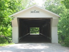 | Adams Mill Covered Bridge | 5.8 miles | 1996 |
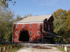 | Adams Mill | 5.9 miles | 1984 |
| Meridian Line Road Iron Truss Bridge | 5.9 miles | 2025 |
| National Archives record | The nomination case file for reference 100010377 in Record Group 79. |
| Carroll County | All 37 listed properties in this county. |