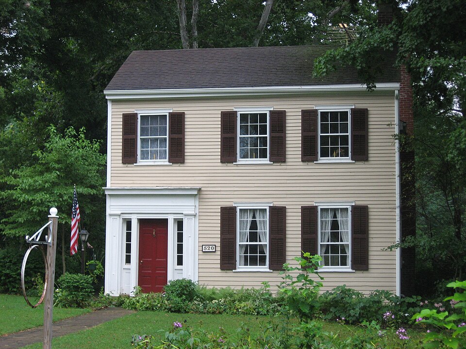
National Register reference number.76000030- the number the National Park Service assigned this property when it was listed, and the key its nomination file is catalogued under at the National Archives.
The lands at and in the vicinity of the site of Cambridge City were settled early. John Hawkins, from Kentucky, a native of South Carolina, entered, in 1813, the north-east quarter of section 27, which included the site of the old town of Vandalia; but he did not live to occupy it. The laud descended to his son, William Hawkins, who took up the fractional quarter west of it ; the two quarters embracing nearl}' all of the site of Cambridge. Simon Powell, from Kentucky, also a native of South Carolina, entered the quarter north of the present farm of General Meredith, extending to the old State road. He, too, died without settling on his purchase. His family settled on it in 1813 or 1814, the eldest son having nearly attained to manhood. Their cabin stood on the east bank of the river, south of East Cambridge. Jesse Symonds, iS'orth Carolina, bought north side of the State road, adjoining Hawkins's, but, without settling on it, sold to Josiah Draper. JSTathan Symonds, from jN". C, settled north of and adjoining Jesse's, and afterward sold to Wm. Conw^ell. These lands are now owned by John Callaway. Henry Crull settled early on the north part, and George Ish on the south part of the present farm of Gen. Solomon Meredith. They sold to Ira Lackey, who, in or about the year 1836, built the house (since enlarged) wliere Meredith now" resides. Wm. Hawkins bought, besides the lands already mentioned, the land w^here his son I^athan S. resides, near and north-west of the town. Samuel Charles, from N". C, on land east side of Hawkins's, forming a part of the tract north side of town, owned by John Callaway. A'anbuskirk, on the land now owned by Alfred B. Williams, and perhaps the lands of Henry and John Ingerman and otliers. Henry Palen, from IS". C., on land now^ owned by John
Benj. Conklin, the last merchant who left East Cambridge, removed to the building then owned by Wm. Hawkins, now occupied by Felix Conklin as a hardware store. About the year 1845, Post & Enyeart built the "Mammoth Store," and for two years carried on an extensive wholesale grocery trade. The Whitewater Yalley Canal, which was completed in 1846, contributed vastly to the trade of Cambridge City. This soon became the central point of trade of an extensive territory. It was the grand depot for the produce of the country, brought here for shipment, and for the delivery of merchandise. The merchants of Indianapolis received for a time their goods at this place. Large quantities of wheat were floured here. The present brick ilouring-mill, then newly built by Benj. Conklin, had in it, at one time, 90,000 bushels of wheat, or 5,400,000 pounds.
Regional context, not property-specific
evidence. The federal mineral resources record lists
1 working within 5 miles of Lackey-Overbeck House: 1 producer.
All of them still produce. What was taken out: Sand and Gravel, Construction. Distance is straight-line from the
map coordinates, so a quarry counted here may appear on a neighbouring
settlement's page as well.
Regional context, not property-specific
evidence. The National Weather Service names
Cambridge City, the town this property stands in, in 23 storm reports between 1996 and 2025: 14 thunderstorm wind, 6 hail, 2 flood, 1 flash flood.
No death or injury is recorded in these reports. Each account below is quoted exactly as the forecast office
filed it, from the NOAA Storm Events Database, and each date
opens the federal record of that event.
No historic map-sheet match is published
for this property yet. That does not mean no map exists. This record needs
a coordinate-quality review before it can be joined to a sheet boundary.
Browse the county's mapped places while that work is
pending.
Listed places nearby
6 within 8 miles
Other National Register properties close
enough to walk or drive between, ordered by distance from this one. Both
positions come from the same geocoding pass that matched these properties
to their map sheets.
Listing record. National Park Service National Register of Historic Places, listed-properties dataset, current to 2026-05-22.
Map join. Address geocoded through the United States Census geocoder, then tested against the published boundary of every sheet in the USGS Historical Topographic Map Collection.
How this page is made. Listing fields come from federal records; map-sheet coverage is a labelled coordinate-to-boundary calculation, not a source-field claim.
Mines and quarries. USGS Mineral Resources Data System (MRDS) https://mrdata.usgs.gov/mrds/ A work of the United States government, no copyright under 17 U.S.C. 105.
Storms. NOAA National Centers for Environmental Information, Storm Events Database https://www.ncei.noaa.gov/stormevents/ A work of the United States government, no copyright under 17 U.S.C. 105. Narratives are quoted verbatim from the National Weather Service report and are not edited or summarised.
 Block