BlockBefore
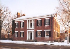
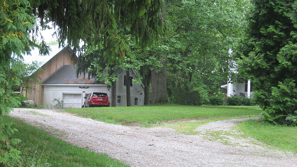
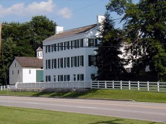
Photograph of Witt-Champe-Myers House
Photograph by Nyttend, Public domain. Via Wikimedia Commons.

Witt-Champe-Myers House

Listed on the National Register of Historic Places in 1995.

From the record

“Witt-Champe-Myers House is a historic home located at Dublin, Indiana. It was built in 1837-38, and is a two-story, Federal style painted brick detached dwelling.”

Wikipedia article Witt-Champe-Myers House, CC BY-SA 4.0.

One of 40 National Register listings published here for Wayne County · listed in 1995 · category: Building.

Sources: the Wikipedia article · the case file at the National Archives · the National Register database, National Park Service
The listing

  • What is counted as historic. The nomination lists 4 buildingss as contributing to the listing.
  • Listed as. Witt--Champe--Myers House - the National Register files a house under its owner's surname.
  • Address. Jct. of Spring and Foundry Sts., SE corner, Dublin, 47335
  • When was it listed? June 1995
  • Category. building
  • Township. Jackson township
  • Architectural style. Federal architecture
  • National Register reference number. 95000700 - the number the National Park Service assigned this property when it was listed, and the key its nomination file is catalogued under at the National Archives.

The ground it stands on

10,460 words

The chapter on Jackson Township in History of Wayne County, Indiana, from Its First Settlement to the Present Time : with Numerous Biographical and Family Sketches, published 1872 names Dublin. This is what it says, exactly as the scans read.

The town of Dublin was laid out by Harmon Davis. The original plat, made out ami signed by him as proprietor, was recorded Jan. 29, 1830. Additions have since been made as follows: First, by Robert Murphy and Eli Brown, trustees for Dempsey Boswell & Sons ; in 1846, by Albertsoii Chappell, Abraham Symonds, Jacob Custer, Beiij. Griffin, John Whippo, J. P. Creager, Caleb W. Witt, Win. McKimmey ; in 1837, by C. AV. Wht; in 1838, by Samuel Schoolfield; in 1868 by Samuel Pierce and Mark H. Perkins. When the town was first laid out, there was not a building on the ground. The first house was a log house built by Isaac King, on what is known as Cook's corner.

Passage source: History of Wayne County, Indiana, from Its First Settlement to the Present Time : with Numerous Biographical and Family Sketches, published 1872.

The Dublin Academy was established in 1837, by a joint stock companj". The building was afterward occupied as a public school-house. In 1867 it was taken down, and the present house built, which was dedicated January 1, 1868. Its cost was about ยง15,000. Scholars enrolled, about 450.

Passage source: History of Wayne County, Indiana, from Its First Settlement to the Present Time : with Numerous Biographical and Family Sketches, published 1872.

Machine-read from a century-old scan, so expect the errors a machine makes: misspelled names, dropped words, stray characters.

Read the whole chapter on Jackson Township - 10,460 words on its settlement, mills, schools and churches.

Mines and quarries near this property

1 within 5 miles

Regional context, not property-specific evidence. The federal mineral resources record lists 1 working within 5 miles of Witt-Champe-Myers House: 1 producer. All of them still produce. What was taken out: Sand and Gravel, Construction. Distance is straight-line from the map coordinates, so a quarry counted here may appear on a neighbouring settlement's page as well.

Where SiteCommodity StatusRecorded
Cambridge City PitSand and Gravel, ConstructionProducer

Every working recorded in Wayne County

Storms near this property

9 since 2005

Regional context, not property-specific evidence. The National Weather Service names Dublin, the town this property stands in, in 9 storm reports between 2005 and 2024: 5 hail, 4 thunderstorm wind. No death or injury is recorded in these reports. Each account below is quoted exactly as the forecast office filed it, from the NOAA Storm Events Database, and each date opens the federal record of that event.

WhenEvent Place namedHarm What the report says
July 2024Thunderstorm WindDublin$5,000A few trees and power lines were downed.
December 2015Thunderstorm WindDublin$5,000A tree was knocked down onto a house.
December 2015Thunderstorm WindDublin$3,000Two 2 1/2 foot diameter pine trees were knocked down.
October 2013Thunderstorm WindDublin$1,000One tree was reported down south of Dublin due to thunderstorm winds.
June 2008HailDublin$1,000no account filed
August 2007HailDublin$1,000no account filed
March 2011HailDublin-no account filed
May 2011HailDublin-no account filed
June 2005HailDublin-no account filed

Every storm recorded in Wayne County

Map coverage status

No historic map-sheet match is published for this property yet. That does not mean no map exists. This record needs a coordinate-quality review before it can be joined to a sheet boundary. Browse the county's mapped places while that work is pending.

Listed places nearby

6 within 8 miles

Other National Register properties close enough to walk or drive between, ordered by distance from this one. Both positions come from the same geocoding pass that matched these properties to their map sheets.

Photograph PropertyDistance Listed
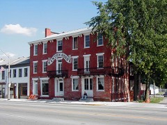
Dublin Friends Meeting House0.4 miles2018
Huddleston House Tavern, The0.9 miles1975
Cambridge City Historic District1.6 miles1991
Conklin-Montgomery House2.0 miles1975
Lackey-Overbeck House2.1 miles1976
Beechwood (Isaac Kinsey House)4.7 miles1975

Sources for this property

National Archives recordThe nomination case file for reference 95000700 in Record Group 79.
Wikipedia articleCommunity-written account of this property, licensed CC BY-SA.
Wayne CountyAll 40 listed properties in this county.

Provenance

  • Listing record. National Park Service National Register of Historic Places, listed-properties dataset, current to 2026-05-22.
  • Map join. Address geocoded through the United States Census geocoder, then tested against the published boundary of every sheet in the USGS Historical Topographic Map Collection.
  • How this page is made. Listing fields come from federal records; map-sheet coverage is a labelled coordinate-to-boundary calculation, not a source-field claim.
  • Mines and quarries. USGS Mineral Resources Data System (MRDS) https://mrdata.usgs.gov/mrds/ A work of the United States government, no copyright under 17 U.S.C. 105.
  • Storms. NOAA National Centers for Environmental Information, Storm Events Database https://www.ncei.noaa.gov/stormevents/ A work of the United States government, no copyright under 17 U.S.C. 105. Narratives are quoted verbatim from the National Weather Service report and are not edited or summarised.