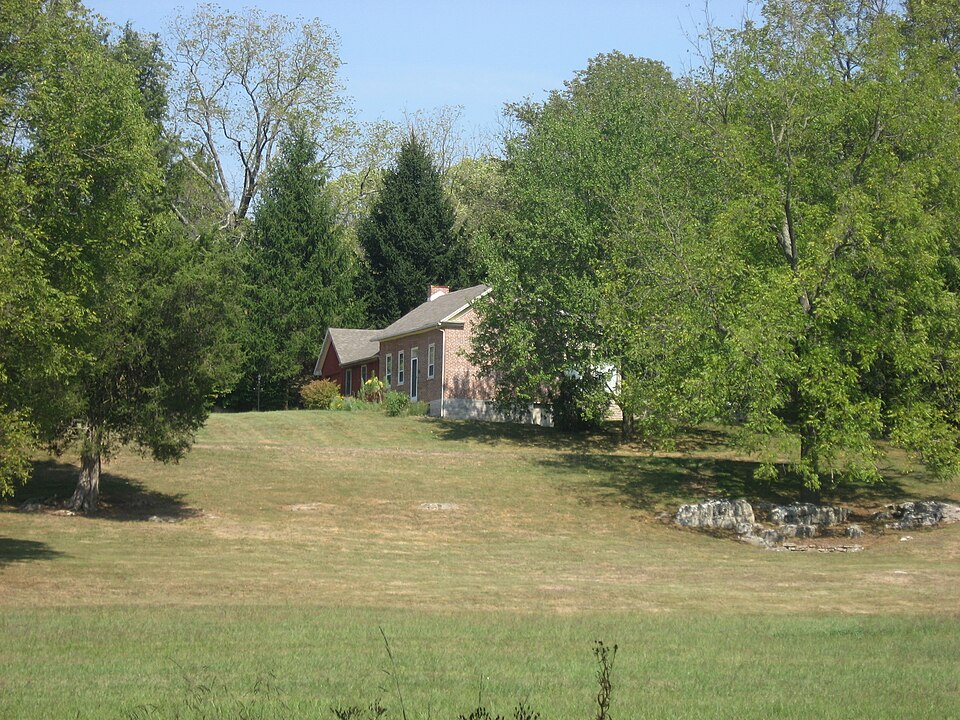
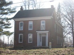
Listed on the National Register of Historic Places in 1986.
From the record
“The Joseph Mitchell House is a historic residence in southern Monroe County, Indiana, United States. Located on Ketcham Road west of the community of Smithville, it is one of the oldest houses in Monroe County, and it has been designated a historic site.”
Wikipedia article Joseph Mitchell House, CC BY-SA 4.0.
One of 48 National Register listings published here for Monroe County · listed in 1986 · category: Building.
National Register reference number.86001268- the number the National Park Service assigned this property when it was listed, and the key its nomination file is catalogued under at the National Archives.
The ground it stands on
6,962 words
The chapter on Clear Creek Township in 1884 History of Monroe County Indiana, published 1884 names Smithville. This is what it says, exactly as the scans read.
Base township is one of the best in the county for agricultural purposes. It has an abundance of low land, as it lies principally in the forks of Clear Creek and Salt Creek, the two principal streams of the southern half of the county. Between the forks the land is gently undulating as a general rule, and the surface soil contains an abundance of food for almost all farm productions. Along the two streams are rather precipitous bluffs, which, back some distance, gradually blend with the general undulating surface of the country. Immediately adjoining the streams are narrow valleys very rich and productive. The geological formation is revealed in many places - at quarries and along the New Albany Railroad principally. In places where the storms have washed away the surface soil, hundreds of geodes, comprising crystalline and butryoidal, are found. The railroad track at Harrodsburg. is 509- feet above the level of the sea, and at Smithville is 710 feet. This shows a railroad grade of 201 feet betweeri those two places. distant about four miles and a half. The altitude at Bloomington is 745, and northwest of Bloomington at the highest point of the grade is 883 feet. The track at Ellettsville is 685 feet above the sea. In the vicinity of Smithville, covering about a section of land, the Keokuk limestone makes its appearance at the surface. A little distance west, extending a little east of north, is the general overlying edge of the Keokuk group, lapping upon the knobstone. A short distance further west is the St. Louis limestone. On Section 2, about a mile northeast of Smithville, the geological formation is as follows:
Smithville was started when the New Albany Railroad was established, in 1852-53. It was laid out in November, 1851, by Mansfield Bennett and George Smith, owners, on Section 8. Thirty-eight lots were laid out on both sides of the railroad. Mr. Smith probably opened the first store. He was soon joined by a blacksmith and a few families. Davis & Humphries were also there about the same time, with a good store. The business was lively: while work on the railroad continued. It is probable that the stores were started before the town was laid out, to accommodate the wants of the workmen. P. & J. Holland were also early at the village with a stock of goods. One or two stores have been in the village, usually one at a time, ever since. About fifteen families comprise the population.
Regional context, not property-specific
evidence. The
federal wildfire occurrence database
lists 33 fires within 5 miles of Joseph Mitchell House
between 2001 and 2007, burning about 12 acres in total. None started naturally. 1 was recorded as arson.
Distance is straight-line from the map coordinates, so a fire counted
here may appear on a neighbouring settlement's page as well.
Reported cause
Fires
Debris and open burning
14
Recreation and ceremony
13
Missing data/not specified/undetermined
3
Smoking
1
Other causes
1
Arson/incendiarism
1
The most recent of
them, most recent first, with the day each was reported and the service
that recorded it.
Regional context, not property-specific
evidence. The federal mineral resources record lists
21 workings within 5 miles of Joseph Mitchell House: 12 past producers, 5 occurrences, 4 producers.
4 still produce. What was taken out: Limestone, Dimension, Iron, Lead, Zinc, Sulfur. Distance is straight-line from the
map coordinates, so a quarry counted here may appear on a neighbouring
settlement's page as well.
Regional context, not property-specific
evidence. The National Weather Service names
Smithville, the town this property stands in, in 4 storm reports between 2008 and 2022: 4 thunderstorm wind.
No death or injury is recorded in these reports. Each account below is quoted exactly as the forecast office
filed it, from the NOAA Storm Events Database, and each date
opens the federal record of that event.
No historic map-sheet match is published
for this property yet. That does not mean no map exists. This record needs
a coordinate-quality review before it can be joined to a sheet boundary.
Browse the county's mapped places while that work is
pending.
Listed places nearby
6 within 8 miles
Other National Register properties close
enough to walk or drive between, ordered by distance from this one. Both
positions come from the same geocoding pass that matched these properties
to their map sheets.
Listing record. National Park Service National Register of Historic Places, listed-properties dataset, current to 2026-05-22.
Map join. Address geocoded through the United States Census geocoder, then tested against the published boundary of every sheet in the USGS Historical Topographic Map Collection.
How this page is made. Listing fields come from federal records; map-sheet coverage is a labelled coordinate-to-boundary calculation, not a source-field claim.
Wildfire. Short, Karen C. 2022. Spatial wildfire occurrence data for the United States, 1992-2020 [FPA_FOD_20221014]. 6th Edition. Fort Collins, CO: Forest Service Research Data Archive. https://doi.org/10.2737/RDS-2013-0009.6 Collected with United States Government funding and usable without additional permissions or fees.
Mines and quarries. USGS Mineral Resources Data System (MRDS) https://mrdata.usgs.gov/mrds/ A work of the United States government, no copyright under 17 U.S.C. 105.
Storms. NOAA National Centers for Environmental Information, Storm Events Database https://www.ncei.noaa.gov/stormevents/ A work of the United States government, no copyright under 17 U.S.C. 105. Narratives are quoted verbatim from the National Weather Service report and are not edited or summarised.
 Block