Block
From the record
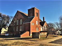
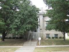
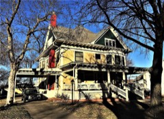
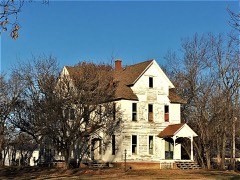
23 National Register listings published here.
Sources: the National Register database, National Park Service
92 topographic sheets cover 49 settlements here, and 23 properties are on the National Register of Historic Places.
23 National Register listings published here.
Sources: the National Register database, National Park Service
Every property in this county listed on the National Register of Historic Places, with the year it was listed and the federal nomination document.
Every wildfire the federal occurrence database records inside this county: 366 of them, burning about 2,362 acres. None started naturally and 40 were recorded as arson. Each settlement page carries the fires within five miles of it.
| Reported cause | Fires |
|---|---|
| Missing data/not specified/undetermined | 172 |
| Debris and open burning | 130 |
| Arson/incendiarism | 40 |
| Equipment and vehicle use | 10 |
| Smoking | 6 |
| Fireworks | 5 |
| Misuse of fire by a minor | 3 |
The five largest, by the area the report gives. None of them was recorded as arson.
| Date | Cause | Size | Reported by | Name on the report |
|---|---|---|---|---|
| 16 March 2016 | Debris and open burning | 600 acres | Kansas Forest Service | 016-061 |
| 23 March 2015 | Missing data/not specified/undetermined | 160 acres | Kansas Forest Service | 015-037 |
| 17 February 2017 | Debris and open burning | 120 acres | Crawford County | 017-028 |
| 9 February 2017 | Debris and open burning | 100 acres | Crawford County | 017-015 |
| 29 February 2016 | Smoking | 100 acres | Kansas Forest Service | 016-038 |
| 19 January 2015 | Missing data/not specified/undetermined | 90 acres | Kansas Forest Service | 11 |
| 4 April 2018 | Missing data/not specified/undetermined | 50 acres | Kansas Forest Service | 018-046 |
| 2 March 2018 | Debris and open burning | 50 acres | Kansas Forest Service | 018-027 |
Every settlement page carries the fires within five miles of it - see the settlement index below.
The NOAA Storm Events Database holds 662 reports for this county, causing 4 deaths, 51 injuries and about $48,635,500 in recorded property damage. Each settlement page carries the reports that name it.
| Kind of event | Reports |
|---|---|
| Thunderstorm Wind | 256 |
| Hail | 238 |
| Flash Flood | 85 |
| Tornado | 38 |
| Heavy Rain | 31 |
| Flood | 12 |
| Funnel Cloud | 2 |
The most serious of them, by death, then injury, then recorded damage. The accounts are quoted exactly as the forecast office filed them.
| When | Event | Place named | Harm | What the report says |
|---|---|---|---|---|
| May 2003 | Tornado (F4) | Mc Cune | 3 killed, 20 hurt, $7,200,000 | no account filed |
| March 1982 | Tornado (F3) | not stated | 1 killed, 8 hurt, $25,000,000 | no account filed |
| March 1983 | Tornado (F3) | not stated | 4 hurt, $2,500,000 | no account filed |
| April 2000 | Tornado (F2) | Mc Cune | 4 hurt, $300,000 | no account filed |
| March 1982 | Tornado (F2) | not stated | 3 hurt, $2,500,000 | no account filed |
| June 2008 | Thunderstorm Wind | Frontenac | 3 hurt, $10,000 | Severe thunderstorm wind speeds in excess of 70 mph caused major tree damage in the community of Frotenac. Three injuries occurred as a large tree was blown down on a vehicle. |
| June 2005 | Thunderstorm Wind | Mc Cune | 2 hurt, $300,000 | An intense bow echo storm entered Crawford County northwest of Mc Cune and swept across southern sections of the county. 80 mph winds damaged several structures including homes and barns. Two Crawford County residents were inside a mobile home when the storm approached. The home was destroyed and the two individuals were injured. A woman survived the storm after she was scalped by flying debris |
| November 1988 | Tornado (F1) | not stated | 2 hurt, $250,000 | no account filed |
| July 1999 | Thunderstorm Wind | Pittsburg | 2 hurt, $30,000 | no account filed |
| November 1961 | Tornado (F1) | not stated | 2 hurt, $25,000 | no account filed |
| July 2016 | Thunderstorm Wind | Curranville | 1 hurt, $10,000 | A large tree was blown down into a house. |
| May 2009 | Thunderstorm Wind | Mc Cune | $3,000,000 | Damaging wind gusts occurred across much of the southern half of Crawford County. Damage occurred to numerous structures, trees, power poles, and crops. The most concentrated damage occurred at Southeast High School where the roof of the gymnasium was torn off. The baseball, softball, and football fields all experienced damage as well. In the town of Cherokee, 130 structures were damaged altogether. In McCune, 63 structures were damaged, as well as six vehicles and two grain elevators at the Co-Op. |
| May 2019 | Tornado (EF1) | Kniveton | $1,100,000 | A National Weather Service storm survey determined that an EF-1 tornado with maximum winds of 105 mph traveled along a 6 mile path before entering Barton County Missouri. The tornado continue for a total of 10 miles before lifting SE of Mindenmines, Missouri. This was the second tornado from a supercell that also produced the Weir tornado. This tornado touched down south of Pittsburg near the intersection of E 50th and S 220th Streets where it uprooted trees and destroyed an outbuilding. The tornado continued and additionally damaged several more outbuildings and numerous homes south of the Pittsburg Mall. There were varying degrees of damage as as the storm tracked across E 520th, 530th, and then between 240th and S 270th streets, where it snapped tree trunks, before moving into Barton County, Missouri. |
| February 2012 | Thunderstorm Wind | Pittsburg | $500,000 | A National Weather Service storm survey determined that straight-line winds of 100 to 120 miles per hour occurred near Pittsburg. This created a one mile path of damage from Centennial Drive and Highway 160 to the northeast across the southern portions of Pittsburg. Numerous tress and power poles were damages or snapped off near the base. The concrete roof of the George Nettle Elementary School Gym was lifted and shifted. Several buildings reveived damage including loss of shingles and other structural damage. Two motels also received significant damage along with several out buildings. |
| July 1994 | Thunderstorm Wind | Farlington | $500,000 | Damaging winds moved through the county, but the northeast received the worst. The Farlington area had the most severe damage. A barn was destroyed, a bale of hay was tossed about, a board was thrown through a truck window and trees were uprooted. Corn fields across the area sustained heavy damage. |
| July 2013 | Flash Flood | Girard | $250,000 | Numerous travel trailers at the fairgrounds near Girard were flooded with estimated depth of 3 to 4 feet. |
| August 1996 | Thunderstorm Wind | Pittsburg | $250,000 | no account filed |
| November 1988 | Tornado (F1) | not stated | $250,000 | no account filed |
| June 1987 | Tornado (F1) | not stated | $250,000 | no account filed |
| April 1984 | Tornado (F2) | not stated | $250,000 | no account filed |
| December 1982 | Tornado (F1) | not stated | $250,000 | no account filed |
| April 1978 | Tornado (F1) | not stated | $250,000 | no account filed |
| March 1973 | Tornado (F2) | not stated | $250,000 | no account filed |
| August 2020 | Thunderstorm Wind | Pittsburg Arpt | $200,000 | Numerous tree limbs were down on homes and power lines across town. At least a dozen power lines were down along with four power poles pushed over. Several large trees were uprooted. Roof damage occurred to several homes. No injuries were reported. |
| April 2000 | Tornado (F2) | Walnut | $200,000 | no account filed |
| May 1999 | Thunderstorm Wind | Girard | $200,000 | no account filed |
| June 2007 | Flash Flood | Pittsburg | $120,000 | An additional band of heavy rainfall caused another round of flooding across Crawford County. The southeast corner of Crawford County near Cow Creek was impacted the most. Damage to several road systems occurred in response to the raging flood water. |
| April 2025 | Flash Flood | Pittsburg | $100,000 | City fire departments responded to several reported stranded and flooded vehicles in high water with in city limits. |
| August 2015 | Hail | Greenbush | $100,000 | A picture from social media showed baseball size hail near Highway 47 and Highway 3. Several residences had damaged roofs and windows to homes. Several cars received severe damage with dents and cracked windshields. |
| May 2013 | Hail | Girard | $100,000 | Tennis ball size hail damaged cars and some roofs. |
| February 2012 | Thunderstorm Wind | Chicopee | $100,000 | Buildings sustained structural damage and numerous trees were downed near 200th and 510th street on the southwest side of Pittsburg. |
| October 1998 | Flash Flood | Countywide | $100,000 | no account filed |
| June 1998 | Thunderstorm Wind | Countywide | $100,000 | no account filed |
| May 1996 | Tornado (F1) | Mulberry | $100,000 | no account filed |
| July 1996 | Thunderstorm Wind | Pittsburg | $100,000 | no account filed |
| August 2003 | Thunderstorm Wind | Mc Cune | $80,000 | no account filed |
| April 2025 | Thunderstorm Wind | Englevale | $75,000 | Winds estimated from 65 to 70 mph caused damage to a homes roof and overturned a semi truck on US Highway 69. |
| March 2002 | Thunderstorm Wind | Pittsburg | $65,000 | no account filed |
| April 2019 | Thunderstorm Wind | Monmouth | $60,000 | Damage was reported to a parsonage house and church at 896 south 80th street, other roofs with shingles torn off and wires and power poles down with a transformer knocked over. |
| October 2024 | Thunderstorm Wind | Greenbush | $50,000 | Power poles and lines were reported down causing power outages. One power line fell on an occupied vehicle. No injuries were reported. |
| July 2023 | Thunderstorm Wind | Arcadia | $50,000 | High winds downed power lines and poles and caused minor shingle and roof damage to a few homes. Winds were estimated at 70 mph. |
| July 2023 | Thunderstorm Wind | Girard | $50,000 | Several large tree limbs were downed. Multiple transformers blew as a result of winds and tree limbs. |
| July 2023 | Thunderstorm Wind | Arcadia | $50,000 | A large, at least 1 foot in diameter tree was downed and multiple power poles were snapped causing power outages. |
| August 2020 | Thunderstorm Wind | Frontenac | $50,000 | Several power lines and poles were reported down. |
| February 2017 | Tornado (EF0) | Hepler | $50,000 | A National Weather Service storm survey revealed that an EF-1 tornado touched down approximately one mile southeast of Hepler, Kansas. The tornado destroyed one outbuilding and heavily damaging two other outbuildings. Several farm equipment items were also heavily damaged and thrown by the tornado. Estimated peak wind speed was 95 mph. |
| November 2015 | Thunderstorm Wind | Girard | $50,000 | There were several videos on social media and eyewitnesses that indicated a microburst occurred in the town of Girard. The microburst produced damage across the town with multiple power lines blown down and large tree branches. There was a roof at the Ace Hardware that was partially blown off. There were a couple reports of trees that had fallen on houses as well. There were no injuries reported. |
| August 2014 | Thunderstorm Wind | Pittsburg | $50,000 | A metal roof was blown off a large barn at 126 Highway and 160th Street. There was damage to roofs of smaller outbuildings as well. A few trees were blown down in the same area. Some metal siding was torn off buildings. |
| April 2025 | Thunderstorm Wind | Ringo | $45,000 | A NWS storm survey determined that straight line winds as high as 73 mph caused damage to several roofs and downed large branches. |
| April 2025 | Thunderstorm Wind | Pittsburg | $40,000 | A large tree was blown onto a home causing minor to moderate damage. |
| April 2025 | Thunderstorm Wind | Arcadia | $40,000 | Several large trees and power poles were snapped due to high winds. |
| May 1999 | Thunderstorm Wind | Pittsburg | $35,000 | no account filed |
| May 2020 | Hail | Beulah | $30,000 | Hail to the size of ping pong balls was reported. Several vehicles suffered minor hail damage from the hail. |
| April 2019 | Thunderstorm Wind | Frontenac | $30,000 | Several power poles were reported down randomly throughout Frontenac and other parts of eastern Crawford County. |
| July 2023 | Thunderstorm Wind | Arcadia | $25,000 | Several trees and powerlines were downed by high winds. |
| July 2023 | Thunderstorm Wind | Pittsburg | $25,000 | Multiple trees and power lines were reported down. |
| May 2019 | Tornado (EF1) | Kirkwood | $25,000 | A National Weather Service storm survey determined that an EF-1 tornado with maximum winds of 105 mph traveled along a total 2 mile path. This tornado tracked out of Cherokee County crossing Highway 400 near NE 50th Street and northeast across Crawford County for a mile and a half. Damage continued to trees as the tornado tracked northeast, then heavily damaged a barn on E 510th Avenue before lifting southeast of Kramer. |
| September 2019 | Thunderstorm Wind | Mulberry | $25,000 | Severe thunderstorm wind gusts damaged nine outbuildings on the south side of Mulberry. |
| June 2018 | Thunderstorm Wind | Frontenac | $25,000 | A large tree was reported to have fallen on a car on 31st Street. No injuries were reported. |
| June 2014 | Thunderstorm Wind | Mulberry | $25,000 | Numerous trees were reported down across the eastern portion of Crawford County. |
| February 2012 | Thunderstorm Wind | Coolis | $25,000 | Three tall wooden power poles were snapped at the base on South 260th Street one mile north of East 530th Ave. One house suffered heavy structural damage at the same location. |
The Survey's mineral resources record lists 2 workings inside this county. All of them still produce. Each settlement page carries the workings within five miles of it.
| Commodity | Workings |
|---|---|
| Clay | 1 |
| Stone, Crushed/Broken | 1 |
The least common of them first, because a county's hundredth gravel pit says nothing its first ten did not.
| Where | Site | Commodity | Status | Recorded |
|---|---|---|---|---|
| Kunshek Quarry & Mill | Stone, Crushed/Broken | Producer | ||
| W.S.Dickey Clay Plant | Clay | Producer |
Named settlements recorded in the Geographic Names Information System, each with the topographic sheets covering it. Villages, hamlets and abandoned places alike. Each is shown with the nearest named watercourse or landform and the survey quadrangle it falls on.
Sheridan township · 66753 · On Wolf Creek · West Mineral quadrangle
20 sheets, 1886 to 1991