 Block
From the record
8 National Register listings published here.
Sources: the National Register database, National Park Service
25 topographic sheets cover 5 settlements here, and 8 properties are on the National Register of Historic Places.
8 National Register listings published here.
Sources: the National Register database, National Park Service
Every property in this county listed on the National Register of Historic Places, with the year it was listed and the federal nomination document.
| Photograph | Property | Type | Listed | Reference |
|---|---|---|---|---|
 | Mary Seaman Ennis House | building | 2006 | 06000598 |
 | Goodland City Library | building | 1985 | 85002129 |
 | Grant School | building | 2015 | 15000387 |
| Kuhrt Ranch | district | 2001 | 01000408 | |
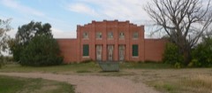 | Ruleton School | building | 2003 | 03000840 |
 | US Post Office-Goodland | building | 1989 | 89001639 |
 | United Telephone Building | building | 2017 | 100001709 |
Every wildfire the federal occurrence database records inside this county: 30 of them, burning about 1,069 acres. 1 started naturally and none was recorded as arson. Each settlement page carries the fires within five miles of it.
| Reported cause | Fires |
|---|---|
| Missing data/not specified/undetermined | 11 |
| Debris and open burning | 9 |
| Equipment and vehicle use | 8 |
| Smoking | 1 |
| Natural | 1 |
The five largest, by the area the report gives. None of them was recorded as arson.
| Date | Cause | Size | Reported by | Name on the report |
|---|---|---|---|---|
| 29 January 2017 | Debris and open burning | 400 acres | Sherman County | 8 |
| 3 November 2018 | Smoking | 200 acres | Kansas Forest Service | 76 |
| 18 April 2017 | Missing data/not specified/undetermined | 180 acres | Sherman County | 33 |
| 10 July 2018 | Equipment and vehicle use | 150 acres | Kansas Forest Service | 50 |
| 4 September 2017 | Missing data/not specified/undetermined | 80 acres | Sherman County | 74 |
| 31 December 2015 | Missing data/not specified/undetermined | 20 acres | Kansas Forest Service | 380 |
| 31 October 2016 | Debris and open burning | 12 acres | Kansas Forest Service | 356 |
| 27 July 2015 | Equipment and vehicle use | 10 acres | Kansas Forest Service | 230 |
Every settlement page carries the fires within five miles of it - see the settlement index below.
The NOAA Storm Events Database holds 1,450 reports for this county, causing 2 deaths, 9 injuries and about $20,910,040 in recorded property damage. Each settlement page carries the reports that name it.
| Kind of event | Reports |
|---|---|
| Hail | 689 |
| Thunderstorm Wind | 594 |
| Tornado | 109 |
| Flash Flood | 43 |
| Flood | 11 |
| Lightning | 2 |
| Funnel Cloud | 1 |
| Heavy Rain | 1 |
The most serious of them, by death, then injury, then recorded damage. The accounts are quoted exactly as the forecast office filed them.
| When | Event | Place named | Harm | What the report says |
|---|---|---|---|---|
| May 2004 | Thunderstorm Wind | Goodland | 1 killed, 1 hurt | Widespread tree damage in town with 6-8 inch diameter branches down. Near zero visibility in blowing dirt resulted in a fatal accident on interstate-70 when the driver slowed down due to reduced visibility and was hit from behind. |
| April 2002 | Thunderstorm Wind | Goodland | 1 killed, $50,000 | no account filed |
| September 2016 | Hail | Goodland | 5 hurt | Hail sizes ranged from golf ball to baseball size. Siding on the west side of houses and west facing windows in buildings across the north half of town were broken out due to the combined effect of the very large hail and 70 MPH winds. Many vehicles had dents and broken windows from the hail. Two adults and a child were treated at Goodland Regional Hospital for injuries to the face, head, and arms. Several students were also injured walking from school and were not treated. The worst of the damage was confined to the north half of town were the hail was the largest. |
| October 1997 | Thunderstorm Wind | Goodland | 1 hurt, $100,000 | Gusts estimated to 80 mph caused a southbound truck-trailer to be lifted and thrown cab first into the east ditch. Driver sustained a hip injury. Rescuers were pelted by small hail. |
| June 2023 | Thunderstorm Wind | Kanorado | 1 hurt | Dispatch reported a westbound truck pulling a bumper-pull camper was blown off the road onto its side due to the winds. There was one minor injury due to a laceration. |
| June 2001 | Thunderstorm Wind | Goodland | 1 hurt | The strong winds blew a semi tractor trailer over on Interstate 70, which closed the eastbound lanes of the interstate for an hour. The truck driver sustained minor injuries. |
| July 2009 | Hail | Goodland Arpt | $12,170,000 | Roof and siding damage occurred to residence as a result of large hail and strong wind gusts. Property and crop damage estimates related to this specific event are actually for all of Sherman County. |
| May 1982 | Tornado (F3) | not stated | $2,500,000 | no account filed |
| June 1962 | Tornado | not stated | $2,500,000 | no account filed |
| May 1994 | Thunderstorm Wind | Goodland | $500,000 | A record wind gust of 96 mph was measured at National Weather Service Goodland and also two miles southwest in the west portion of Goodland. The winds demolished a commercial storage building, damaged or destroyed seven mobile homes, downed numerous mature trees and power lines, and stripped portions of many roofs including at the National Weather Service. One nearly new vehicle sustained $11,000 damage from blowing pebbles and sand. Total damage was estimated around $260,000. |
| June 1994 | Tornado (F2) | Goodland | $500,000 | Tornado inflicted $100,000 damage to farmstead. |
| June 1999 | Hail | Ruleton | $250,000 | All the windows on the west side of house broken by large hail. |
| June 1984 | Tornado (F1) | not stated | $250,000 | no account filed |
| June 1984 | Tornado (F2) | not stated | $250,000 | no account filed |
| August 2004 | Hail | Goodland | $200,000 | Large hail and gusty winds caused an estimated $200,000 in damage to vehicles in an RV park south of Goodland. Several windows and mirrors were broken. Most roof vents, many air conditioner shrouds and refrigerator vents and some plumbing vents were destroyed. Hail penetrated vents and screens and came into some of the campers. Some awnings were shredded and one tent reportedly had holes punched through the roof. |
| May 2017 | Thunderstorm Wind | Edson | $100,000 | Three irrigation pivots were blown over. |
| June 2014 | Thunderstorm Wind | Kanorado Arpt | $100,000 | Grain bins were leveled from wind and baseball size hail. |
| March 2007 | Tornado (EF2) | Goodland | $100,000 | This tornado tracked from Sherman county through most of Cheyenne county with a total path length of 34 miles. The Sherman county path length was 7 miles. The tornado was on the ground for 62 minutes and produced F1-F2 damage along much of its path, especially in Cheyenne county. In Sherman county, no homes were affected. Tree and power pole damage was most noteworthy in the northern portion of the county near Roads 79 and 30 where 15 poles were snapped and extensive tree damage occurred. The tornado developed near Roads 73 and 30 and tracked straight north near Road 30 for most of its length in Sherman, and exited into Cheyenne county near Road 30.| |
| June 1998 | Thunderstorm Wind | Ruleton | $100,000 | Thunderstorm winds estimated at least 70 mph flipped over a full irrigation rig, knocked over 16 power poles, broke branches, and damaged outdoor play equipment, sheds, a roof, and grain bins. |
| July 2018 | Thunderstorm Wind | Kanorado | $70,000 | Two irrigation pivots were flipped on their side on the south side of I-70 near mile marker 5. |
| August 2002 | Thunderstorm Wind | Kanorado | $70,000 | Damage to grain elevator, trees down, power poles down, roof damage to store and abandoned school. |
| July 2018 | Thunderstorm Wind | Ruleton | $60,000 | Numerous trees of eight inches or larger snapped off at the ground between Mile Marker 8 and the Colorado border. Four semis were blown over on I-70. The travel center on east bound I-70 is without power. |
| May 2016 | Thunderstorm Wind | Goodland Arpt | $50,000 | A local farmer reported that one of his pivots was blown over. He sent the report through social media. |
| May 2016 | Thunderstorm Wind | Goodland Arpt | $50,000 | A pivot was blown over from the intense thunderstorm winds. |
| July 2015 | Thunderstorm Wind | Goodland | $50,000 | An irrigation pivot was blown over northwest of town. |
| July 2013 | Thunderstorm Wind | Goodland Arpt | $50,000 | Barn destroyed with other damage to shingles and gutters. Hail to one-half inch and rainfall of 1.5 also occurred with the storm. Corn crop was laid down and likely a total loss but no crop damage estimates are available. |
| July 1994 | Thunderstorm Wind | Goodland | $50,000 | Quonetset building was blown over. Large branches between 12 and 28 inches in diameter were snapped. |
| July 1994 | Hail | Goodland | $50,000 | Weather service employee reported hail slightly larger than baseballs at the Goodland softball field. |
| July 2023 | Thunderstorm Wind | Edson | $48,000 | Report received of 4 semi trucks overturned on I-70 around mile marker 35 near Brewster, KS. Wind speed estimate based on damage indicators. |
| October 2021 | Thunderstorm Wind | Goodland | $40,000 | Sherman County Dispatch reported a car window knocked out of a customers car at Walmart along with an uprooted small tree that was blown across the lot. Other small branches were found snapped behind Walmart. A damage survey found no evidence of tornado as all the damage was blown to the east. |
| June 2014 | Thunderstorm Wind | Goodland Arpt | $40,000 | An irrigation pivot was overturned near the intersection of Road 28 and Road 76. Estimated time of the event from radar. |
| May 2013 | Thunderstorm Wind | Ruleton | $30,000 | Large grain bin blown down. Time of report and wind speed estimated from Doppler radar. |
| July 1998 | Thunderstorm Wind | Goodland | $30,000 | Trailer home destroyed. Debris scattered 1/4 mile. |
| May 2017 | Thunderstorm Wind | Goodland | $25,500 | Near the hospital a 30 ft. camper trailer was rolled three times, including rolling over a privacy fence and a shed. A large cottonwood tree was also blown over and a pine tree was uprooted on the hospital campus. |
| June 2018 | Thunderstorm Wind | Edson | $25,000 | An empty grain bin was blown over. |
| May 2010 | Tornado (EF1) | Goodland Arpt | $25,000 | Stovepipe tornado was visible from NWS Goodland. Irrigation pivot was damaged and trees were reported down. Several utility poles were broken. |
| June 2008 | Thunderstorm Wind | Ruleton | $25,000 | A center pivot irrigation system was overturned and tree branches were broken by strong thunderstorm outflow winds. Minor damage was also reported to outbuildings and grain bins. |
| March 2007 | Flash Flood | Goodland | $25,000 | Very heavy rainfall from several rounds of strong to severe thunderstorms during the evening resulted in numerous county roads becoming impassible, especially across the eastern third of the county. Some county roads were still closed during the day on March 29th as tornado damage surveys were being conducted. |
| June 2006 | Tornado (F1) | Goodland | $25,000 | One home received damage to a gazebo. A church suffered roof damage...with some of the roof debris causing minor damage to a neighboring home. Tree damage also occurred. |
| May 1979 | Tornado (F1) | not stated | $25,000 | no account filed |
| June 1971 | Tornado (F1) | not stated | $25,000 | no account filed |
| May 1960 | Tornado | not stated | $25,000 | no account filed |
| June 1960 | Tornado (F0) | not stated | $25,000 | no account filed |
| July 2009 | Thunderstorm Wind | Edson | $21,500 | Time of event estimated from Doppler radar. Wind speed estimated from Doppler radar velocity. Power poles were blown down around intersection of Road 57 and Road 23 southeast of Goodland. A barn was also blown down just east of this location. |
| June 2018 | Thunderstorm Wind | Caruso | $20,000 | Unknown size and number of branches broken off of a tree and a nearby irrigation pivot blown over from thunderstorm winds. |
| May 2011 | Thunderstorm Wind | Goodland Arpt | $20,000 | Game warden reported two circle pivot irrigation systems damaged. Wind speed and time estimated from nearby Goodland ASOS wind report of 79 mph. |
| August 2013 | Thunderstorm Wind | Goodland | $15,000 | There was a semi rollover at mile marker 25 on I-70. It was blown off the road by a wind gust from the south. The semi was loaded with freight. |
| June 2006 | Tornado (F1) | Goodland | $15,000 | A short-lived tornado developed just west of highway 27 and just north of interstate 70 in extreme southwest Goodland. The tornado ripped a metal frame door off of the Dairy Queen and tossed it 150 feet across the highway. Surface debris also resulted in broken car windows at this location. A large dumpster at the Conoco gas station was tossed/rolled 150 yards into a field. |
| August 2002 | Thunderstorm Wind | Goodland | $15,000 | Tractor trailer blown off Interstate 70. |
| May 2010 | Thunderstorm Wind | Ruleton | $12,500 | Time of report and gust intensity estimated from Doppler radar and nearby mesonet observations. Several power poles reported down and a barn door blown in. |
| July 2022 | Thunderstorm Wind | Edson | $10,000 | Report received of power poles blown down at location. Time is estimated by radar and wind speed is estimated by damage indicators. |
| July 2022 | Thunderstorm Wind | Ruleton | $10,000 | Report relayed via local emergency dispatch of power poles down on Road 11. Time is radar estimated and wind speed is based on damage indicators. |
| August 2014 | Thunderstorm Wind | Edson | $10,000 | A semi was blown over just west of Brewster on Interstate 70. Time of report estimated from Doppler radar. |
| June 2014 | Thunderstorm Wind | Kanorado Arpt | $10,000 | Several large trees down near intersection of Road 76 and Road 8. |
| June 2006 | Flash Flood | Goodland | $10,000 | Major street flooding in downtown Goodland with water 1 foot deep in some areas. Two resturants received minor water damage when water seeped into the buildings from the outside street where poor drainage was occurring. |
| July 2004 | Hail | Goodland | $8,500 | Hail and wind resulted in a broken windshield and extensive body damage to a Ford Expedition. |
| May 2017 | Thunderstorm Wind | Edson | $8,000 | A semi was blown over on I-70 near mile marker 25. |
| May 2010 | Thunderstorm Wind | Caruso | $7,500 | At least two power poles were blown down on county Road 67. One started a fire and the other damaged a vehicle. |
| June 2006 | Thunderstorm Wind | Edson | $7,500 | Power poles blown over to the other side of the road. Wind speed estimated. |
| May 2013 | Thunderstorm Wind | Ruleton | $6,000 | Six power poles down at Rd 12/Rd 70. Time of report and wind speed estimated from Doppler radar. This is the same general location as a previous report of a grain bin blown down. The downed power lines also started a grass/stubble fire. |
The Survey's mineral resources record lists 2 workings inside this county. All of them still produce. Each settlement page carries the workings within five miles of it.
| Commodity | Workings |
|---|---|
| Sand and Gravel, Construction | 2 |
The least common of them first, because a county's hundredth gravel pit says nothing its first ten did not.
| Where | Site | Commodity | Status | Recorded |
|---|---|---|---|---|
| Mille Brothers Constr Sand Pit | Sand and Gravel, Construction | Producer | ||
| Siebert Lucan Sand Pit | Sand and Gravel, Construction | Producer |
Named settlements recorded in the Geographic Names Information System, each with the topographic sheets covering it. Villages, hamlets and abandoned places alike. Each is shown with the nearest named watercourse or landform and the survey quadrangle it falls on.