 Block
Ruleton, Kansas
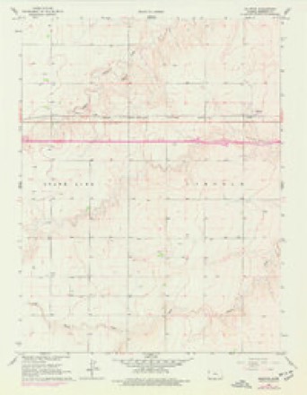
8 topographic sheets cover this place, the earliest surveyed in 1954 and the latest in 1985. It stands in Lincoln Township. It lies in ZIP code area 67735. The Survey maps it on the Ruleton quadrangle.
On record in Ruleton
Buildings and businesses the archive holds for this place. Each opens its own page, with the source record it came from.
On the National Register within a mile 1 record
The National Register names another town for these. They stand within one mile of this settlement's coordinate.
 Ruleton Schoollisted 2003 · 0.2 miles away
Topographic sheets covering this place
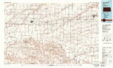
5 surveys from 8 printed sheetsMatched by testing this settlement's coordinate against the published boundary of every sheet in the United States Geological Survey's historical collection. Each opens the scanned sheet at the Survey.
- 1954 USGS Goodland quadrangle1:250000
- 1956 USGS Goodland quadrangle1:250000
- 1957 USGS Goodland quadrangle1:250000, 2 printings
- 1966 USGS Ruleton quadrangle1:24000, 2 printings
- 1985 USGS Goodland quadrangle1:100000, 2 printings



Fires near this place
4 since 2017Regional context, not property-specific evidence. The federal wildfire occurrence database lists 4 fires within 5 miles of Ruleton between 2017 and 2018, burning about 5 acres in total. None started naturally. None was recorded as arson. Distance is straight-line from the map coordinates, so a fire counted here may appear on a neighbouring settlement's page as well.
| Reported cause | Fires |
|---|---|
| Debris and open burning | 4 |
The most recent of them, most recent first, with the day each was reported and the service that recorded it.
| Date | Cause | Size | Reported by | Name on the report |
|---|---|---|---|---|
| 5 July 2018 | Debris and open burning | under an acre | Kansas Forest Service | 48 |
| 29 April 2018 | Debris and open burning | under an acre | Kansas Forest Service | 34 |
| 9 March 2017 | Debris and open burning | 2.0 acres | Sherman County | 24 |
| 11 February 2017 | Debris and open burning | 3.0 acres | Sherman County | 13 |
Settlements close enough to share some of these fires:
Mines and quarries near this place
1 within 5 milesRegional context, not property-specific evidence. The federal mineral resources record lists 1 working within 5 miles of Ruleton: 1 producer. All of them still produce. What was taken out: Sand and Gravel, Construction. Distance is straight-line from the map coordinates, so a quarry counted here may appear on a neighbouring settlement's page as well.
| Where | Site | Commodity | Status | Recorded |
|---|---|---|---|---|
| Mille Brothers Constr Sand Pit | Sand and Gravel, Construction | Producer |
Storms near this place
60 of 100 shownRegional context, not property-specific evidence. The National Weather Service names Ruleton in 100 storm reports between 1994 and 2025: 57 hail, 33 thunderstorm wind, 6 tornado, 3 flood. No death or injury is recorded in these reports. Each account below is quoted exactly as the forecast office filed it, from the NOAA Storm Events Database, and each date opens the federal record of that event.
| When | Event | Place named | Harm | What the report says |
|---|---|---|---|---|
| June 1999 | Hail | Ruleton | $250,000 | All the windows on the west side of house broken by large hail. |
| June 1998 | Thunderstorm Wind | Ruleton | $100,000 | Thunderstorm winds estimated at least 70 mph flipped over a full irrigation rig, knocked over 16 power poles, broke branches, and damaged outdoor play equipment, sheds, a roof, and grain bins. |
| July 2018 | Thunderstorm Wind | Ruleton | $60,000 | Numerous trees of eight inches or larger snapped off at the ground between Mile Marker 8 and the Colorado border. Four semis were blown over on I-70. The travel center on east bound I-70 is without power. |
| May 2013 | Thunderstorm Wind | Ruleton | $30,000 | Large grain bin blown down. Time of report and wind speed estimated from Doppler radar. |
| June 2008 | Thunderstorm Wind | Ruleton | $25,000 | A center pivot irrigation system was overturned and tree branches were broken by strong thunderstorm outflow winds. Minor damage was also reported to outbuildings and grain bins. |
| May 2010 | Thunderstorm Wind | Ruleton | $12,500 | Time of report and gust intensity estimated from Doppler radar and nearby mesonet observations. Several power poles reported down and a barn door blown in. |
| July 2022 | Thunderstorm Wind | Ruleton | $10,000 | Report relayed via local emergency dispatch of power poles down on Road 11. Time is radar estimated and wind speed is based on damage indicators. |
| May 2013 | Thunderstorm Wind | Ruleton | $6,000 | Six power poles down at Rd 12/Rd 70. Time of report and wind speed estimated from Doppler radar. This is the same general location as a previous report of a grain bin blown down. The downed power lines also started a grass/stubble fire. |
| October 2013 | Thunderstorm Wind | Ruleton | $2,000 | Two power poles were snapped. Report was relayed via The Spotter Network. |
| June 2014 | Hail | Ruleton | $750 | Report receive via social media. Hail broke windows in the residence. |
| May 2011 | Thunderstorm Wind | Ruleton | $500 | Employee reported that three windows were broken by wind-blown hail, with some minor roof damage also occurring. |
| May 2025 | Hail | Ruleton | - | A public report of half dollar size hail. |
| July 2025 | Thunderstorm Wind | Ruleton | - | A public report of blowing dust associated with thunderstorm outflow wind reducing visibility to less than one half mile. Wind gusts of 53 mph was recorded at the Goodland Airport with the outflow, and 60 mph was reported at the Burlington Airport as well with the outflow. Further downstream reports around 70mph were also recorded with winds from the thunderstorm outflow. |
| August 2025 | Thunderstorm Wind | Ruleton | - | Report of a semi truck blown over on I-70 at mile marker 7. |
| September 2025 | Hail | Ruleton | - | Accumulating hail also reported with heavy rain. |
| August 2024 | Thunderstorm Wind | Ruleton | - | One power pole was seen broken, but power lines were still up. |
| June 2022 | Hail | Ruleton | - | Dime to quarter sized hail observed. |
| April 2018 | Hail | Ruleton | - | The hail ranged from quarter to ping-pong ball size. |
| July 2018 | Flash Flood | Ruleton | - | Multiple county roads either washed out or underwater. Barricades have been setup across some of these roads. |
| July 2018 | Hail | Ruleton | - | The hail ranged from pea to quarter in size, with hail piling up in the yard. |
| July 2018 | Thunderstorm Wind | Ruleton | - | Power lines from an unknown number of poles have been blown down. Pea size hail several inches deep is also covering the ground. |
| May 2017 | Hail | Ruleton | - | The hail was measured at .9 in diameter. |
| May 2016 | Hail | Ruleton | - | The hail ranged from nickel to quarter size. |
| April 2015 | Hail | Ruleton | - | The average hail size covering the ground was half an inch. |
| June 2014 | Thunderstorm Wind | Ruleton | - | Peak wind was measured using a Davis weather station. |
| June 2014 | Hail | Ruleton | - | Strong winds caused blowing dust with visibility reduced to less than a quarter mile. |
| May 2013 | Hail | Ruleton | - | Nickel size hail with the largest being one and a half inches in diameter. |
| September 2013 | Flood | Ruleton | - | Road 13 between Roads 52 and 55 was closed due to water over the road as a result of heavy rainfall. The Smoky Hill River was over the bridge at Road 13. |
| September 2013 | Flood | Ruleton | - | Road 10 between Roads 59 and 64 was closed due to water over the road as a result of heavy rainfall. |
| September 2013 | Flood | Ruleton | - | Interstate 70 was closed for approximately six hours due to water over parts of the highway after six inches of rain fell across the county overnight. This section of road is in a construction zone. Traffic was re-routed to nearby Highway 24. |
| May 2013 | Hail | Ruleton | - | Hail ranged from 1.5 to 1.75 in diameter. |
| May 2013 | Hail | Ruleton | - | Estimated time of report from radar. |
| May 2011 | Hail | Ruleton | - | Wind gusts of 40 to 50 mph were also reported. |
| May 2010 | Tornado (EF0) | Ruleton | - | Tornado was reported to be very brief...less than 30 seconds duration. |
| May 2010 | Hail | Ruleton | - | This report was relayed via Sherman County dispatch. |
| June 2010 | Hail | Ruleton | - | The hail was reported via the CoCoRaHS network. |
| September 2010 | Tornado (EF0) | Ruleton | - | Off duty NWS employee reported a large cone tornado which became rain-wrapped. |
| August 2009 | Thunderstorm Wind | Ruleton | - | Off-duty NWS employee reported a couple four-inch diameter tree branches down at Road 55 and Road 12 in Sherman County. |
| June 2008 | Hail | Ruleton | - | This report was relayed by the NSSL SHAVE project. |
| June 2008 | Hail | Ruleton | - | This report was relayed by the NSSL SHAVE project. |
| June 2008 | Hail | Ruleton | - | Law enforcement reported golf ball size hail fell at the Interstate 70 rest area west of Ruleton. |
| May 2004 | Thunderstorm Wind | Ruleton | - | Zero visibility on highway 24 for 15 minutes |
| May 2004 | Thunderstorm Wind | Ruleton | - | Zero visibility in blowing dirt |
| October 2000 | Tornado (F1) | Ruleton | - | Tornado touched down on farmstead and took off the roof of a sheep barn, flipped a trailer, destroyed a small buildings, and broke some windows. In addition, the tornado tore out trees, fences, and a utility pole. No one was injured at the residence. |
| October 2000 | Tornado (F2) | Ruleton | - | Tornado destroyed abandoned house and garage as it entered southwest Sherman County from Wallace County. Tornado also ripped out utility poles and trees. It was likely the widest just after crossing the county line, and was briefly described as an "elephant trunk" tornado by storm spotters. |
| August 2023 | Hail | Ruleton | - | no account filed |
| May 2017 | Hail | Ruleton | - | no account filed |
| October 2017 | Hail | Ruleton | - | no account filed |
| May 2016 | Hail | Ruleton | - | no account filed |
| June 2014 | Hail | Ruleton | - | no account filed |
| June 2014 | Thunderstorm Wind | Ruleton | - | no account filed |
| July 2011 | Hail | Ruleton | - | no account filed |
| June 2010 | Hail | Ruleton | - | no account filed |
| June 2010 | Hail | Ruleton | - | no account filed |
| June 2010 | Hail | Ruleton | - | no account filed |
| April 2010 | Hail | Ruleton | - | no account filed |
| August 2007 | Thunderstorm Wind | Ruleton | - | no account filed |
| August 2007 | Hail | Ruleton | - | no account filed |
| March 2007 | Hail | Ruleton | - | no account filed |
| May 2006 | Hail | Ruleton | - | no account filed |
Nearest settlements
The eight closest, with where each one stands in the county. Distances are straight-line, computed from the Geographic Names Information System coordinates.
Provenance
This settlement is recorded in the Geographic Names Information System as feature 471240. The sheet list is computed by point-in-boundary test against the United States Geological Survey's historical topographic inventory. Both are works of the United States government and carry no copyright under 17 U.S.C. 105.
Wildfire. Short, Karen C. 2022. Spatial wildfire occurrence data for the United States, 1992-2020 [FPA_FOD_20221014]. 6th Edition. Fort Collins, CO: Forest Service Research Data Archive. https://doi.org/10.2737/RDS-2013-0009.6 Collected with United States Government funding and usable without additional permissions or fees.
Mines and quarries. USGS Mineral Resources Data System (MRDS) https://mrdata.usgs.gov/mrds/ A work of the United States government, no copyright under 17 U.S.C. 105.
Storms. NOAA National Centers for Environmental Information, Storm Events Database https://www.ncei.noaa.gov/stormevents/ A work of the United States government, no copyright under 17 U.S.C. 105. Narratives are quoted verbatim from the National Weather Service report and are not edited or summarised.