 Block
Caruso, Kansas
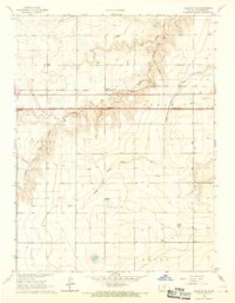
8 topographic sheets cover this place, the earliest surveyed in 1954 and the latest in 1985. It stands in Logan Township. It lies in ZIP code area 67735. The Survey maps it on the Ruleton SE quadrangle.
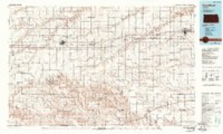
Topographic sheets covering this place
5 surveys from 8 printed sheetsMatched by testing this settlement's coordinate against the published boundary of every sheet in the United States Geological Survey's historical collection. Each opens the scanned sheet at the Survey.
- 1954 USGS Goodland quadrangle1:250000
- 1956 USGS Goodland quadrangle1:250000
- 1957 USGS Goodland quadrangle1:250000, 2 printings
- 1966 USGS Ruleton SE quadrangle1:24000, 2 printings
- 1985 USGS Goodland quadrangle1:100000, 2 printings



Fires near this place
7 since 2015Regional context, not property-specific evidence. The federal wildfire occurrence database lists 7 fires within 5 miles of Caruso between 2015 and 2018, burning about 3 acres in total. None started naturally. None was recorded as arson. Distance is straight-line from the map coordinates, so a fire counted here may appear on a neighbouring settlement's page as well.
| Reported cause | Fires |
|---|---|
| Debris and open burning | 4 |
| Missing data/not specified/undetermined | 2 |
| Equipment and vehicle use | 1 |
The most recent of them, most recent first, with the day each was reported and the service that recorded it.
| Date | Cause | Size | Reported by | Name on the report |
|---|---|---|---|---|
| 5 July 2018 | Debris and open burning | under an acre | Kansas Forest Service | 48 |
| 4 July 2015 | Missing data/not specified/undetermined | under an acre | Kansas Forest Service | 194 |
| 29 April 2018 | Debris and open burning | under an acre | Kansas Forest Service | 34 |
| 24 March 2018 | Debris and open burning | under an acre | Kansas Forest Service | 14 |
| 5 February 2018 | Equipment and vehicle use | under an acre | Kansas Forest Service | 5 |
| 11 February 2017 | Debris and open burning | 3.0 acres | Sherman County | 13 |
| 3 December 2015 | Missing data/not specified/undetermined | under an acre | Kansas Forest Service | 355 |
Settlements close enough to share some of these fires:
Mines and quarries near this place
1 within 5 milesRegional context, not property-specific evidence. The federal mineral resources record lists 1 working within 5 miles of Caruso: 1 producer. All of them still produce. What was taken out: Sand and Gravel, Construction. Distance is straight-line from the map coordinates, so a quarry counted here may appear on a neighbouring settlement's page as well.
| Where | Site | Commodity | Status | Recorded |
|---|---|---|---|---|
| Mille Brothers Constr Sand Pit | Sand and Gravel, Construction | Producer |
Storms near this place
60 of 79 shownRegional context, not property-specific evidence. The National Weather Service names Caruso in 79 storm reports between 1994 and 2025: 44 hail, 33 thunderstorm wind, 1 tornado, 1 flood. No death or injury is recorded in these reports. Each account below is quoted exactly as the forecast office filed it, from the NOAA Storm Events Database, and each date opens the federal record of that event.
| When | Event | Place named | Harm | What the report says |
|---|---|---|---|---|
| June 2018 | Thunderstorm Wind | Caruso | $20,000 | Unknown size and number of branches broken off of a tree and a nearby irrigation pivot blown over from thunderstorm winds. |
| May 2010 | Thunderstorm Wind | Caruso | $7,500 | At least two power poles were blown down on county Road 67. One started a fire and the other damaged a vehicle. |
| August 2020 | Hail | Caruso | $2,000 | Quarter to golf ball sized hail reported at location while traveling eastbound on I-70. Hail had dented a van's hood and cracked its windshield. |
| June 2009 | Thunderstorm Wind | Caruso | $1,500 | Three utility poles were blown over by strong thunderstorm winds. |
| July 2022 | Thunderstorm Wind | Caruso | $1,000 | Report received of power lines down between Rd 13 and 14 on Road 59 due to a thunderstorm wind gust. A hog hut also blown 30 ft. and a T-post was bent by the wind gust. Time is radar estimated and wind speed is estimated based on damage indicators. |
| July 2022 | Thunderstorm Wind | Caruso | $1,000 | Report received via social media of power lines blown down in Road 14 between Roads 60 and 61 at location. Time and wind speed estimated from nearby Mesonet station. |
| May 2025 | Hail | Caruso | - | A trained spotter reported quarter size hail. |
| August 2025 | Hail | Caruso | - | Up to golf ball sized hail reported for 20 minutes. 0.55 inches of rainfall accompanied the thunderstorm. |
| August 2025 | Hail | Caruso | - | The hail was reported via Social Media. |
| September 2025 | Thunderstorm Wind | Caruso | - | Weather Link Site Delta Dos report of 61 MPH gust. |
| August 2024 | Hail | Caruso | - | MPing report of 1.5 inch hail. |
| August 2024 | Hail | Caruso | - | Phone call reporting hail between pea and golf ball with a few 2 inch stones. Multiple broken windows due to wind driven hail. Wind gusts estimated up to 70 MPH. |
| August 2024 | Thunderstorm Wind | Caruso | - | Report of a tree uprooted and multiple other branches torn off tree. |
| August 2024 | Thunderstorm Wind | Caruso | - | Phone call report of wind driven hail with winds estimated around 65 to 70 mph. Wind driven hail broke windows. Hail estimated up to 2 inches. |
| August 2024 | Hail | Caruso | - | Nickel size hail that fell for 3-4 minutes. |
| June 2023 | Hail | Caruso | - | Report received of hail up to pennies in size at location. |
| June 2023 | Hail | Caruso | - | Reported pea to penny sized hail. |
| October 2023 | Hail | Caruso | - | Pea to quarter sized hail reported. |
| August 2023 | Hail | Caruso | - | Report received of pea to quarter sized hail at location. Time is estimated from radar. |
| August 2023 | Hail | Caruso | - | Dime to half dollar sized hail reported at location. |
| July 2022 | Thunderstorm Wind | Caruso | - | Kansas State Mesonet site measured a 59 mph wind gust at location. |
| August 2020 | Hail | Caruso | - | Hail up to golf ball sized reported at location. |
| August 2020 | Hail | Caruso | - | Pea to penny sized hail fell for a duration of four minutes. |
| June 2019 | Hail | Caruso | - | Dime to golf ball sized hail was reported via Facebook. |
| May 2019 | Hail | Caruso | - | Quarter to ping pong ball size hail. |
| June 2018 | Thunderstorm Wind | Caruso | - | An estimated wind gust of 85 MPH was reported. |
| June 2018 | Thunderstorm Wind | Caruso | - | Unknown number of large cottonwood trees blown down in Soldier Park. |
| June 2018 | Thunderstorm Wind | Caruso | - | Winds ahead of the thunderstorm caused blowing dust to reduce the visibility to three or four miles. |
| June 2018 | Hail | Caruso | - | The hail ranged from nickel to quarter in size. |
| May 2017 | Hail | Caruso | - | The hail ranged from nickel to ping-pong ball size. |
| May 2017 | Thunderstorm Wind | Caruso | - | NWS Goodland employee reported an estimated 65 mph wind gust. |
| May 2017 | Thunderstorm Wind | Caruso | - | NWS Goodland employee reported a 63 mph wind gust. |
| April 2017 | Hail | Caruso | - | Hail near dime size was reported. |
| September 2016 | Hail | Caruso | - | Estimated hen egg size hail. |
| August 2016 | Hail | Caruso | - | Dime sized hail was reported southeast of Ruleton. |
| November 2015 | Thunderstorm Wind | Caruso | - | Measured with a Davis Weather station. |
| July 2014 | Hail | Caruso | - | Most stones were penny to quarter size. |
| August 2014 | Hail | Caruso | - | Penny size hail and torrential rainfall was reducing visibility to 50 yards south of Goodland, but no flooding reports were received. |
| June 2014 | Thunderstorm Wind | Caruso | - | Peak wind was measured using a Davis Vantage Pro weather station. |
| June 2014 | Hail | Caruso | - | Hail stones were mostly nickel size with some golf ball in size. Also measured 55 MPH wind gusts. |
| September 2013 | Flood | Caruso | - | Road 17 between Roads 52 and 55 was closed due to water over the road as a result of heavy rainfall. |
| July 2011 | Thunderstorm Wind | Caruso | - | NWS employee estimates peak wind gust of 65 mph. |
| July 2011 | Thunderstorm Wind | Caruso | - | NWS employee estimates peak wind gusts of 80 to 90 mph. Quarter sized hail was also reported. |
| May 2010 | Thunderstorm Wind | Caruso | - | This was the highest wind gust measured at this station since it was installed in September 2002. |
| July 2010 | Hail | Caruso | - | Report relayed via The Spotter Network. |
| October 2000 | Tornado (F0) | Caruso | - | Brief tornado in open field causing no damage. |
| June 1994 | Hail | Caruso | - | Brief tornado over open country. |
| May 2021 | Hail | Caruso | - | no account filed |
| August 2020 | Hail | Caruso | - | no account filed |
| June 2018 | Hail | Caruso | - | no account filed |
| June 2018 | Thunderstorm Wind | Caruso | - | no account filed |
| June 2018 | Hail | Caruso | - | no account filed |
| June 2018 | Thunderstorm Wind | Caruso | - | no account filed |
| May 2017 | Thunderstorm Wind | Caruso | - | no account filed |
| May 2016 | Thunderstorm Wind | Caruso | - | no account filed |
| September 2016 | Thunderstorm Wind | Caruso | - | no account filed |
| July 2014 | Hail | Caruso | - | no account filed |
| July 2014 | Thunderstorm Wind | Caruso | - | no account filed |
| July 2014 | Hail | Caruso | - | no account filed |
| July 2014 | Hail | Caruso | - | no account filed |
Nearest settlements
The eight closest, with where each one stands in the county. Distances are straight-line, computed from the Geographic Names Information System coordinates.
Provenance
This settlement is recorded in the Geographic Names Information System as feature 484551. The sheet list is computed by point-in-boundary test against the United States Geological Survey's historical topographic inventory. Both are works of the United States government and carry no copyright under 17 U.S.C. 105.
Wildfire. Short, Karen C. 2022. Spatial wildfire occurrence data for the United States, 1992-2020 [FPA_FOD_20221014]. 6th Edition. Fort Collins, CO: Forest Service Research Data Archive. https://doi.org/10.2737/RDS-2013-0009.6 Collected with United States Government funding and usable without additional permissions or fees.
Mines and quarries. USGS Mineral Resources Data System (MRDS) https://mrdata.usgs.gov/mrds/ A work of the United States government, no copyright under 17 U.S.C. 105.
Storms. NOAA National Centers for Environmental Information, Storm Events Database https://www.ncei.noaa.gov/stormevents/ A work of the United States government, no copyright under 17 U.S.C. 105. Narratives are quoted verbatim from the National Weather Service report and are not edited or summarised.