 Block
Edson, Kansas
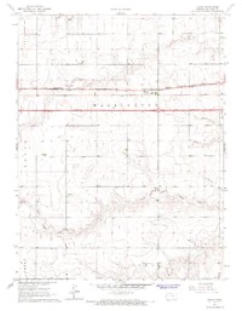
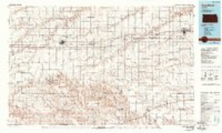
8 topographic sheets cover this place, the earliest surveyed in 1954 and the latest in 1985. It stands in Washington Township. It lies in ZIP code area 67733. The Survey maps it on the Edson quadrangle. 17 people lived here at the 2020 count. It stands 3,576 feet above sea level.
On record in Edson
Buildings and businesses the archive holds for this place. Each opens its own page, with the source record it came from.
On the National Register 1 record
- Kuhrt Ranchlisted 2001
Topographic sheets covering this place
5 surveys from 8 printed sheetsMatched by testing this settlement's coordinate against the published boundary of every sheet in the United States Geological Survey's historical collection. Each opens the scanned sheet at the Survey.
- 1954 USGS Goodland quadrangle1:250000
- 1956 USGS Goodland quadrangle1:250000
- 1957 USGS Goodland quadrangle1:250000, 2 printings
- 1966 USGS Edson quadrangle1:24000, 2 printings
- 1985 USGS Goodland quadrangle1:100000, 2 printings



Fires near this place
2 since 2018Regional context, not property-specific evidence. The federal wildfire occurrence database lists 2 fires within 5 miles of Edson in 2018, burning about 200 acres in total. None started naturally. None was recorded as arson. Distance is straight-line from the map coordinates, so a fire counted here may appear on a neighbouring settlement's page as well.
| Reported cause | Fires |
|---|---|
| Equipment and vehicle use | 1 |
| Smoking | 1 |
The most recent of them, most recent first, with the day each was reported and the service that recorded it.
| Date | Cause | Size | Reported by | Name on the report |
|---|---|---|---|---|
| 4 November 2018 | Equipment and vehicle use | under an acre | Kansas Forest Service | 77 |
| 3 November 2018 | Smoking | 200 acres | Kansas Forest Service | 76 |
Storms near this place
60 of 151 shownRegional context, not property-specific evidence. The National Weather Service names Edson in 151 storm reports between 1993 and 2025: 75 hail, 50 thunderstorm wind, 17 tornado, 7 flash flood. No death or injury is recorded in these reports. Each account below is quoted exactly as the forecast office filed it, from the NOAA Storm Events Database, and each date opens the federal record of that event.
| When | Event | Place named | Harm | What the report says |
|---|---|---|---|---|
| May 2017 | Thunderstorm Wind | Edson | $100,000 | Three irrigation pivots were blown over. |
| July 2023 | Thunderstorm Wind | Edson | $48,000 | Report received of 4 semi trucks overturned on I-70 around mile marker 35 near Brewster, KS. Wind speed estimate based on damage indicators. |
| June 2018 | Thunderstorm Wind | Edson | $25,000 | An empty grain bin was blown over. |
| July 2009 | Thunderstorm Wind | Edson | $21,500 | Time of event estimated from Doppler radar. Wind speed estimated from Doppler radar velocity. Power poles were blown down around intersection of Road 57 and Road 23 southeast of Goodland. A barn was also blown down just east of this location. |
| July 2022 | Thunderstorm Wind | Edson | $10,000 | Report received of power poles blown down at location. Time is estimated by radar and wind speed is estimated by damage indicators. |
| August 2014 | Thunderstorm Wind | Edson | $10,000 | A semi was blown over just west of Brewster on Interstate 70. Time of report estimated from Doppler radar. |
| May 2017 | Thunderstorm Wind | Edson | $8,000 | A semi was blown over on I-70 near mile marker 25. |
| June 2006 | Thunderstorm Wind | Edson | $7,500 | Power poles blown over to the other side of the road. Wind speed estimated. |
| September 2005 | Thunderstorm Wind | Edson | $6,000 | Three power poles down. |
| June 2025 | Thunderstorm Wind | Edson | $3,000 | Report of numerous blow overs from mile markers 26 MM 36 on I-70, including a camper. |
| March 2007 | Tornado (EF0) | Edson | $3,000 | Brief tornado with little damage. Power flashes noted as circulation passed over power poles. |
| June 2019 | Thunderstorm Wind | Edson | $2,000 | Residents of Edson reported wind damage associated with a supercell thunderstorm. Damage included trees and power lines downed in Edson. Time of this event was estimated based on radar and other reports. |
| June 2025 | Thunderstorm Wind | Edson | $1,000 | Camper tipped over on I-70 at mile marker 26. |
| May 2011 | Thunderstorm Wind | Edson | $1,000 | A power pole was reported down on Highway 24. |
| August 2008 | Thunderstorm Wind | Edson | $750 | Newly constructed chicken house shifted off foundation. Time of report estimated. |
| June 2009 | Thunderstorm Wind | Edson | $500 | Several 3 to 4 inch diameter tree limbs were broken off trees. A garden fence was blown down. One and a half inches of rain was also reported. |
| July 2025 | Thunderstorm Wind | Edson | - | A KSN Storm Chaser measured 82 mph wind gust at mile marker 28 on I-70. |
| August 2025 | Hail | Edson | - | An off duty NWS employee reports 1 inch hail. |
| August 2025 | Thunderstorm Wind | Edson | - | A semi truck was blown over on westbound I-70 southwest of Brewster in Sherman County. |
| August 2025 | Thunderstorm Wind | Edson | - | Off duty NWS Employee reports 65 MPH gust. The wind gust appears to be associated with outflow thunderstorms. A 55 mph wind gust was also reported via a mesonet site 10 NNE Goodland around 7 minutes before this but was more associated with the thunderstorms. A trained spotter located 9 miles north of Goodland also reported brown out conditions with skies turning dark and visibility estimated at a quarter mile. |
| May 2024 | Hail | Edson | - | Retired NWS employee reports quarter sized hail 3 E of Edson on I-70. |
| April 2024 | Hail | Edson | - | Estimated 2-3 inch sized hail fell for roughly 20 minutes at the location. |
| July 2024 | Thunderstorm Wind | Edson | - | Site K5ED7 reported the wind gust. |
| June 2024 | Thunderstorm Wind | Edson | - | Semi-truck was overturned near MM 25 on Interstate 70. Reports were strong winds from a line of thunderstorms caused the accident. |
| September 2024 | Thunderstorm Wind | Edson | - | A trained spotter estimated wind gusts of 60-65 mph that occurred over a 2 minute span. |
| May 2023 | Tornado (EFU) | Edson | - | Brief tornado in southeastern Sherman County reported by spotters. No damage was reported. |
| June 2023 | Thunderstorm Wind | Edson | - | Report of 60 mph winds and a lot of pea sized hail. |
| August 2023 | Thunderstorm Wind | Edson | - | Report received of blowing dust reducing visibility down to 15-20 feet at 4 miles west of Brewster, KS. |
| May 2021 | Thunderstorm Wind | Edson | - | Outflow from thunderstorms moving across northwest Kansas produced an estimated 65 mph wind gust with blowing dust reducing visibility to near zero. |
| August 2021 | Thunderstorm Wind | Edson | - | Report received of an estimated 60 to 70 mph thunderstorm wind gust at location. Time is radar-estimated. |
| May 2021 | Hail | Edson | - | Off-duty NWS employee reported nickel sized hail at location. |
| May 2021 | Hail | Edson | - | Delayed report received from off-duty NWS employee. Time is radar estimated. Dime to half dollar sized hail was observed on the road after storm passed. Road was covered in hail from roughly Sherman County Road 30 to 34. |
| May 2020 | Thunderstorm Wind | Edson | - | A member of the public reported a 72 mph wind gust 6 SSW of Edson, KS. |
| May 2020 | Thunderstorm Wind | Edson | - | Mesonet station K5ED7 along I-70 in Edson reported a wind gust of 77 mph. |
| August 2020 | Hail | Edson | - | Ongoing pea to dime sized hail reported at location. |
| June 2019 | Hail | Edson | - | Hail was observed on Road 29 about 2 miles south of Edson, KS. |
| June 2019 | Hail | Edson | - | Public reported golf ball to tennis ball size hail at the overpass near mile marker 25 along I-70. |
| July 2019 | Flash Flood | Edson | - | Flash flooding at least 6 inches deep across the road way was reported near the intersection of road 75.2 and County Rd 28. The nearby Beaver Creek was also threatening to overflow its banks. |
| August 2019 | Flash Flood | Edson | - | The public reported via facebook that some rural roads were flooding roughly 12 miles northwest of Winona, KS. Water depth was estimated to be at least 2 feet deep in spots. |
| May 2017 | Hail | Edson | - | The hail occurred with estimated 80 MPH winds on CR 29, roughly .3 miles north of the county line. |
| May 2017 | Thunderstorm Wind | Edson | - | The wind occurred with baseball size hail on CR 29, .3 miles north of the county line. |
| May 2017 | Hail | Edson | - | Hail was just a little over two inches in diameter. |
| May 2017 | Flash Flood | Edson | - | Between three and five inches of rain fell causing one of the streams at the headwaters of the South Fork of the Sappa to flood CR 30 about a third of a mile south of the CR 59/30 intersection. |
| May 2017 | Flood | Edson | - | Between three and five inches of rain fell causing one of the streams at the headwaters of the South Fork of the Sappa to flood CR 30 about a third of a mile south of the CR 59/30 intersection. |
| May 2017 | Flash Flood | Edson | - | Three to four inches of rain fell causing a stream at the headwaters of the North Fork of the Smokey River to flood CR 27 1.5 S of the CR 57/27 intersection. |
| May 2017 | Flash Flood | Edson | - | Three to five inches of rain fell causing a stream to flood CR 26 1.5 S of the CR 61/26 intersection. This stream is at the headwaters of the South Fork of the Sappa. |
| May 2017 | Flood | Edson | - | Three to five inches of rain fell causing a stream to flood CR 26 1.5 S of the CR 61/26 intersection. This stream is at the headwaters of the South Fork of the Sappa. |
| July 2017 | Thunderstorm Wind | Edson | - | Spotter estimated the wind gusts to be at least 60 MPH. |
| August 2016 | Hail | Edson | - | Dime sized hail began to fall in Edson. |
| August 2016 | Thunderstorm Wind | Edson | - | The top half of a live Chinese Elm tree was broken off about 10 feet above the ground. An 8 inch limb and another 6 inch limb were also broken off the tree. Estimated time of report from radar. |
| August 2015 | Hail | Edson | - | Hail was mostly pea size. |
| May 2015 | Thunderstorm Wind | Edson | - | Peak wind gust was estimated at 60 mph. |
| April 2015 | Thunderstorm Wind | Edson | - | The storm chaser also reported blowing dust and reduced visibilities. |
| April 2015 | Tornado (EF0) | Edson | - | Location of tornado was approximated by Doppler radar. |
| June 2014 | Flash Flood | Edson | - | Law enforcement reported water flowing across Road 57 between Roads 29 and 30. |
| June 2014 | Tornado (EF0) | Edson | - | Damage to a corn field was later noted by law enforcement in the location of this tornado. |
| May 2013 | Thunderstorm Wind | Edson | - | Two different wind gusts moved through; the first one lasted for about 5 minutes, then about 10 minutes later another wind gust moved through with the same strength and duration. |
| August 2013 | Thunderstorm Wind | Edson | - | Spotter estimated peak wind gusts to 60 mph. |
| August 2013 | Tornado (EF0) | Edson | - | A landspout tornado was seen from the weather office looking northeast. It dissipated after about two minutes while remaining over open country. |
| May 2012 | Tornado (EF0) | Edson | - | Employee reported a small landspout tornado that eventually dissipated after 20 minutes. Little movement noted and tornado remained over open fields with no known damage. |
Nearest settlements
The eight closest, with where each one stands in the county. Distances are straight-line, computed from the Geographic Names Information System coordinates.
Elsewhere
Matched on this settlement's Geographic Names Information System number rather than its name, so it cannot be a different place of the same name in another state.
| Wikipedia article on Edson | An encyclopaedic summary. Its text is share-alike, so it is linked here rather than copied. |
| Wikidata item Q5340290 | The structured record the population and elevation above come from. Public domain (CC0). |
Provenance
This settlement is recorded in the Geographic Names Information System as feature 471252. The sheet list is computed by point-in-boundary test against the United States Geological Survey's historical topographic inventory. Both are works of the United States government and carry no copyright under 17 U.S.C. 105.
Wildfire. Short, Karen C. 2022. Spatial wildfire occurrence data for the United States, 1992-2020 [FPA_FOD_20221014]. 6th Edition. Fort Collins, CO: Forest Service Research Data Archive. https://doi.org/10.2737/RDS-2013-0009.6 Collected with United States Government funding and usable without additional permissions or fees.
Storms. NOAA National Centers for Environmental Information, Storm Events Database https://www.ncei.noaa.gov/stormevents/ A work of the United States government, no copyright under 17 U.S.C. 105. Narratives are quoted verbatim from the National Weather Service report and are not edited or summarised.