 Block
Blakeman, Kansas
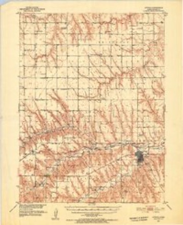
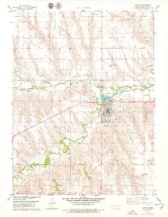
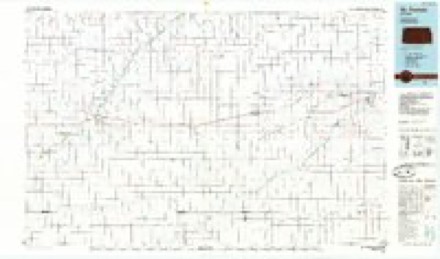
9 topographic sheets cover this place, the earliest surveyed in 1951 and the latest in 1985. It stands in Center Township. It lies in ZIP code area 67730. It stands on North Beaver Creek. The Survey maps it on the Atwood quadrangle.
Topographic sheets covering this place
6 surveys from 9 printed sheetsMatched by testing this settlement's coordinate against the published boundary of every sheet in the United States Geological Survey's historical collection. Each opens the scanned sheet at the Survey.
- 1951 USGS Atwood quadrangle1:62500, 2 printings
- 1954 USGS Goodland quadrangle1:250000
- 1956 USGS Goodland quadrangle1:250000
- 1957 USGS Goodland quadrangle1:250000, 2 printings
- 1978 USGS Atwood quadrangle1:24000
- 1985 USGS St. Francis quadrangle1:100000, 2 printings



Fires near this place
1 since 2015Regional context, not property-specific evidence. The federal wildfire occurrence database lists 1 fire within 5 miles of Blakeman in 2015, burning about 250 acres in total. 1 started naturally. None was recorded as arson. Distance is straight-line from the map coordinates, so a fire counted here may appear on a neighbouring settlement's page as well.
| Reported cause | Fires |
|---|---|
| Natural | 1 |
The most recent of them, most recent first, with the day each was reported and the service that recorded it.
| Date | Cause | Size | Reported by | Name on the report |
|---|---|---|---|---|
| 13 September 2015 | Natural | 250 acres | Kansas Forest Service | 4 |
Settlements close enough to share some of these fires:
Storms near this place
60 of 61 shownRegional context, not property-specific evidence. The National Weather Service names Blakeman in 61 storm reports between 2001 and 2025: 35 thunderstorm wind, 23 hail, 2 flood, 1 flash flood. No death or injury is recorded in these reports. Each account below is quoted exactly as the forecast office filed it, from the NOAA Storm Events Database, and each date opens the federal record of that event.
| When | Event | Place named | Harm | What the report says |
|---|---|---|---|---|
| June 2014 | Thunderstorm Wind | Blakeman | $150,000 | The top half of trees were blown down. Estimated a couple hundred trees a foot in diameter or larger were blown down. Time of the event estimated from radar. |
| May 2024 | Thunderstorm Wind | Blakeman | $20,000 | Power pole was blown down by thunderstorm outflow along a cold front about seven miles west of Atwood near mile marker 47 on Highway 36. |
| June 2014 | Thunderstorm Wind | Blakeman | $15,000 | Two to three inch diameter tree limbs blown down. Estimated time of report from radar. |
| July 2023 | Thunderstorm Wind | Blakeman | $10,000 | Thunderstorm winds estimated 70-80 mph caused many tree limbs to be blown down of various sizes, shingles torn off a building, and 2x4s blown out of a truck bed. |
| April 2022 | Thunderstorm Wind | Blakeman | $2,500 | Strong winds associated with the outflow of a thunderstorm moving across eastern Rawlins and western Decatur counties produced estimated 70 mph winds. Small tree limbs were reported down and siding torn off a building. |
| July 2022 | Thunderstorm Wind | Blakeman | $2,000 | Report received of a 12 inch healthy cottonwood tree limb being blown through a metal roof of a workshop by an estimated 80 mph wind gust. Time is radar estimated and wind speed estimated from damage indicators. |
| August 2019 | Thunderstorm Wind | Blakeman | $2,000 | A sixteen inch diameter tree was reportedly blown down and a door jam on the outside door of a house was broken from the winds. |
| August 2019 | Thunderstorm Wind | Blakeman | $2,000 | Fourteen inch green Cottonwood tree limbs down. |
| June 2025 | Thunderstorm Wind | Blakeman | $1,000 | Spotter estimated 70 to 80 mph winds with blowing dust creating visibility reductions of 1/8 to 1/2 half mile. Also reported a 12 inch and multiple 8 inch tree limb broken. Some 8 inch limbs were thrown 300 to 350 feet from trees. |
| May 2018 | Thunderstorm Wind | Blakeman | $1,000 | Fourteen inch diameter ash tree blown down from thunderstorm winds. A camper was also lifted a foot off the ground. |
| June 2015 | Thunderstorm Wind | Blakeman | $1,000 | A 100 year old tree was blown down. |
| July 2020 | Thunderstorm Wind | Blakeman | $800 | Live tree 1 foot in diameter and 25 feet long knocked down by winds measured a few miles east at 65 mph. |
| July 2022 | Thunderstorm Wind | Blakeman | $500 | Report of 2.5 inch diameter branches snapped off of trees. Magnitude and timing are estimated and based off of the Atwood, Kansas AWOS and the severity of damage. |
| June 2021 | Thunderstorm Wind | Blakeman | $500 | A 3.5 to 4 inch tree branch was blown down. The caller also reported 0.60 inches of total rainfall for the entire event. |
| June 2018 | Thunderstorm Wind | Blakeman | $300 | Several tree branches three inches in diameter were broken from the thunderstorm winds. |
| May 2023 | Thunderstorm Wind | Blakeman | $250 | Report received of a 12-inch tree limb breaking off of a tree at location. Time is radar approximated. |
| May 2025 | Thunderstorm Wind | Blakeman | - | Numerous two and a half inch diameter tree limbs blown down across the property. |
| June 2025 | Thunderstorm Wind | Blakeman | - | Report of 60 MPH wind gust. |
| June 2025 | Thunderstorm Wind | Blakeman | - | Winds estimated and coming out of the southeast. |
| June 2025 | Thunderstorm Wind | Blakeman | - | A trained spotter reports 13 inch tree limb down. It is unknown how healthy the tree limb was. |
| July 2025 | Thunderstorm Wind | Blakeman | - | Four inch tree limb down from the wind with thunderstorms that moved through. |
| July 2025 | Hail | Blakeman | - | Trained spotter measure hail up to 0.80 inches in size. |
| July 2025 | Hail | Blakeman | - | A trained spotter reported hail up to penny size occurring. |
| July 2025 | Hail | Blakeman | - | A trained spotter reported one inch hail. |
| August 2025 | Hail | Blakeman | - | Spotter reports penny sized hail that covered the ground. |
| September 2025 | Thunderstorm Wind | Blakeman | - | Near zero visibility in blowing dust was reported along a broken line of thunderstorms that were moving north. The dust storm came from the south. |
| April 2024 | Hail | Blakeman | - | Trained spotter reports 1 3/8 inch diameter hail. |
| May 2024 | Thunderstorm Wind | Blakeman | - | Numerous 0.75 to 1.5 inch live tree limbs blown down. Large 5.5 inch diameter dead tree limb also down. |
| July 2024 | Thunderstorm Wind | Blakeman | - | Many three and a half inch diameter green tree limbs blown down. |
| April 2023 | Thunderstorm Wind | Blakeman | - | Spotter reported estimated 55-60mph wind gusts. There was lightning in the area as of the time of the report. Spotter also reported a few small limbs down. |
| August 2023 | Thunderstorm Wind | Blakeman | - | Wind gusts were estimated at 60-70 MPH. |
| May 2021 | Thunderstorm Wind | Blakeman | - | A linear cluster of storms produced 60 mph wind gusts and pea sized hail. |
| August 2021 | Thunderstorm Wind | Blakeman | - | Report received of 2.75 inch diameter tree limbs snapped off a 100 year old cottonwood tree by the wind and blown 30-40 feet away. Wind speed is estimated based on wind damage. |
| May 2021 | Hail | Blakeman | - | A linear cluster of storms produced pea to penny sized hail with estimated wind gusts up to 50 mph. |
| June 2019 | Thunderstorm Wind | Blakeman | - | Small tree limbs down. Estimated wind gusts up to about 60 mph. |
| August 2019 | Flood | Blakeman | - | Twenty-five acres of alfalfa reportedly flooded along the north Beaver Creek. |
| June 2018 | Thunderstorm Wind | Blakeman | - | Unknown number of tree limbs up to five inches in diameter were snapped off. |
| June 2018 | Thunderstorm Wind | Blakeman | - | Winds from a thunderstorm blew down power lines. No information given as to how many poles were damaged. |
| June 2018 | Thunderstorm Wind | Blakeman | - | Estimated the wind gusts to be 60-65 MPH. A few shingles were blown off the roof of the house. |
| October 2017 | Hail | Blakeman | - | The hail lasted for 10 minutes then transitioned to heavy rainfall. |
| May 2016 | Thunderstorm Wind | Blakeman | - | The ground was 70% covered with half inch hail. |
| August 2015 | Thunderstorm Wind | Blakeman | - | The strong winds were accompanied by quarter size hail. |
| June 2015 | Flash Flood | Blakeman | - | A dispatch officer in Atwood estimated a foot of water to be over the road near the intersection of Road 15 and Road M.5. |
| August 2014 | Flood | Blakeman | - | Beaver Creek was out of its banks with minor flooding occurring after heavy rainfall during the evening of August 26th. |
| March 2013 | Hail | Blakeman | - | The hail sizes ranged from nickels to golf balls and completely covered the ground. |
| July 2011 | Thunderstorm Wind | Blakeman | - | Spotter reported 5-inch diameter live tree limbs down. |
| May 2023 | Hail | Blakeman | - | no account filed |
| May 2019 | Hail | Blakeman | - | no account filed |
| June 2019 | Hail | Blakeman | - | no account filed |
| June 2019 | Hail | Blakeman | - | no account filed |
| May 2018 | Hail | Blakeman | - | no account filed |
| May 2017 | Hail | Blakeman | - | no account filed |
| May 2017 | Hail | Blakeman | - | no account filed |
| July 2016 | Hail | Blakeman | - | no account filed |
| July 2016 | Hail | Blakeman | - | no account filed |
| July 2015 | Hail | Blakeman | - | no account filed |
| August 2015 | Hail | Blakeman | - | no account filed |
| June 2014 | Hail | Blakeman | - | no account filed |
| May 2013 | Hail | Blakeman | - | no account filed |
| May 2004 | Hail | Blakeman | - | no account filed |
Nearest settlements
The eight closest, with where each one stands in the county. Distances are straight-line, computed from the Geographic Names Information System coordinates.
Provenance
This settlement is recorded in the Geographic Names Information System as feature 484543. The sheet list is computed by point-in-boundary test against the United States Geological Survey's historical topographic inventory. Both are works of the United States government and carry no copyright under 17 U.S.C. 105.
Wildfire. Short, Karen C. 2022. Spatial wildfire occurrence data for the United States, 1992-2020 [FPA_FOD_20221014]. 6th Edition. Fort Collins, CO: Forest Service Research Data Archive. https://doi.org/10.2737/RDS-2013-0009.6 Collected with United States Government funding and usable without additional permissions or fees.
Storms. NOAA National Centers for Environmental Information, Storm Events Database https://www.ncei.noaa.gov/stormevents/ A work of the United States government, no copyright under 17 U.S.C. 105. Narratives are quoted verbatim from the National Weather Service report and are not edited or summarised.