 Block
Ludell, Kansas
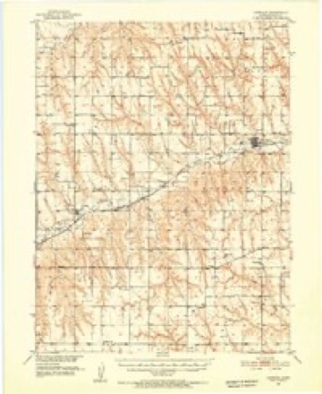
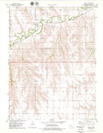
8 topographic sheets cover this place, the earliest surveyed in 1951 and the latest in 1985. It stands in Ludell Township. It lies in ZIP code area 67744. The Survey maps it on the Ludell quadrangle. 41 people lived here at the 2020 count. It stands 2,782 feet above sea level.
Topographic sheets covering this place
6 surveys from 8 printed sheetsMatched by testing this settlement's coordinate against the published boundary of every sheet in the United States Geological Survey's historical collection. Each opens the scanned sheet at the Survey.
- 1951 USGS Herndon quadrangle1:62500
- 1954 USGS Goodland quadrangle1:250000
- 1956 USGS Goodland quadrangle1:250000
- 1957 USGS Goodland quadrangle1:250000, 2 printings
- 1978 USGS Ludell quadrangle1:24000
- 1985 USGS Oberlin quadrangle1:100000, 2 printings



Storms near this place
60 of 76 shownRegional context, not property-specific evidence. The National Weather Service names Ludell in 76 storm reports between 1996 and 2025: 44 hail, 26 thunderstorm wind, 2 flash flood, 2 tornado. No death or injury is recorded in these reports. Each account below is quoted exactly as the forecast office filed it, from the NOAA Storm Events Database, and each date opens the federal record of that event.
| When | Event | Place named | Harm | What the report says |
|---|---|---|---|---|
| July 2009 | Hail | Ludell | $330,000 | Siding on north side of home was heavily damaged. A bedroom window was also broken. One thousand acres of farmland suffered heavy to complete damage to crops. |
| April 2011 | Lightning | Ludell | $100,000 | At 1330 CDT, lightning struck an oil tank battery on a farm northeast of Ludell, causing an explosion that blew the lid off the crude oil storage tank and damaged a second tank. Firefighters were able to control the fire in about an hour. |
| June 2014 | Thunderstorm Wind | Ludell | $8,000 | Shingles were blown off the house and six inch diameter tree limbs were blown down. |
| June 2002 | Tornado (F1) | Ludell | $6,000 | Brief touchdown near Ludell. Several power poles were down, and irrigation equipment and trailer home were damaged. |
| May 2018 | Thunderstorm Wind | Ludell | $800 | Three to four inch diameter limbs were broken. This is the same location that had golf ball size hail. |
| May 2025 | Thunderstorm Wind | Ludell | - | Trained spotter estimated 60 MPH wind gusts. |
| August 2025 | Thunderstorm Wind | Ludell | - | The Kansas Mesonet site named KS-Ludell3N reported 60 MPH gusts and 69 mph wind gusts during this time frame. |
| August 2025 | Hail | Ludell | - | A Department of Highway employee reported quarter size hail along with estimated 50-60 mph winds. |
| August 2025 | Thunderstorm Wind | Ludell | - | A Department of Highway employee reported quarter size hail along with estimated 50-60 mph winds. |
| June 2025 | Thunderstorm Wind | Ludell | - | Automated weather station reported 58 MPH gust. |
| September 2025 | Hail | Ludell | - | Trained spotter reports a lot of quarter to ping-pong ball size hail; enough to cover the ground. |
| April 2024 | Hail | Ludell | - | Trained spotter reports estimated quarter size hail. |
| July 2024 | Hail | Ludell | - | Quarter to ping pong ball sized hail fell over the location. |
| May 2023 | Flash Flood | Ludell | - | Water was running over the county road between Ludell and Herndon. |
| May 2023 | Flood | Ludell | - | Several feet of water running over the county road between Ludell and Herndon, making the road impassible. No damage was reported. |
| July 2023 | Thunderstorm Wind | Ludell | - | Via a K-State mesonet station. |
| July 2023 | Thunderstorm Wind | Ludell | - | Reported by the Tallgrass Energy mesonet station. |
| May 2023 | Hail | Ludell | - | Hail was estimated to be between nickel and quarter in size. |
| August 2023 | Thunderstorm Wind | Ludell | - | Estimated the wind gusts to be 50-60 MPH. |
| August 2023 | Thunderstorm Wind | Ludell | - | K-State Mesonet site north of Ludell reported a 62 mph over a duration of five minutes. |
| August 2023 | Thunderstorm Wind | Ludell | - | Trained spotter estimated thunderstorm wind gusts of 60 mph. |
| May 2021 | Hail | Ludell | - | A linear cluster of storms produced pea to quarter sized hail. Heavy rain and wind gusts estimated at 40-50 mph were also reported. |
| August 2021 | Thunderstorm Wind | Ludell | - | Mesonet station reported a 58 mph thunderstorm wind gust at location. |
| May 2021 | Tornado (EFU) | Ludell | - | Trained spotters and off-duty NWS employees report large tornado northeast of Ludell, KS over open portions of Rawlins County. Spotter pictures show distinct tornado southwest of the location that was eventually hit by a separate EF-1 tornado northwest of Herdon. |
| July 2020 | Hail | Ludell | - | Estimated time of report from radar. |
| June 2020 | Thunderstorm Wind | Ludell | - | Spotter reported estimated wind gusts near 63 mph causing blowing dust to reduce visibility to 1/4 mile. |
| May 2019 | Hail | Ludell | - | Spotter report of golf ball size hail. |
| May 2019 | Hail | Ludell | - | Hail ranging in size from 1.5-2 inches covering the ground 1 mile south of the Nebraska border on Kansas Highway 25. Largest hailstone was 2.25 inches. |
| May 2019 | Hail | Ludell | - | Public reported via Twitter hail up to 2.25 inches in diameter 1 mile south of the Kansas-Nebraska border along Highway 25. |
| July 2019 | Thunderstorm Wind | Ludell | - | Dime size hail also reported. |
| October 2017 | Hail | Ludell | - | The hail ranged from nickel to quarter in size. |
| May 2016 | Hail | Ludell | - | The hailstones ranged from pea to penny in size. |
| July 2015 | Hail | Ludell | - | Hail size estimated to range from dime to quarter size. |
| July 2015 | Hail | Ludell | - | Mostly pea to dime size hail with some quarter size hail mixed in. Relayed via spotter network. |
| June 2015 | Hail | Ludell | - | Rawlins county dispatch received a report of golf ball to tennis ball size hail near Ludell. |
| July 2013 | Hail | Ludell | - | Torrential rainfall accompanied hail to the size of golf balls. |
| June 2012 | Hail | Ludell | - | The ground is white with pea to golf ball size hail. |
| June 2012 | Hail | Ludell | - | Dime size hail is still falling. |
| May 2011 | Hail | Ludell | - | Spotter also reported minor tree and leaf damage with the hail. |
| August 2011 | Hail | Ludell | - | Spotters reported hail from 1.75 to two inches in diameter. |
| August 2011 | Thunderstorm Wind | Ludell | - | Spotter estimated peak thunderstorm winds near 70 mph. |
| May 2010 | Hail | Ludell | - | Mostly one half to three quarter inch diameter hail reported, but a few stones were as large as one inch in diameter. |
| July 2009 | Thunderstorm Wind | Ludell | - | Spotter estimated wind gusts to 60 mph. |
| July 2003 | Thunderstorm Wind | Ludell | - | Eight-inch diameter tree limbs down. |
| April 2001 | Thunderstorm Wind | Ludell | - | Trees uprooted and power lines were down across Rawlins County. |
| May 2025 | Thunderstorm Wind | Ludell | - | no account filed |
| May 2023 | Hail | Ludell | - | no account filed |
| May 2023 | Hail | Ludell | - | no account filed |
| July 2020 | Hail | Ludell | - | no account filed |
| July 2020 | Thunderstorm Wind | Ludell | - | no account filed |
| July 2020 | Thunderstorm Wind | Ludell | - | no account filed |
| April 2019 | Thunderstorm Wind | Ludell | - | no account filed |
| June 2019 | Thunderstorm Wind | Ludell | - | no account filed |
| August 2019 | Thunderstorm Wind | Ludell | - | no account filed |
| August 2019 | Hail | Ludell | - | no account filed |
| August 2019 | Thunderstorm Wind | Ludell | - | no account filed |
| May 2018 | Hail | Ludell | - | no account filed |
| August 2017 | Hail | Ludell | - | no account filed |
| April 2015 | Hail | Ludell | - | no account filed |
| June 2015 | Hail | Ludell | - | no account filed |
Nearest settlements
The eight closest, with where each one stands in the county. Distances are straight-line, computed from the Geographic Names Information System coordinates.
Elsewhere
Matched on this settlement's Geographic Names Information System number rather than its name, so it cannot be a different place of the same name in another state.
| Wikipedia article on Ludell | An encyclopaedic summary. Its text is share-alike, so it is linked here rather than copied. |
| Wikidata item Q6698722 | The structured record the population and elevation above come from. Public domain (CC0). |
Provenance
This settlement is recorded in the Geographic Names Information System as feature 470997. The sheet list is computed by point-in-boundary test against the United States Geological Survey's historical topographic inventory. Both are works of the United States government and carry no copyright under 17 U.S.C. 105.
Storms. NOAA National Centers for Environmental Information, Storm Events Database https://www.ncei.noaa.gov/stormevents/ A work of the United States government, no copyright under 17 U.S.C. 105. Narratives are quoted verbatim from the National Weather Service report and are not edited or summarised.