 Block
Gove, Kansas
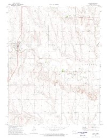
8 topographic sheets cover this place, the earliest surveyed in 1955 and the latest in 1985. It stands in Gove Township. It lies in ZIP code area 67736. The Survey maps it on the Gove quadrangle.
On record in Gove
Buildings and businesses the archive holds for this place. Each opens its own page, with the source record it came from.
On the National Register 2 records
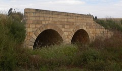 Benson Culvertlisted 2013
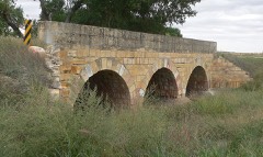 Jenkins Culvertlisted 2013
Topographic sheets covering this place
4 surveys from 8 printed sheetsMatched by testing this settlement's coordinate against the published boundary of every sheet in the United States Geological Survey's historical collection. Each opens the scanned sheet at the Survey.
- 1955 USGS Scott City quadrangle1:250000, 4 printings
- 1958 USGS Scott City quadrangle1:250000
- 1972 USGS Gove quadrangle1:24000
- 1985 USGS Healy quadrangle1:100000, 2 printings
Fires near this place
3 since 2018Regional context, not property-specific evidence. The federal wildfire occurrence database lists 3 fires within 5 miles of Gove between 2018 and 2020, burning about 202 acres in total. None started naturally. None was recorded as arson. Distance is straight-line from the map coordinates, so a fire counted here may appear on a neighbouring settlement's page as well.
| Reported cause | Fires |
|---|---|
| Equipment and vehicle use | 2 |
| Debris and open burning | 1 |
The most recent of them, most recent first, with the day each was reported and the service that recorded it.
| Date | Cause | Size | Reported by | Name on the report |
|---|---|---|---|---|
| 21 September 2020 | Equipment and vehicle use | 160 acres | Kansas Forest Service | not named |
| 13 May 2018 | Debris and open burning | 2.0 acres | Kansas Forest Service | 839001 |
| 7 April 2020 | Equipment and vehicle use | 40 acres | Kansas Forest Service | not named |
Storms near this place
60 of 245 shownRegional context, not property-specific evidence. The National Weather Service names Gove in 245 storm reports between 1993 and 2026: 144 hail, 60 thunderstorm wind, 28 tornado, 9 flash flood. No death or injury is recorded in these reports. Each account below is quoted exactly as the forecast office filed it, from the NOAA Storm Events Database, and each date opens the federal record of that event.
| When | Event | Place named | Harm | What the report says |
|---|---|---|---|---|
| May 1995 | Hail | Gove | $2,500,000 | Hail and high winds damaged 25,000 acres of wheat and 30 farm structures. |
| May 2008 | Tornado (EF1) | Gove | $150,000 | A tornado moved across rural eastern Gove county during the late afternoon and produced EF1 damage at a home on Road O before dissipating. Severe roof damage occurred and several outbuildings were damaged or destroyed. |
| June 2014 | Tornado (EF1) | Gove | $50,000 | Time estimated from Doppler radar. Two outbuildings heavily damaged and one nearly destroyed. Three hail bales moved. Residence itself sustained minor to no damage. |
| May 2010 | Thunderstorm Wind | Gove | $50,000 | Farm business received damage to several grain bins from the rear flank downdraft of a supercell just south of a large tornado. Time of report is estimated from Doppler radar. |
| October 2017 | Tornado (EF1) | Gove | $40,000 | A brief tornado crossed CR I between CR 38 and CR 42. Several large trees were snapped in a creek bottom. A few farm structures suffered significant damage to their roofs. One or two windows were also broken in one of the structures. Some of the metal roofing from one of the structures was blown into a field northeast of the farm property. Many limbs and a few tree trunks were snapped on the property too. |
| May 2010 | Tornado (EF1) | Gove | $25,000 | A center pivot was overturned near Road K and Road 64. |
| May 2010 | Thunderstorm Wind | Gove | $25,000 | A quonset building lost its roof in thunderstorm outflow. This outflow appears to be associated with a strong rear flank downdraft on the south end of a tornado-producing supercell. |
| May 2010 | Tornado (EF1) | Gove | $22,500 | The tornado was described as very large. Approximately 15 power poles were damaged on Road L associated with this tornado. |
| July 2024 | Thunderstorm Wind | Gove | $10,000 | Numerous healthy cottonwood, elm, and cedar trees down on the property. All were healthy. Peak winds occurred around 4 pm CDT. Location also received 4.2 inches of rain. |
| August 2018 | Thunderstorm Wind | Gove | $10,000 | Straight-line winds from a thunderstorm uprooted entire trees, and broke large branches from other trees. A south facing window was also broken. The winds peeled off a metal roof of a shed, and damaged a glass greenhouse as well as the plants in it. |
| June 1998 | Thunderstorm Wind | Gove | $10,000 | Windows blown out of tractor. Large grain bin blown over. |
| May 1998 | Hail | Gove | $10,000 | Destroyed satellite dish and numerous windows and crops |
| June 2014 | Thunderstorm Wind | Gove | $6,000 | Thunderstorm outflow brought down six power poles. |
| May 1998 | Hail | Gove | $5,000 | Broken windows |
| June 1998 | Thunderstorm Wind | Gove | $5,000 | Power pole and power lines downed. |
| June 2014 | Thunderstorm Wind | Gove | $4,500 | Sunflower Electric double wooden utility poles are either leaning or damaged in this area. Time of damage estimated from Doppler radar. |
| October 2017 | Tornado (EF0) | Gove | $4,000 | An old shed collapsed due to walls giving way and an enclosed trailer was blown over. Several small limbs were snapped and a single pole for a residential cell tower was blown over. |
| April 2003 | Lightning | Gove | $750 | Cow struck and killed by lightning. Value of cow was listed as $750.00. |
| April 2017 | Thunderstorm Wind | Gove | $500 | Living cedar tree branches up to three inches in diameter broken off. |
| July 2009 | Hail | Gove | $500 | Hail reportedly broke windows in the house. |
| May 2025 | Hail | Gove | - | A report of dime to penny size hail was relayed by the public. |
| August 2025 | Hail | Gove | - | Dime to penny size hail was reported by the emergency manager. |
| August 2025 | Hail | Gove | - | Spotter reported quarter sized hail. Lots of hail falling. |
| August 2025 | Thunderstorm Wind | Gove | - | Ambient weather station named My Weather Station reported the wind gust. |
| May 2024 | Hail | Gove | - | Hail was observed to range in size from an apple to grapefruit on Highway 23. |
| May 2024 | Hail | Gove | - | Multiple storm chasers reported softball sized hail on County Road 50. |
| May 2024 | Tornado (EFU) | Gove | - | Multiple reports from media and storm chasers of a landspout EF-U tornado in a field near the Gove/Lane county line. No damage was reported. Tornado was in Gove County for one minute before continuing for another five minutes in Lane County. |
| May 2024 | Hail | Gove | - | Tennis ball sized hail caused an unknown amount of damage at a house along the Gove/Lane county line. |
| May 2024 | Hail | Gove | - | Multiple baseball sized hailstones found on the property. |
| May 2024 | Hail | Gove | - | Quarter to half dollar sized hail stone reported. |
| May 2024 | Hail | Gove | - | Spotter reported golf ball sized hail around intersection of CR I and KS 23. |
| May 2024 | Tornado (EFU) | Gove | - | Multiple storm chasers reported an EF-U landspout tornado in a field east of Highway 23. Location is an approximate and it did not appear to move far from where it developed over it's brief life. No damage was observed or reported. |
| May 2024 | Hail | Gove | - | Multiple baseball sized hail stones observed at the location. |
| May 2024 | Hail | Gove | - | Quarter to baseball sized hail reported. |
| May 2024 | Hail | Gove | - | Hail lasted for 15-20 minutes and was up to the size of a quarter. |
| July 2024 | Hail | Gove | - | Trained spotter reported 1.25 inch hail starting at 45 past the hour, but later reported 1.5 inch hail was found. |
| July 2024 | Hail | Gove | - | Trained spotter reported 1.75 inch hail. |
| July 2024 | Thunderstorm Wind | Gove | - | Weather Underground site KKSUTICA3 reported 60-64 mph gusts over a duration of five minutes. |
| July 2023 | Thunderstorm Wind | Gove | - | A severe thunderstorm produced extreme damaging straight line winds estimated between 90 to 100 mph. Several large trees were snapped or uprooted with numerous small and large branches downed by the winds. One large branch landed on top of a metal outbuilding and punctured the roof. A few power poles were also broken or snapped with powerlines downed by the winds. Sprinklers were knocked over and an irrigation pivot was overturned over by the winds. A four inch by four inch wood post for a 4-way crossing sign was snapped by the winds causing the post and the sign to fall into a ditch to the southwest nearby. The damage path length was measured at 0.56 miles and the damage path width was measured at 0.94 miles. No injuries were reported. Wind speed estimates based on damage indicators. |
| July 2023 | Thunderstorm Wind | Gove | - | Mesonet station OVEK1 recorded a 63 mph thunderstorm 10-meter wind gust at location. |
| September 2023 | Thunderstorm Wind | Gove | - | Reported via mesonet station OVEK1. |
| September 2023 | Thunderstorm Wind | Gove | - | Mesonet station KKSUTICA3 reported a 70 mph thunderstorm wind gust. |
| August 2023 | Thunderstorm Wind | Gove | - | Wind gusts were estimated to be atleast 60 MPH; potentially higher. |
| August 2023 | Hail | Gove | - | Reports received of hail up to golf balls in size accumulating on ground in Gove, KS. Emergency manager reported damage to nearly all buildings in town on the north-facing sides as windows on the north-facing sides of buildings had been broken by hail. |
| May 2022 | Hail | Gove | - | Nickel to quarter sized hail reported. |
| June 2022 | Thunderstorm Wind | Gove | - | Mesonet station recorded a 58 mph thunderstorm wind gust at location. |
| July 2021 | Thunderstorm Wind | Gove | - | Kansas State mesonet recorded a 59 mph wind gust. |
| July 2021 | Thunderstorm Wind | Gove | - | Kansas State mesonet OVEK1 recorded a 67 mph wind gust on the back edge of the storms as they exited Gove County. |
| June 2021 | Thunderstorm Wind | Gove | - | Mesonet station KKSGOVEC3 recorded a 63 mph wind gust. |
| May 2021 | Thunderstorm Wind | Gove | - | Mesonet station KKSGRAIN4 measured a 60 mph wind gust associated with a band of heavy rain moving across Gove County. |
| May 2020 | Thunderstorm Wind | Gove | - | Estimated time of report from radar. |
| August 2020 | Hail | Gove | - | Trained spotter reported various sized hail that increased from quarter to half-dollar in size over a duration of 10 minutes. |
| May 2019 | Hail | Gove | - | Lasted 5 minutes. |
| April 2019 | Thunderstorm Wind | Gove | - | Estimated the wind gusts to be 50-60 MPH. |
| August 2019 | Hail | Gove | - | A trained spotter reported pea to golf ball size hail. |
| June 2018 | Thunderstorm Wind | Gove | - | Brownout conditions reported due to the blowing dust. |
| July 2018 | Hail | Gove | - | The hail size ranged from quarter to golf ball. |
| September 2018 | Hail | Gove | - | Not much hail fell, however at least an inch of rain occurred. |
| August 2018 | Hail | Gove | - | The hail ranged from quarter to golf ball in size. |
| May 2017 | Hail | Gove | - | The hail size started out at quarter size then increased to ping-pong ball size toward the end. |
Nearest settlements
The eight closest, with where each one stands in the county. Distances are straight-line, computed from the Geographic Names Information System coordinates.
| Map | Place | Distance | Sheets |
|---|---|---|---|
| Grainfield | 10.8 miles | 7 | |
| Park | 12.7 miles | 7 | |
| Grinnell | 13.9 miles | 7 | |
| Quinter | 15.6 miles | 7 | |
| Alanthus | 24.6 miles | 8 |
Provenance
This settlement is recorded in the Geographic Names Information System as feature 471381. The sheet list is computed by point-in-boundary test against the United States Geological Survey's historical topographic inventory. Both are works of the United States government and carry no copyright under 17 U.S.C. 105.
Wildfire. Short, Karen C. 2022. Spatial wildfire occurrence data for the United States, 1992-2020 [FPA_FOD_20221014]. 6th Edition. Fort Collins, CO: Forest Service Research Data Archive. https://doi.org/10.2737/RDS-2013-0009.6 Collected with United States Government funding and usable without additional permissions or fees.
Storms. NOAA National Centers for Environmental Information, Storm Events Database https://www.ncei.noaa.gov/stormevents/ A work of the United States government, no copyright under 17 U.S.C. 105. Narratives are quoted verbatim from the National Weather Service report and are not edited or summarised.