 Block
Quinter, Kansas
7 topographic sheets cover this place, the earliest surveyed in 1954 and the latest in 1985. It stands in Baker Township. It lies in ZIP code area 67752. The Survey maps it on the Quinter quadrangle. 929 people lived here at the 2020 count. It stands 2,664 feet above sea level.
On record in Quinter
Buildings and businesses the archive holds for this place. Each opens its own page, with the source record it came from.
On the National Register 1 record
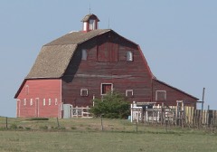 Oxley Barnlisted 2008
Population over time
2 figuresQuinter grew from 918 to 929 between 2010 and 2020. These are the recorded population figures Wikidata holds for this place, reached through the Geographic Names Information System number this page is keyed on rather than by name, so they belong to this place and not to another of the same name. Most are census counts, but not all are: an early figure may be a founding or settlement estimate, and an estimate published within five years of a census is left out. The change column is computed, and is left blank where more than 20 years separate a figure from the one before it, because a gap that long is not a change between two counts.
| Year | People | Change |
|---|---|---|
| 2010 | 918 | |
| 2020 | 929 | +11 (+1%) |
Topographic sheets covering this place
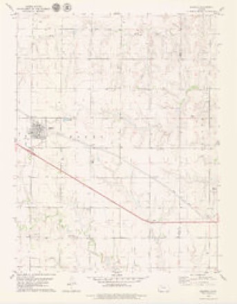
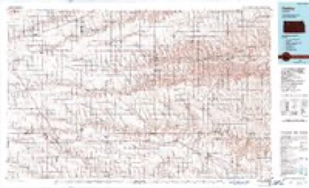
5 surveys from 7 printed sheetsMatched by testing this settlement's coordinate against the published boundary of every sheet in the United States Geological Survey's historical collection. Each opens the scanned sheet at the Survey.
- 1954 USGS Goodland quadrangle1:250000
- 1956 USGS Goodland quadrangle1:250000
- 1957 USGS Goodland quadrangle1:250000, 2 printings
- 1979 USGS Quinter quadrangle1:24000
- 1985 USGS Oakley quadrangle1:100000, 2 printings



Fires near this place
2 since 2017Regional context, not property-specific evidence. The federal wildfire occurrence database lists 2 fires within 5 miles of Quinter between 2017 and 2020, burning about 100 acres in total. None started naturally. None was recorded as arson. Distance is straight-line from the map coordinates, so a fire counted here may appear on a neighbouring settlement's page as well.
| Reported cause | Fires |
|---|---|
| Debris and open burning | 1 |
| Missing data/not specified/undetermined | 1 |
The most recent of them, most recent first, with the day each was reported and the service that recorded it.
| Date | Cause | Size | Reported by | Name on the report |
|---|---|---|---|---|
| 11 June 2020 | Missing data/not specified/undetermined | 90 acres | Kansas Forest Service | not named |
| 6 February 2017 | Debris and open burning | 10 acres | Gove County | 2017009 |
Storms near this place
60 of 148 shownRegional context, not property-specific evidence. The National Weather Service names Quinter in 148 storm reports between 1993 and 2025: 88 hail, 39 thunderstorm wind, 9 tornado, 7 flash flood. The reports record 2 injuries. Each account below is quoted exactly as the forecast office filed it, from the NOAA Storm Events Database, and each date opens the federal record of that event.
| When | Event | Place named | Harm | What the report says |
|---|---|---|---|---|
| May 2008 | Tornado (EF4) | Quinter | 2 hurt, $2,500,000 | A large wedge tornado developed about 9 miles SSW of Quinter and moved north, then northwest, eventually dissipating 2 miles SE of Park. This tornado caused extensive damage to several homes, including EF4 damage to one home which was completely destroyed. A car and a pickup truck were tossed or bounced 200 yards at the residence. Nearby, two other homes suffered extensive damage. This tornado caused two injuries, including the driver of a vehicle which was thrown off Interstate 70, and an older male attempting to get into his storm cellar when he was struck by flying debris. |
| May 2008 | Tornado (EF0) | Quinter | $750,000 | Storm chaser videotaped a large wedge tornado just north of Quinter, which moved into Sheridan county along a path just west of a second tornado occurring simultaneously. This tornado caused extensive utility pole damage from northern Gove into southern Sheridan county, and impacted several homesteads with roof and outbuilding damage. |
| August 1996 | Thunderstorm Wind | Quinter | $250,000 | no account filed |
| October 2017 | Tornado (EF1) | Quinter | $75,000 | Many structures were damaged in Quinter. The tornado began near the elementary school, causing damage to play ground equipment and blew a fence down. The tornado then caused damage to the city building to the northeast of the school, and damaged a few businesses, a few single-wide mobile homes, and a few homes. Damage to the buildings ranged from loosing shingles to porches being blown over, blowing in a set of doors to a hardware store, and blowing a mobile home off its foundation. Many windows were also broken out of the buildings and a few vehicles. Some of the buildings with metal roofing lost some paneling. Numerous trees had significant damage, with some tree trunks having been snapped. A windbreak on the edge of town was damaged in the middle but not on either end. |
| July 1999 | Flash Flood | Quinter | $75,000 | Numerous reports of flash flooding in vicinity of Quinter. Several houses suffered flood damage in basements. |
| August 2024 | Thunderstorm Wind | Quinter | $70,000 | Report relayed of damage to two tin sheds that had part of the roofs torn off, a metal fence blown over, and some power lines were broken. Time is estimated from a nearby mesonet report. |
| May 2010 | Hail | Quinter | $30,000 | Newspaper reported extensive damage to a home as a result of hail and strong winds associated with a tornado-producing supercell. |
| May 2008 | Tornado (EF1) | Quinter | $25,000 | KAKE-TV relayed this tornado report. This tornado damaged utility poles and trees as it moved northeast from Gove into southern Sheridan county. |
| September 2008 | Flood | Quinter | $24,000 | Castle Rock Road and surrounding county roads south of Quinter were closed due to high water in Big Creek resulting from extremely heavy rainfall. The heaviest precipitation occurred the previous evening across northern Gove county further upstream in the Grainfield and Park areas. County officials reported many road washouts and several damaged culverts. |
| August 2018 | Thunderstorm Wind | Quinter | $17,000 | Tree uprooted and roof blown off a house. Animal pen and other structural material blown against a chain link fence enclosure. |
| August 2024 | Thunderstorm Wind | Quinter | $12,000 | Semi tipped over on Interstate 70 at mile marker 110-111. The semi was travelling east and blown to the north. |
| May 2010 | Heavy Rain | Quinter | $9,000 | Twelve calves were drown when they apparently fell into fast running water from heavy rainfall. |
| May 2017 | Thunderstorm Wind | Quinter | $1,000 | A power line was blown down in town. |
| August 2017 | Thunderstorm Wind | Quinter | $1,000 | A large tree was split in two. |
| July 1994 | Tornado (F0) | Quinter | $500 | Tornado briefly touched down over the west edge of Quinter. There was one power pole that was snapped by the tornado. |
| June 2017 | Thunderstorm Wind | Quinter | $100 | Several small branches blown down in town. |
| June 2025 | Thunderstorm Wind | Quinter | - | UP846 reported the wind gust. |
| September 2025 | Thunderstorm Wind | Quinter | - | Kksquint19 weather underground. |
| June 2025 | Thunderstorm Wind | Quinter | - | Mesonet station UP846 2 miles east of Quinter. |
| September 2025 | Hail | Quinter | - | Trained spotter reports 0.75 inch hail. |
| July 2024 | Thunderstorm Wind | Quinter | - | Trained spotter estimated 60 MPH wind gusts. |
| July 2024 | Thunderstorm Wind | Quinter | - | UPR846 measured 58 and 63 MPH gusts over 5 minutes. |
| July 2024 | Hail | Quinter | - | Public report of 1.75 inch hail. |
| July 2024 | Thunderstorm Wind | Quinter | - | Mesonet UP846 measured a 63 MPH wind gust. |
| July 2024 | Hail | Quinter | - | Public report of 1.75 inch hail. |
| July 2024 | Thunderstorm Wind | Quinter | - | Reported via Ambient weather station My Weather Station. |
| September 2024 | Thunderstorm Wind | Quinter | - | Reported gust via mesonet UP846. |
| September 2024 | Hail | Quinter | - | Estimated up to ping pong ball sized hail that occurred on and off over an hour. Hail broke some vehicle windshields with some smaller accumulating hail drifts up against buildings. Time of LSR is when the ping pong ball sized hail most likely occurred via radar estimates. |
| September 2024 | Flash Flood | Quinter | - | Reported via social media. Four feet of water over County Road 82/Trego County Line 100 yards south of the intersection with County Road O. |
| August 2024 | Thunderstorm Wind | Quinter | - | UP846 mesonet site reported the gust. |
| May 2023 | Hail | Quinter | - | Dime to quarter size hail was reported. |
| May 2023 | Hail | Quinter | - | Hailstones were a little smaller than ping pong ball size. |
| September 2023 | Thunderstorm Wind | Quinter | - | Mesonet station KKSQUINT10 reported a thunderstorm wind gust of 58 mph. |
| April 2022 | Hail | Quinter | - | Dime to penny sized hail reported. |
| April 2022 | Thunderstorm Wind | Quinter | - | Reported via UP846 near Quinter, Kansas. |
| May 2020 | Hail | Quinter | - | The report was sent through MPing. |
| May 2019 | Hail | Quinter | - | EM reported that from Kansas Highway 23 east to Quinter, hail increased from dime sized to approximately 3 inches in diameter. |
| April 2019 | Hail | Quinter | - | The hail ranged from nickel to half dollar in size, and occurred with 60 MPH gusts. |
| April 2019 | Thunderstorm Wind | Quinter | - | The winds also occurred with nickel to half dollar size hail. |
| June 2018 | Thunderstorm Wind | Quinter | - | Wind gusts of 60-70 MPH were measured as the storms began to move through. |
| July 2018 | Thunderstorm Wind | Quinter | - | A spare tire was moved 20-30 feet by the thunderstorm winds. |
| May 2018 | Hail | Quinter | - | The hail was reported between MM 108 and 109 on I-70. |
| May 2018 | Hail | Quinter | - | The hail ranged from nickel to golf ball then to quarter in size. The hail was still falling at the end of this time frame. |
| May 2018 | Hail | Quinter | - | The hail ranged from quarter to ping-pong ball in size. The hail was still falling at the end of this time frame. |
| May 2018 | Flood | Quinter | - | Plum Creek continues to flow over CR Castle Rock. |
| May 2018 | Hail | Quinter | - | Golf ball size hail measured at MM 107 on I-70. |
| May 2018 | Flash Flood | Quinter | - | Over a foot of water from Plum Creek was running over the CR Castle Rock north of Quinter. |
| May 2018 | Hail | Quinter | - | The hail started out as ping-pong size then decreased to quarter size. |
| May 2018 | Flash Flood | Quinter | - | A number of streets are underwater in Quinter. The bottom of the ramp at exit 107 has water roughly eight to ten inches deep. |
| September 2018 | Flash Flood | Quinter | - | Even though rainfall was 1.6 or less, the repeated rounds of rainfall in the prior days had conditioned the ground to be more susceptible to flooding than normal. Flooding from the rainfall was reported along CR Castle Rock from three miles north of Quinter to south of town near CR V. |
| September 2018 | Hail | Quinter | - | Pea to dime size hail fell in town. |
| May 2017 | Thunderstorm Wind | Quinter | - | EM reported zero visibility due to blowing dust along with nickel sized hail. |
| June 2017 | Hail | Quinter | - | Nickel to quarter size hail fell at mile marker 106 on I-70. |
| May 2016 | Hail | Quinter | - | Hail stones up to ping-pong ball size covered the ground. |
| June 2015 | Thunderstorm Wind | Quinter | - | Two to three inch diameter limbs were blown down in town. Estimated time of report from Radar. |
| August 2014 | Hail | Quinter | - | Report was relayed via county emergency manager. |
| August 2014 | Thunderstorm Wind | Quinter | - | Peak wind gusts were estimated by the public. Report was relayed via county emergency manager. |
| June 2014 | Thunderstorm Wind | Quinter | - | Storm chaser estimated peak winds to be 60 mph. |
| May 2013 | Hail | Quinter | - | Estimated the time of the report based on radar data. Observer mentioned the hail was soft/slushy. |
| September 2012 | Thunderstorm Wind | Quinter | - | Fire department reported several one-inch diameter tree limbs were broken as a result of the thunderstorm winds. |
Nearest settlements
The eight closest, with where each one stands in the county. Distances are straight-line, computed from the Geographic Names Information System coordinates.
| Map | Place | Distance | Sheets |
|---|---|---|---|
| Park | 7.3 miles | 7 | |
| Grainfield | 12.7 miles | 7 | |
| Gove | 15.6 miles | 8 | |
| Grinnell | 21.4 miles | 7 | |
| Alanthus | 25.7 miles | 8 |
Elsewhere
Matched on this settlement's Geographic Names Information System number rather than its name, so it cannot be a different place of the same name in another state.
| Wikipedia article on Quinter | An encyclopaedic summary. Its text is share-alike, so it is linked here rather than copied. |
| Wikidata item Q1023043 | The structured record the population and elevation above come from. Public domain (CC0). |
Provenance
This settlement is recorded in the Geographic Names Information System as feature 471350. The sheet list is computed by point-in-boundary test against the United States Geological Survey's historical topographic inventory. Both are works of the United States government and carry no copyright under 17 U.S.C. 105.
Wildfire. Short, Karen C. 2022. Spatial wildfire occurrence data for the United States, 1992-2020 [FPA_FOD_20221014]. 6th Edition. Fort Collins, CO: Forest Service Research Data Archive. https://doi.org/10.2737/RDS-2013-0009.6 Collected with United States Government funding and usable without additional permissions or fees.
Storms. NOAA National Centers for Environmental Information, Storm Events Database https://www.ncei.noaa.gov/stormevents/ A work of the United States government, no copyright under 17 U.S.C. 105. Narratives are quoted verbatim from the National Weather Service report and are not edited or summarised.