 Block
Park, Kansas
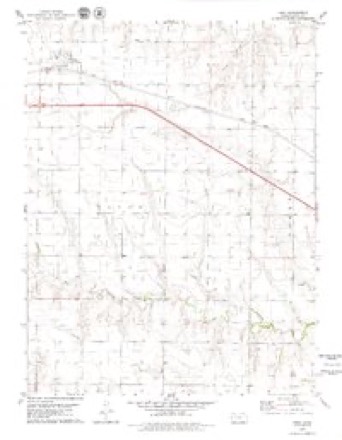
7 topographic sheets cover this place, the earliest surveyed in 1954 and the latest in 1985. It stands in Payne Township. It lies in ZIP code area 67751. The Survey maps it on the Park quadrangle. 112 people lived here at the 2020 count. It stands 2,749 feet above sea level.
Population over time
2 figuresPark fell from 126 to 112 between 2010 and 2020. These are the recorded population figures Wikidata holds for this place, reached through the Geographic Names Information System number this page is keyed on rather than by name, so they belong to this place and not to another of the same name. Most are census counts, but not all are: an early figure may be a founding or settlement estimate, and an estimate published within five years of a census is left out. The change column is computed, and is left blank where more than 20 years separate a figure from the one before it, because a gap that long is not a change between two counts.
| Year | People | Change |
|---|---|---|
| 2010 | 126 | |
| 2020 | 112 | -14 (-11%) |
Topographic sheets covering this place
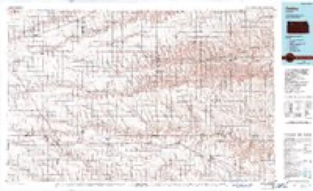
5 surveys from 7 printed sheetsMatched by testing this settlement's coordinate against the published boundary of every sheet in the United States Geological Survey's historical collection. Each opens the scanned sheet at the Survey.
- 1954 USGS Goodland quadrangle1:250000
- 1956 USGS Goodland quadrangle1:250000
- 1957 USGS Goodland quadrangle1:250000, 2 printings
- 1979 USGS Park quadrangle1:24000
- 1985 USGS Oakley quadrangle1:100000, 2 printings



Mines and quarries near this place
1 within 5 milesRegional context, not property-specific evidence. The federal mineral resources record lists 1 working within 5 miles of Park: 1 producer. All of them still produce. What was taken out: Sand and Gravel, Construction. Distance is straight-line from the map coordinates, so a quarry counted here may appear on a neighbouring settlement's page as well.
| Where | Site | Commodity | Status | Recorded |
|---|---|---|---|---|
| Kleaver Sand Pit | Sand and Gravel, Construction | Producer |
Storms near this place
50 since 1999Regional context, not property-specific evidence. The National Weather Service names Park in 50 storm reports between 1999 and 2024: 34 hail, 13 thunderstorm wind, 2 flash flood, 1 funnel cloud. No death or injury is recorded in these reports. Each account below is quoted exactly as the forecast office filed it, from the NOAA Storm Events Database, and each date opens the federal record of that event.
| When | Event | Place named | Harm | What the report says |
|---|---|---|---|---|
| September 2001 | Hail | Park | $480,000 | Large hail and wind damaged buildings in and around Park. Windows were broken, crops were destroyed, and hail was 4 to 6 inches deep in places. Hail completely covered Interstate 70 until snow plows cleared the highway. |
| May 2008 | Hail | Park | $150,000 | About a dozen reports of large, damaging hail were received from the NSSL SHAVE project. Windows were broken, and some roof damage occurred. Hail was embedded 1-2 inches into the ground in some locations. The hail occurred with a supercell thunderstorms tracking north through the area. |
| September 2023 | Thunderstorm Wind | Park | $100,000 | Kansas Highway Patrol reported three semi trucks rolled over due to thunderstorm wind gusts estimated to be 70 mph. The semi trucks were blown over between mile markers 99 and 104 on I-70. |
| June 2015 | Thunderstorm Wind | Park | $59,000 | A semi pulling a loaded trailer and a truck pulling a camper were blown over at mile marker 99 near the Park exit. The driver of the semi received injuries from the accident. |
| June 2003 | Thunderstorm Wind | Park | $39,600 | Seven towers of irrigation system blown over by strong thunderstorm winds. Center pivot still standing. |
| May 2016 | Hail | Park | $4,000 | The hail broke windows in the house. |
| July 2021 | Thunderstorm Wind | Park | $1,000 | Caller reported a full grown evergreen tree was uprooted as a strong supercell moved over the location. |
| July 2011 | Thunderstorm Wind | Park | $1,000 | A power pole broke at the ground as a result of thunderstorm winds. |
| March 2024 | Thunderstorm Wind | Park | - | Visibility down to 50 ft. reported at MM98 and 99 on I-70 due to blowing dust from thunderstorm winds. |
| May 2024 | Thunderstorm Wind | Park | - | Reported via Weather Underground mesonet site KKSPARK1. |
| June 2023 | Thunderstorm Wind | Park | - | Measured at a personal weather station. |
| September 2023 | Thunderstorm Wind | Park | - | Mesonet station KKSPARK1 reported a 62 mph wind gust at the location. |
| August 2019 | Flash Flood | Park | - | Roads and adjacent fields were described as beginning to flood in an area generally between Quinter and southeast of Grainfield due to heavy rain. |
| May 2018 | Hail | Park | - | Reported at MM 103 on I-70. |
| May 2016 | Hail | Park | - | Lightning also started a grass fire in a nearby tree row. |
| July 2016 | Thunderstorm Wind | Park | - | Estimated wind speeds of 60-70 MPH occurred between Park and Quinter. |
| August 2014 | Flash Flood | Park | - | One foot of water was reported flowing across Road 58, south of road Y. Doppler radar estimated 3.5 inches of rain fell in this area. |
| May 2008 | Hail | Park | - | Hail report relayed via the National Spotter Network stating hail was covering Interstate 70 near Park. |
| May 2008 | Hail | Park | - | Hail report relayed via the National Spotter Network. |
| June 2008 | Hail | Park | - | Quarter size hail covered the ground. |
| May 2008 | Hail | Park | - | This report relayed via the NSSL Shave project. |
| June 2007 | Thunderstorm Wind | Park | - | Four-inch tree branch down. Report relayed via NSSL SHAVE project. |
| June 2007 | Hail | Park | - | Quarter to half dollar sized hail. Also, 1.10 inches of rain in the last 30 minutes. |
| June 2007 | Hail | Park | - | This report was relayed via the NSSL SHAVE project. |
| May 2007 | Hail | Park | - | Mile marker 102 on Interstate 70 about 3 SE Park. |
| May 2007 | Hail | Park | - | Hail occurred with estimated 50 mph wind. |
| April 2001 | Funnel Cloud | Park | - | Funnel reported by public. |
| May 2023 | Hail | Park | - | no account filed |
| July 2021 | Hail | Park | - | no account filed |
| May 2019 | Hail | Park | - | no account filed |
| May 2018 | Hail | Park | - | no account filed |
| June 2017 | Hail | Park | - | no account filed |
| June 2017 | Hail | Park | - | no account filed |
| October 2017 | Hail | Park | - | no account filed |
| May 2016 | Hail | Park | - | no account filed |
| May 2016 | Hail | Park | - | no account filed |
| May 2008 | Hail | Park | - | no account filed |
| May 2008 | Hail | Park | - | no account filed |
| May 2008 | Hail | Park | - | no account filed |
| May 2008 | Hail | Park | - | no account filed |
| May 2008 | Hail | Park | - | no account filed |
| May 2008 | Hail | Park | - | no account filed |
| June 2008 | Hail | Park | - | no account filed |
| May 2008 | Hail | Park | - | no account filed |
| May 2007 | Hail | Park | - | no account filed |
| May 2007 | Hail | Park | - | no account filed |
| June 2006 | Hail | Park | - | no account filed |
| June 2005 | Hail | Park | - | no account filed |
| July 2000 | Thunderstorm Wind | Park | - | no account filed |
| May 1999 | Thunderstorm Wind | Park | - | no account filed |
Nearest settlements
The eight closest, with where each one stands in the county. Distances are straight-line, computed from the Geographic Names Information System coordinates.
| Map | Place | Distance | Sheets |
|---|---|---|---|
| Grainfield | 5.6 miles | 7 | |
| Quinter | 7.3 miles | 7 | |
| Gove | 12.7 miles | 8 | |
| Grinnell | 14.4 miles | 7 | |
| Alanthus | 30.2 miles | 8 |
Elsewhere
Matched on this settlement's Geographic Names Information System number rather than its name, so it cannot be a different place of the same name in another state.
| Wikipedia article on Park | An encyclopaedic summary. Its text is share-alike, so it is linked here rather than copied. |
| Wikidata item Q2901291 | The structured record the population and elevation above come from. Public domain (CC0). |
Provenance
This settlement is recorded in the Geographic Names Information System as feature 471348. The sheet list is computed by point-in-boundary test against the United States Geological Survey's historical topographic inventory. Both are works of the United States government and carry no copyright under 17 U.S.C. 105.
Mines and quarries. USGS Mineral Resources Data System (MRDS) https://mrdata.usgs.gov/mrds/ A work of the United States government, no copyright under 17 U.S.C. 105.
Storms. NOAA National Centers for Environmental Information, Storm Events Database https://www.ncei.noaa.gov/stormevents/ A work of the United States government, no copyright under 17 U.S.C. 105. Narratives are quoted verbatim from the National Weather Service report and are not edited or summarised.