 Block
Norcatur, Kansas
9 topographic sheets cover this place, the earliest surveyed in 1951 and the latest in 1985. It stands in Lincoln Township. It lies in ZIP code area 67653. The Survey maps it on the Norcatur quadrangle. 159 people lived here at the 2020 count. It stands 2,644 feet above sea level.
On record in Norcatur
Buildings and businesses the archive holds for this place. Each opens its own page, with the source record it came from.
On the National Register 1 record
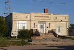 Norcatur City Halllisted 2014
Population over time
2 figuresNorcatur grew from 151 to 159 between 2010 and 2020. These are the recorded population figures Wikidata holds for this place, reached through the Geographic Names Information System number this page is keyed on rather than by name, so they belong to this place and not to another of the same name. Most are census counts, but not all are: an early figure may be a founding or settlement estimate, and an estimate published within five years of a census is left out. The change column is computed, and is left blank where more than 20 years separate a figure from the one before it, because a gap that long is not a change between two counts.
| Year | People | Change |
|---|---|---|
| 2010 | 151 | |
| 2020 | 159 | +8 (+5%) |
Topographic sheets covering this place
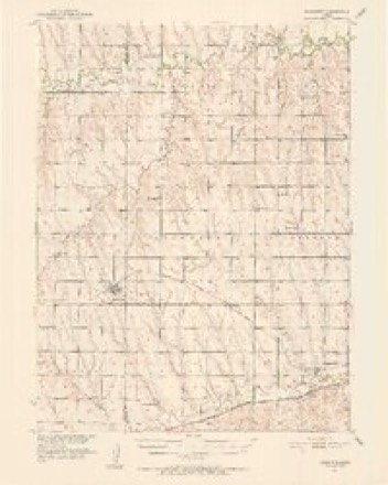
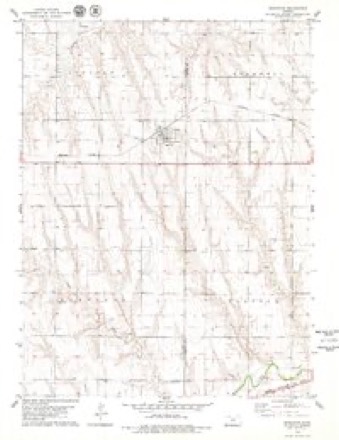
6 surveys from 9 printed sheetsMatched by testing this settlement's coordinate against the published boundary of every sheet in the United States Geological Survey's historical collection. Each opens the scanned sheet at the Survey.
- 1951 USGS Norcatur quadrangle1:62500, 2 printings
- 1954 USGS Goodland quadrangle1:250000
- 1956 USGS Goodland quadrangle1:250000
- 1957 USGS Goodland quadrangle1:250000, 2 printings
- 1978 USGS Norcatur quadrangle1:24000
- 1985 USGS Oberlin quadrangle1:100000, 2 printings



Storms near this place
60 of 77 shownRegional context, not property-specific evidence. The National Weather Service names Norcatur in 77 storm reports between 1993 and 2025: 48 hail, 24 thunderstorm wind, 2 tornado, 1 lightning. No death or injury is recorded in these reports. Each account below is quoted exactly as the forecast office filed it, from the NOAA Storm Events Database, and each date opens the federal record of that event.
| When | Event | Place named | Harm | What the report says |
|---|---|---|---|---|
| August 2011 | Hail | Norcatur | $75,000 | Trained spotters and Law Enforcement reported hail up to 1.75 inches in diameter. Law Enforcement also reported damage to two of their vehicles, with damages totaling almost $20,000. Many other reports of damage to vehicles, windows of houses and businesses, and crops. |
| June 2024 | Thunderstorm Wind | Norcatur | $60,000 | Damage to a pole barn, garage, and chicken coop on property. Pole barn and chicken coop lost majority of the tin panels. The garage had a wall collapse. Report also mentioned downed power lines in town, but no additional information was provided. |
| May 2022 | Thunderstorm Wind | Norcatur | $35,000 | A 32 foot south facing cattle shed was torn off its anchors and rolled several yards across the property. The strong winds were produced along the outflow of a decaying thunderstorm moving over the Norcatur, KS area. |
| April 2022 | Thunderstorm Wind | Norcatur | $20,000 | Straight-line winds caused roof damage to the old Norcatur school. |
| September 2013 | Thunderstorm Wind | Norcatur | $17,000 | An intense downburst with estimated winds of 75 mph skewed a 30 by 30 foot barn and partially rotated it off its foundation. One mile east, a neighbor of the cooperative observer reported his barn was destroyed after it was blown off its foundation. Four REA poles nearby were also pushed over with the top cross members broken. The observer reported seeing a large plume of dirt which briefly brought visibility to near zero as the strong winds arrived. |
| June 2024 | Thunderstorm Wind | Norcatur | $10,000 | Report of a damaged brick garage with a brick wall pushed out 3-4 inches from wood frame. Tin panels off the roof were blown off including some original wood shingles with debris found in the same block to the NE. |
| August 2011 | Hail | Norcatur | $6,000 | Newspaper reports later indicated that the hail damaged the roof of a shed. |
| May 2022 | Thunderstorm Wind | Norcatur | $2,000 | Large, rotted tree limbs were down in front of a home with another rotted tree snapped near the base on the side of the property. The strong winds were produced along the outflow of a decaying thunderstorm moving over the Norcatur, KS area. |
| September 2013 | Thunderstorm Wind | Norcatur | $1,500 | Storm outflow uprooted a large tree and broke a large branch of another tree which caused minor damage to a roof. An 8 by 10 foot storage shed was moved about 8 feet from its original location. It was not anchored to the ground. |
| October 2023 | Thunderstorm Wind | Norcatur | $1,000 | Report of a healthy tree uprooted. |
| April 2022 | Thunderstorm Wind | Norcatur | $1,000 | Straight-line winds damaged a metal shed just north of Norcatur, Kansas. |
| June 2025 | Thunderstorm Wind | Norcatur | - | Delayed report of a 10-12 inch diameter live tree limb down in Norcatur. |
| June 2025 | Thunderstorm Wind | Norcatur | - | Social media report with pictures of damage to an out building and a tree limb down from the winds. |
| June 2025 | Thunderstorm Wind | Norcatur | - | PWS-kksnorca2 reported gust. |
| July 2024 | Hail | Norcatur | - | Dime to penny sized hail reported. |
| July 2024 | Hail | Norcatur | - | Pea to penny sized hail reported. |
| June 2024 | Hail | Norcatur | - | Multiple reports of half dollar to ping pong ball sized hail in Norcatur. |
| June 2024 | Hail | Norcatur | - | Lime to tennis ball sized hail occurred at the location over a duration of five minutes. Damage included a broken windshield on a suburban, all west and north facing window screens broken on the house, in addition to several holes in cement siding of house. Over an hour after the storm passed hail was melted to quarter sized or larger. |
| October 2023 | Thunderstorm Wind | Norcatur | - | Station KKSNORCA2 reported a 65 mph wind gust. |
| July 2023 | Hail | Norcatur | - | Report via social media of 1.75 inch hail. |
| July 2023 | Hail | Norcatur | - | Report via social media of 1.75 inch hail. |
| July 2023 | Hail | Norcatur | - | Spotter report of 1 inch hail. |
| July 2021 | Thunderstorm Wind | Norcatur | - | Thunderstorm wind gust reported strong enough to blow steel lawn furniture 6-7 ft. Wind gust also snapped off an 8 ft. long branch from a tree and threw it across from across the road to the house. Spotter estimated wind gust speed to be around 70 mph with the spotter having to hold the door shut to prevent it from opening. Wind gusts also caused rain to come indoors horizontally through a keyhole of a door briefly. |
| June 2018 | Thunderstorm Wind | Norcatur | - | The thunderstorm winds blew over the swing outside. |
| May 2016 | Hail | Norcatur | - | Estimated the time of the report from radar data. |
| June 2014 | Thunderstorm Wind | Norcatur | - | Elevator leg and grain bin blown over in Norcatur. May 6-8 inch diameter limbs blown down. Some or all of roof blown off of city building/old school house. Shingles blown off houses. Estimated time of report from radar. |
| June 2014 | Thunderstorm Wind | Norcatur | - | Six to eight inch limbs blown down. Estimated time of report from radar. |
| April 2013 | Hail | Norcatur | - | Observer reported that hail lasted about ten minutes. |
| June 2011 | Tornado (EF0) | Norcatur | - | The tornado was brief and remained over open fields with no known damage. |
| June 2011 | Tornado (EF0) | Norcatur | - | The tornado was brief and remained over open fields with no known damage. Law enforcement reported two tornadoes occurring at the same time...one about one and a half miles east of Norcatur, and another about a mile north of Norcatur (this tornado). |
| May 2007 | Hail | Norcatur | - | This report relayed via CoCoRaHS program. |
| August 2005 | Heavy Rain | Norcatur | - | Rain occurred in 60 minutes resulting in minor nuisance flooding. |
| May 2004 | Thunderstorm Wind | Norcatur | - | Two power poles snapped, lines fell on haystacks and started fires. |
| May 1998 | Hail | Norcatur | - | Dime hail at 2149 CST. |
| June 1994 | Hail | Norcatur | - | Golf ball- to tennis ball-size hail observed by Norcatur Fire and Rescue. |
| June 2024 | Hail | Norcatur | - | no account filed |
| March 2018 | Hail | Norcatur | - | no account filed |
| May 2016 | Hail | Norcatur | - | no account filed |
| June 2010 | Hail | Norcatur | - | no account filed |
| June 2010 | Hail | Norcatur | - | no account filed |
| July 2010 | Hail | Norcatur | - | no account filed |
| May 2007 | Hail | Norcatur | - | no account filed |
| July 2005 | Hail | Norcatur | - | no account filed |
| June 2005 | Hail | Norcatur | - | no account filed |
| June 2005 | Hail | Norcatur | - | no account filed |
| June 2004 | Hail | Norcatur | - | no account filed |
| September 2004 | Hail | Norcatur | - | no account filed |
| May 2003 | Hail | Norcatur | - | no account filed |
| June 2003 | Hail | Norcatur | - | no account filed |
| May 2002 | Hail | Norcatur | - | no account filed |
| April 2001 | Hail | Norcatur | - | no account filed |
| May 2001 | Hail | Norcatur | - | no account filed |
| May 2001 | Hail | Norcatur | - | no account filed |
| May 2001 | Funnel Cloud | Norcatur | - | no account filed |
| June 2001 | Hail | Norcatur | - | no account filed |
| June 2001 | Hail | Norcatur | - | no account filed |
| May 2000 | Hail | Norcatur | - | no account filed |
| June 2000 | Thunderstorm Wind | Norcatur | - | no account filed |
| June 2000 | Thunderstorm Wind | Norcatur | - | no account filed |
| June 2000 | Hail | Norcatur | - | no account filed |
Nearest settlements
The eight closest, with where each one stands in the county. Distances are straight-line, computed from the Geographic Names Information System coordinates.
Elsewhere
Matched on this settlement's Geographic Names Information System number rather than its name, so it cannot be a different place of the same name in another state.
| Wikipedia article on Norcatur | An encyclopaedic summary. Its text is share-alike, so it is linked here rather than copied. |
| Wikidata item Q2656319 | The structured record the population and elevation above come from. Public domain (CC0). |
Provenance
This settlement is recorded in the Geographic Names Information System as feature 471026. The sheet list is computed by point-in-boundary test against the United States Geological Survey's historical topographic inventory. Both are works of the United States government and carry no copyright under 17 U.S.C. 105.
Storms. NOAA National Centers for Environmental Information, Storm Events Database https://www.ncei.noaa.gov/stormevents/ A work of the United States government, no copyright under 17 U.S.C. 105. Narratives are quoted verbatim from the National Weather Service report and are not edited or summarised.