 Block
Oberlin, Kansas
9 topographic sheets cover this place, the earliest surveyed in 1951 and the latest in 1985. It stands in Oberlin City. It lies in ZIP code area 67749. The Survey maps it on the Oberlin quadrangle. 1,644 people lived here at the 2020 count. It stands 2,562 feet above sea level.
Research this city
On record in Oberlin
Buildings and businesses the archive holds for this place. Each opens its own page, with the source record it came from.
On the National Register 1 record
 Bank of Oberlinlisted 1994
Population over time
2 figuresOberlin fell from 1,788 to 1,644 between 2010 and 2020. These are the recorded population figures Wikidata holds for this place, reached through the Geographic Names Information System number this page is keyed on rather than by name, so they belong to this place and not to another of the same name. Most are census counts, but not all are: an early figure may be a founding or settlement estimate, and an estimate published within five years of a census is left out. The change column is computed, and is left blank where more than 20 years separate a figure from the one before it, because a gap that long is not a change between two counts.
| Year | People | Change |
|---|---|---|
| 2010 | 1,788 | |
| 2020 | 1,644 | -144 (-8%) |
Topographic sheets covering this place
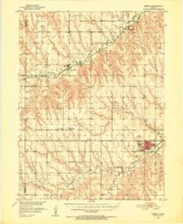
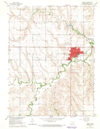
6 surveys from 9 printed sheetsMatched by testing this settlement's coordinate against the published boundary of every sheet in the United States Geological Survey's historical collection. Each opens the scanned sheet at the Survey.
- 1951 USGS Oberlin quadrangle1:62500, 2 printings
- 1954 USGS Goodland quadrangle1:250000
- 1956 USGS Goodland quadrangle1:250000
- 1957 USGS Goodland quadrangle1:250000, 2 printings
- 1965 USGS Oberlin quadrangle1:24000
- 1985 USGS Oberlin quadrangle1:100000, 2 printings



Storms near this place
60 of 207 shownRegional context, not property-specific evidence. The National Weather Service names Oberlin in 207 storm reports between 1993 and 2025: 120 hail, 65 thunderstorm wind, 16 tornado, 5 flash flood. No death or injury is recorded in these reports. Each account below is quoted exactly as the forecast office filed it, from the NOAA Storm Events Database, and each date opens the federal record of that event.
| When | Event | Place named | Harm | What the report says |
|---|---|---|---|---|
| May 2008 | Tornado (EF1) | Oberlin | $1,000,000 | The same supercell thunderstorm which produced the tornado across SW-C Decatur county developed a second tornado about 3 miles SW of Oberlin. This tornado moved north and and dissipated one mile SE of Cedar Falls, traveling along the west side of highway 83. This tornado remained mostly over open fields, but destroyed a number of irrigation pivots and damaged. The rear flank downdraft caused damage in several locations on highway 83, including grain bins at a feed lot and outbuildings at a farmstead. |
| October 1997 | Thunderstorm Wind | Oberlin | $50,000 | Gusts to at least 60 mph blew down fences, branches, power lines, and TV antennas. |
| July 2011 | Thunderstorm Wind | Oberlin | $27,100 | The public reported that siding was ripped off the side of a retail store. Newspaper reports also indicated that 20 headstones were pushed over at the cemetery, and the flag pole was bent. A car port was also lifted off the ground and landed on the car dealer's roof. |
| September 2005 | Thunderstorm Wind | Oberlin | $20,000 | Metal horse barn and two irrigation pivots damaged. Time estimated based on nearby reports. |
| July 2011 | Thunderstorm Wind | Oberlin | $18,000 | COOP observer reported several trees uprooted. House had part of its roof blown off, and several power poles were broken off. |
| June 2006 | Thunderstorm Wind | Oberlin | $12,000 | Power poles downed, east wall of garage destroyed. Wind speeds estimated. |
| April 2022 | Thunderstorm Wind | Oberlin | $8,000 | Straight-line winds caused metal roof panels to be ripped off an outer building near Oberlin, Kansas. |
| June 2002 | Tornado (F1) | Oberlin | $7,000 | Metal barn partially destroyed by tornado, losing several walls and most of the roof. Nearby house suffered minor roof damage. |
| May 2015 | Tornado (EF1) | Oberlin | $6,000 | Chaser reported utility poles were snapped just north of Highway 36 on Road 314. |
| July 2022 | Thunderstorm Wind | Oberlin | $5,000 | Thunderstorm wind gusts estimated up to 80 mph snapped several large tree branches, moved a utility trailer, and damaged an outbuilding. |
| August 2015 | Thunderstorm Wind | Oberlin | $5,000 | A porch awning was peel back against the house and porch furniture was blown off. There was also sign damage in the Oberlin area and a mobile home was blown off its foundation. |
| July 2011 | Thunderstorm Wind | Oberlin | $5,000 | The public reported 5-inch tree limbs down. Newspaper accounts also indicated trees and tree limbs were down throughout town. |
| August 1993 | Hail | Oberlin | $5,000 | Hail and winds estimated to 60 mph broke windows and stripped corn with estimated crop loss at $68,000. |
| April 1998 | Tornado (F1) | Oberlin | $2,500 | Tornado moved southeast then east until it passed 1.5 miles north of Oberlin; then it moved southeast again. Siding was torn from residence 1.5 miles north of Oberlin. At the golf course...a tree was taken down and a window was broken. |
| April 1998 | Tornado (F1) | Oberlin | $2,000 | Landspout tornado observed by personnel from KFNF radio station hit farmstead and slightly damaged home and outbuildings. Tornado moved ESE across U. S. Highway 36 before dissipating around 1513 CST. |
| April 1998 | Tornado (F1) | Oberlin | $500 | Briief tornado. Individual drove through the tornado. Side view mirrors and windshield wipers were ripped from vehicle. |
| July 2002 | Thunderstorm Wind | Oberlin | $100 | Large tree blown over by thunderstorm winds. |
| May 2025 | Thunderstorm Wind | Oberlin | - | A tree trunk of unknown size was split in half. |
| June 2025 | Hail | Oberlin | - | The Emergency Manager reported quarter sized hail and sustained winds of 35 mph south of Oberlin. |
| June 2025 | Thunderstorm Wind | Oberlin | - | Emergency Manager reported estimated 60 MPH winds just behind the storms. |
| May 2025 | Hail | Oberlin | - | Report of nickel sized hail in Oberlin. |
| April 2024 | Hail | Oberlin | - | Quarter sized hail fell over the location. |
| July 2024 | Thunderstorm Wind | Oberlin | - | Wind gust reported via Ambient weather station. |
| July 2023 | Hail | Oberlin | - | Spotter reported quarter sized hail at location. Time is radar estimated. |
| September 2023 | Hail | Oberlin | - | Report of nickel to quarter sized hail in Oberlin. |
| August 2023 | Thunderstorm Wind | Oberlin | - | Estimated wind report from social media. |
| April 2022 | Hail | Oberlin | - | Nickel to quarter sized hail reported. |
| June 2022 | Tornado (EFU) | Oberlin | - | Tornado lasted 2-3 minutes. Located east of Highway 83 and County Road 348. Locations estimated by radar. |
| June 2022 | Hail | Oberlin | - | Ping pong ball sized hail ripped holes into three greenhouse covers. |
| May 2021 | Thunderstorm Wind | Oberlin | - | As a linear cluster of storms moved into the city of Oberlin, wind gusts up to 54 mph occurred at the location. The strong winds produced blowing dust with visibility as low as one-quarter mile to a few hundred yards at times. |
| June 2020 | Thunderstorm Wind | Oberlin | - | A trained spotter observed estimated 65 mph wind gusts that broke a few live 2 inch diameter tree limbs and also caused blowing dust. |
| August 2019 | Thunderstorm Wind | Oberlin | - | A member of the public estimated 60 mph thunderstorm wind gusts in Oberlin. |
| May 2018 | Hail | Oberlin | - | The hail ranged from hen egg to golf ball in size. The hail was still falling at the end of this time frame. |
| June 2017 | Hail | Oberlin | - | Quite a bit of dime size hail fell along with heavy rainfall. |
| June 2014 | Thunderstorm Wind | Oberlin | - | Estimated time of report from radar. |
| May 2013 | Hail | Oberlin | - | Hail reported east of highway 83. |
| May 2011 | Hail | Oberlin | - | Minor street flooding was also reported in Oberlin. |
| July 2011 | Thunderstorm Wind | Oberlin | - | Wind gust was measured from KSN's Weather Network. |
| June 2010 | Thunderstorm Wind | Oberlin | - | Wind gust was measured by KSN Weatherlab in Oberlin. |
| June 2010 | Thunderstorm Wind | Oberlin | - | Tree limbs were blown down across town in Oberlin. |
| June 2010 | Flash Flood | Oberlin | - | Streets in town currently have 6 inches of water flowing across them. |
| July 2010 | Thunderstorm Wind | Oberlin | - | Thunderstorm wind caused damage to a large tree. |
| August 2009 | Flash Flood | Oberlin | - | Several episodes of heavy rain occurred during the evening hours, resulting in up to eight inches of water flowing across roads in town. |
| May 2007 | Hail | Oberlin | - | Hail covered the ground. |
| April 2005 | Hail | Oberlin | - | Quarter size hail covered the ground. |
| May 2005 | Thunderstorm Wind | Oberlin | - | KSN WX Lab Weathernet. Tree limbs also reported down. |
| June 2005 | Tornado (F0) | Oberlin | - | Brief tornado over open fields. No known damage. |
| June 2005 | Tornado (F0) | Oberlin | - | Tornado occurred over open fields. No known damage. |
| July 2005 | Thunderstorm Wind | Oberlin | - | A thunderstorm downburst caused severe damage to a 36' by 72' barn. Part of the roof was blown onto the adjacent highway with the remainder of the barn pivoted 90 degrees and moved off the foundation. Witnesses described a large wall of dirt and near zero visibility moving rapidly through the area at the time. Collapsing thunderstorms were likely causing intense downbursts in this area. Time was estimated based on nearby report. |
| September 2005 | Hail | Oberlin | - | Hail covered the ground. |
| August 2005 | Hail | Oberlin | - | Hail was accompanied by very heavy rainfall. |
| June 2004 | Thunderstorm Wind | Oberlin | - | Small hail and local power outages also reported. |
| June 2004 | Thunderstorm Wind | Oberlin | - | Trees down |
| June 2004 | Thunderstorm Wind | Oberlin | - | Tree down on shed. |
| June 2004 | Thunderstorm Wind | Oberlin | - | Several large trees snapped in half |
| June 2004 | Thunderstorm Wind | Oberlin | - | Shed blown over. |
| May 2004 | Thunderstorm Wind | Oberlin | - | Oberlin Elementary School |
| June 2004 | Thunderstorm Wind | Oberlin | - | Tree fell through roof of house. Roof blown off shed. |
| May 2004 | Thunderstorm Wind | Oberlin | - | Tree fell through a wall of a house, heavily damaging the home. |
| July 2004 | Thunderstorm Wind | Oberlin | - | Numerous 2-inch tree limbs down near Oberlin and outlying areas. Time estimated based on time of highest non-severe wind report from nearby weather instrument. |
Nearest settlements
The eight closest, with where each one stands in the county. Distances are straight-line, computed from the Geographic Names Information System coordinates.
Elsewhere
Matched on this settlement's Geographic Names Information System number rather than its name, so it cannot be a different place of the same name in another state.
| Wikipedia article on Oberlin | An encyclopaedic summary. Its text is share-alike, so it is linked here rather than copied. |
| Wikidata item Q2232894 | The structured record the population and elevation above come from. Public domain (CC0). |
Provenance
This settlement is recorded in the Geographic Names Information System as feature 471014. The sheet list is computed by point-in-boundary test against the United States Geological Survey's historical topographic inventory. Both are works of the United States government and carry no copyright under 17 U.S.C. 105.
Storms. NOAA National Centers for Environmental Information, Storm Events Database https://www.ncei.noaa.gov/stormevents/ A work of the United States government, no copyright under 17 U.S.C. 105. Narratives are quoted verbatim from the National Weather Service report and are not edited or summarised.