 Block
Paducah, Kentucky
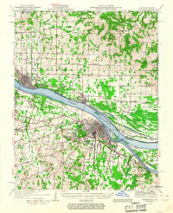
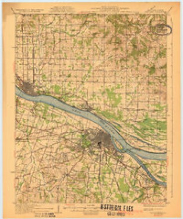
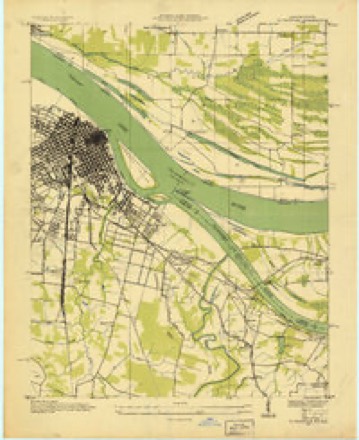
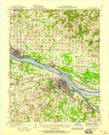
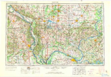
24 topographic sheets cover this place, the earliest surveyed in 1926 and the latest in 1987. It stands in the Paducah census division. It lies in ZIP code area 42003. It lies near Owens Island. The Survey maps it on the Paducah East quadrangle. 27,137 people lived here at the 2020 count. It stands 341 feet above sea level.
Research this city
On record in Paducah
Buildings and businesses the archive holds for this place. Each opens its own page, with the source record it came from.
On the National Register 12 of 33 shown
 Anderson-Smith Houselisted 1984
 Angles, Thelisted 1976
 Confederate Monument in Paducahlisted 1997
 Grace Episcopal Churchlisted 1976
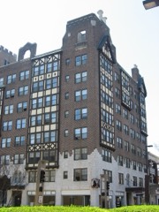 Hotel Irvin Cobblisted 1978
 Hotel Metropolitanlisted 2002
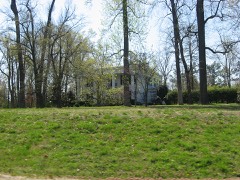 Kenmil Placelisted 2009
 Market Houselisted 1973
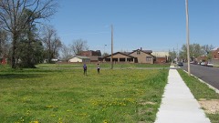 Masonic Templelisted 2002
 Paducah Coca-Cola Bottling Plantlisted 2013
 People's First National Bank and Trust Company Buildinglisted 1980
 St. Francis DeSales Roman Catholic Churchlisted 1979
Every listing in McCracken County
Surveyed buildings and structures 1 record
- Paducah City Hall, South Fifth Street, Paducahfederal building survey, 1 photograph
Population over time
2 figuresPaducah grew from 25,024 to 27,137 between 2010 and 2020. These are the recorded population figures Wikidata holds for this place, reached through the Geographic Names Information System number this page is keyed on rather than by name, so they belong to this place and not to another of the same name. Most are census counts, but not all are: an early figure may be a founding or settlement estimate, and an estimate published within five years of a census is left out. The change column is computed, and is left blank where more than 20 years separate a figure from the one before it, because a gap that long is not a change between two counts.
| Year | People | Change |
|---|---|---|
| 2010 | 25,024 | |
| 2020 | 27,137 | +2,113 (+8%) |
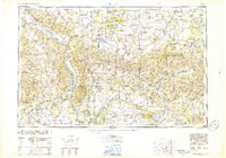
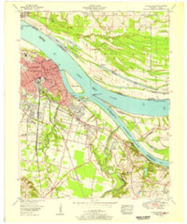
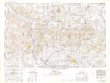
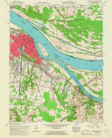
Topographic sheets covering this place
15 surveys from 24 printed sheetsMatched by testing this settlement's coordinate against the published boundary of every sheet in the United States Geological Survey's historical collection. Each opens the scanned sheet at the Survey.
- 1926 USGS Paducah quadrangle1:62500
- 1929 USGS Paducah quadrangle1:62500, 4 printings
- 1936 USGS Paducah quadrangle1:24000
- 1940 USGS Paducah quadrangle1:62500
- 1949 USGS Paducah quadrangle1:250000, 2 printings
- 1950 USGS Paducah quadrangle1:250000
- 1953 USGS Paducah East quadrangle1:24000
- 1954 USGS Paducah quadrangle1:250000, 2 printings
- 1958 USGS Paducah East quadrangle1:24000, 3 printings
- 1961 USGS Paducah quadrangle1:250000, 2 printings
- 1964 USGS Paducah quadrangle1:250000, 2 printings
- 1982 USGS Paducah East quadrangle1:24000
- 1984 USGS Paducah quadrangle1:100000
- 1986 USGS Paducah quadrangle1:100000
- 1987 USGS Paducah quadrangle1:250000
Photographs
8 of 20 photographs shown, 2020Taken for the Office of War Information and the Farm Security Administration, who photographed the country between 1935 and 1944. Works of United States government photographers, with no known restriction on use. Each opens its catalogue record.
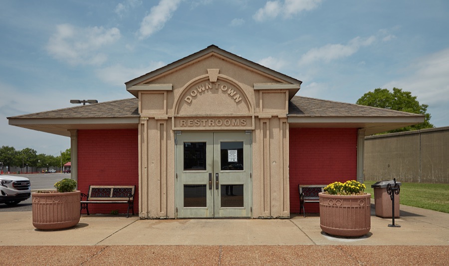
Highsmith, Carol M, 2020. Library of Congress
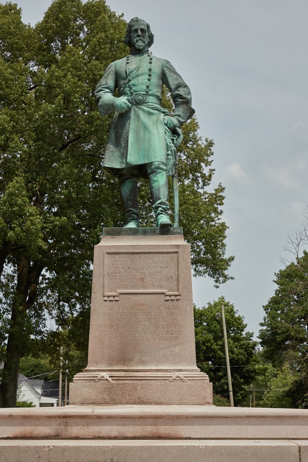
Highsmith, Carol M, 2020. Library of Congress

Highsmith, Carol M, 2020. Library of Congress

Highsmith, Carol M, 2020. Library of Congress

Highsmith, Carol M, 2020. Library of Congress

Highsmith, Carol M, 2020. Library of Congress
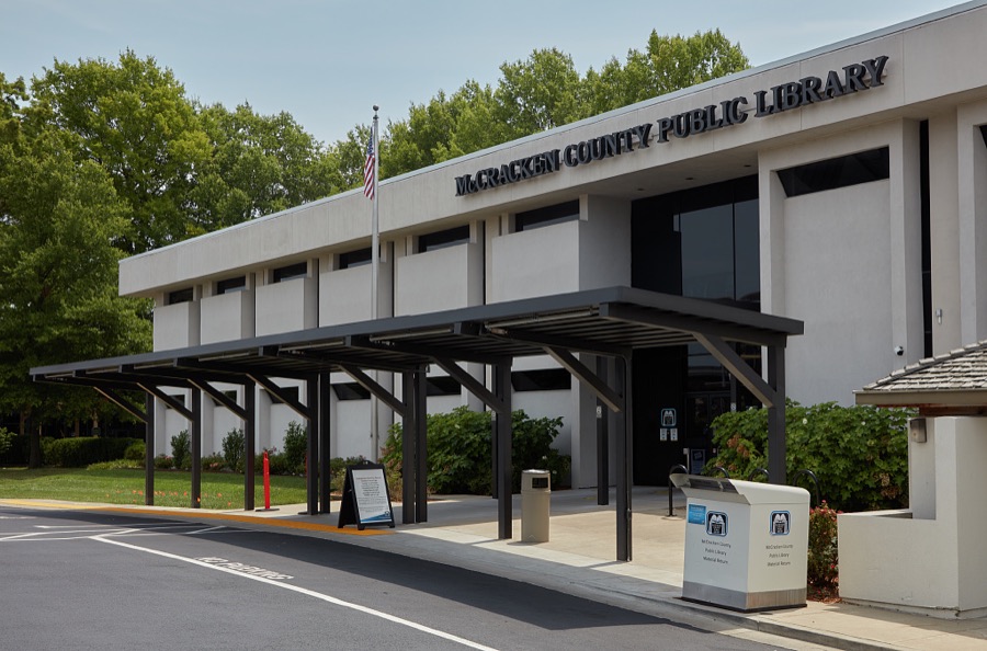
Highsmith, Carol M, 2020. Library of Congress
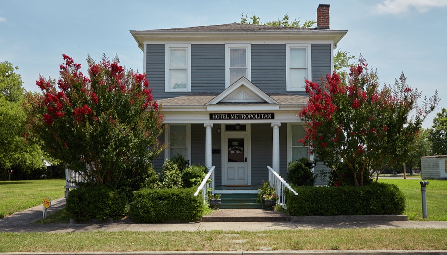
Highsmith, Carol M, 2020. Library of Congress
Every photograph of McCracken County
Fires near this place
20 since 1997Regional context, not property-specific evidence. The federal wildfire occurrence database lists 20 fires within 5 miles of Paducah between 1997 and 2013, burning about 85 acres in total. None started naturally. 2 were recorded as arson. Distance is straight-line from the map coordinates, so a fire counted here may appear on a neighbouring settlement's page as well.
| Reported cause | Fires |
|---|---|
| Missing data/not specified/undetermined | 10 |
| Recreation and ceremony | 4 |
| Debris and open burning | 3 |
| Arson/incendiarism | 2 |
| Smoking | 1 |
The most recent of them, most recent first, with the day each was reported and the service that recorded it.
| Date | Cause | Size | Reported by | Name on the report |
|---|---|---|---|---|
| 25 September 1999 | Missing data/not specified/undetermined | 5.0 acres | Kentucky Division of Forestry | not named |
| 23 September 1999 | Smoking | 3.0 acres | Kentucky Division of Forestry | not named |
| 20 September 2004 | Missing data/not specified/undetermined | 10 acres | Kentucky Division of Forestry | not named |
| 16 August 2004 | Missing data/not specified/undetermined | 2.5 acres | Kentucky Division of Forestry | not named |
| 1 August 2012 | Recreation and ceremony | 2.0 acres | Kentucky Division of Forestry | JOHNY KING |
| 28 July 2005 | Missing data/not specified/undetermined | 2.0 acres | Kentucky Division of Forestry | not named |
| 2 July 2012 | Missing data/not specified/undetermined | 2.0 acres | Illinois Division of Forestry Resources | UNIONVILLE |
| 3 April 2011 | Debris and open burning | 2.0 acres | Illinois Division of Forestry Resources | GRAVEL |
Settlements close enough to share some of these fires:
Mines and quarries near this place
1 within 5 milesRegional context, not property-specific evidence. The federal mineral resources record lists 1 working within 5 miles of Paducah: 1 producer. All of them still produce. What was taken out: Sand and Gravel, Construction. Distance is straight-line from the map coordinates, so a quarry counted here may appear on a neighbouring settlement's page as well.
| Where | Site | Commodity | Status | Recorded |
|---|---|---|---|---|
| Federal Mine Dredge | Sand and Gravel, Construction | Producer |
Storms near this place
60 of 121 shownRegional context, not property-specific evidence. The National Weather Service names Paducah in 121 storm reports between 1995 and 2025: 46 thunderstorm wind, 19 flash flood, 18 heavy rain, 16 flood. The reports record 3 injuries. Each account below is quoted exactly as the forecast office filed it, from the NOAA Storm Events Database, and each date opens the federal record of that event.
| When | Event | Place named | Harm | What the report says |
|---|---|---|---|---|
| January 1996 | Tornado (F1) | Paducah | 2 hurt, $75,000 | no account filed |
| July 2003 | Thunderstorm Wind | Paducah | 1 hurt, $85,000 | A thunderstorm produced damaging winds in downtown Paducah. Two buildings were unroofed in Paducah, including part of an old warehouse and an accounting office. The roof of the accounting office was blown into a street. The roof debris struck a vehicle driven by a 75-year-old man, who was slightly injured and treated at a local hospital. The strong winds blew down a monument at the courthouse square. Bricks falling from the roof of an old hotel landed on vehicles below. |
| May 2011 | Flood | Paducah | $10,000,000 | Major flooding continued on the Ohio River from April. At the Paducah river gage, the flood crest of 55.03 feet around noon on May 5 was over three feet higher than the 1997 flood. This was still several feet lower than the record crest set in 1937. The activation of the New Madrid Floodway by the U.S. Army Corps of Engineers spared McCracken County from an even higher crest that would have inundated even larger areas of the county. With the detonation of the Mississippi River levee at Birds Point, Missouri, the Ohio River stopped rising or rose much more slowly at the Paducah gage. The flood gates were installed in the floodwall protecting the city of Paducah. Low-lying areas outside of the levee and floodwall protection system were flooded, displacing hundreds of residents. Preliminary estimates were that between 200 and 500 homes were flooded, some beyond repair. Many of the homes were located in the Clarks River floodplain, where water was nearly up to the second floor of one home. Ohio River backwater worsened flooding along the Clarks River, which empties into the Ohio between Reidland and Paducah. A mobile home was nearly completely submerged. Over a dozen water rescues were conducted. Water marks along tree lines were at least ten feet high in many locations near the Clarks River. Besides flooding numerous homes, the river submerged a small airport and a car-racing track. Many state roads were closed, making travel around the county difficult. The bridge carrying U.S. Route 45 over the Ohio River was closed due to water over the approaches. At the peak of the flooding, at least 60 roads were closed in McCracken County. Floodwaters crept toward U.S. Highway 60 in the city of Paducah outside the levee, but very few structures were affected on Route 60. The main exception was a major grocery store next to the levee, which was forced to close. A convention center located on the river side of the floodwall was saved by the construction of a makeshift levee. |
| June 2014 | Flash Flood | West Paducah | $150,000 | Widespread flash flooding occurred in Paducah. Between 4.8 and 5.5 inches of rain was measured in less than two hours. Numerous vehicles were stranded on flooded streets. Some people were rescued from stranded cars by police and fire personnel. A railroad underpass on a major city street was impassable. Garages and basements were flooded. Several apartments and at least one home were flooded. In the downtown Paducah area, the courthouse and jail were flooded. |
| August 2025 | Flash Flood | Paducah | $125,000 | A wide area of flooding developed near Baptist Hospital in Paducah, with water flooding the main entrance of the hospital. Multiple cars were pictured stranded in roughly 6-8 inches of water. Several vehicles were stuck in the water at 28th and Jefferson, and additional stuck vehicle reports came in from Broadway St and Jackson St. Hourly rainfall rates peaked at 1.5-2 an hr over that Midtown portion of Paducah. |
| June 2004 | Thunderstorm Wind | West Paducah | $100,000 | A microburst with winds up to 75 MPH affected an area on the west side of Paducah 1.8 miles long and 0.7 mile wide. The damage path was entirely along Kentucky Highway 305, beginning about 2 miles west of Interstate 24 and ending about 100 yards west of exit 3 on the interstate. Small sheds and outbuildings were destroyed, siding and roofs were damaged, and trees were uprooted or snapped. A pontoon boat was blown into a motor home, damaging both. A flatbed trailer was extensively damaged by a tree that fell on it. Three utility poles were broken, and 10 spans of wire between poles were knocked down by trees. Kentucky Highway 305 and a set of railroad tracks were closed due to trees and power lines down. |
| June 2018 | Thunderstorm Wind | Paducah | $75,000 | Widespread damaging winds occurred over the county. Numerous trees and power lines were down. Some roads were blocked by downed trees and power lines, especially Highway 2187 on the south side of Paducah. The roof was partially torn off a downtown office building in Paducah, and windows were blown out. A power pole was down in Paducah. Thousands of people lost power. Some of the power outages lasted through the following day. The peak wind gust at the National Weather Service at Barkley Regional Airport was 62 mph. |
| May 1996 | Thunderstorm Wind | West Paducah | $75,000 | no account filed |
| March 1997 | Flash Flood | Paducah | $70,000 | no account filed |
| October 2014 | Thunderstorm Wind | Paducah | $60,000 | Three buildings lost their roofs in a densely populated neighborhood on the north side of Paducah. One building was residential, and the other two buildings were commercial. |
| January 1999 | Thunderstorm Wind | Paducah | $50,000 | A camper was destroyed. A tree fell on a house, causing structural damage. |
| May 1997 | Flash Flood | Paducah | $50,000 | Slow moving thunderstorms produced rainfall amounts estimated as much as 2 inches per hour over downtown Paducah. The police department reported all major intersections in downtown Paducah were covered by water. Water went over the Crooked Creek bridge. Evacuations were advised for a small neighborhood on the west side of paducah. Several roads were closed by high water. |
| January 1996 | Thunderstorm Wind | Paducah | $50,000 | no account filed |
| July 2023 | Thunderstorm Wind | Paducah | $35,000 | Trees were down over roads in at least three locations in Paducah. A tree fell on a car in Reidland. Some minor damage was reported to the convention center near downtown Paducah. |
| August 2016 | Flash Flood | Paducah | $30,000 | Flash flooding of portions of U.S. Highway 45 was reported in Paducah. A county road in the Lone Oak area was washed out, leaving a large hole in the roadway. Water was reported over several roads. The National Weather Service office in Paducah measured 2.43 inches of rain in 50 minutes. |
| October 1998 | Thunderstorm Wind | Paducah | $30,000 | An isolated small thunderstorm produced wind gusts around 70 MPH as it passed over the western side of Paducah. An off-duty meteorologist estimated speeds near 70 MPH at the intersection of Interstate 24 and U.S. Highway 60. Trees were blown down in the area. At Kentucky Oaks Mall, signs were blown down, including a Days Inn motel sign. A utility pole was pushed over. The storm continued to produce some damage as it passed across the Ohio River into Brookport, Illinois in Massac County. |
| July 2021 | Flash Flood | Paducah | $25,000 | Considerable flooding of streets and creeks was reported. A state road was undermined near Lone Oak. County emergency management personnel utilized all available personnel to block flooded roads. |
| April 2001 | Thunderstorm Wind | Paducah | $25,000 | Numerous tree limbs were blown down, causing scattered power outages. At least 8 streets were blocked by fallen trees or power lines. A tree limb about 9 inches in diameter brought power lines down across U.S. Highway 62 just west of I-24. Route 62 was closed for about an hour. The storm produced 60 MPH wind at a sensor maintained by the Paducah Power System. |
| February 2019 | Flood | Paducah | $20,000 | During the height of the heavy rainfall, a couple of flood-prone intersections were flooded in Paducah. Following the heavy rain, creeks remained out of their banks. A few state roads near these flood-prone creeks were closed. These roads included Routes 994 and 1014 at Champion Creek and Route 339 at Mayfield Creek. |
| August 2012 | Thunderstorm Wind | West Paducah | $20,000 | A wind gust to 59 mph was measured at Barkley Regional Airport, four miles west of Paducah. Numerous tree limbs and a few small trees were blown down about a mile north of the airport. A tree fell on a house in the city of Paducah. |
| March 1999 | Lightning | Paducah | $20,000 | Lightning started a house fire. |
| July 1998 | Lightning | Paducah | $20,000 | Nearly continuous lightning from a very strong thunderstorm caused scattered damage in and near Paducah. Two direct lightning strikes on the runway lighting system at Barkley Regional Airport caused the cancellation of the only two evening commercial passenger flights. Small electrical fires were started by lightning at two separate houses in Paducah, and a tree was downed by lightning in the city. |
| May 1995 | Thunderstorm Wind | Paducah | $20,000 | A wind gust to 84 MPH was clocked at the National Weather Service office in West Paducah. Damage to trees, signs, and unsecured outdoor objects occurred from the Barkley Regional Airport to the western city limits of Paducah. Spotty roof damage was also observed, and siding was ripped from the National Weather Service office. |
| June 2019 | Thunderstorm Wind | Paducah | $15,000 | About four miles west of Paducah, a wind gust to 62 mph was measured by a trained spotter. Downed trees and power lines blocked Kentucky Highway 305 between Interstate 24 and Highway 358 for several hours. |
| September 2009 | Heavy Rain | Paducah | $15,000 | Street flooding was reported in the usual problem areas on Business Loop U.S. 60 on the south side of Paducah. The water was one to three feet deep and caused at least a few vehicles to stall out. One small car floated around. Police assisted motorists. |
| April 2014 | Thunderstorm Wind | Paducah | $10,000 | A sixty-foot section of tin roof was removed from a car wash. A storm damage survey conducted by the National Weather Service determined the damage was caused by a microburst. |
| September 2012 | Thunderstorm Wind | Paducah | $10,000 | Shingles were blown off a house onto a neighbor's house. Tree branches were blown down. |
| July 2011 | Flash Flood | Paducah | $10,000 | An intersection on U.S. Highway 62 was shut down because of flooding that was estimated to be almost two feet deep. Considerable street flooding was reported on roadways across Paducah, including the railroad underpass on U.S. Highway 62. Some cars were stranded. A television station in Paducah measured 2.40 inches of rain. |
| November 2005 | Lightning | Paducah | $10,000 | A mobile home in downtown Paducah completely burned due to a lightning strike. |
| June 2001 | Thunderstorm Wind | Paducah | $10,000 | Thunderstorm wind gusts blew off part of the roof of a furniture store. There was no other damage in the area, and wind speed estimates from spotters were around 50 MPH. |
| September 2000 | Lightning | Paducah | $10,000 | Lightning struck the Irvin Cobb Apartments, a downtown Paducah landmark formerly known as the Irvin Cobb Hotel. The chimney was struck by lightning, and fallen debris closed a block of South 6th Street. Debris fell through the roof of a ninth-floor apartment, creating a hole through which water leaked. |
| January 1999 | Thunderstorm Wind | Paducah | $10,000 | About 10 trees were down across roadways in McCracken County. In the Reidland area, an outbuilding was down. |
| August 1997 | Thunderstorm Wind | West Paducah | $10,000 | Numerous trees were blown down in a small area south of Barkley Regional Airport. The microburst brought down some large trees up to 70 feet tall. At least one road was blocked by fallen trees. |
| May 2003 | Thunderstorm Wind | Paducah | $10,000 | no account filed |
| July 1997 | Thunderstorm Wind | Paducah | $8,000 | Sporadic reports of downed tree limbs and power lines were received from across the county. A back porch was damaged. |
| November 1996 | Flash Flood | Paducah | $8,000 | no account filed |
| August 2016 | Thunderstorm Wind | West Paducah | $7,000 | In West Paducah, a large tree was down on a house. A couple miles southwest of West Paducah, a tree was down on a road. |
| July 2025 | Flash Flood | Paducah | $5,000 | A water rescue took place for a stranded vehicle at 21st Street and Mayfield Paducah Rd. |
| November 2017 | Thunderstorm Wind | West Paducah | $5,000 | On the west side of Paducah, a few downed trees were photographed and posted on social media. One of the trees fell over Highway 305. A highway sign along Interstate 24 near exit 4 was damaged. Power outages were reported. |
| October 2004 | Thunderstorm Wind | Paducah | $5,000 | A Paducah television station estimated wind gusts from 55 to 60 MPH. Power lines and a few large tree limbs were blown down in the city. A large tree limb fell on a dump truck, causing minor damage to the truck. Power lines fell on a car. |
| June 2002 | Thunderstorm Wind | Paducah | $5,000 | Large tree limbs were blown down in a residential neighborhood on the west side of town. The damage area was about one square mile. |
| July 2002 | Lightning | Paducah | $5,000 | A shed burned down after a lightning strike. |
| May 1998 | Thunderstorm Wind | Paducah | $5,000 | Wind gusts to 60 MPH were estimated on the Irvin Cobb Bridge in Paducah. About 10 trees were blown down in Paducah. |
| July 2023 | Thunderstorm Wind | Paducah | $3,000 | An off-duty National Weather Service meteorologist reported tree limbs were down in a residential neighborhood. |
| July 2021 | Thunderstorm Wind | Paducah | $3,000 | Two trees were down, along with power lines. |
| July 2006 | Thunderstorm Wind | West Paducah | $3,000 | Trees were down in Lone Oak. Power lines were down in West Paducah. |
| July 2022 | Thunderstorm Wind | Paducah | $2,000 | Two large trees were snapped in Paducah. |
| June 2008 | Thunderstorm Wind | Paducah | $2,000 | Several trees were blown down by winds estimated up to 60 mph. |
| June 2007 | Flash Flood | West Paducah | $2,000 | The automated observing system at the National Weather Service office at Barkley Regional Airport measured about 2.65 inches of rain in one hour. Extensive street flooding was reported countywide. Water crept into the county courthouse basement, wetting some carpet. Four people were injured in a rear-end collision on Interstate 24 when several vehicles slowed in the heavy rain. Standing water on U.S. Highway 60 near the Ballard County line contributed to an accident. |
| June 2005 | Thunderstorm Wind | Paducah | $2,000 | A person was trapped inside their vehicle under downed power lines. A fallen tree blocked a secondary road. |
| June 2004 | Thunderstorm Wind | Paducah | $2,000 | A few trees and wires were blown down on the west side of Paducah and in Lone Oak. The storm that caused the tree damage originated in southeast Missouri, crossed southwest Illinois, and weakened shortly after crossing the Ohio River into the Paducah area. |
| October 2001 | Thunderstorm Wind | West Paducah | $2,000 | Five tree tops, up to 20 inches in diameter, were blown down. Along the Ballard County line, a 40-foot television tower and a tree limb fell on a roof, causing minor damage. |
| March 2000 | Thunderstorm Wind | Paducah | $2,000 | Gusty thunderstorm winds knocked down a large tree limb onto a house. |
| July 1996 | Thunderstorm Wind | Paducah | $2,000 | no account filed |
| August 2006 | Thunderstorm Wind | Paducah | $1,000 | Two trees were blown down, including one that fell on a cable line. |
| July 2025 | Flood | Paducah | - | A webcam showed street flooding of several inches near downtown Paducah. |
| February 2022 | Flash Flood | Paducah | - | Several state roads were closed due to flooding. Massac and Champion Creeks overflowed onto roadways and yards. A railroad underpass on U.S. Highway 62 in Paducah was flooded and closed. |
| March 2022 | Flood | Paducah | - | Moderate flooding occurred on the Ohio River. At the Paducah river gage, the river crested at 44.58 feet on the 2nd. Flood stage is 39 feet. Mainly bottomland and surrounding low-lying areas were flooded. Floodwaters crept into some back yards along Highway 1420 west of the city. The riverfront park in downtown Paducah was partially flooded but remained open to traffic. |
| January 2021 | Flood | Paducah | - | U.S. Highway 60 was flooded at an intersection in Paducah. |
| March 2020 | Hail | Paducah | - | A severe thunderstorm produced hail up to the size of golf balls in Paducah, mostly in the downtown area north along the Ohio River. |
Newspapers printed here
27,203 digitised pages6 papers published in this town, digitised by the Library of Congress and free to read: 3,834 issues, 27,203 pages. Every page is searchable, so a name or a street can be looked for directly in what the town printed about itself at the time.
| Newspaper | Published |
|---|---|
| The Paducah Evening Sun | 1906 to 1929 |
| The Paducah Weekly Sun | 1902 to 19?? |
| The Paducah Sun | 1898 to 1906 |
| Paducah Sun | 1??? to 1902 |
| The Paducah Daily Sun | 1896 to 1898 |
| The Sunday Chat | 1901 to 19?? |
What the paper printed
46,853 wordsFront pages of the local paper, read from the Library of Congress scans: 17 issues spread across its run from 1896 to 1910, 46,853 words in total. Each is reproduced on its own page, exactly as the recogniser returned it.
These pages read less well than anything else here, and the number is worth stating: about three words in four come through cleanly, against nine in ten for the building records. An 1896 broadsheet sets eight-point type in seven columns on microfilm, which is the hardest thing in this archive to read by machine. We tested our own recognisers against the Library's and they were not better, so the Library's text is what appears, with the wholly unreadable columns removed. Read it as a guide to what the paper covered, and follow the link to the scan before quoting anything.
| Issue | Paper | Length |
|---|---|---|
| 1906-06-23 | The Paducah Evening Sun | 3,763 words |
| 1906-08-09 | The Paducah Evening Sun | 4,028 words |
| 1906-09-27 | The Paducah Evening Sun | 3,242 words |
| 1906-11-13 | The Paducah Evening Sun | 4,471 words |
| 1910-12-31 | The Paducah Evening Sun | 4,290 words |
| 1898-12-30 | The Paducah Sun | 592 words |
| 1905-09-07 | The Paducah Sun | 3,891 words |
| 1901-02-21 | Paducah Sun | 2,752 words |
| 1901-04-11 | Paducah Sun | 2,365 words |
| 1901-06-20 | Paducah Sun | 4,137 words |
| 1901-11-13 | Paducah Sun | 4,820 words |
| 1896-11-09 | The Paducah Daily Sun | 590 words |
| 1896-11-25 | The Paducah Daily Sun | 1,523 words |
| 1896-12-07 | The Paducah Daily Sun | 952 words |
| 1896-12-19 | The Paducah Daily Sun | 934 words |
| 1901-05-05 | The Sunday Chat | 1,862 words |
| 1901-06-09 | The Sunday Chat | 2,641 words |
Nearest settlements
The eight closest, with where each one stands in the county. Distances are straight-line, computed from the Geographic Names Information System coordinates.
| Map | Place | Distance | Sheets |
|---|---|---|---|
| Littleville | 1.5 miles | 24 | |
| Tyler | 1.9 miles | 24 | |
| Rowlandtown | 1.9 miles | 22 | |
| Hinkleville | 2.5 miles | 22 | |
| Avondale Heights | 2.8 miles | 22 | |
| Forest Hill | 2.9 miles | 22 | |
| Farley | 3.1 miles | 24 | |
| Woodlawn | 3.3 miles | 24 |
Elsewhere
Matched on this settlement's Geographic Names Information System number rather than its name, so it cannot be a different place of the same name in another state.
| Wikipedia article on Paducah | An encyclopaedic summary. Its text is share-alike, so it is linked here rather than copied. |
| Wikidata item Q984377 | The structured record the population and elevation above come from. Public domain (CC0). |
Provenance
This settlement is recorded in the Geographic Names Information System as feature 500106. The sheet list is computed by point-in-boundary test against the United States Geological Survey's historical topographic inventory. Both are works of the United States government and carry no copyright under 17 U.S.C. 105.
Wildfire. Short, Karen C. 2022. Spatial wildfire occurrence data for the United States, 1992-2020 [FPA_FOD_20221014]. 6th Edition. Fort Collins, CO: Forest Service Research Data Archive. https://doi.org/10.2737/RDS-2013-0009.6 Collected with United States Government funding and usable without additional permissions or fees.
Mines and quarries. USGS Mineral Resources Data System (MRDS) https://mrdata.usgs.gov/mrds/ A work of the United States government, no copyright under 17 U.S.C. 105.
Storms. NOAA National Centers for Environmental Information, Storm Events Database https://www.ncei.noaa.gov/stormevents/ A work of the United States government, no copyright under 17 U.S.C. 105. Narratives are quoted verbatim from the National Weather Service report and are not edited or summarised.